We
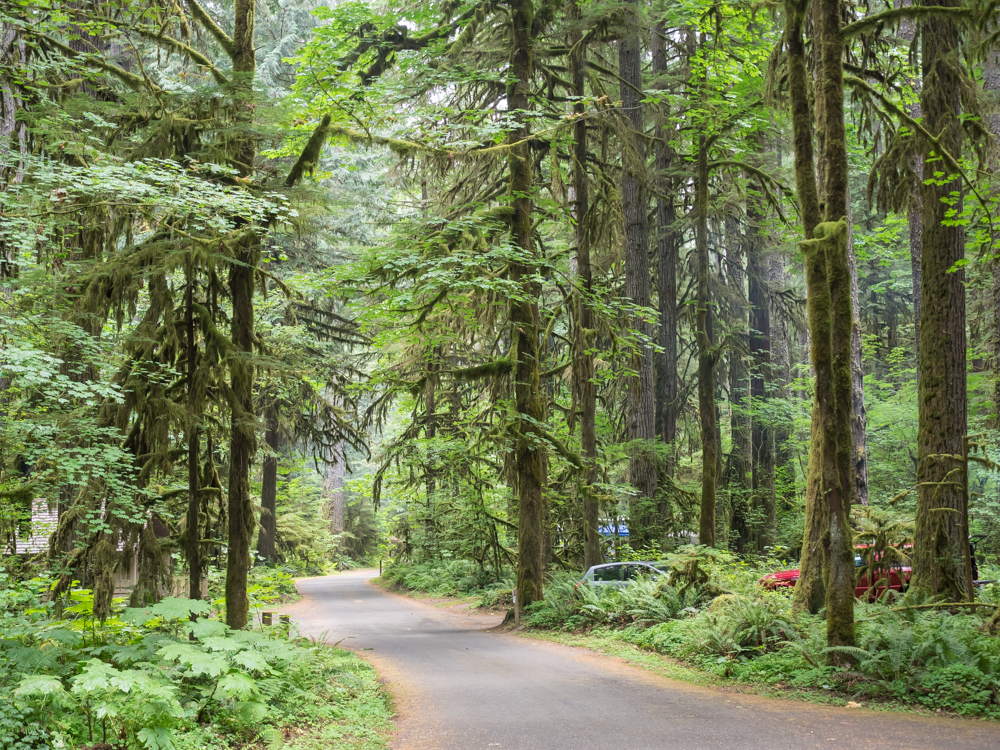
spent the night at the NPS campground at the base of Mount Rainier.
It was rainy and cold and the sites were small. But, the
camper was sufficiently comfortable and we had a good
night. Next morning, we headed up to the Sunrise Viewpoint
for a look at Mt. Rainier.
The photos below are what we saw.
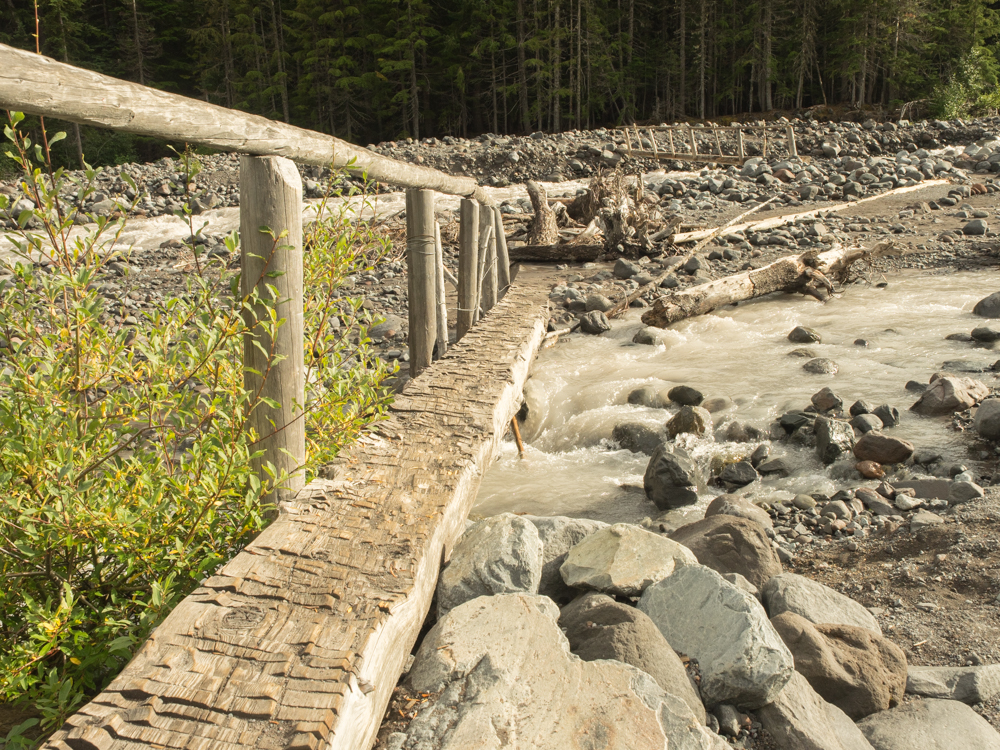
We went
down to the White River and indeed it was white. The color
was due to the high level of rock flour that is carried by the
river. The NPS has erected a bridge across the creek to
allow foot traffic without getting your boots filled with water.
From the
center of the foot bridge you could see downriver toward the
main drainage. The canyon was filled with glacial cobbles
and debris that has washed down from recent storms.
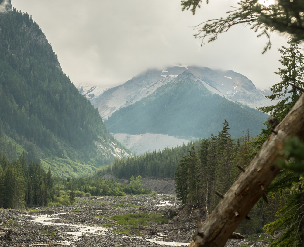
We left
the campsite and drove up the mountain to the Sunrise visitor
center. Along the way, we got views of the snow fields on
the upper portions of the mountain. Sadly, the clouds and
rain obscured views of Mt. Rainier itself.
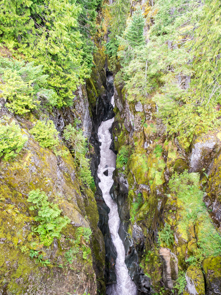
The
views of Mt. Rainier were totally obscured by the clouds, so we
decided to leave the park through the western portal. Along
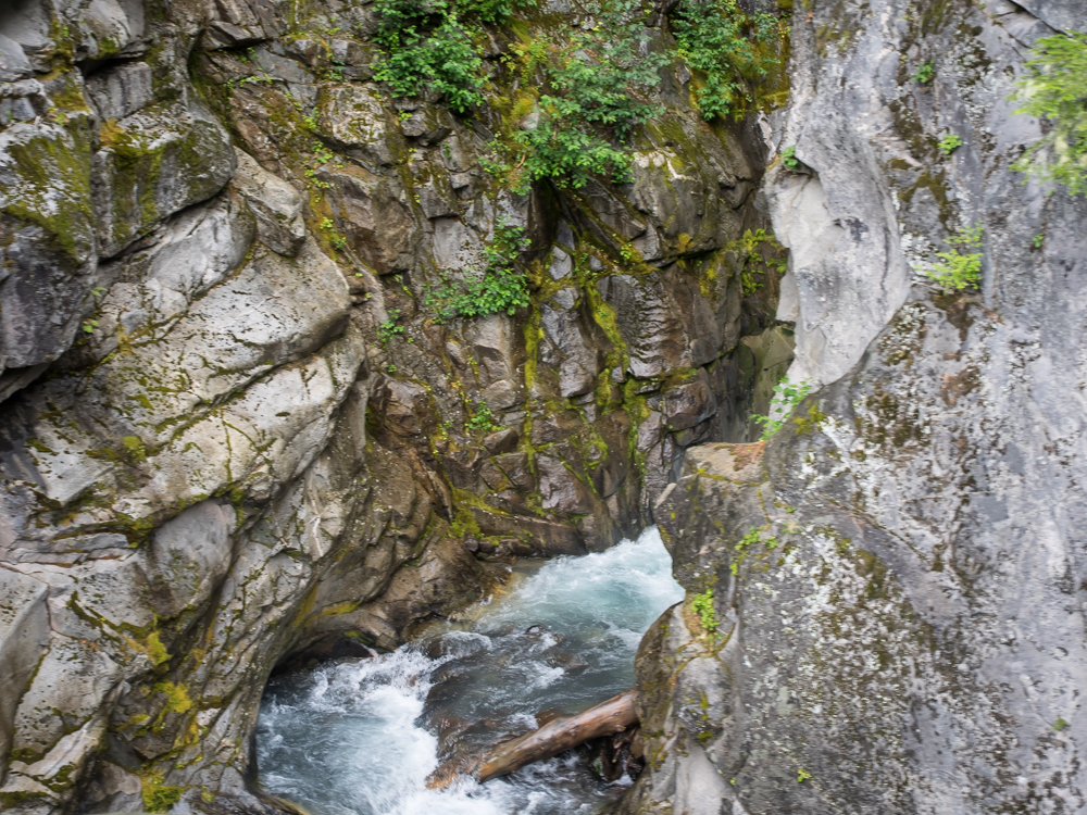
the way we passed a river gorge that had a viewing point.
On the bridge over the gorge, we had a good view of the rushing
waters below. There was a small separation in the layers
of rocks and the water found the cracks and exploited it to the
fullest.
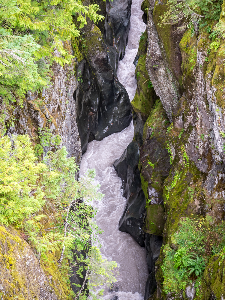
The
waters in the gorge were like a bandsaw: cutting and gouging at
the undelying rock. The high mineral content of the water
added to the cutting power of the rushing water creating a deep
gorge with smooth sides.
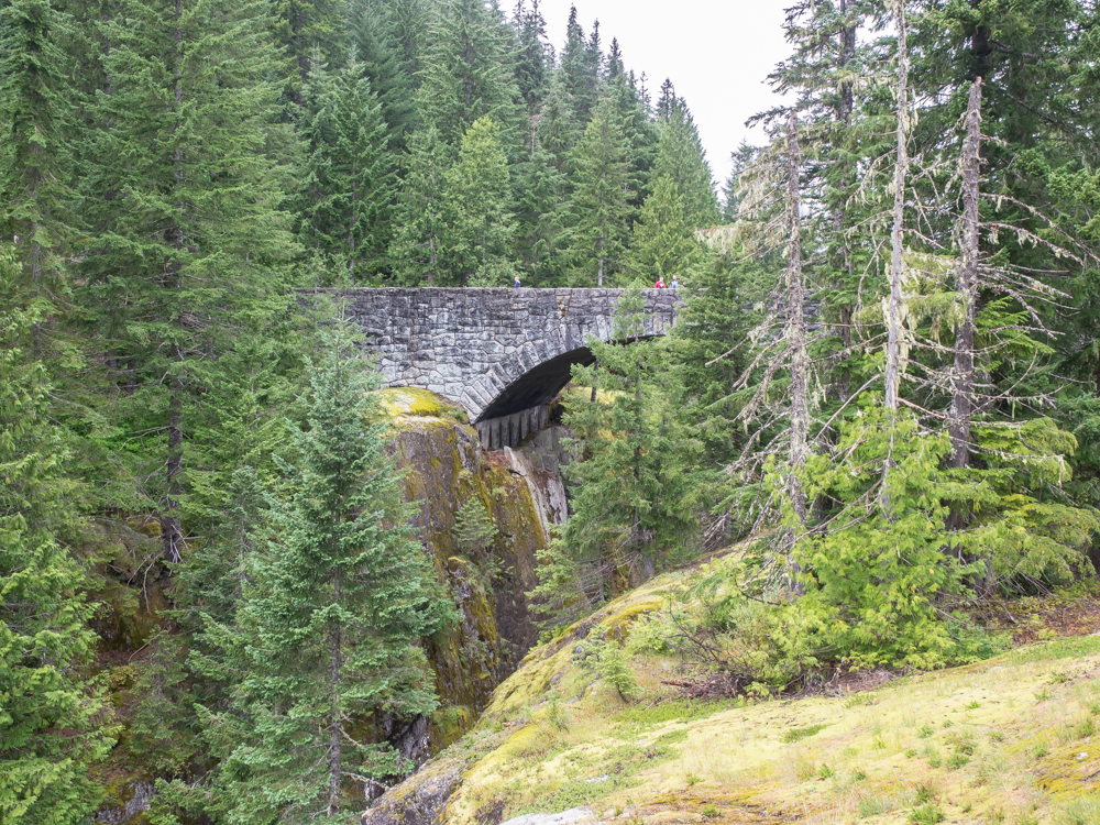
The
bridge that crossed the gorge was made of cut stone and was a
conventional arch design.
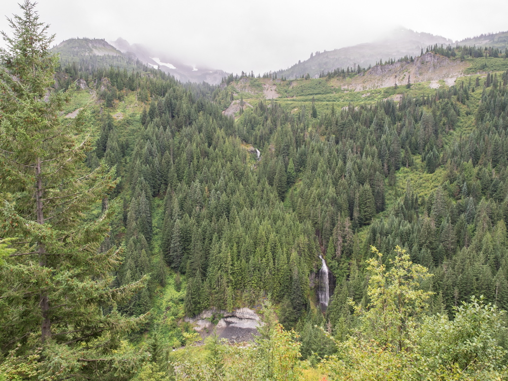
Higher
on the mountain the route provided views of multiple
waterfalls. Note the path of the road on the cliff.
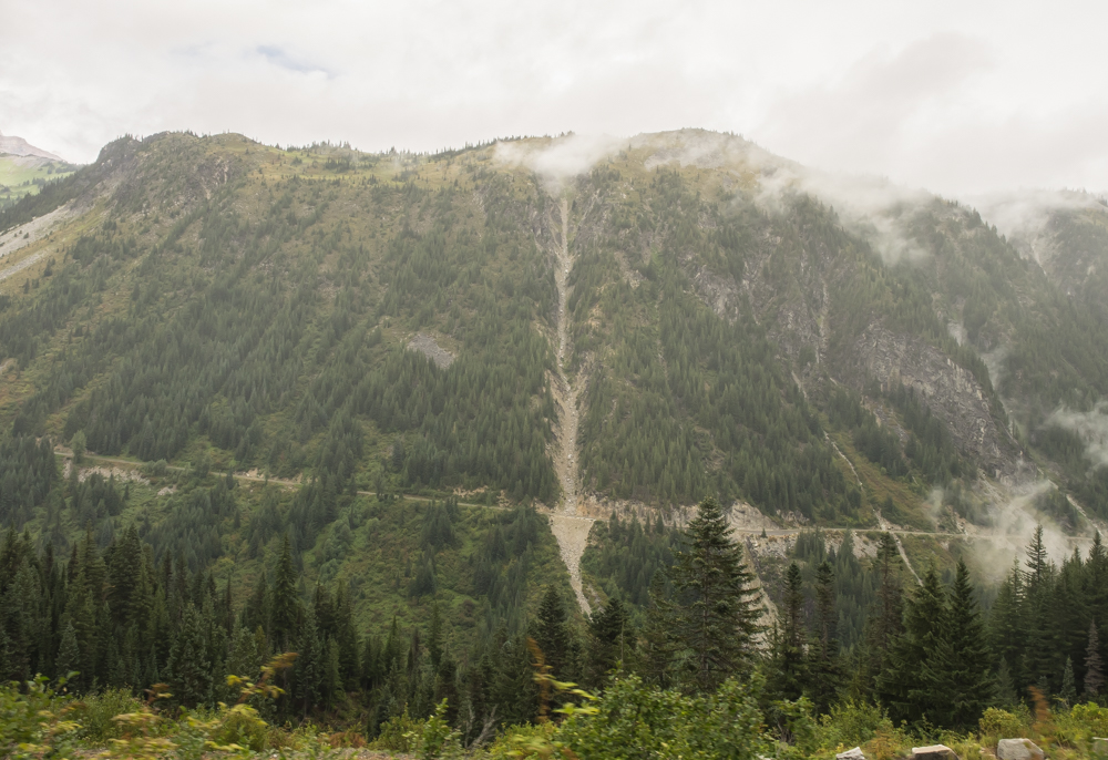
From the
side of the cliff we could see back down the canyon. There
was a huge debris slide that crossed the road. In winter
this slide was an avalanche run. Maintaining that portion
of the road must me difficult and expensive.
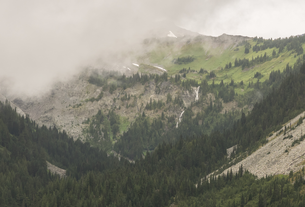
There
were a number of rivers that came down from the upper reaches of
Mt. Rainier. Some resulted in dramatic waterfalls.
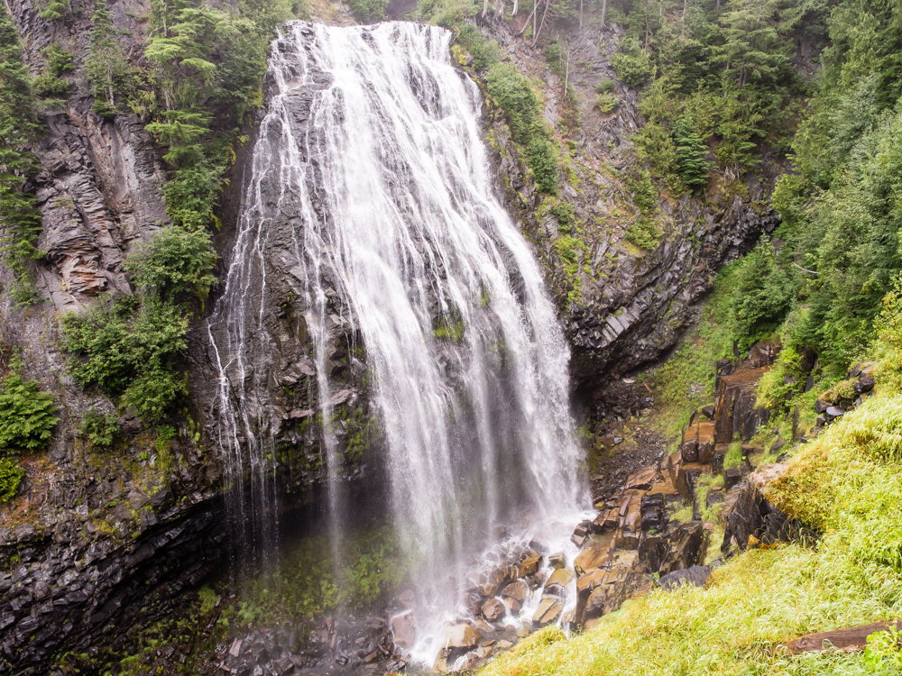
As we
progressed toward the western exit portal, we came upon a scenic
turnout for a waterfall. We stopped and had lunch and then
hiked to the falls. The falls were substantial and totally
worth the 1/2 mile hike.
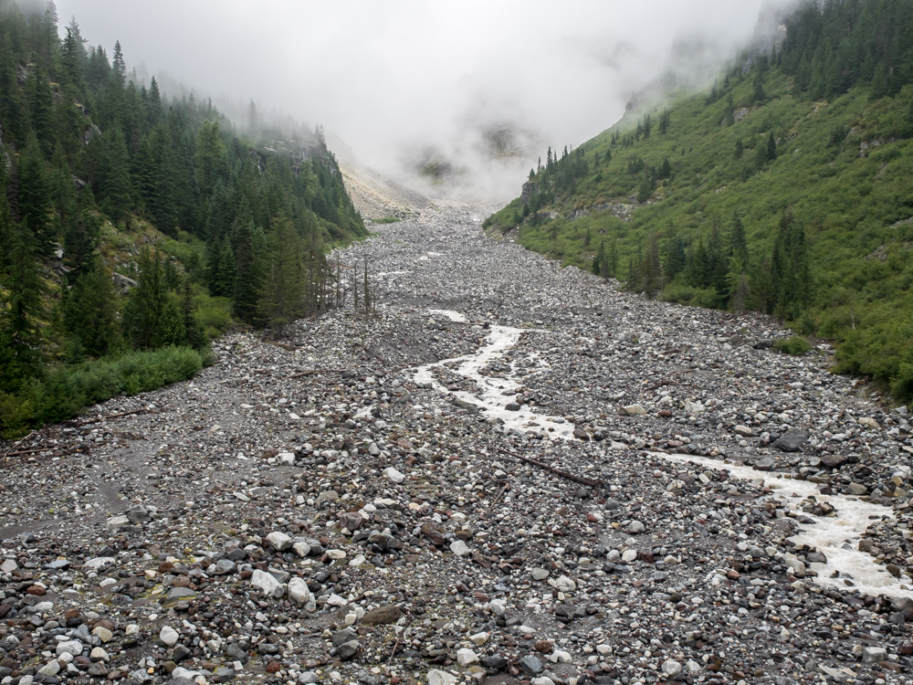
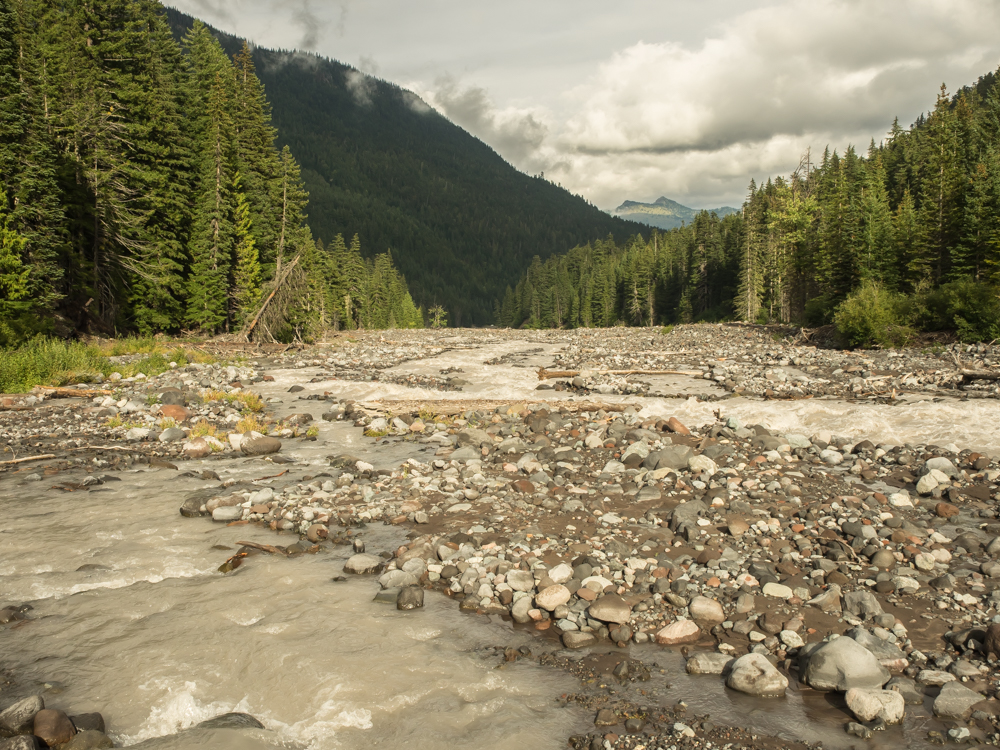
The road
passed over a large bridge that gave a great view of a river
valley totally filled with glacial debris.
There
were plenty of small waterfalls that were visible from the
roadway. Sadly, the road was in poor shape and it was
rough going. It reminded us of the frost heave damge we
experienced in Maine.
We
traveled west out of the park and then south, then east
again. We ended up in a Forest Service campsite called
"Iron Creek" As campsites go, Iron Creek was very, very
nice. It cost only $15 and the sites were paved
(preventing muddy feet in the camper) and the restrooms were
clean.
We
watched a movie and had a calm night. Next morning after
breakfast we headed south toward Mt. Saint Helens and the
volcano overlook.
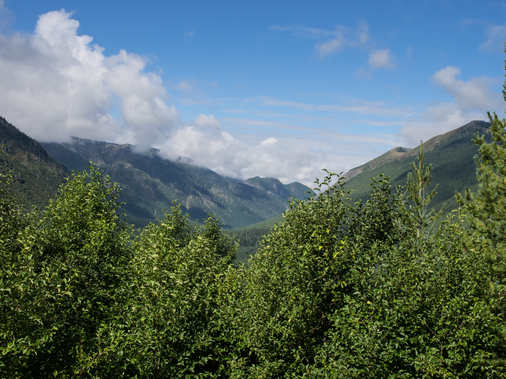
We
followed a backroad into the park. Our route had many
places where the road bed had failed; the whole mountain side was
slumping into the valley and taking the road with it was part of
the process. From the side of the cliff we could see the
mountains to our west that showed damage to the forest.
Looking
back to the north we could see steep walled valleys that showed
evidence of previous glaciation.
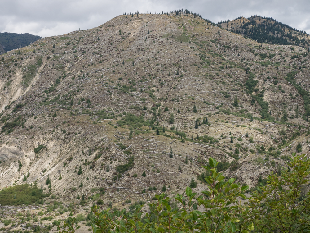
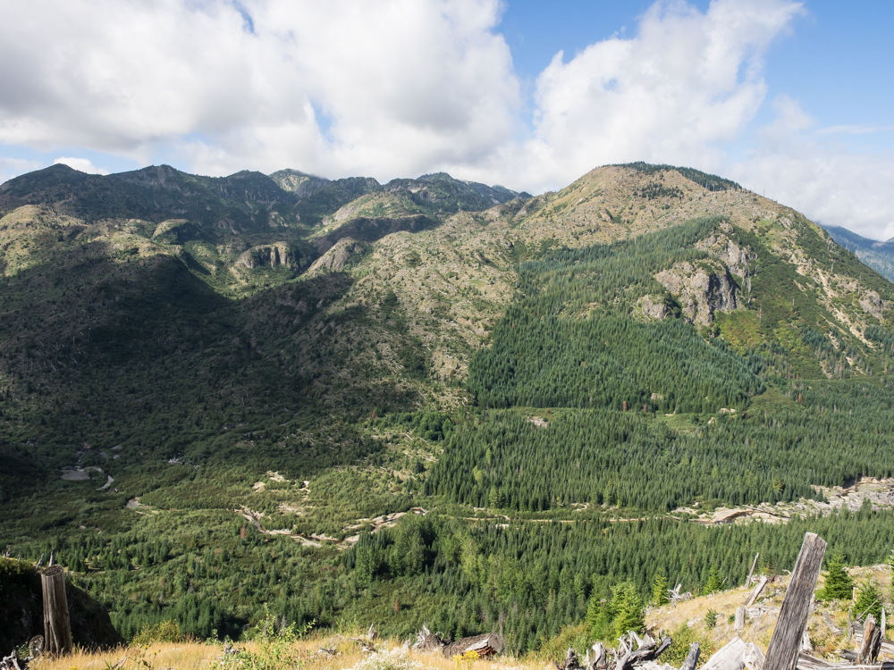
As we
got closer to Mt. St. Helens, the terrain showed evidence of the
volcanic eruption. Note the trees that have been blown
down due to the force of the 600 mph explosive winds.
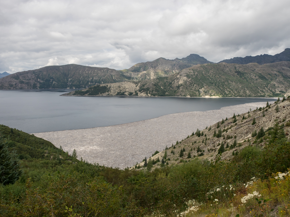
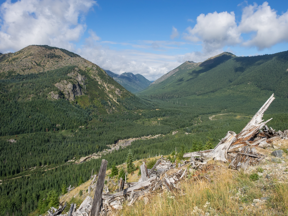
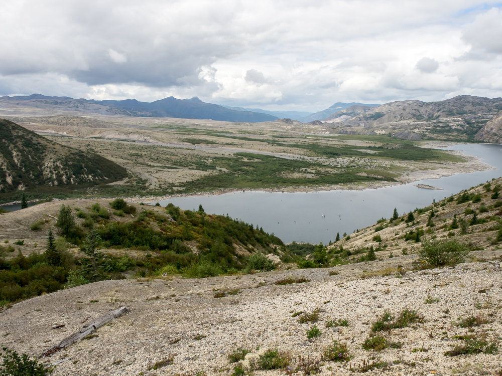
Further
up the road we came to Spirit Lake. From an overlook at Spirit
Lake we could see an ocean of drift wood on the lake
surface. These logs are remnants of the dead trees that
resulted from the 1980 explosion of the mountain.
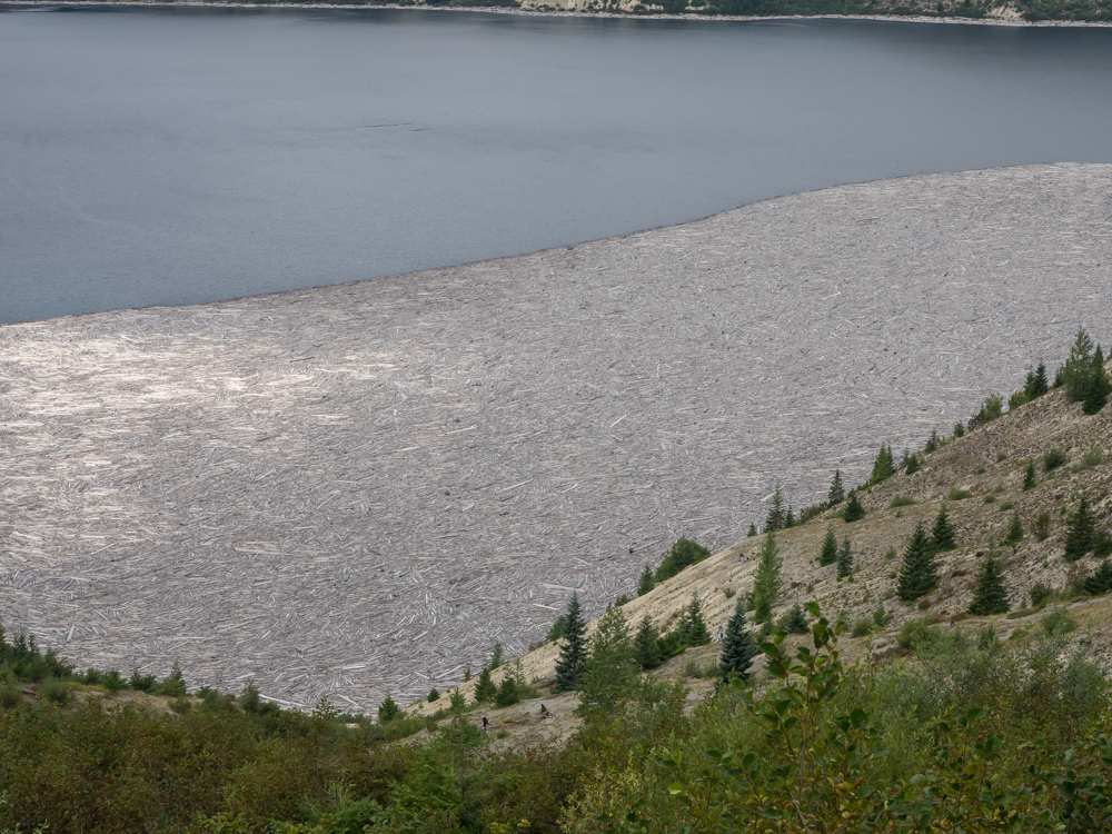
The
amount of dead timber on the lake was awe-inspiring and a true
testament to the forces of nature. The prevailing winds
pushed the timber against the east shore of Spirit Lake.
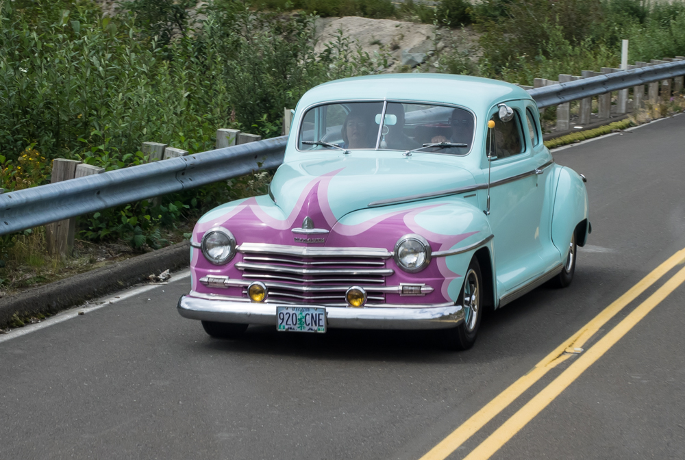
On the
path to Windy Ridge viewpoint we passed this nice restoration.
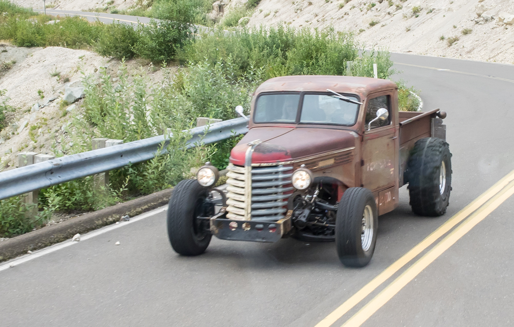
Behind
the nice restoration was his buddy with an obvious
work-in-progress truck.
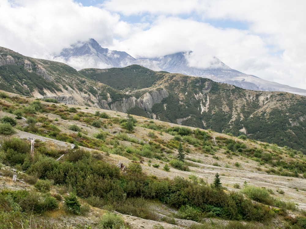
When we
got to Windy Ridge, the whole mountain was socked-in. For
a brief moment, the clouds cleared allowing a partial photo of
the mountain.
From
Windy Ridge, we could see the so-called Pumice Plain on the
north slopes of St. Helens. Due to the harsh nature of the
soils, the area had only been colonized by a minimal amount of
vegetation since 1980.
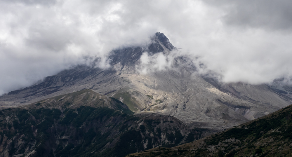
Finally,
as we were ready to leave, the clouds parted enough to provide a
partial view of Mt. St. Helens. Note the harsh pumice
slopes with steep erosion channels.
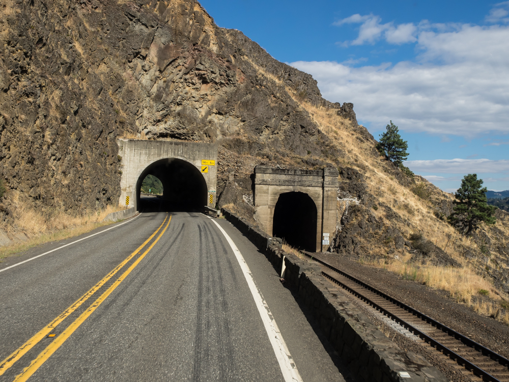
We continued
south on various forest roads until we hit the Columbia River,
then we headed east. The road followed the railroad tracks
and the railroad tracks followed the river. The route
headed through tunnels in the basalt cliffs at many points.
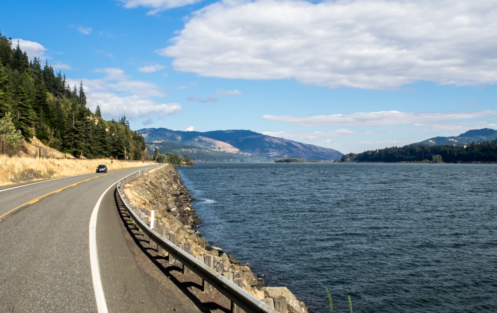
The
Columbia River is huge and is a major sculptor in the regional
landscape.
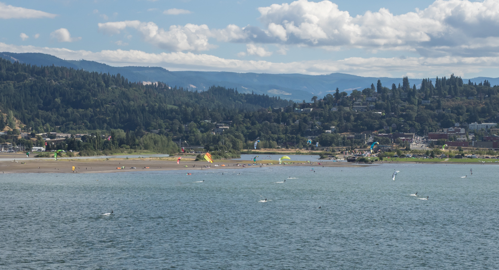
The
Columbia River gorge is known for strong, consistent winds and
has become a mecca for kite surfers. On the south side of
the river we could see dozens of surfers working the strong
winds.
| Previous Adventure | ||
| Trip Home Page |
Photos and Text Copyright Bill Caid 2014, all rights
reserved.
For your enjoyment only, not for commercial use.