We left
the Columbia Confluence State Park in Wenatchee and headed west
into the Wenatchee mountains. The road was steep and
climbed quickly from the river grade into the mountains.
The road started out good, but quickly turned gnarly making us
wonder about the logic of choosing the route. At one
point, we met a fellow oncoming that told us that the road "got
tight and twisty" further up, but we elected to take his
comments under advisement given his driving skills. So, we
soldiered on. And, we found out that we had already been
through the "twisty and tight" areas before we encounterd him --
the balance of the trail was better (but not good).
We
spent the night in a remote camp near a nice meadow. Next
morning, we continued west, then south.
The photos below are what we saw.
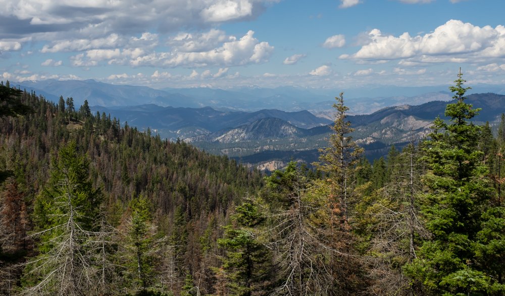
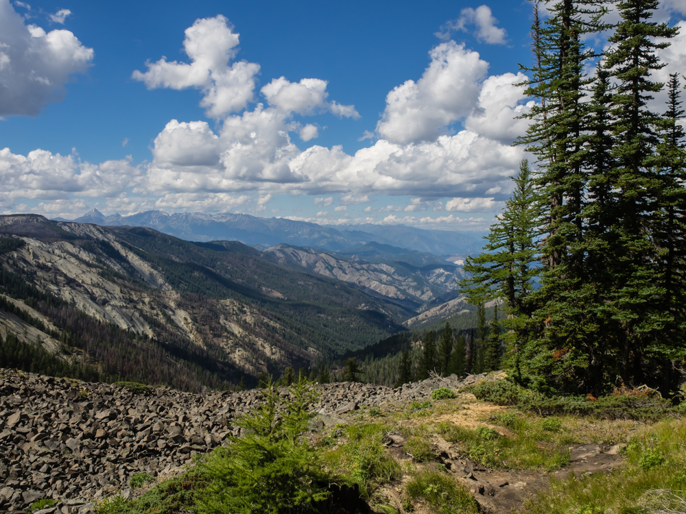
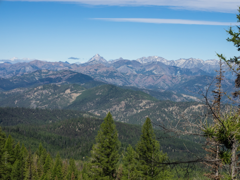
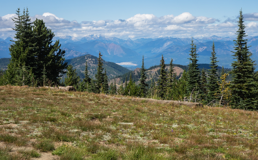
We had
already encountered narrow roads, tight, multi-point turn
switchbacks and low-hanging trees by the time we got high enough
on the mountain for a respectable view. But, the view
looking north was really awesome and made us glad that we came
(despite the hard road).
In the
distance we could see the snow-capped peaks of the Cascade
Range.
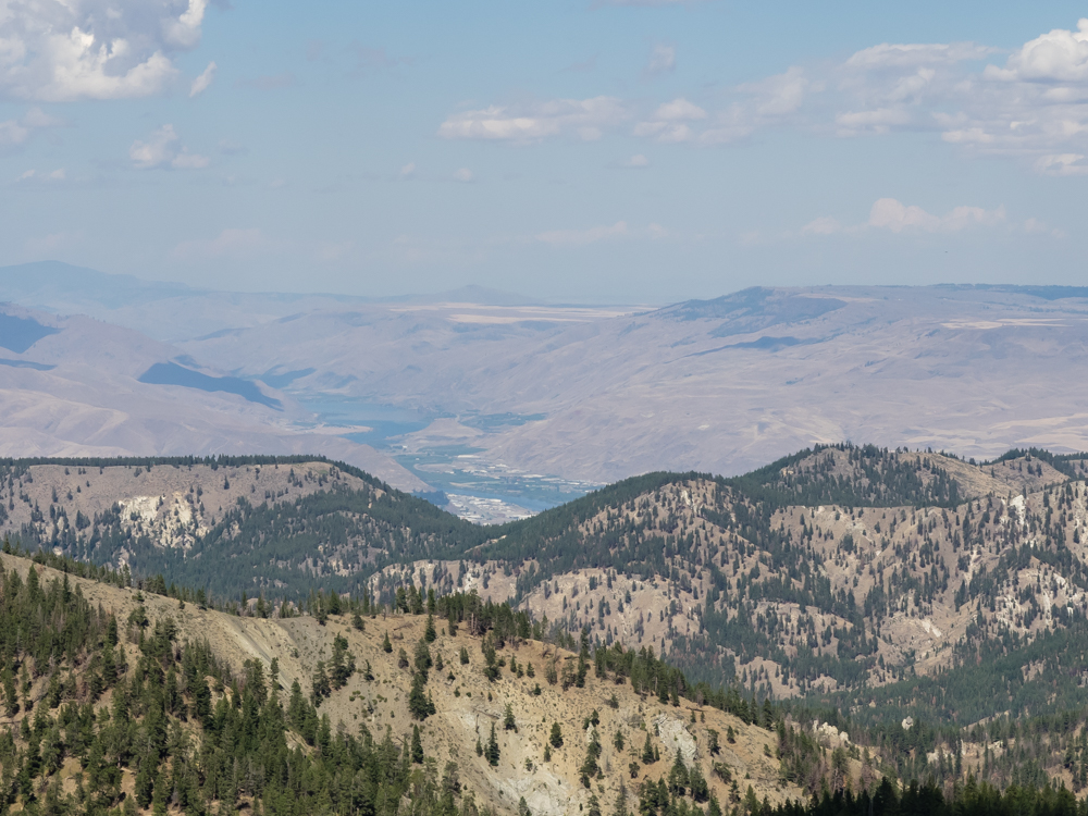
From
another view point between the trees we could see the lower,
barren hills of the Columbia River valley.
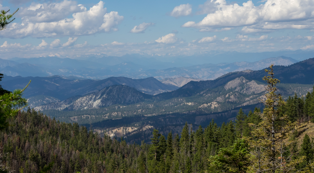
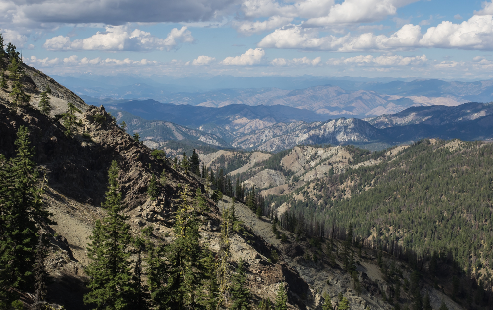
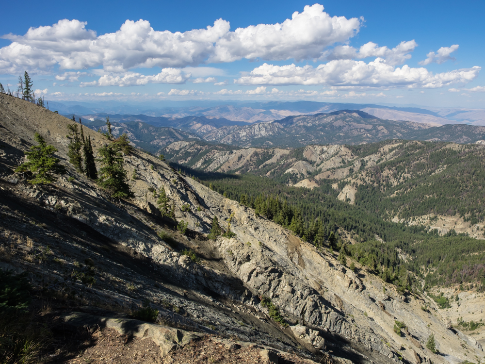
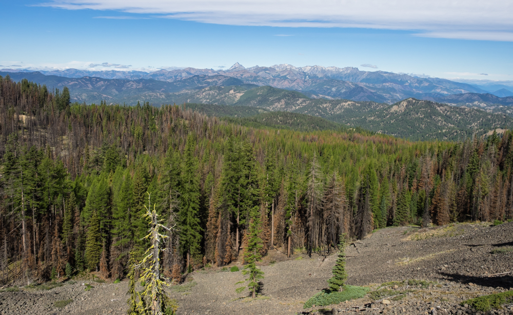
The
trail skirted a cliff for miles, but only brief breaks in the
trees gave us a view of the vista beyond.
The
mountains were a combination of fractured basalt and twisted
underlying strata.
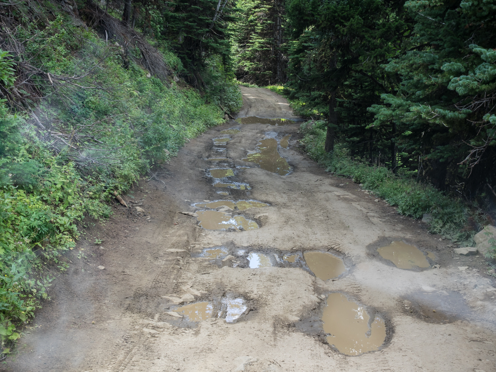
We had
many miles of rutted, muddy roads. The mud holes provide a
jarring ride and successfully rearranged our cargo in the camper
despite being "secured". Mud holes are heinous because
they are self-propagating: the more folks that drive into them,
the deeper become and more likely to catch and retain water.
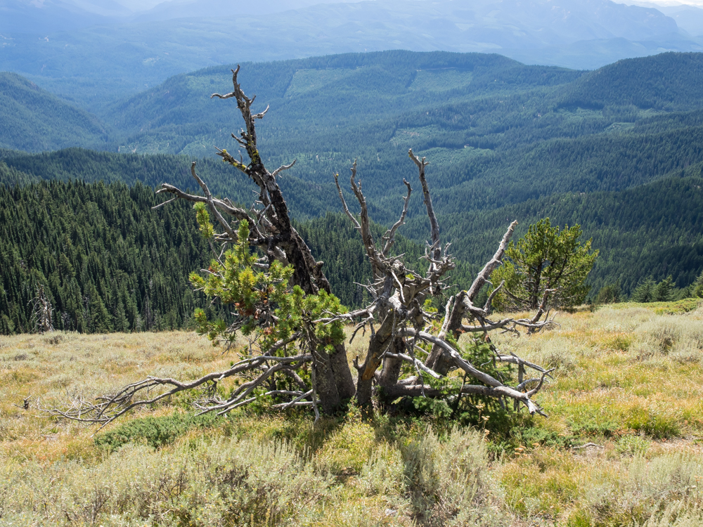
Further
along the cliff we hit a sparse spot in the trees. Note
the slope of the terrain.
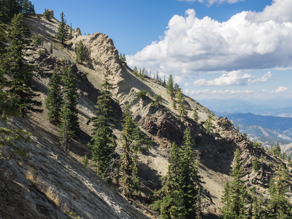
This fin
looks like an intrusive dike, but given its color, I am betting
it is just a point of weather-resistant material.
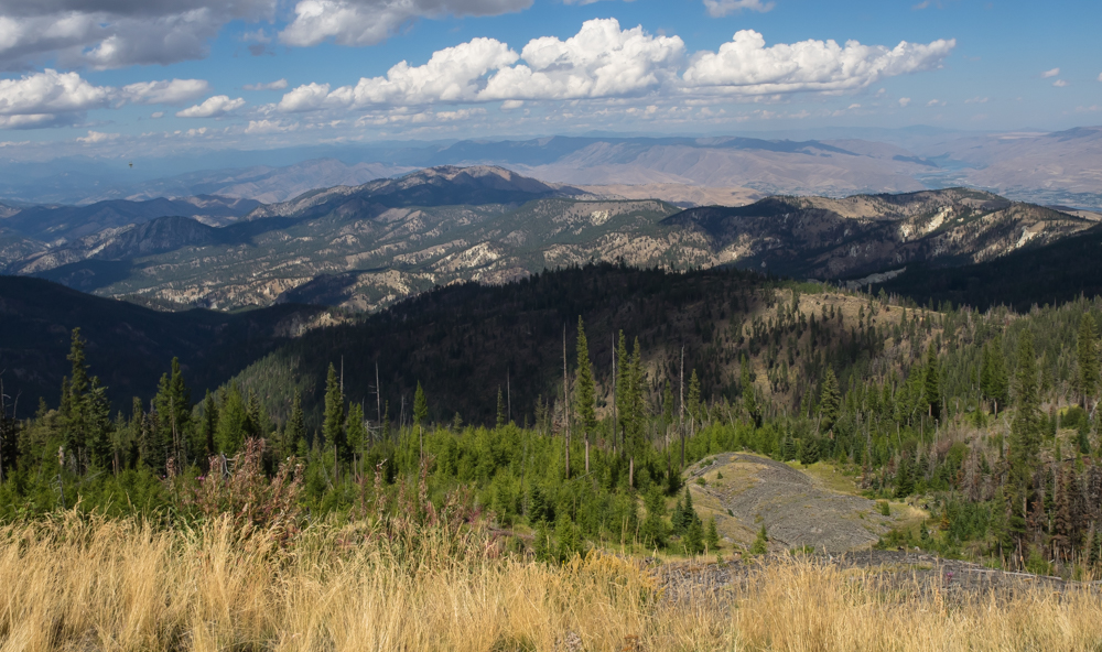
Further
west, the cliff trail provided us a view of the Columbia River
valley. The far plateaus are on Indian reservation and are
clearly being farmed. The city in the valley is likely
Wenatchee, WA.
Continuing
along the ridge line we came to another view point that showed
the exposed strata.
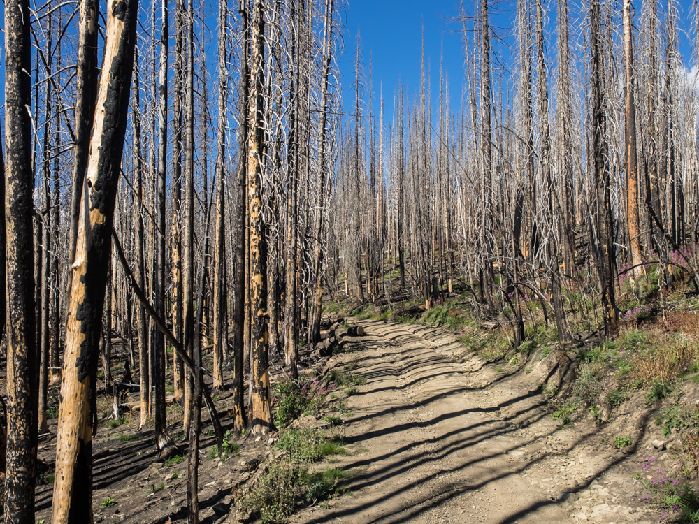
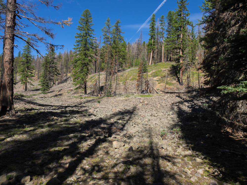
We
crossed the crest of a ridge and the trail turned to the south
over another ridge into an area that suffered heavy fire
damage. There were miles of wasted area. But, in for
a penny, in for a pound. We continued on hoping that we
would get past the fire damage before nightfall.
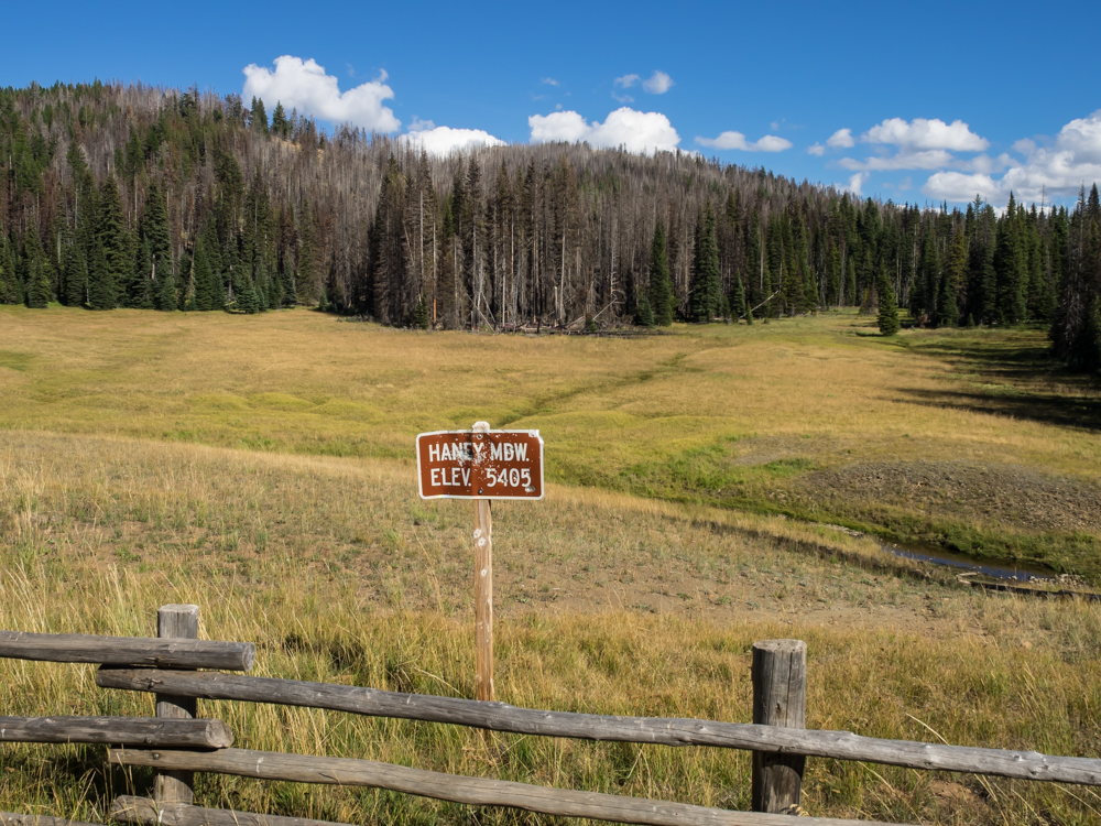
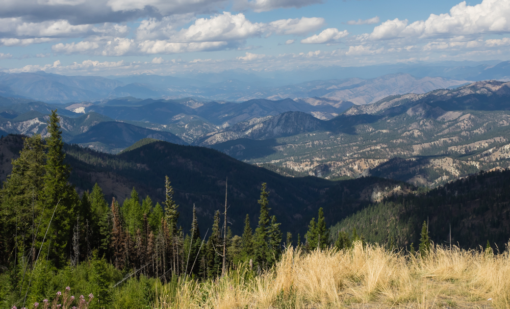
A few
bumpy miles later we crested another ridge and started down the
western flank of the ridge. Soon, we had dropped 1,000
feet of elevation and got past the burned area into a nice
meadow. I think it is laudable that the government puts up
targets for the shooters.
We found
a sufficiently flat area near the meadow and set up for the
night. It had been warm/hot in Wenatchee (elevation 700
feet), but at over 5400 feet, it got cold quickly after dark.
Next
morning we broke camp and continued west on the same
trail. We came to a horse camping area and the road got
significantly better on the western side. The trail took
us past several large areas of fractured basalt.
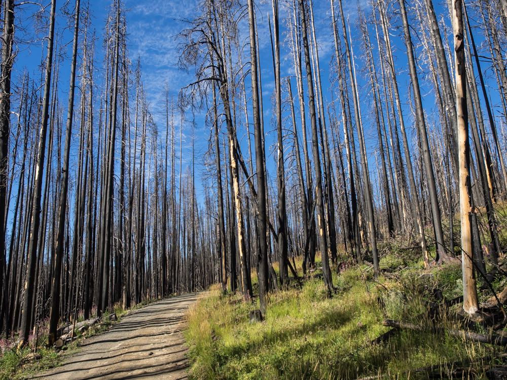
When it
burned, the fire hopped from one portion of the mountain to
another, sparing some areas and burning others. We went in
and out of burned areas for several miles.
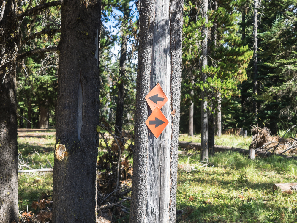
A good
sign for those that don't know whether they are coming or going.
Further
west, the trail traversed a large fractured basalt zone on a
steep, narrow ledge created by a bulldozer. The trail was
very exposed and the rockfall area was steep leaving no room for
wheel placement errors. But, the trail giveth and the
trail takes away. What we lost in driving comfort we
gained in view. No trees grew through the fractured basalt
allowing a clear view of the mountains beyond.
A
portion of the basalt scree zone is visible in the bottom right
of the photo above.

We
descended the final ridges and came to US97 and headed south to
Ellensburg, WA for lunch and a supply stop. Outside the
Mexican restaurant I spotted this gem. Nicely done, Jed.
From
Ellensburg, we headed west through Manastash Canyon back into
the mountains. The plan was to go up Quartz Mountain and
then follow the trail down the other side to WA410. The
map said the trail was there, so we decided to check it out as
it would save us 60-70 miles of road driving. But, short
cuts are rarely shorter. The road most of the way up
Quartz Mountain was pretty good. Higher up, it got
steeper, more narrow and rutted. We finally got to the
peak and got a nice view. Note the clear-cut areas in the
photo above.
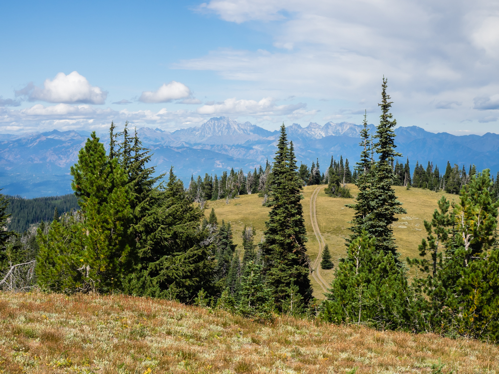
To the
north we could see rugged peaks.
At the
base of the range was a reservoir that looked well below it's
capacity.
The peak
area at Quartz Mountain was flat, but windy and cold. We
started down the trail going southwest and were immediately
thwarted by trees. Thor is a full 8 feet wide and the trail
had not been maintained in years. There were plenty of ATV
tracks, but no full size vehicle tracks. We scouted about
1/2 mile of trail on foot and both of us concluded that the
grade and rocks were of no concern. But, without a chain
saw and plenty of muscle (and time) the trail was a no-go.
So, we admitted defeat and returned to Ellensburg for that 60
miles of road that we were seeking to avoid. The cost of
the whole affair: 60 miles of dirt (including the backtrack) and
60 miles of road.
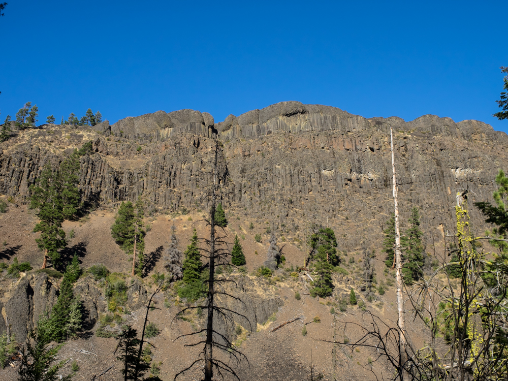
Manastash
Canyon has steep walls cut into the basalt flows. Look
carefully at the photo above and you can see at least 6 separate
basalt flows stacked like a layer cake. In the past the
whole Columbia River basin suffered repeated volcanic flows that
have been uplifted, folded and eroded to provide today's
topography.
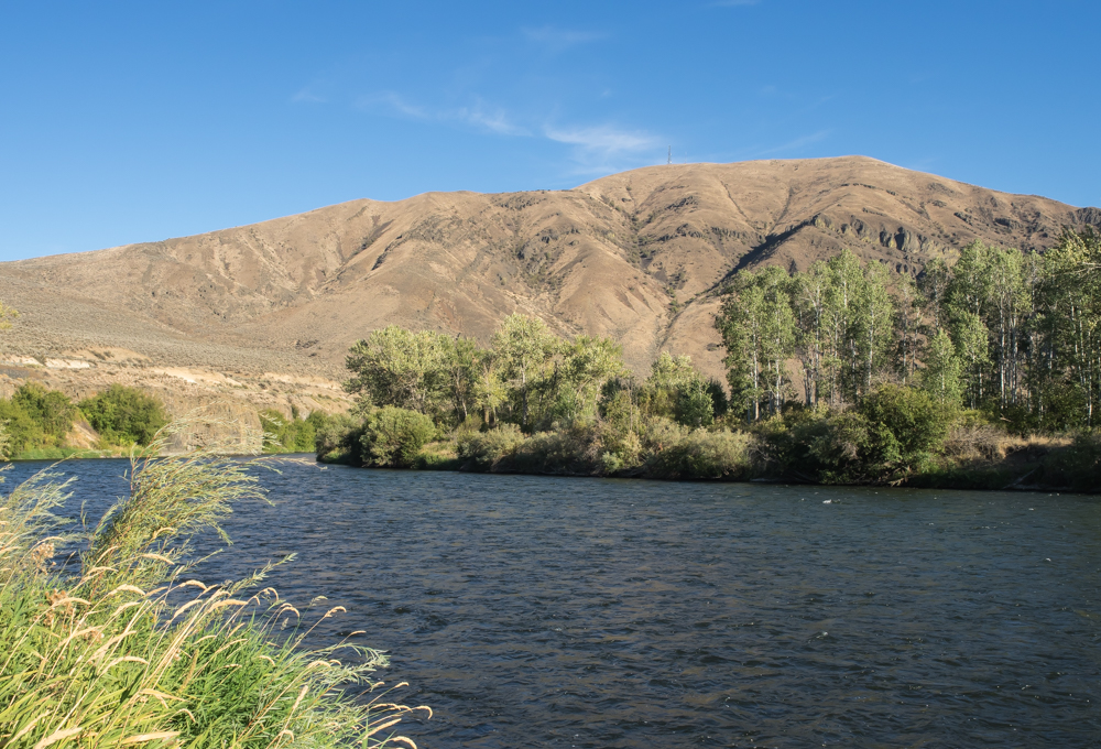
We
traveled back to Ellensburg and then went south along the Yakima
River. It was getting late so we chose a BLM camp site on
the river. We also realized that it was Thursday before Labor
Day and the coming weekend would provide heavy traffic in the
back country areas. Indeed, after we set up our camp many
folks came into the area seeking a spot and then having to
continue on.
The
night next to the river was uneventful (some of the best nights
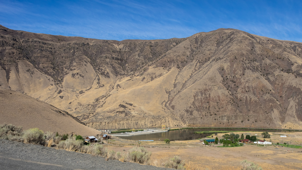
are...) and next morning we continued south toward Yakima along
the Yakima River canyon. Above is a mystery facility we
spotted on the river. At first we thought it was a fish
hatchery, but there was too much concrete for a simple
hatchery. My second guess was a water treatment plant, but
it did not have enough infrastructure for that. My final
guess was an intake for the irrigation canal that serves Yakima.
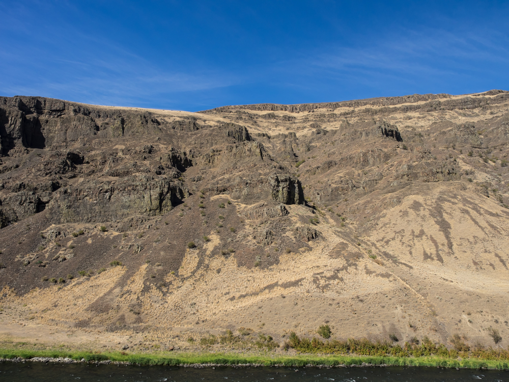
The layer-cake
structure of the repeated basalt flows in visible in the cliff
walls in Yakima River canyon.
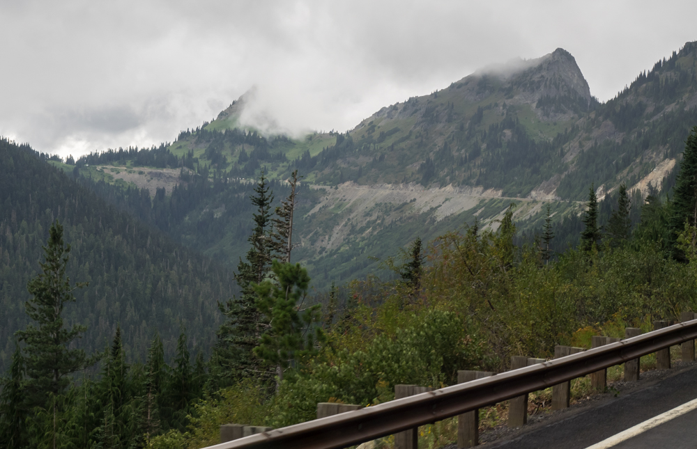
We did a
resupply stop in Yakima and then headed west on US12 over Chinook
Pass. The upper reaches of the approach were shrouded in
clouds.
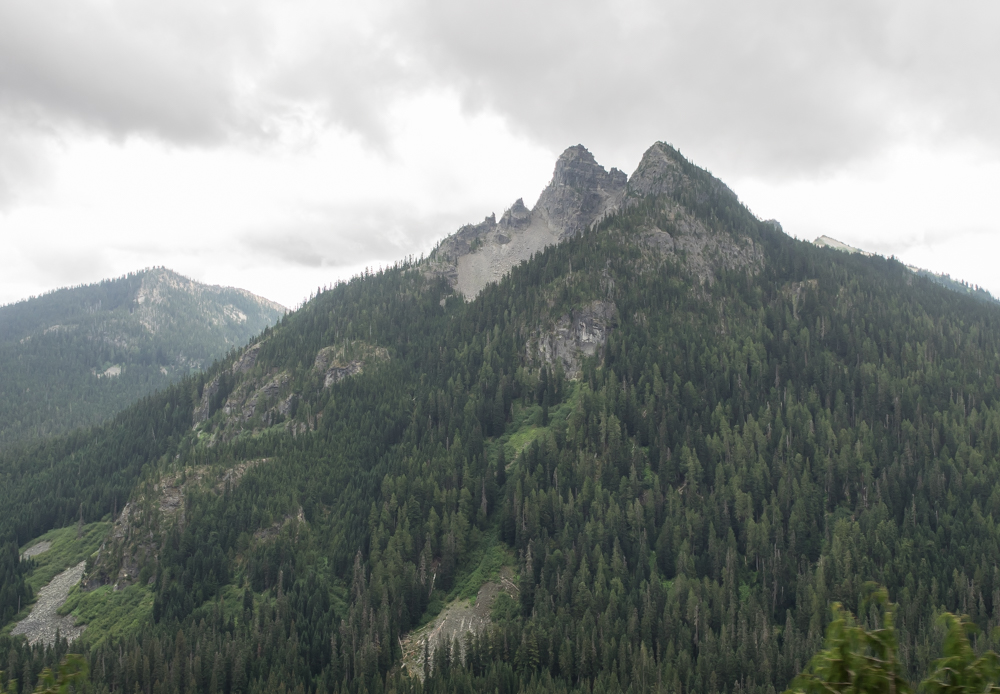
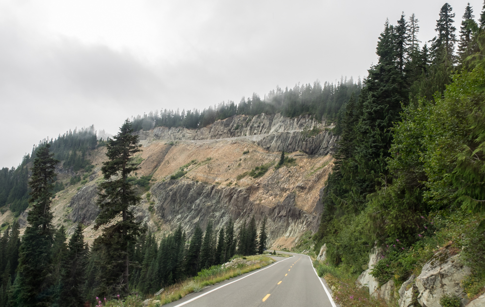
The
approach to Chinook Pass provided nice views of rugged peaks to
the south of the highway.
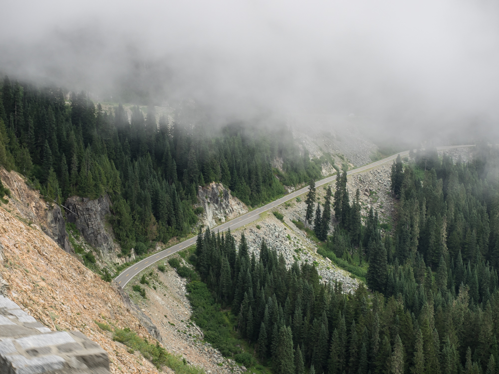
There
were many rock slide areas on the approach to the pass.
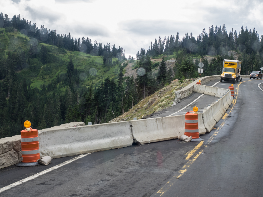
This section of the highway was blown away by a slide. The
retaining wall was demolished and a portion of the highway
itself was starting to slide into the canyon.
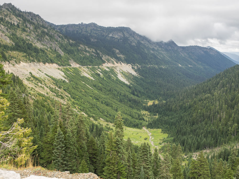
At the
crest of Chinook Pass was a pull-out area. Looking back,
the pass is a pretty constant grade. The slide areas are
obvious.
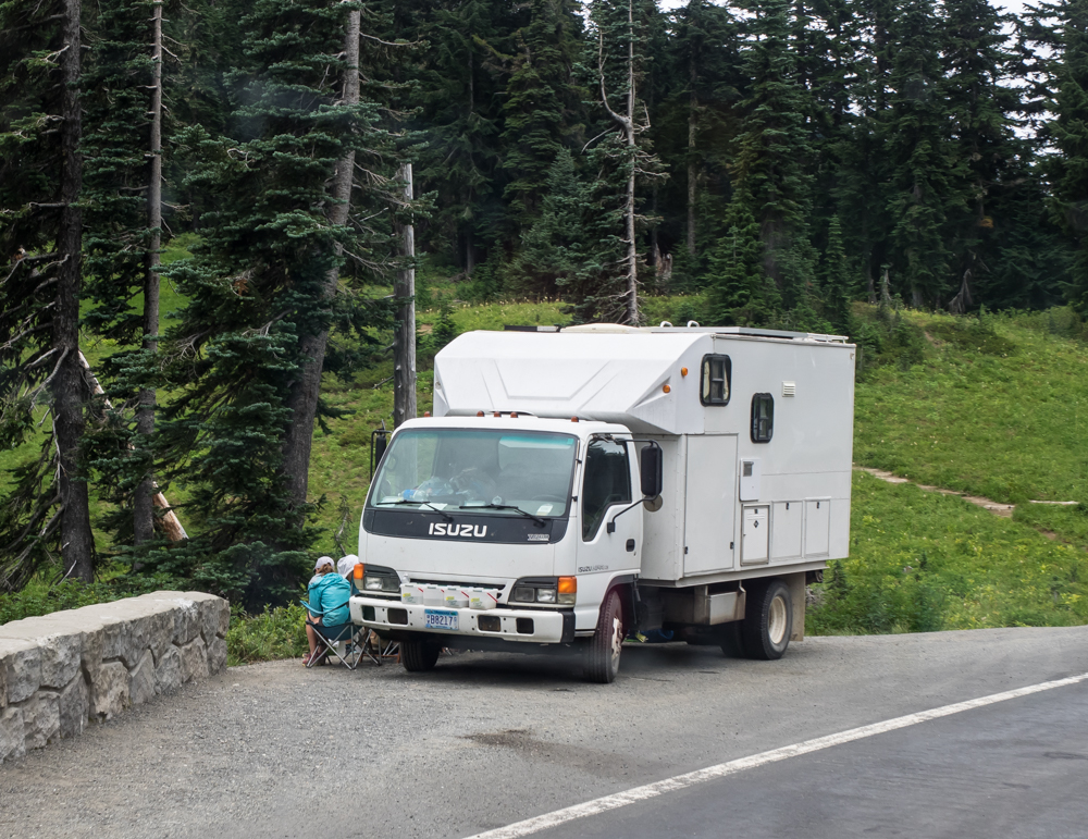
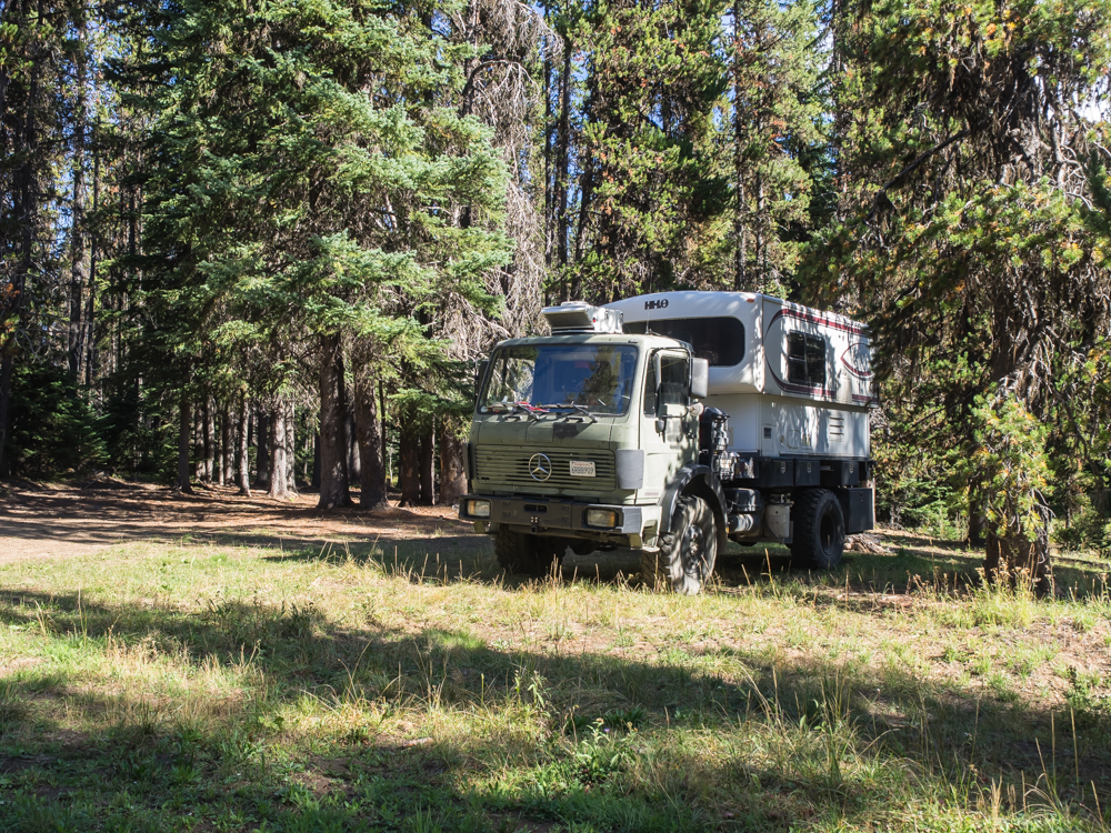
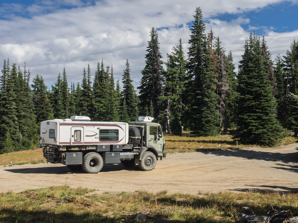
At the
crest of the pass, we saw this camper. We should have
stopped, but instead kept going. This truck is significant
because we saw it in 2011 in the
Badlands in South Dakota. (See photos 11 and 12 on
that link.) The license plate is from Minnesota, there is no question
it is the same vehicle. What are the chances that we would
be at the same place at the same time 3 years later?
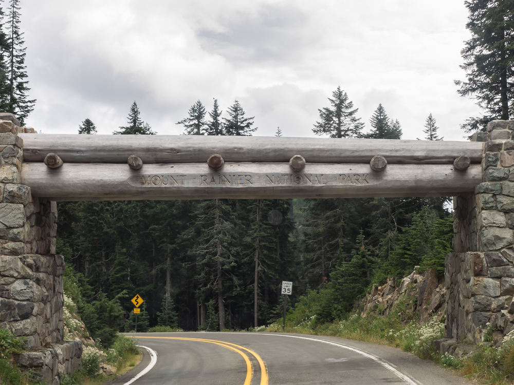
The
crest of the pass brought us into the Mount Rainier National
Park.
The west
side of Chinook Pass was much steeper and intense than the east
side.
The
switchbacks cut through layer upon layer of basalt.
| Previous Adventure | ||
| Trip Home Page |
Photos and Text Copyright Bill Caid 2014, all rights
reserved.
For your enjoyment only, not for commercial use.