We
spent the night at a camp on the Indian reservation. The
facilities were basic, but adequate. The good news was
that the camp was right on the beach. From Hobuck, we did
a banzai run to Bellingham, WA to meet some college friends and
stay at their place for a few days. From Bellingham, we
headed over the Cascade Mountains and down the east slope to the
Columbia River.
The photos below are what we saw.
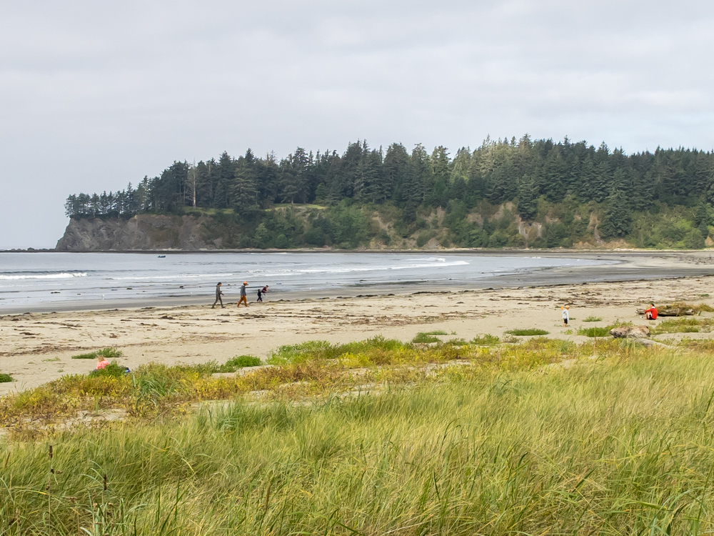
When
morning came at Hobuck, I headed down to the beach to see what
was going on. There were families there enjoying walking
on the beach and looking for shells.
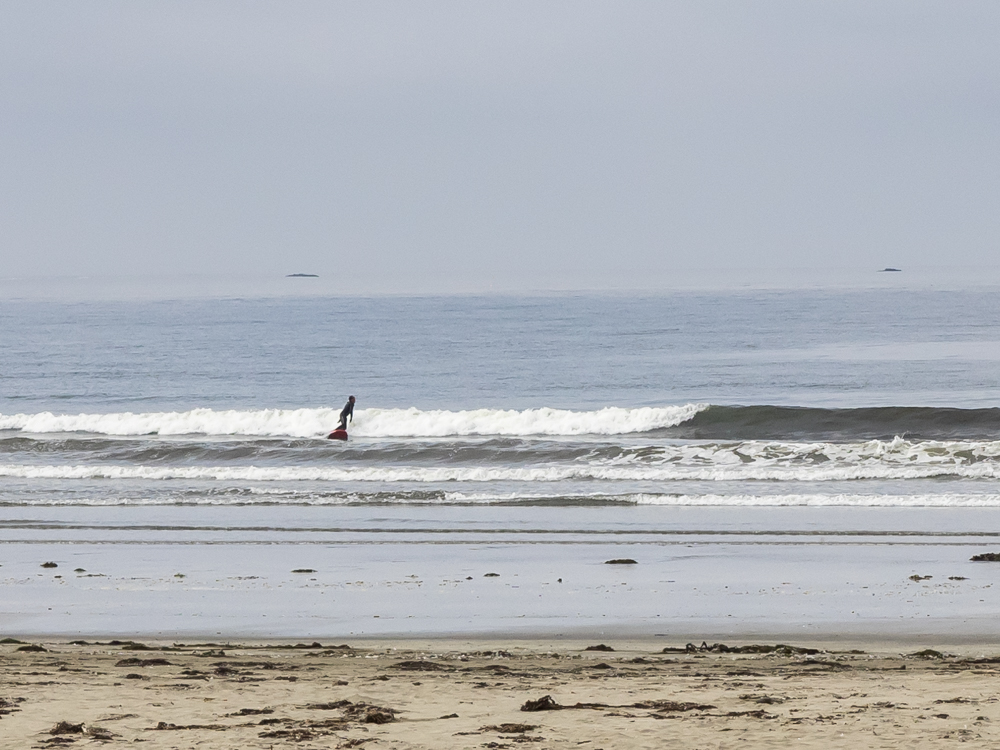
Out in
the cold water was a hearty surfer making use of the waves.
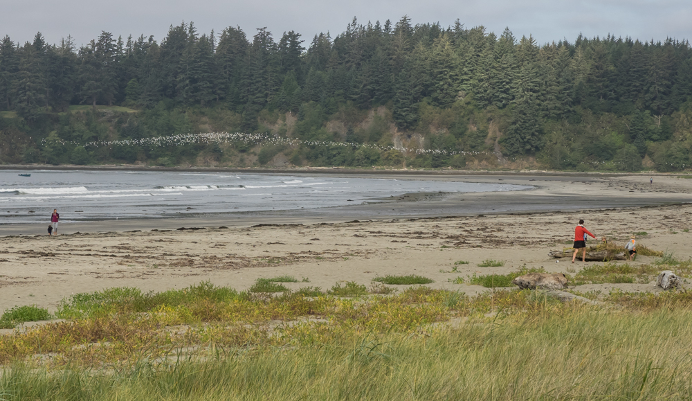
While
cruising the beach I spotted a huge flock of sea birds. The
flock swooped and swirled and eventually landed in the marshy
area next to the surf.
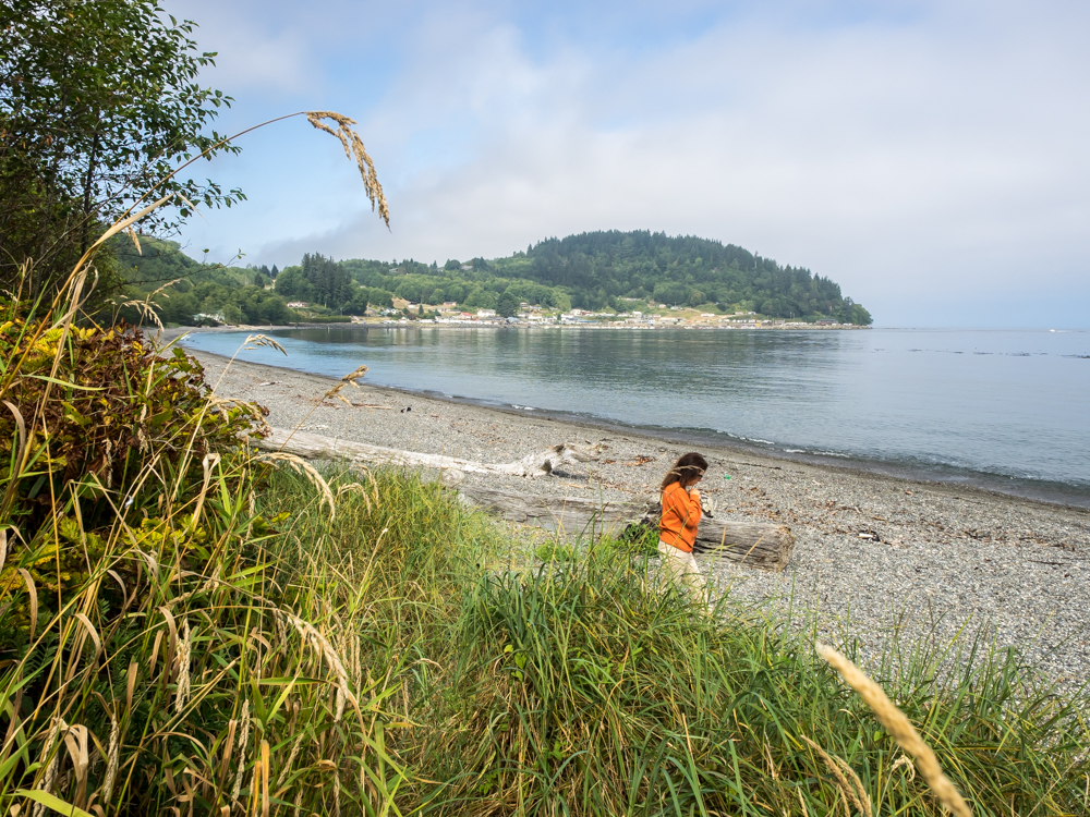
Kathleen
traveled the gravel beach with me. There was plenty of
driftwood. In the distance, the structures are associated
with the Indian reservation. It was a beautiful bay and
the water was calm. But, Hobuck bay faces directly into
the Pacific and I am guessing that it is anything but calm
during the frequent winter storms.
To make
the journey from the Olympic peninsula to Bellingham required a
ferry ride. We boarded at Port Townsend and headed across
Puget Sound to Whitby Island. We timed our arrival
perfectly and waited less than 5 minutes before boarding.
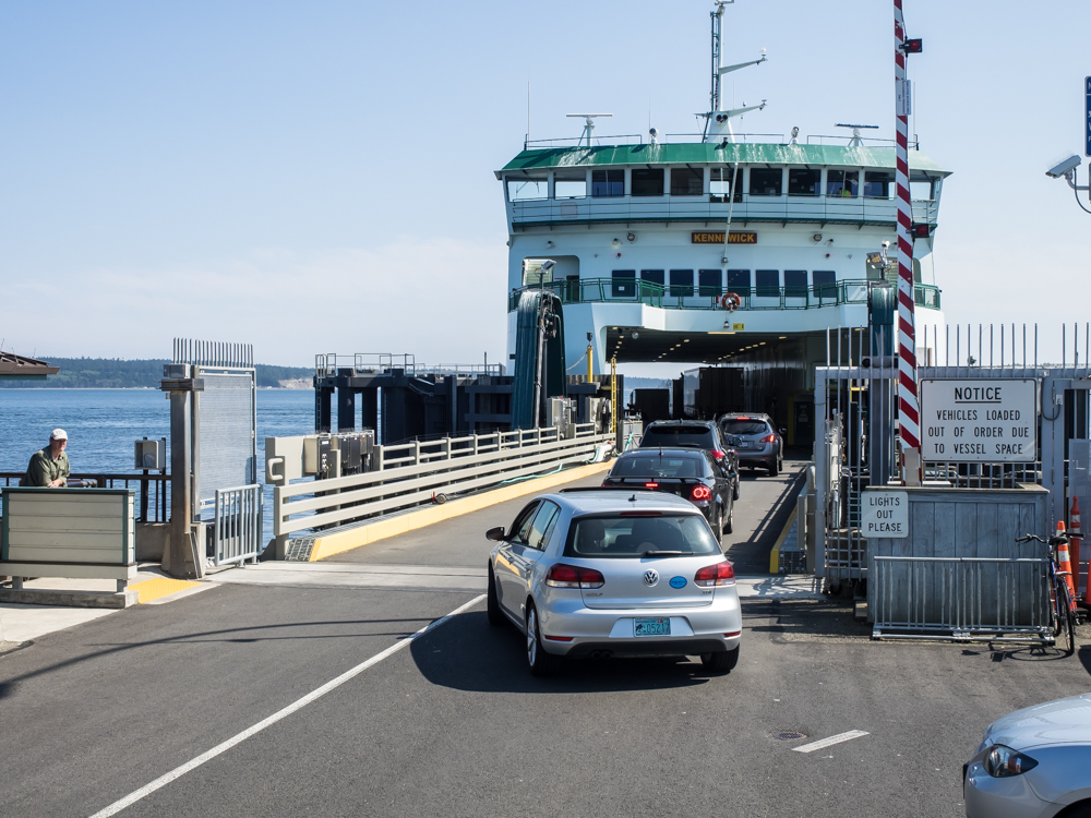
The
ferry terminal is a substantial structure. In the distance
the old buildings of Port Townsend are visible.
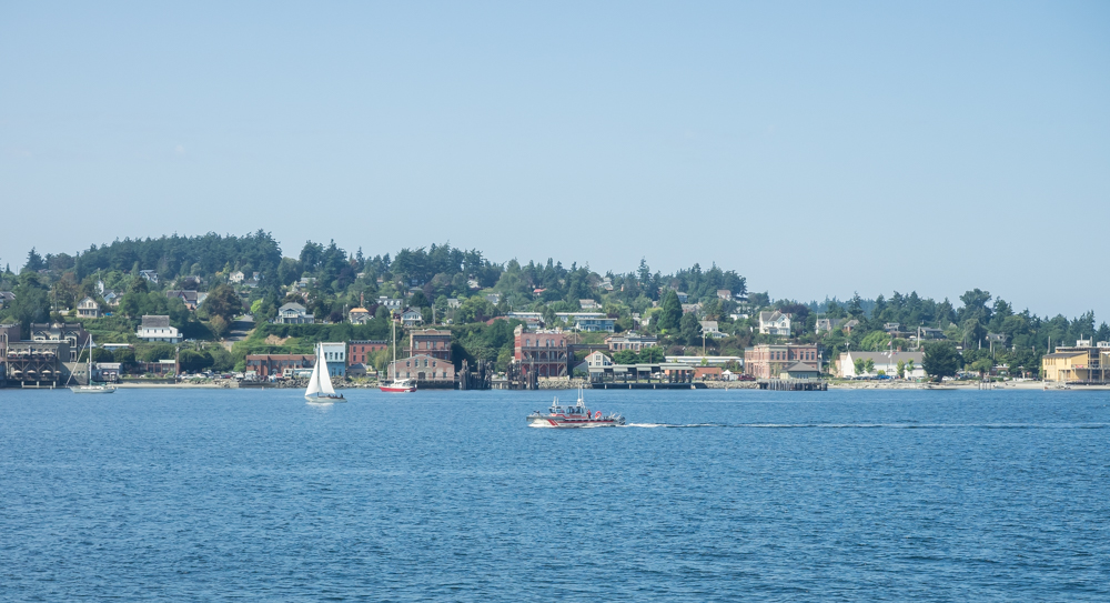
There is
plenty of Coast Guard activity in Puget Sound. The waters
around Port Townsend were no exception. Above a small
patrol craft makes a pass by the port.
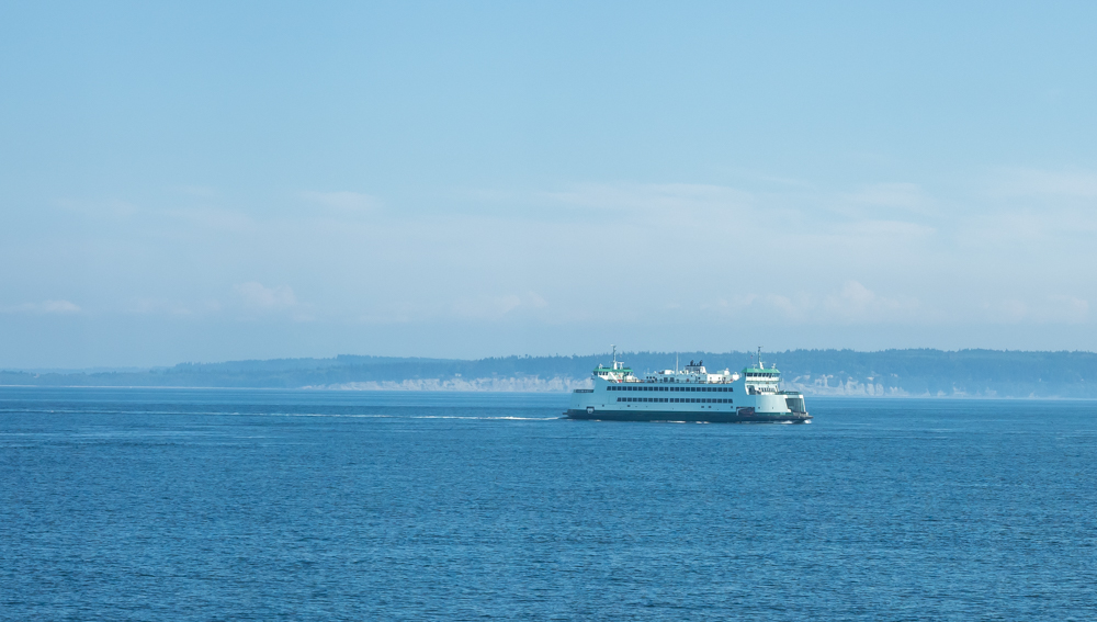
In
mid-bay, we passed the sister ferry for this route coming west.
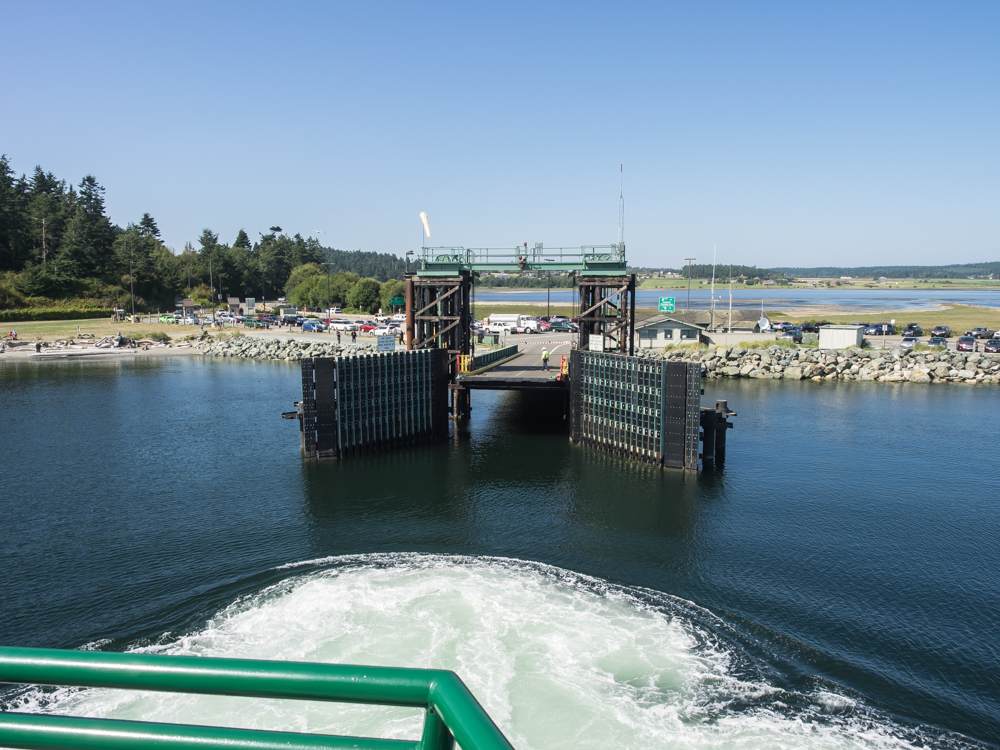
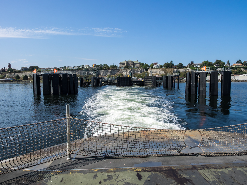
Whitby
Island terminal was much smaller, but sufficient for our
needs. Note the thruster prop wash serving to brake our
approach toward the ferry dock.
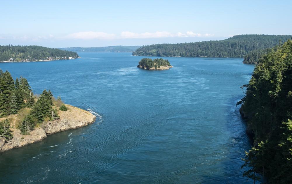
The path
was WA20 that took us over Deception Pass.
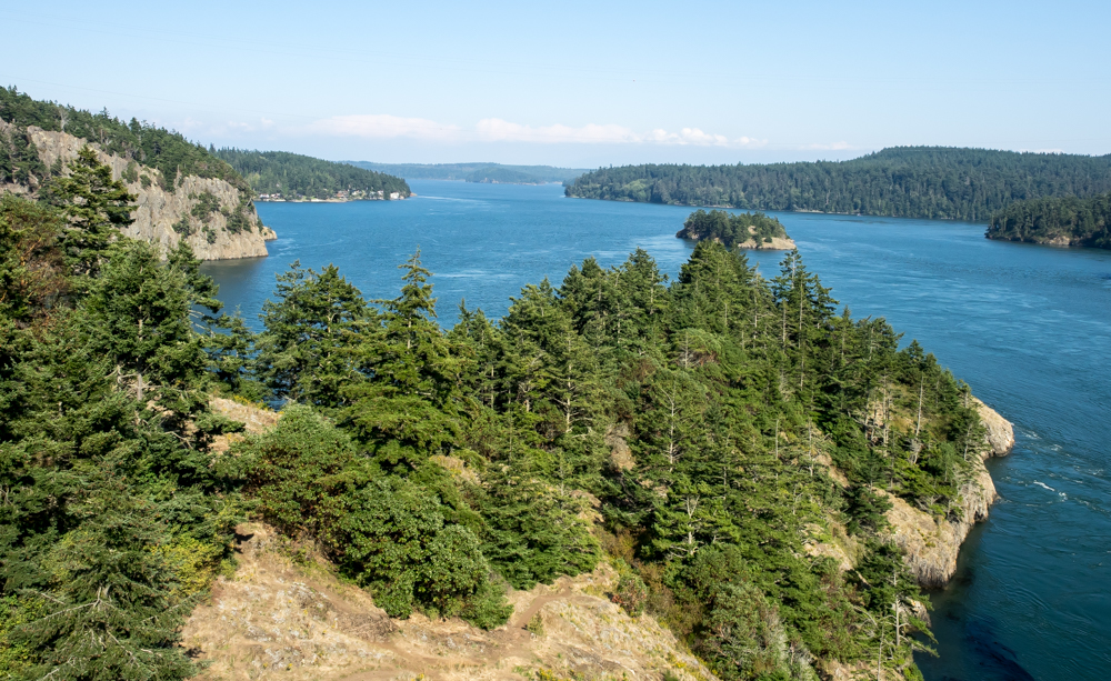
Between
Anacortes and the mainland was another bridge that provided a
nice view.
We visited
our long-time friends, George and Randi, at their place in
Bellingham. They threw several parties for us and we had a
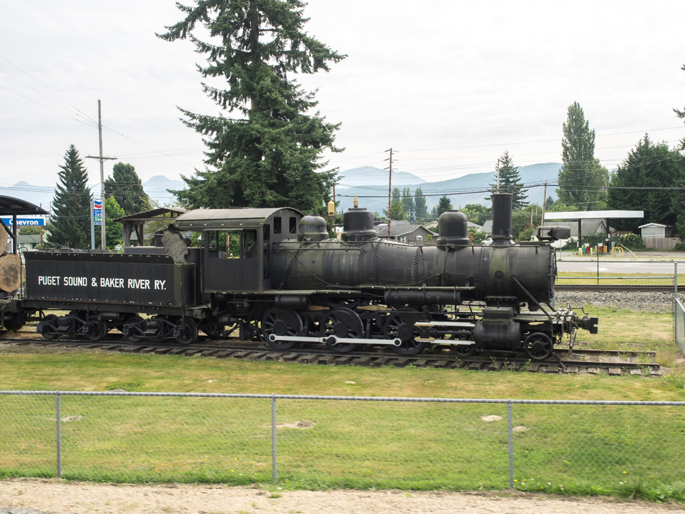
great time. From Bellingham we headed east on WA20 toward
the Cascade mountains. At the base of mountain we spotted
this old steam engine.
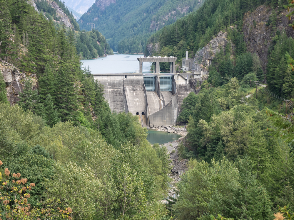
From the
highway we were able to see several of the dams that part of the
Seattle Light hydroelectric system. This is the lower dam
of the 3-dam system and is somewhat unique in that the
powerhouse is not adjacent to the dam itself. In this
case, the topography made that impractical so the powerhouse is
several miles downriver with water being diverted through a
series of tunnels through the mountain. The benefit is
that the powerhouse is located in an easily accessible area and
the tunnels provide extra "head" for the generators.
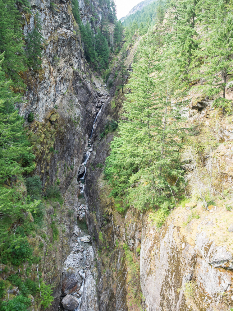
Further
upriver there was a highway bridge over a deep, narrow
gorge. The bridge crossing allowed a view of the series of
cascades in the gorge.
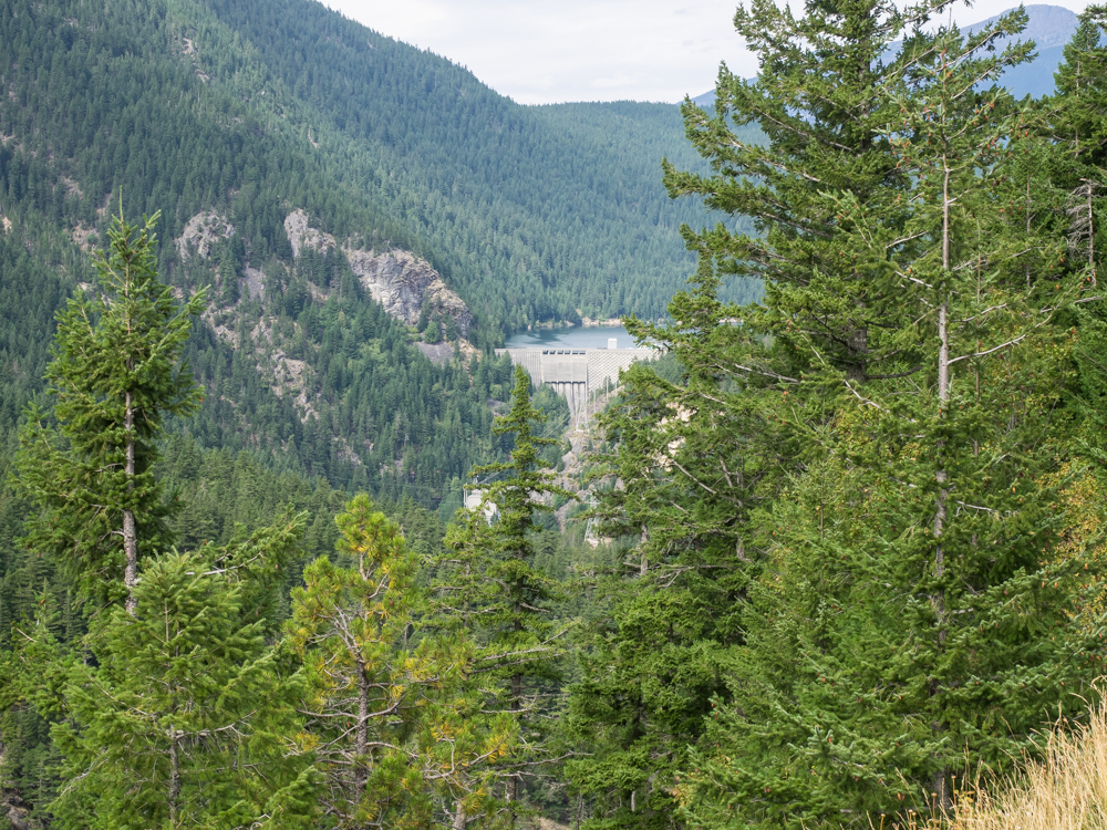
Still
further upriver was Diablo Dam.
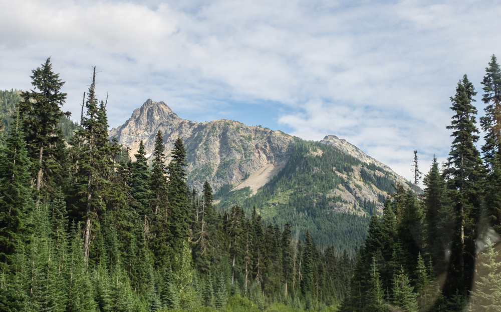
WA20
crosses the Cascade Range and the path provides awesome vistas
of the mountains.
The
upper reaches of the mountains were very rugged.
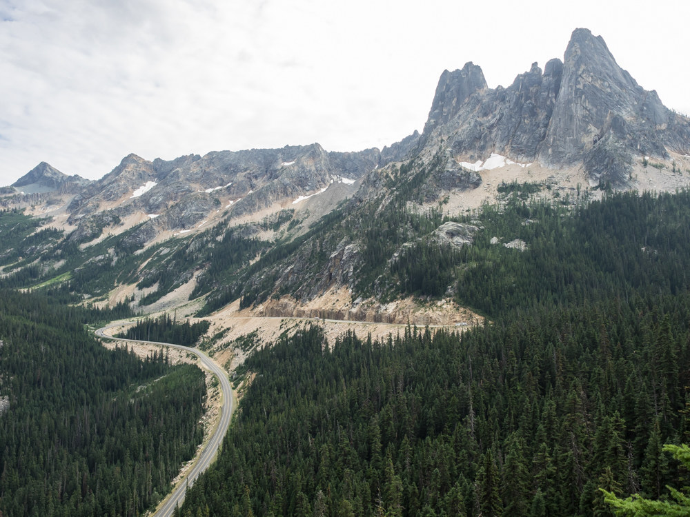
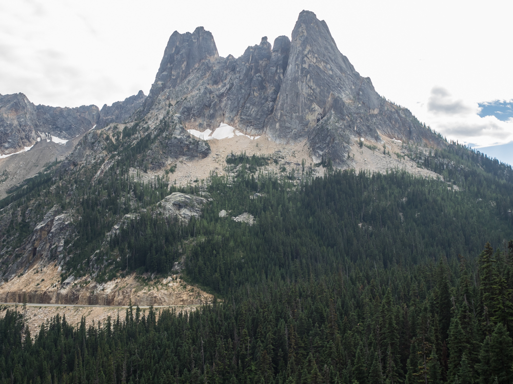
At
Washington Pass we spotted a sign for a viewpoint. A short
hike was required to get to the actual overlook, but it was
worth it. The highway is visible in the photo above.
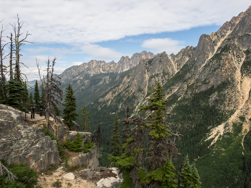
The
overlook had several vista points with one being visible at the
left in the photo above.
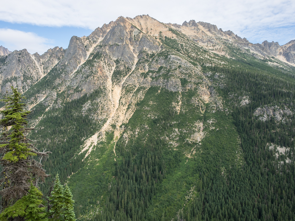
To the
south of the overlook, the peaks showed scars resulting from
avalanches and rockslides.
Some of
the upper peaks still had small snow fields.
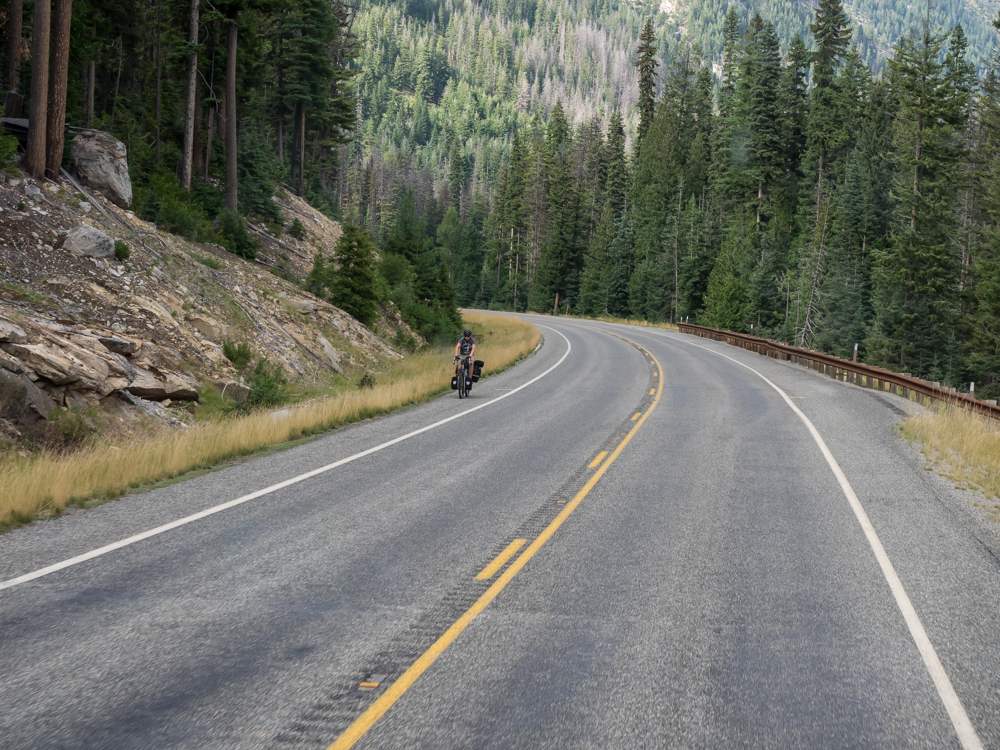
On the
east side of Washington Pass we encountered a pair of bikers
coming up the grade. This fellow has another 2,000 of
vertical to complete before cresting the pass.
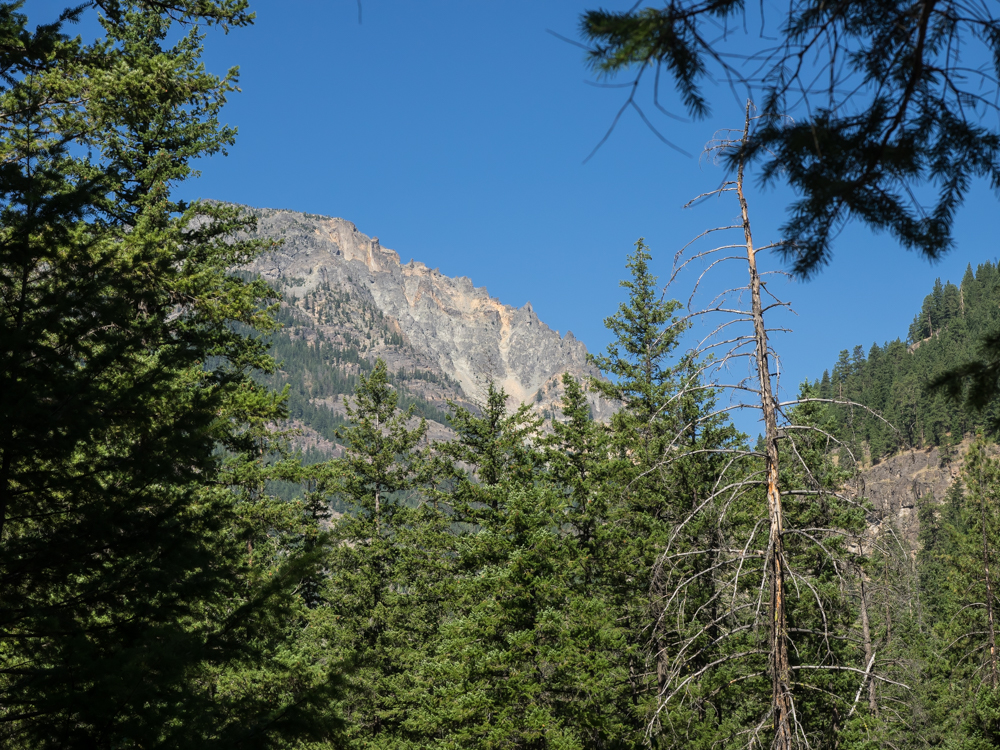
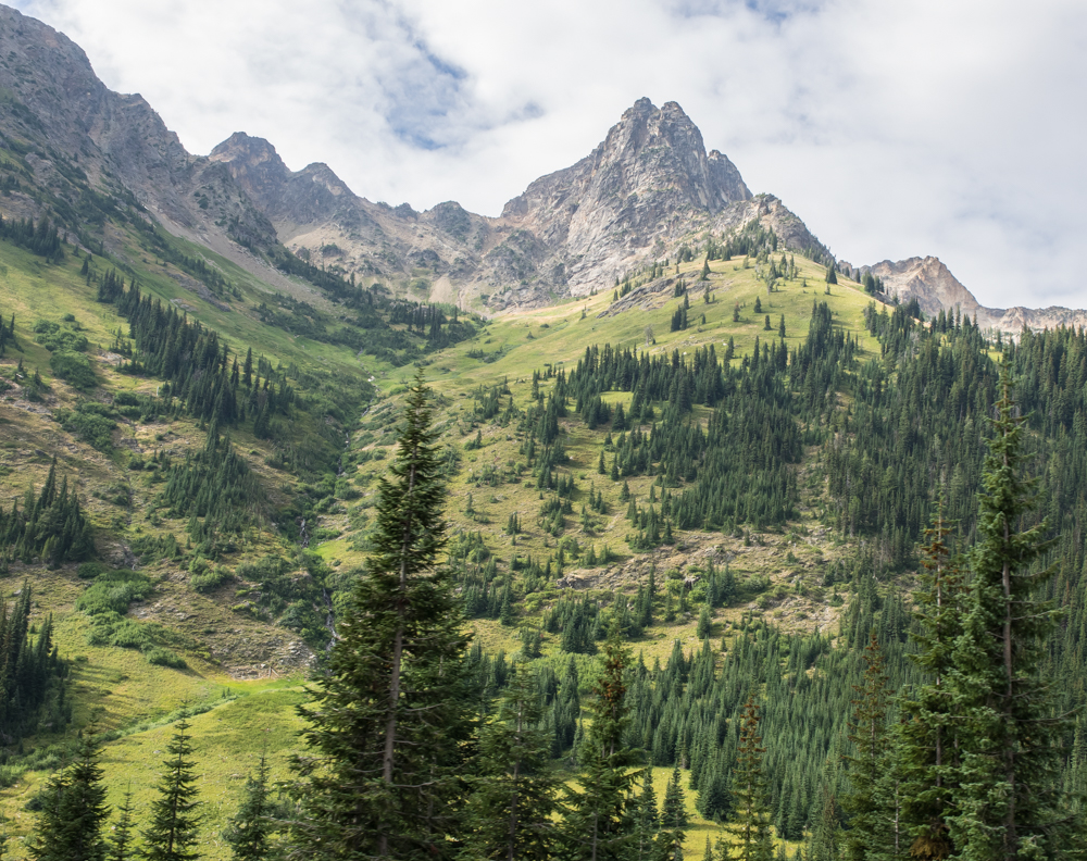
We followed
the canyon to the lower elevations and then found a side road
that provided access to the forest. We chose a dirt path
and found a flat spot for our camp. Next morning, we could
see some of the cliffs associated with the structure known as
"Goat Wall".
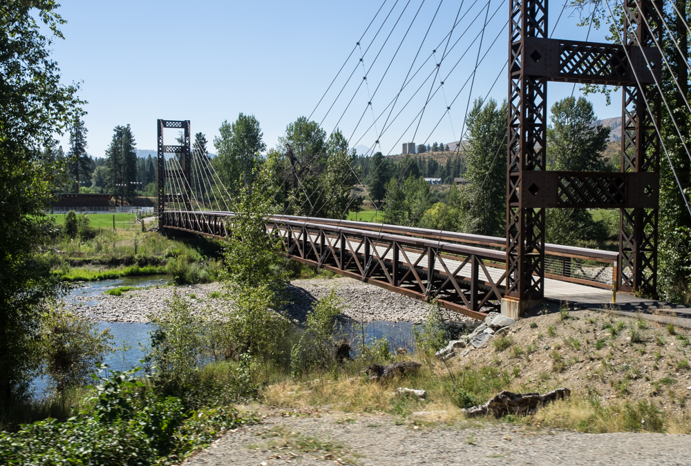
Further
east in the little tourist town of Winthrop we spotted this nice
pedestrian bridge over the river. Most of the year, the
flow prevents safe fording of the river.
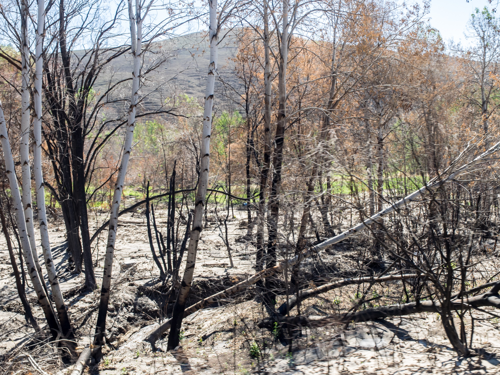
Further
east of Winthrop, in a small town called Twisp, there was
graphic evidence of the recent fires and thunderstorms.
The area was ravaged by fire early in the summer and then just a
few days before had suffered strong thunderstorms that brought
heavy rains. When rain meets fire-damaged terrain, large
runoff-driven debris flows tear into the landscape. The
photo above was taken from WA20 just east of Twisp. We
wanted to take the southern route from Twisp, but that route was
closed due to a large landslide as a result of the flooding.
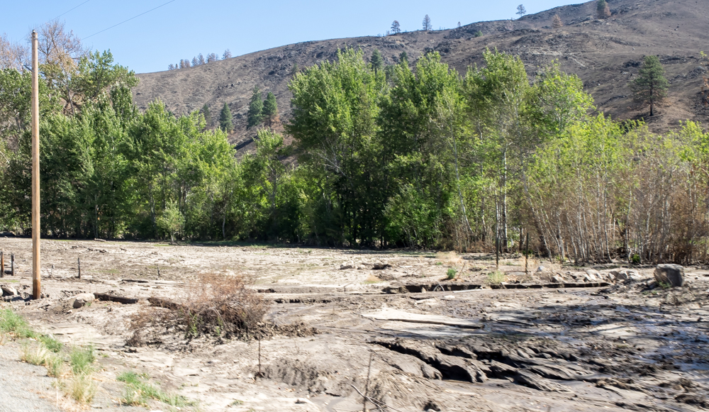
Heavy
runoff will cut deep trenches in the landscape.
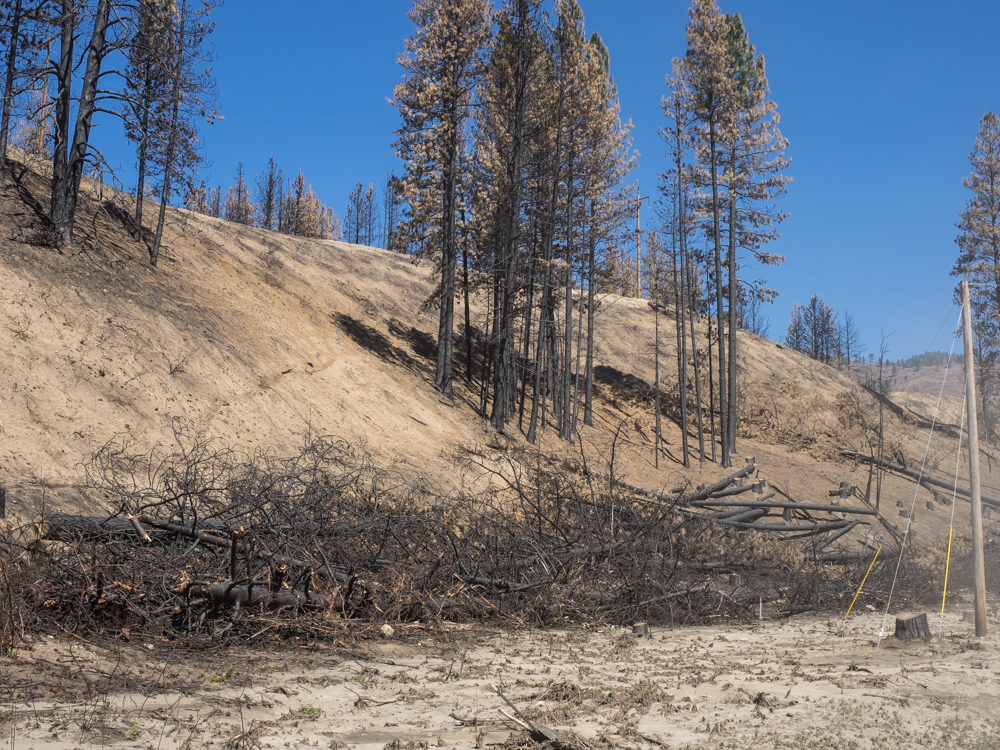
The fire
damage was heavy and stretched over the mountains from Twisp all
the way to the Columbia River. Trees near the road had to
be cut to prevent them from becoming "dead-fall" and blocking
the road.
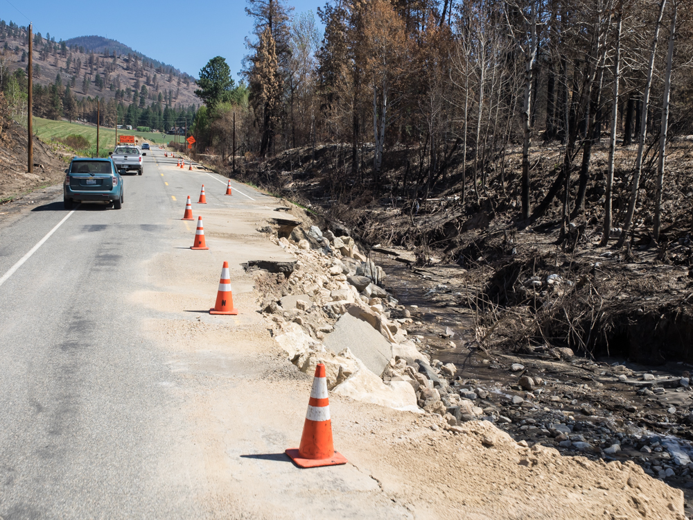
The
heavy runoff due to missing ground cover produced substantial
damage to the highway in many points. The photo above
shows only one of about a dozen points of damage.
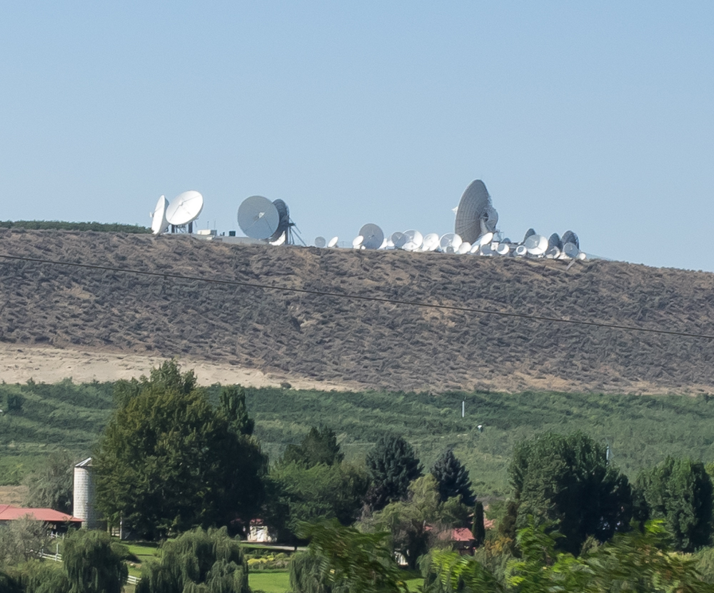
Further
east on WA20 we spotted this antenna farm. Given the scope
of the farm, I can only guess that the owner is the government.
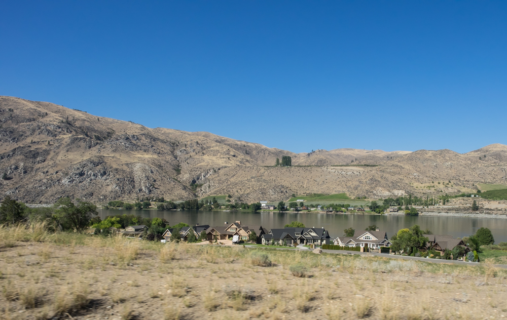
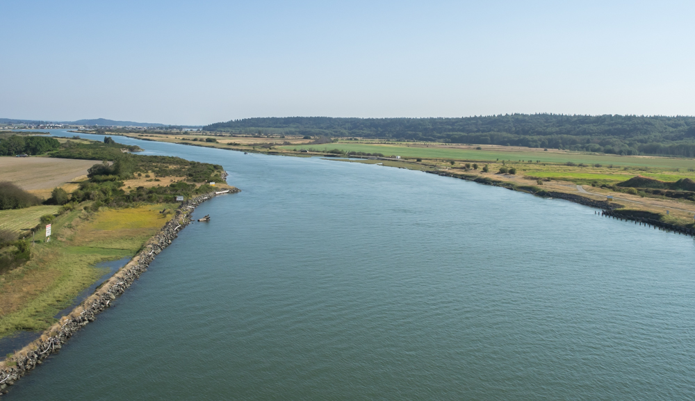
We
followed the highway to Okanogan and then Omak. From Omak,
we headed south along the Columbia River. Many sections
along the river had been transformed from "backcountry low-rent"
to expensive river-front mansions. While I would prefer
seeing virgin land, this alternative was far superior to the
first possibility.
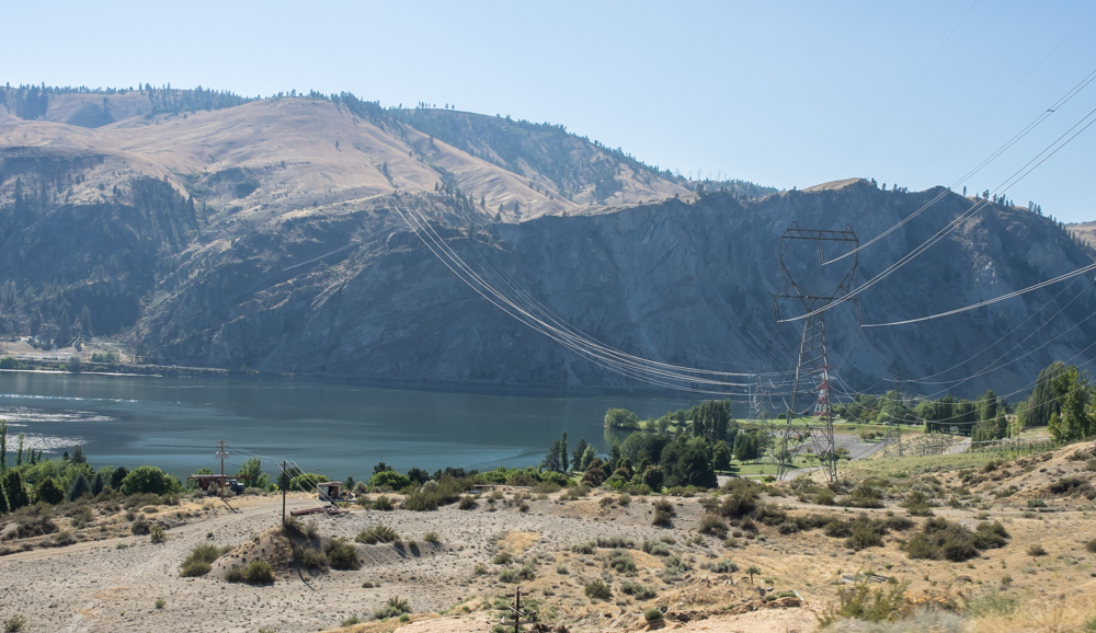
Our
route took us past plenty of electrical infrastructure that
moved power from Grand Coulee Dam to the east.
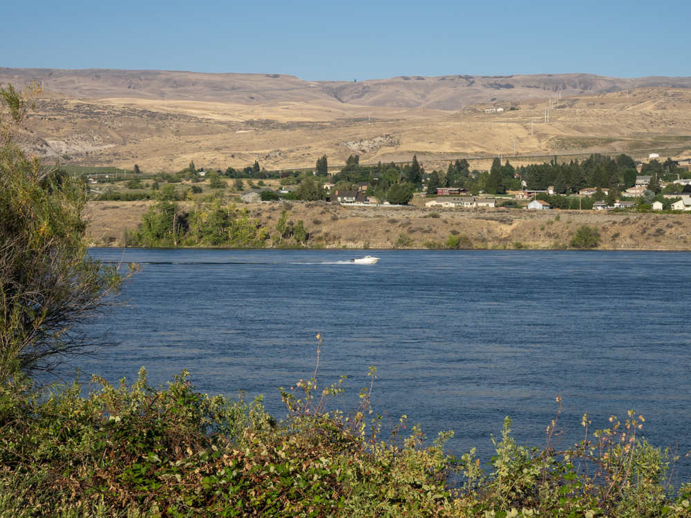
We
decided to go to the Columbia Confluence State Park in
Wenatchee. The park had all the amenities we needed (which
at this point was a shower) and was located right on the banks
of the Columbia river. From our camp we could see the
recreational boats on the river.
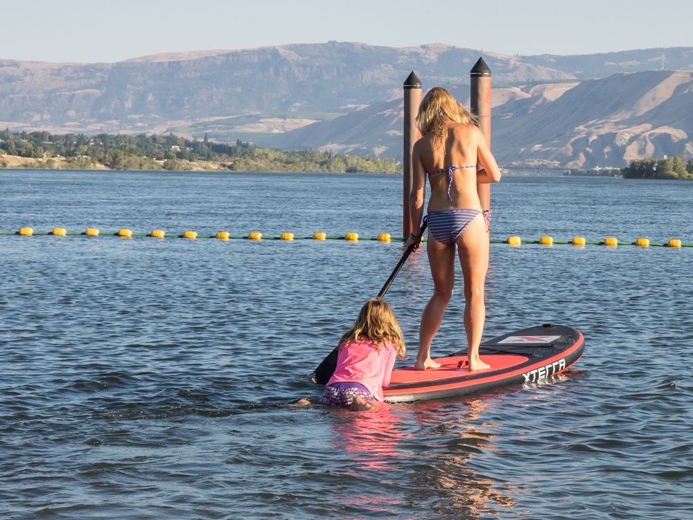
Ha!
Proof that there is hope yet for the human race. I was
really tired of viewing FFAs, but "when in Rome.." I
spotted this gal on the inflatable paddle board and headed over
to talk to her. Kathleen and I had an extended
conversation with her and she was an extremely nice person in
addition to her other obvious qualities.
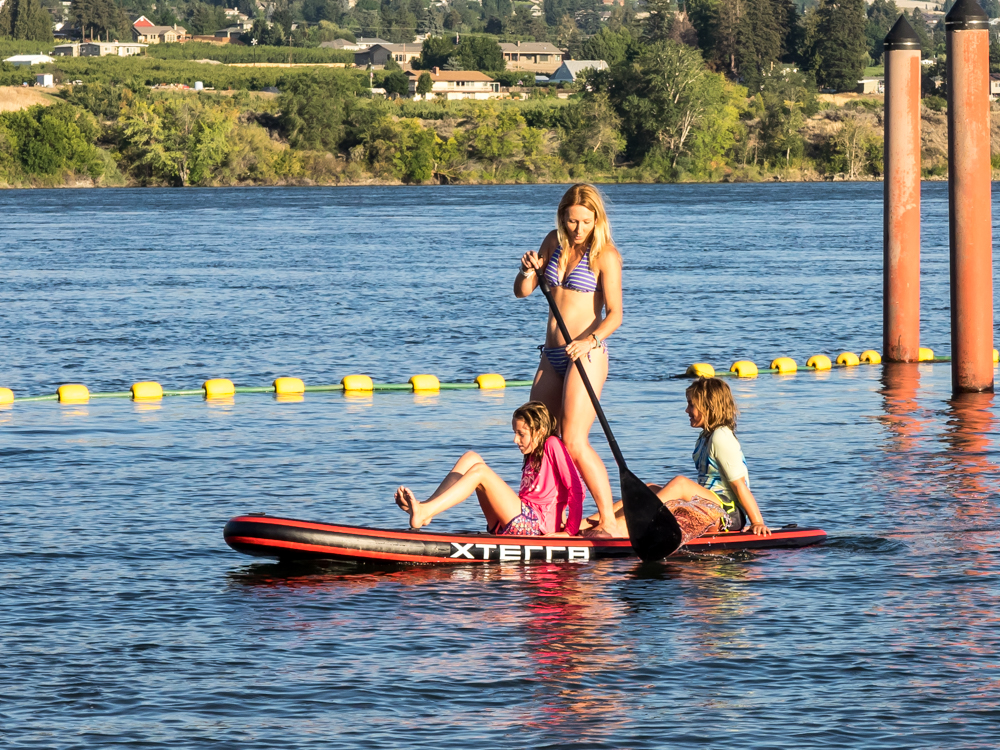
Her name
is Arla and she lives in Wenatchee and brought her daughter and
a neighbor kid with her to the Columbia Confluence beach where
we were camped.
| Previous Adventure | ||
| Trip Home Page |
Photos and Text Copyright Bill Caid 2014, all rights
reserved.
For your enjoyment only, not for commercial use.