We left
White Salmon, WA and headed east toward the Dalles Bridge and
then south through central Oregon. Our first objective was
meeting with our friends Mark and Arrenia in Arcata, CA and then
travel south to the San Francisco Bay area to see Kevin and
Kristen.
The photos below are what we saw.
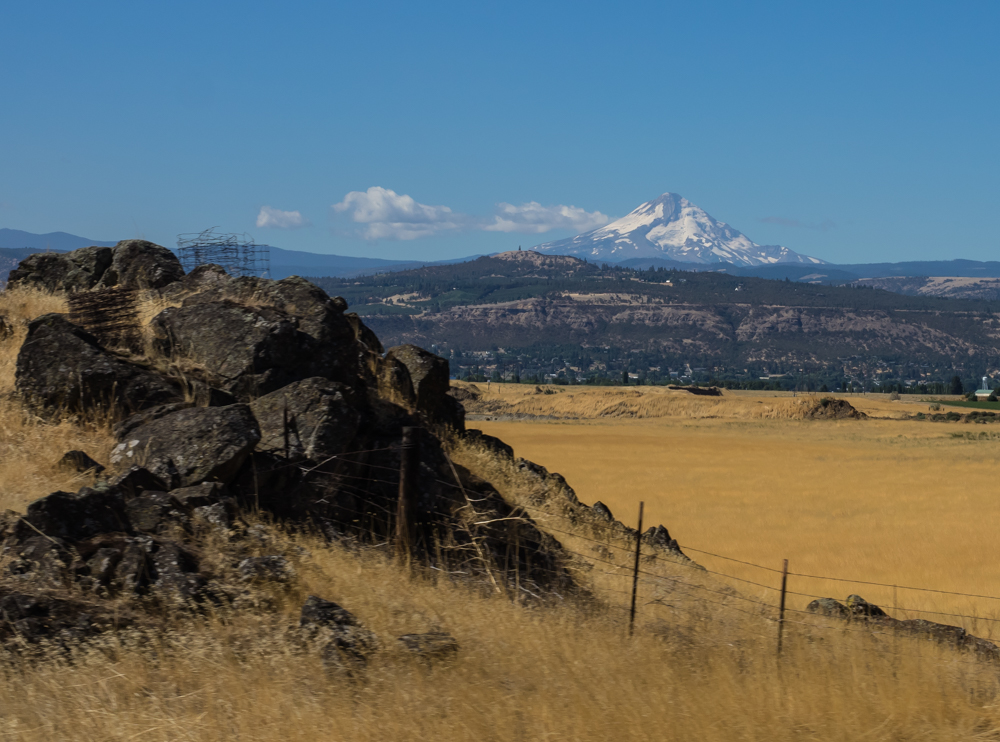
As we
headed east along the Columbia River, we got our first view of
Mt. Hood. Like many of the large peaks in the Pacific
Northwest, Mt. Hood is an extinct volcano. Well, not
really extinct as much as dormant. Any of the existing volcanoes
along the Juan de Fuca subduction zone are likely candidates to
erupt again. Just like Mt. Saint Helens, it is one more way
to say "Fuca you!"
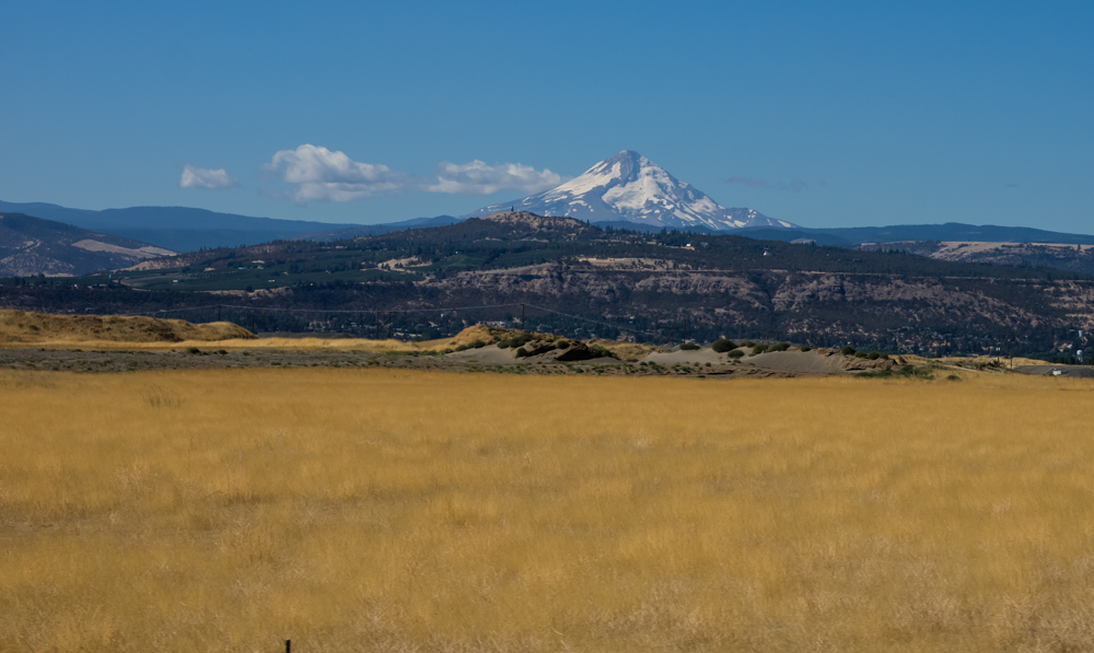
The
proximate regions of Mt. Hood are forested mountains. But,
further east close to our path are grassy prairies.
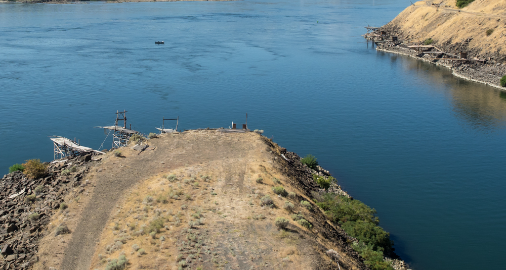
We
crossed the Columbia River at the Dalles bridge and turned off
to examine the Dalles Dam. Next to the dam were a number
of native fishing structures used to catch salmon.
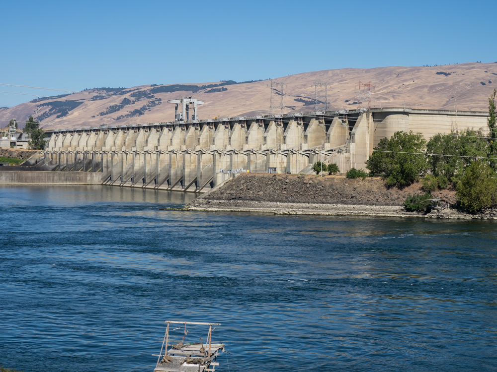
The
Dalles Dam was constructed by the Army Corps of Engineers and is
used for both flood control and power generation.
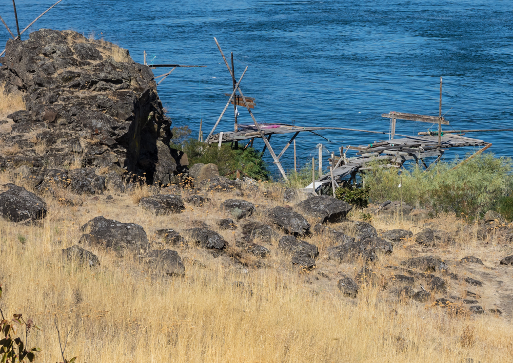
The
fishing points looked quite shaky and unreliable.
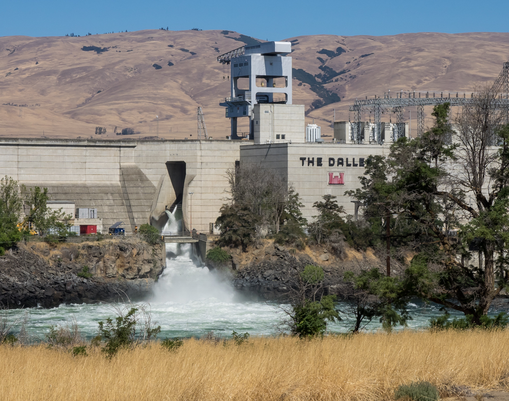
The
Dalles is not a tall dam, but it is still a massive
structure. The spillway is visible but the powerhouse is
hidden behind the trees beyond the right side of the photo
above.
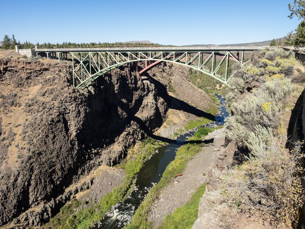
We
traveled south through central Oregon and came upon a viewpoint
for the Crooked River Bridge. The bridge was constructed
in 1926 and was the only way to cross this gorge through the
basalt for many miles in either direction. The bridge is
now retired and used only for foot traffic.
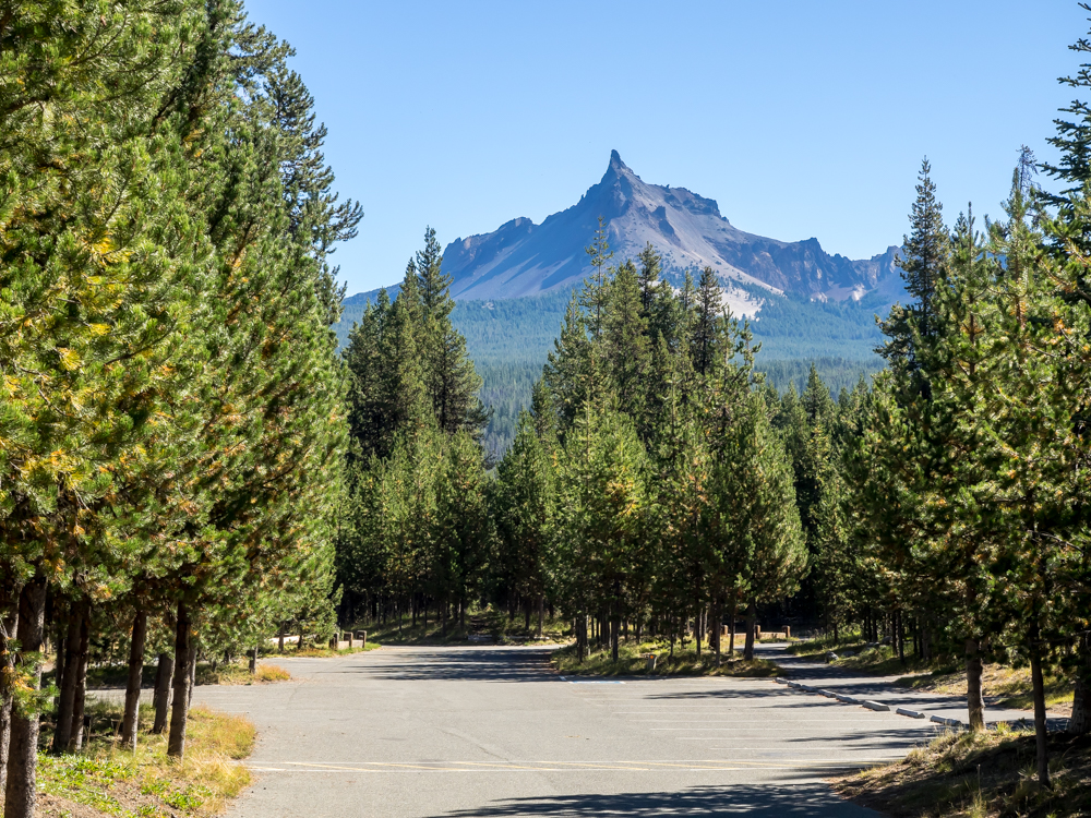
We
decided to head west toward the coast to shorten our travel path
and ended up spending the night at an FS campground on Diamond
Lake. Mount Thielsen is the peak visible from the campground and
the sides of the peak have been heavily eroded by glacial
action. Thielsen is just one more of the dozens of
volcanic peaks created by the subduction of the Juan de Fuca
plate under the North American plate. Diamond Lake is
quite close to another well known volcanic structure: Crater
Lake.
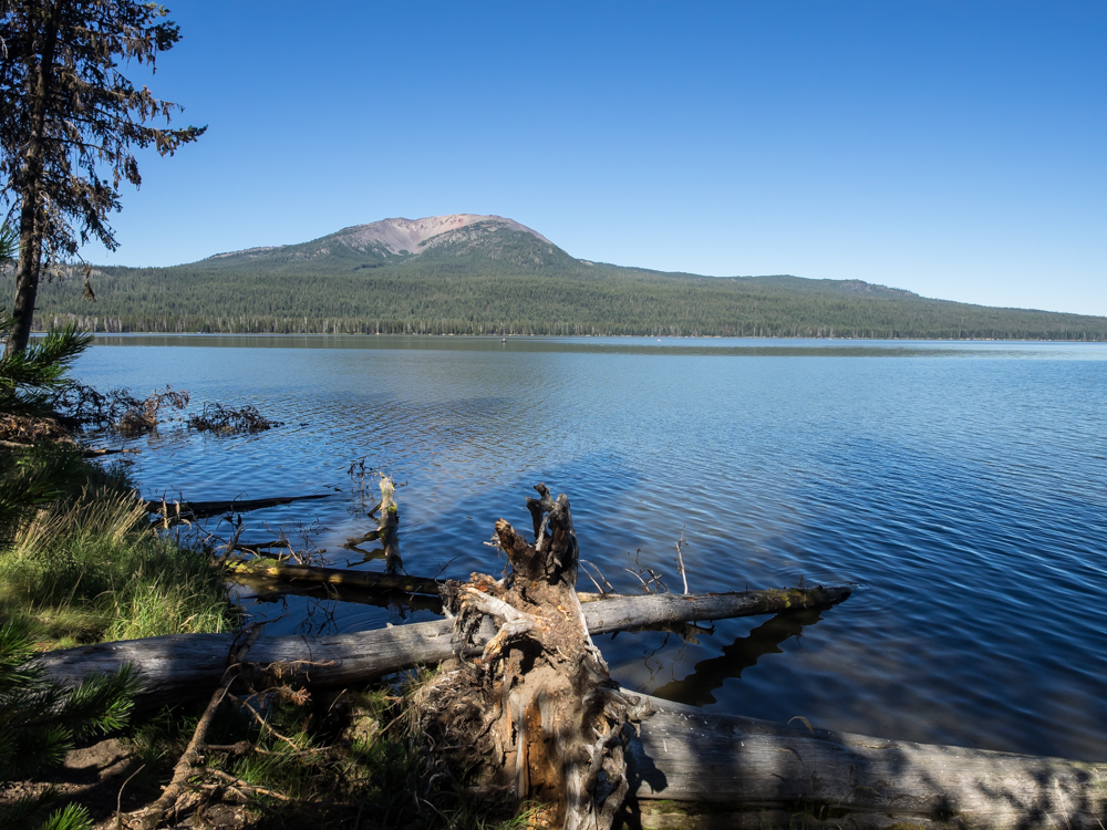
In the
foreground of the photo above is Diamond Lake. In the
distance another volcanic caldera can be seen.
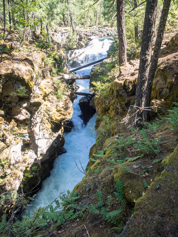
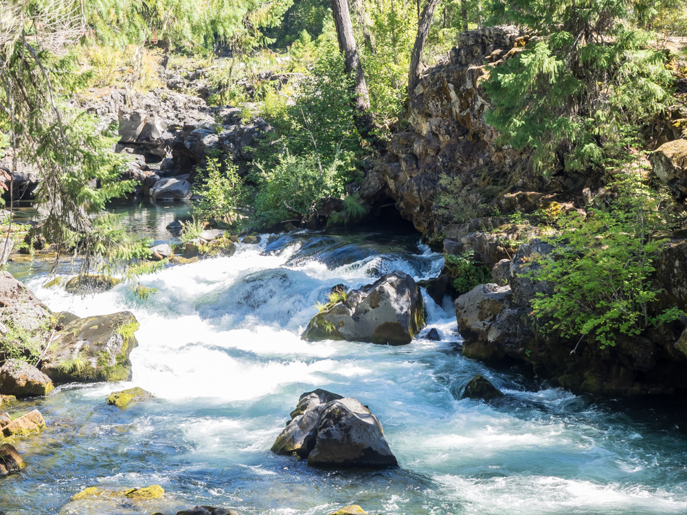
We
continued generally west along the Rogue River and came to a
viewpoint for the Rogue River Gorge. The gorge is where
the river has cut deeply into the basalt surface rock and left a
slot canyon.
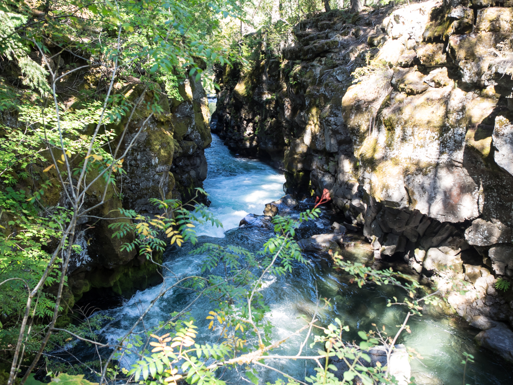
The
river has cut a deep slot into the basalt. While not as
impressive as some slot canyons, it was unique due to the path
that the river chose.
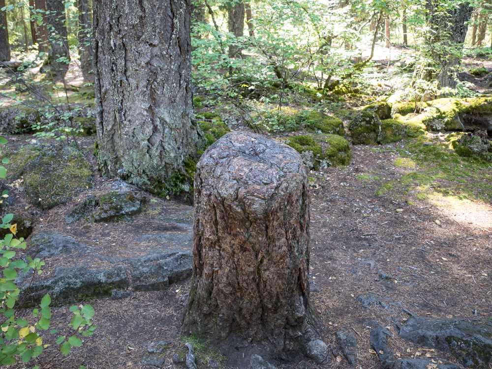
This stump
was quite unique. The tree was cut down by the Forest
Service during the construction of access trails for the Rogue
Gorge. But, the tree's roots had fused with those of
a neighboring tree so loss of its leaves did not kill the
stump. In fact, it coated the wound with bark and
continues to live compliments of its neighbor(s).
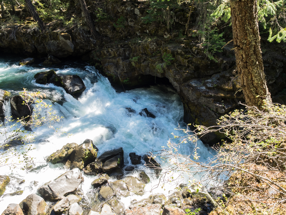
The
Rogue Canyon is unique because the river chose a path that
exploited an old lava tube. The river totally disappears
from the surface and goes through the basalt lava tube.
Above,
the river reemerges from a lava tube.
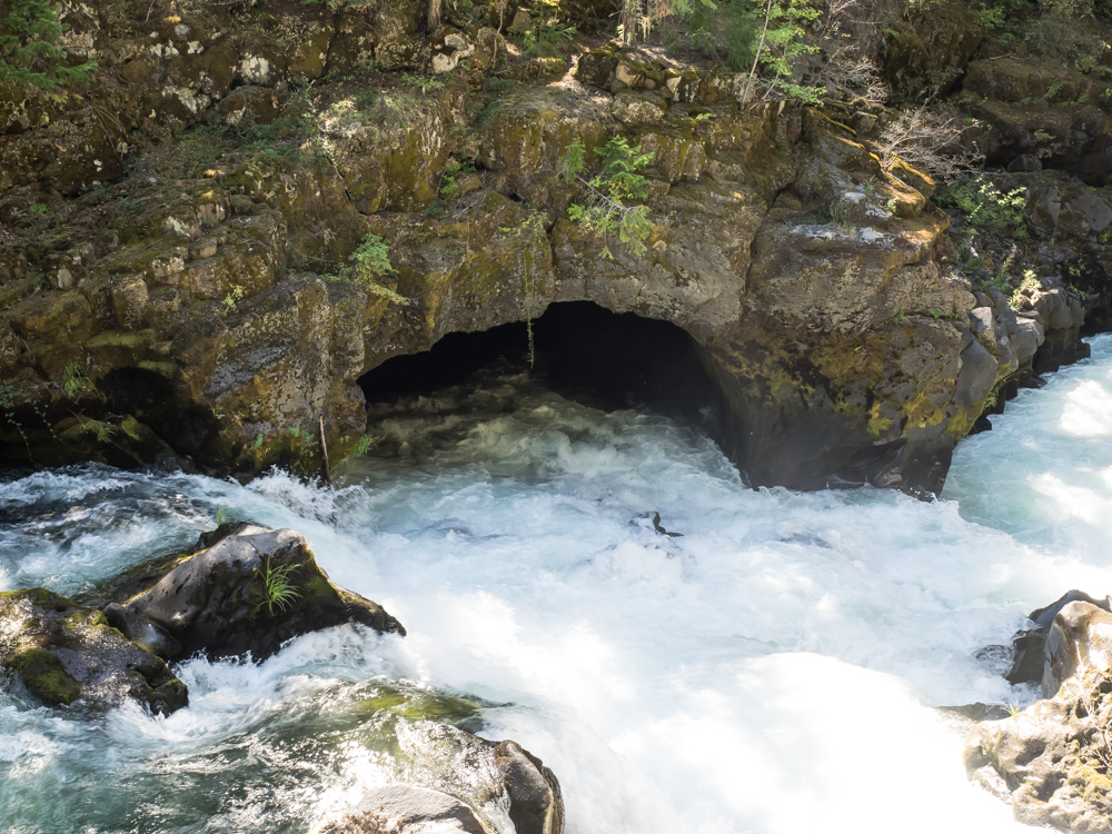
Another
side tube passes part of the full flow of the river.
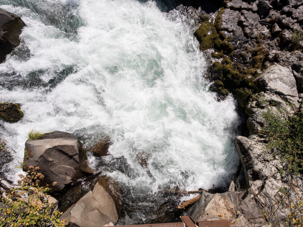
This
hole swallows the entire river.
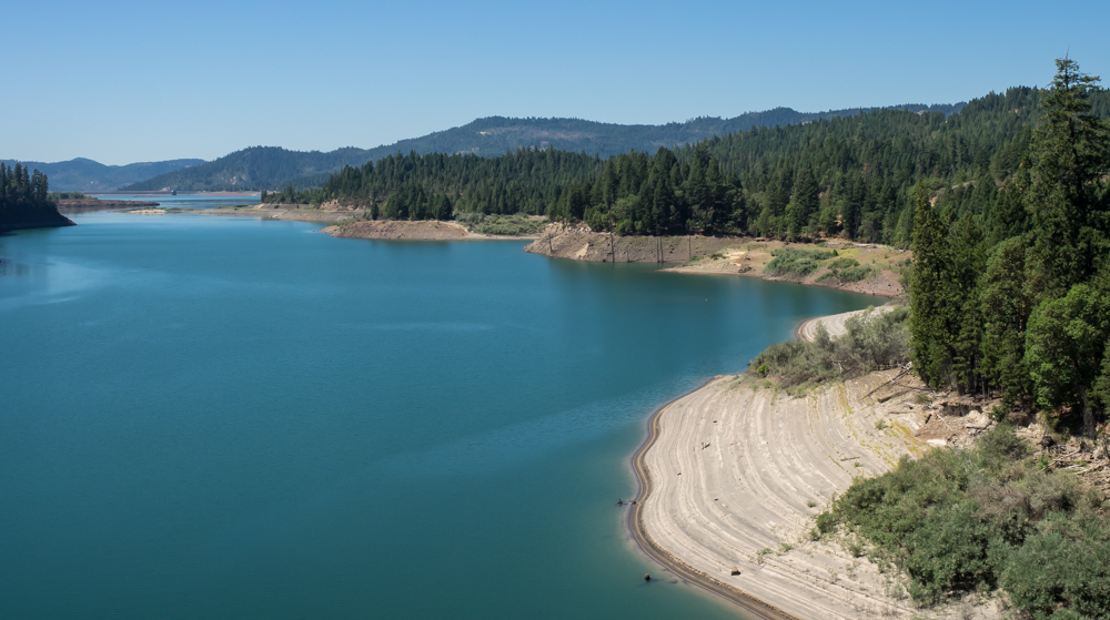
Many
miles downstream, the Rogue flows into a man-made
reservoir. Note that the current water level is well below
the high water mark.
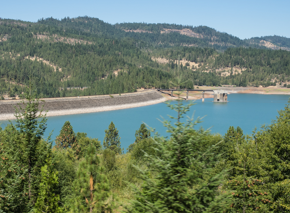
The dam
was earthen and made good use of the local basalt rock.
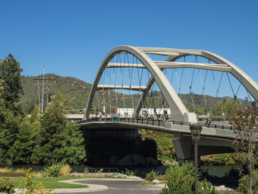
Near
Grant's Pass we encountered this nice, new span over the Rogue
River.
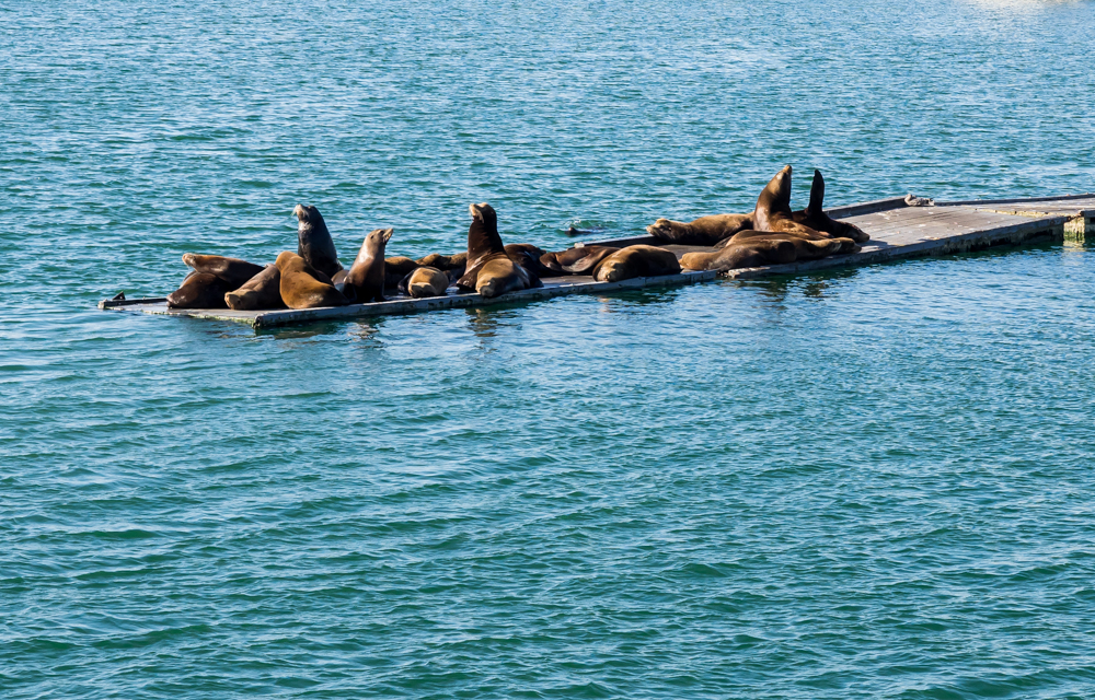
The road
was tight, but we managed to make it all the way to Crescent
City, CA. We spent the night in a rather, um, scummy RV
park near the water. We went out to a local restaurant at
the Crescent City marina and were confronted with this noisy
group of Sea Lions.
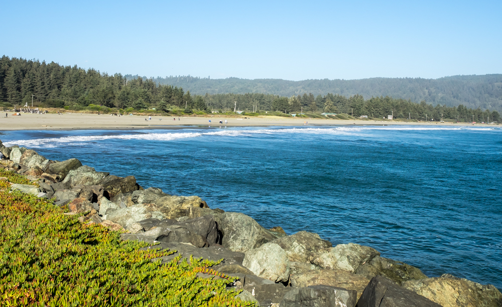
Crescent
City has a nice crescent beach, but the water is cold.
And, due to the geometry of the shore it has been repeatedly hit
by tsunamis, each with significant damage to the city.
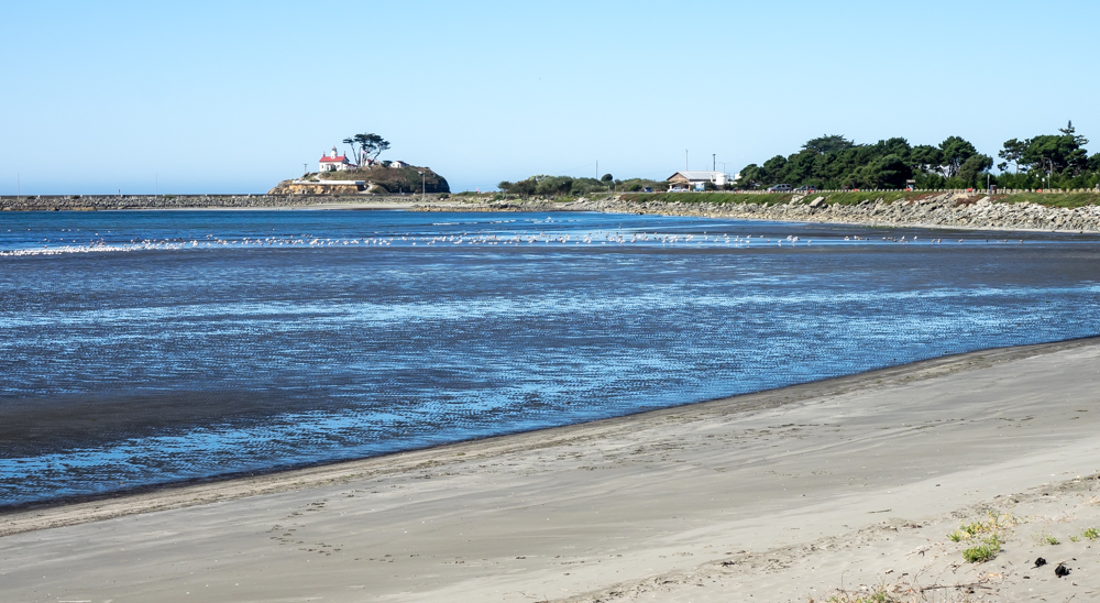
The
lighthouse at Crescent City is out on a small bluff. As a
side note, the odd look of the waves was present in the RAW
image out of my camera. I am not sure what it is, but it
is likely an artifact of the shutter speed combined with the
slower motion of the waves. Very strange.
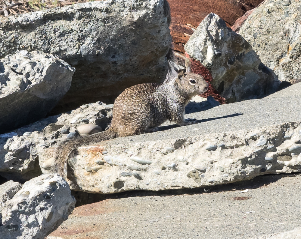
Near our
vantage point of the bay we spotted a number of squirrels living
in the rip-rap of the breakwater. While "cute", they are
likely infected with various parasites and diseases including bubonic
plague.
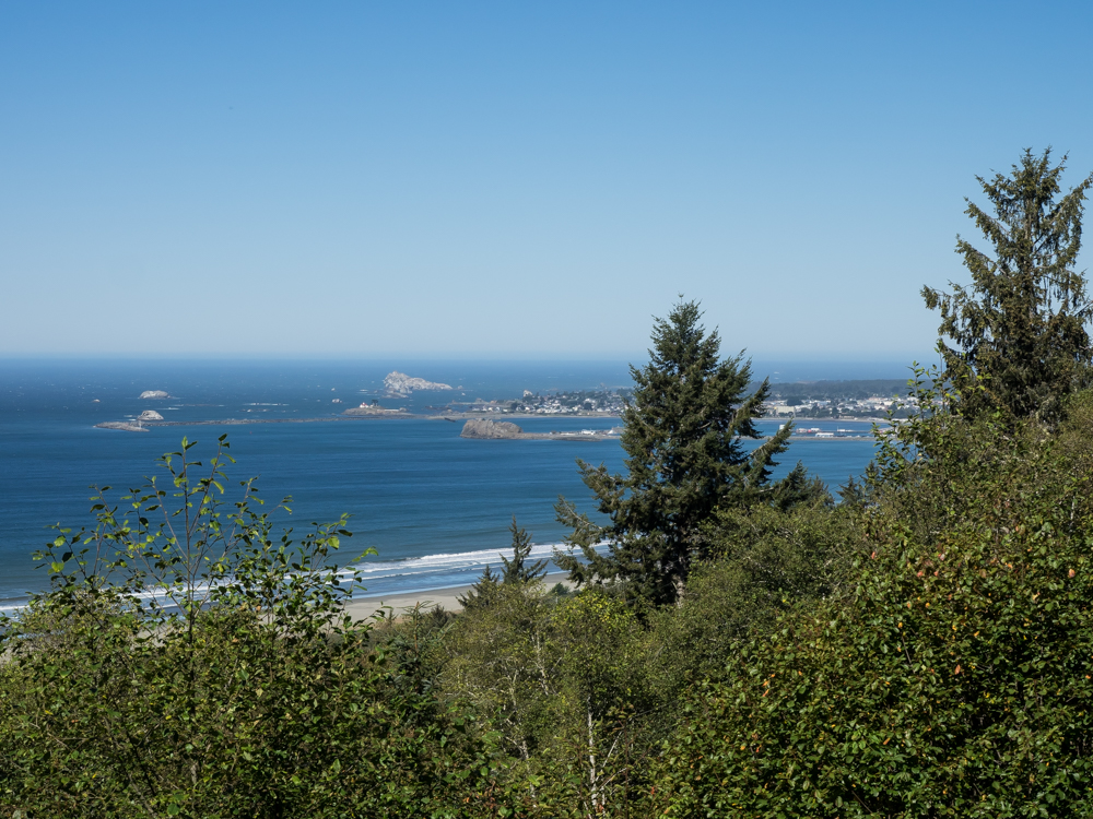
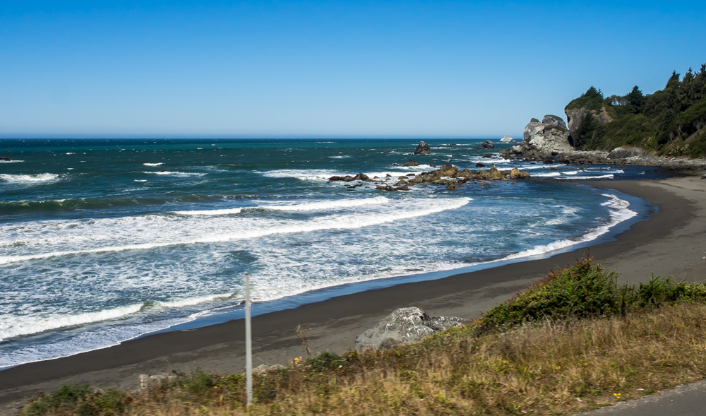
The road
to the south of Crescent City gave us nice views of the bay and
the lighthouse.
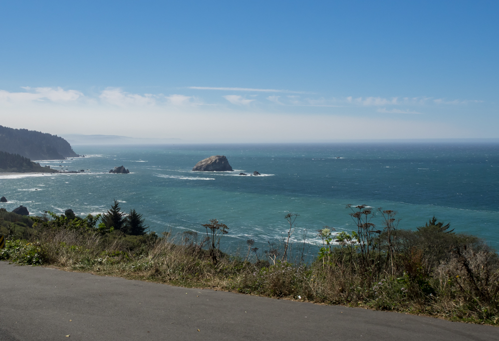
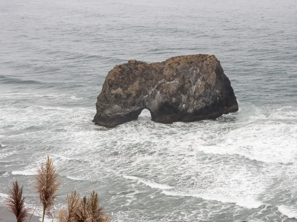
Further
south along the cliffs we saw nice haystacks and headlands.
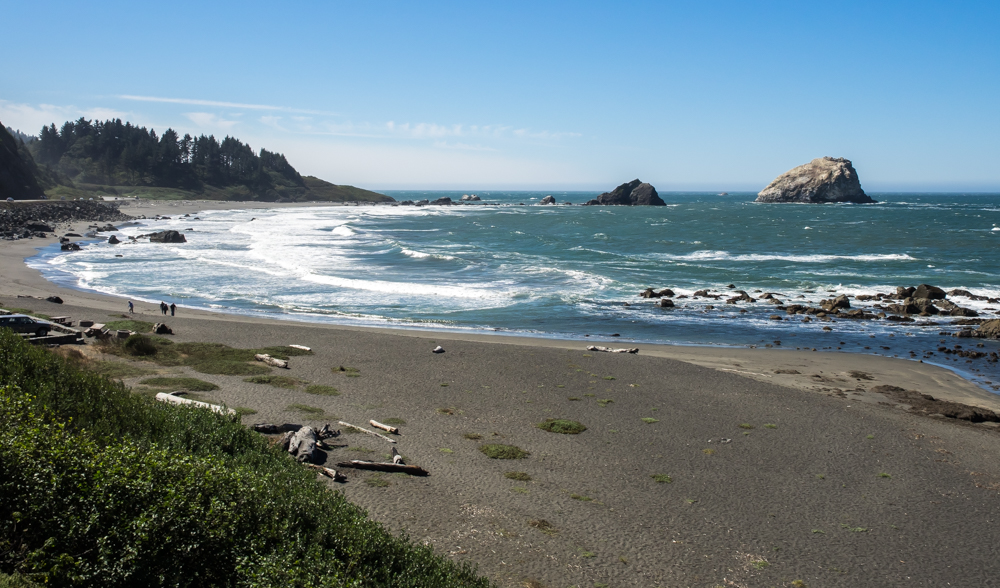
Some of
the bays had nice sand beaches and tame, but cold, surf.
Perhaps
on another trip we will better explore the beach areas.
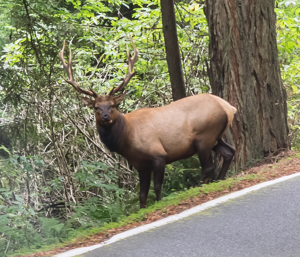
We
traveled south on US101 and then turned west onto CA1.
Highway 1 is narrow, steep and twisty and at the north end goes
through very thick brush and trees. We rounded a tight corner
and surprised this elk bull standing by the side of the
road. We slowed down for a better photo, but the noise
from Thor's motor sent the bull crashing through the trees.
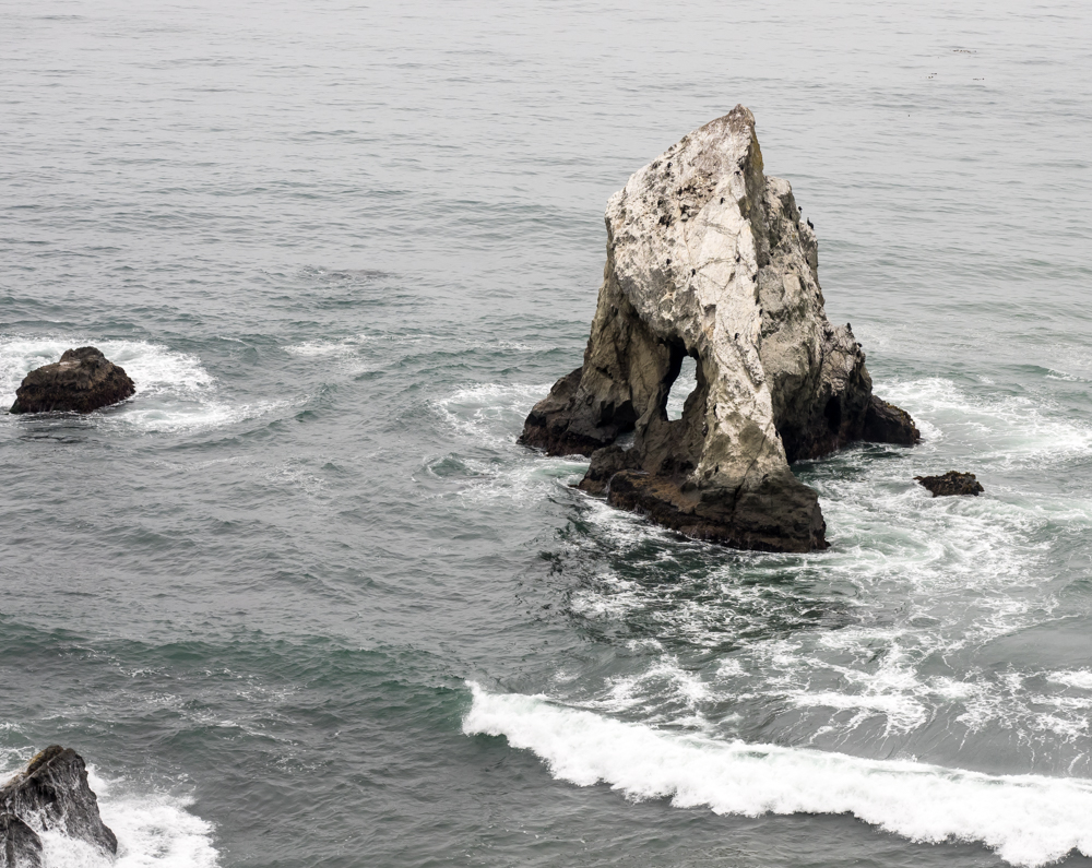
When CA1
finally intersected the coast, we got our first view of
haystacks with erosion caves.
The wave
action had eroded a significant tunnel into this haystack.
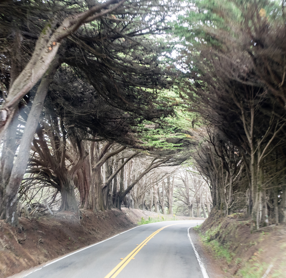
North of
Ft. Bragg the road went through areas that were lined with
cypress trees creating the illusion of driving through a tunnel.
After a
long, hard day of driving narrow roads we arrived at the Albion
River Inn. ARI is situated on the cliffs of the Albion
River and the cottage rooms have great views of the river
channel and the surf on the cliffs. We have stayed at ARI
4 times over the years and have greatly enjoyed each stay.
This one was no exception. After finishing the
complimentary bottle of wine in the room, we headed to the
dining area for a great meal (and more wine).
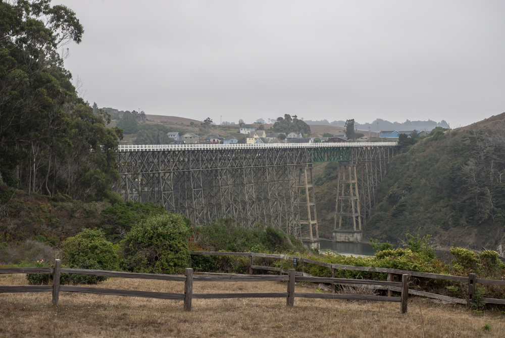
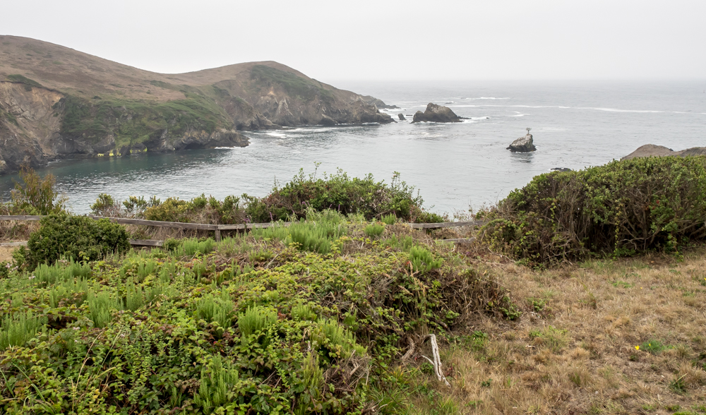
From the
deck of our cottage we could easily see the wooden bridge that
spans the Albion River.
| Previous Adventure | ||
| Trip Home Page |
Photos and Text Copyright Bill Caid 2014, all rights
reserved.
For your enjoyment only, not for commercial use.