We made
it to Elk River, ID and found that there was a new FS campsite
right next to town so we decide to stay there. We got our
spot and then headed into town for dinner at the local
cafe. It was a quiet night. Next morning, we headed
south toward Orofino.
The photos below are what we saw.
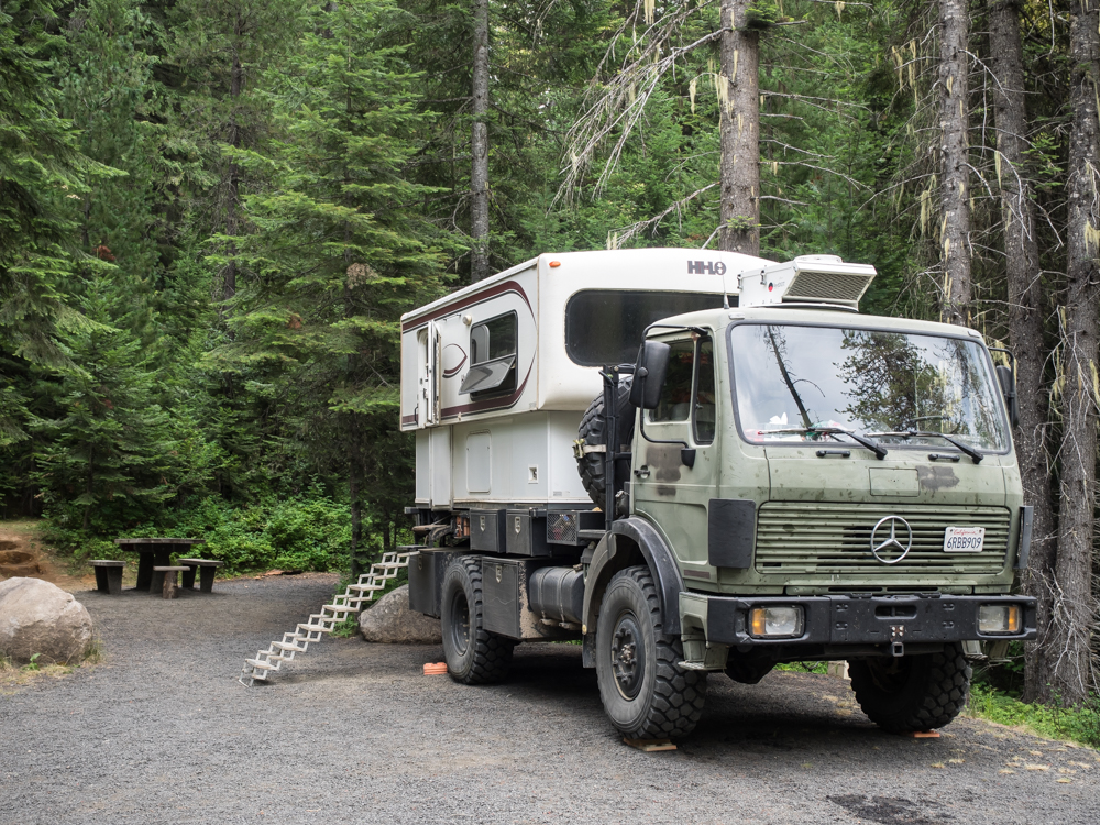
Our
campsite in Elk River was somewhat unique. This site had
30A electric service, but no water and no trash dumpster.
In fact, there was no trash dump at all in Elk River; we had to
carry our (several days old) garbage all the way to Orofino.
We ate
in the Elk River Cafe again because the food was good. We
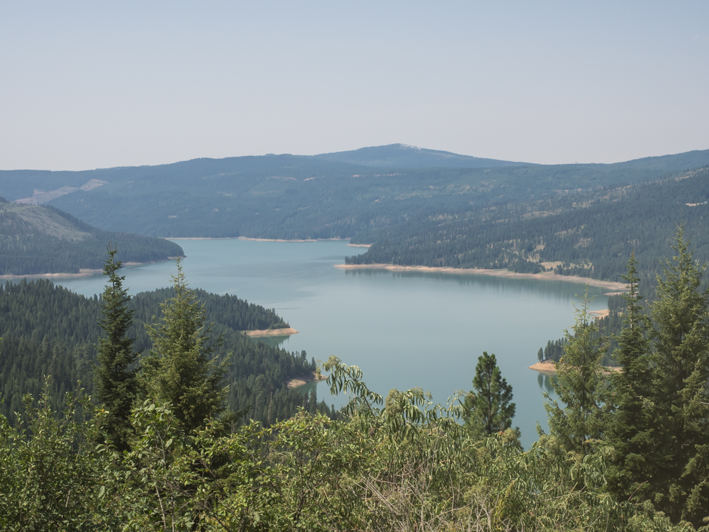
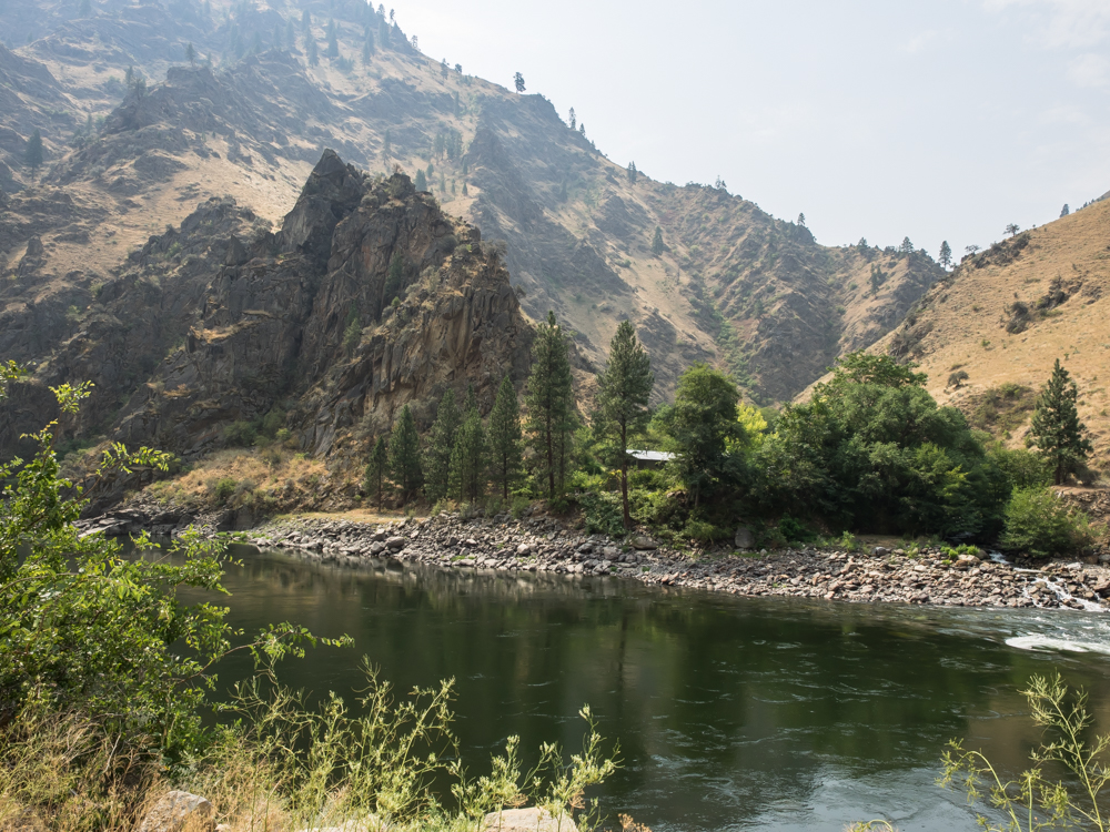
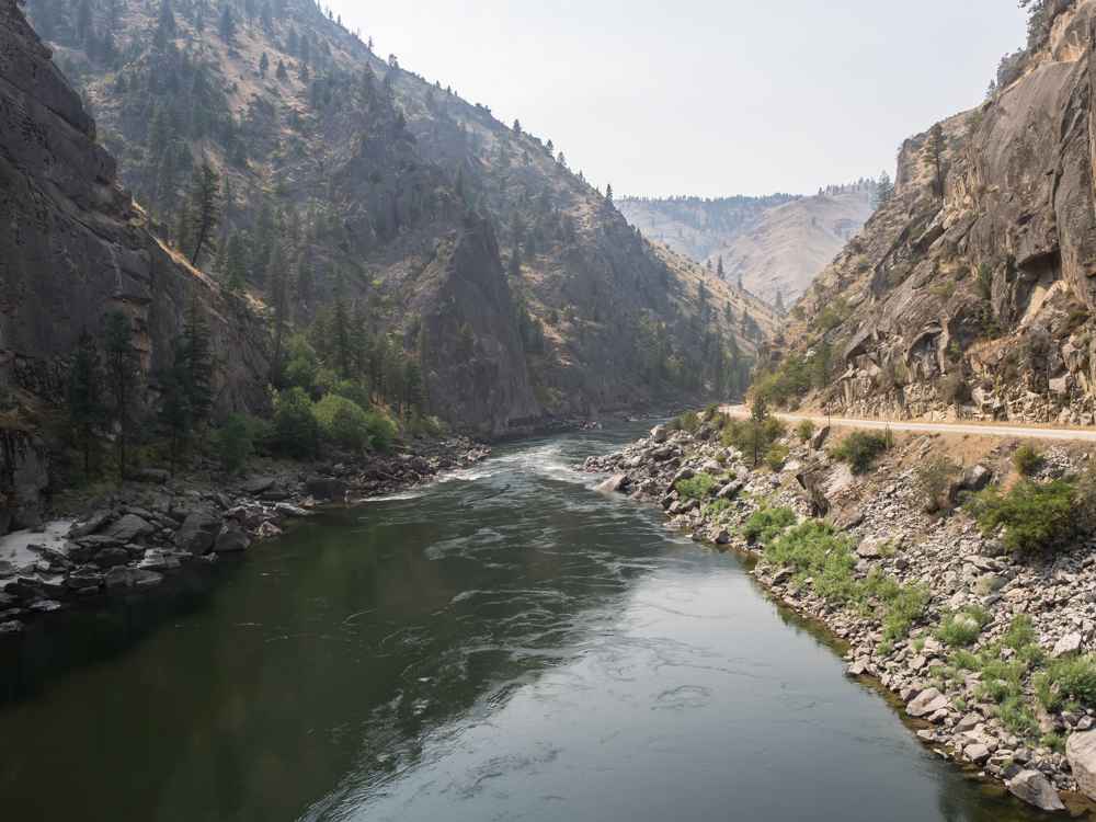
headed south out of Elk River to Dworkshak reservoir. This
is a big body of water that sits behind Dworshak Dam. The
reservoir started filling in 1971.
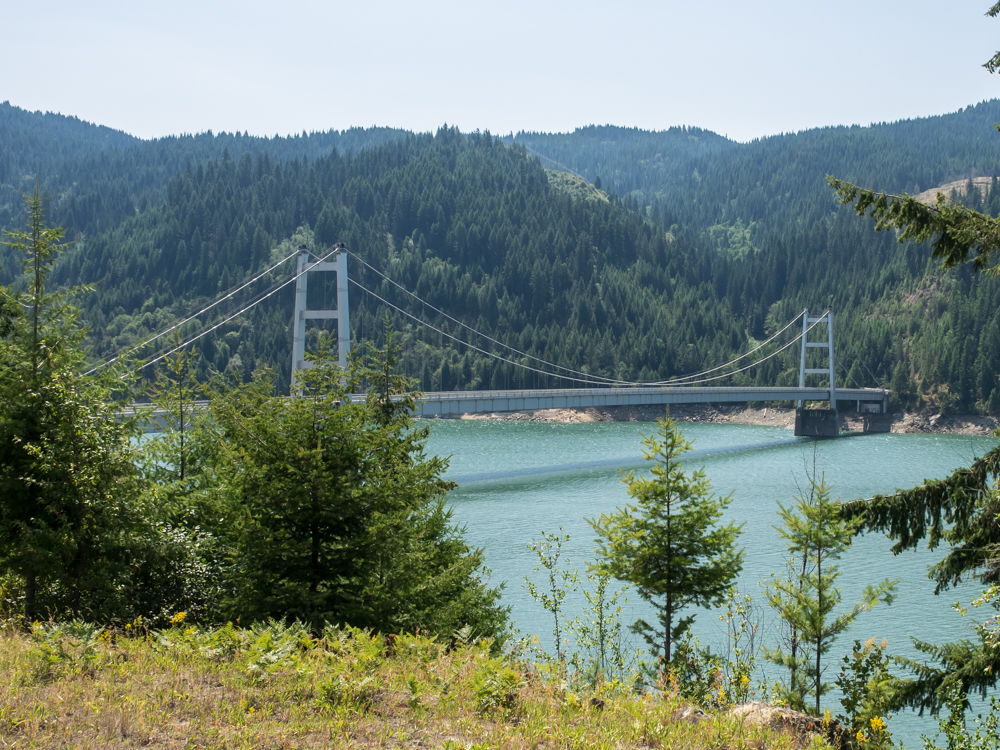
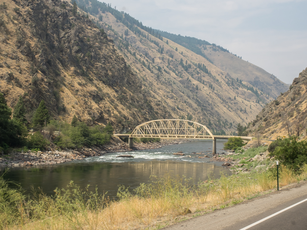
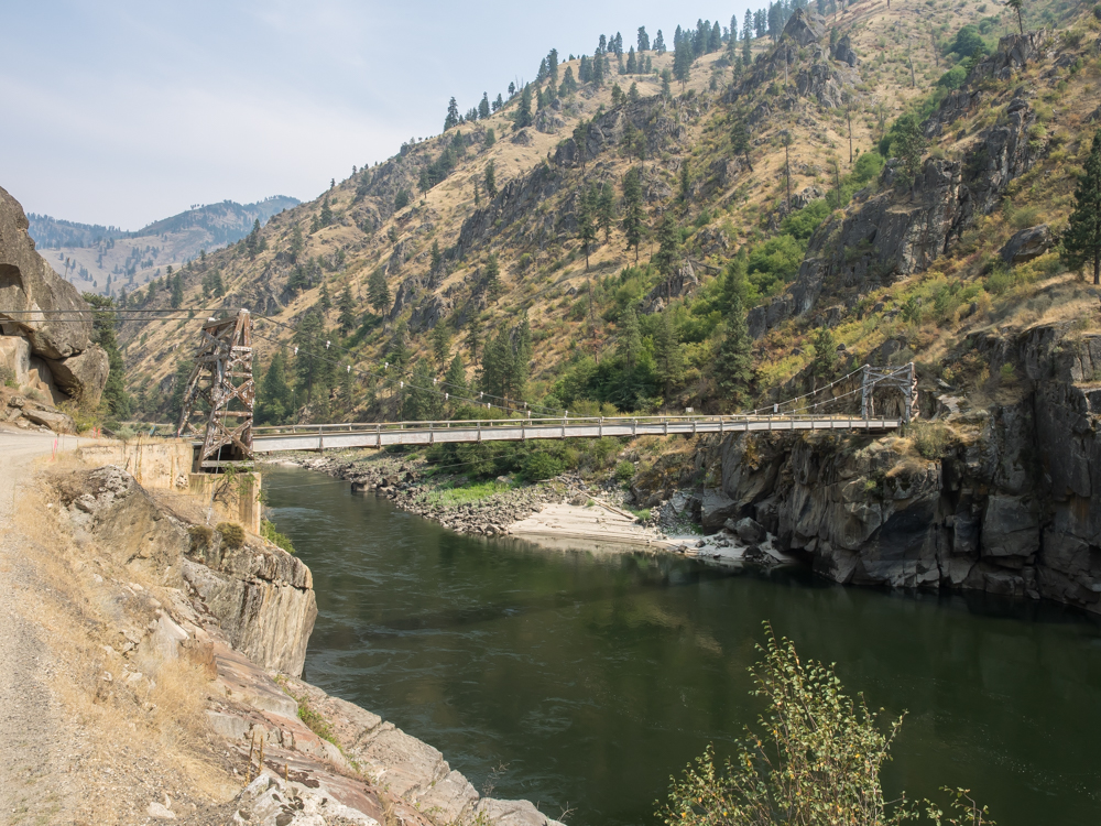
The Dent
Bridge is a 1,000 foot span and is the only way across the
reservoir and North Fork of the Clearwater River for 50 miles.
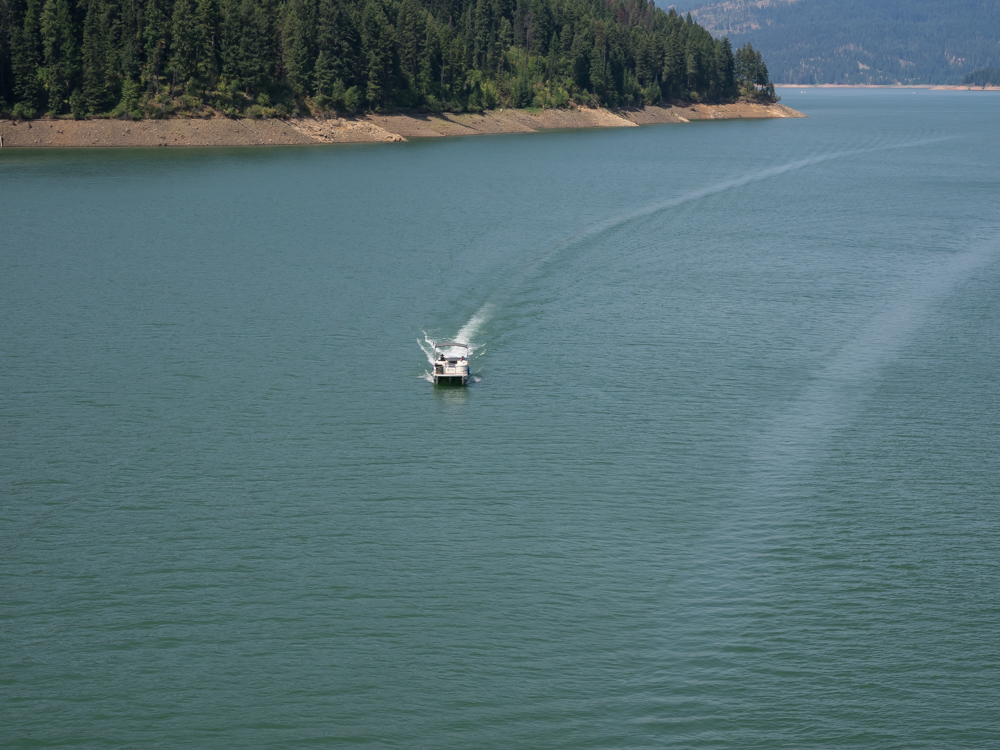
The
reservoir has boat launches and we saw both pleasure boats and
house boats.
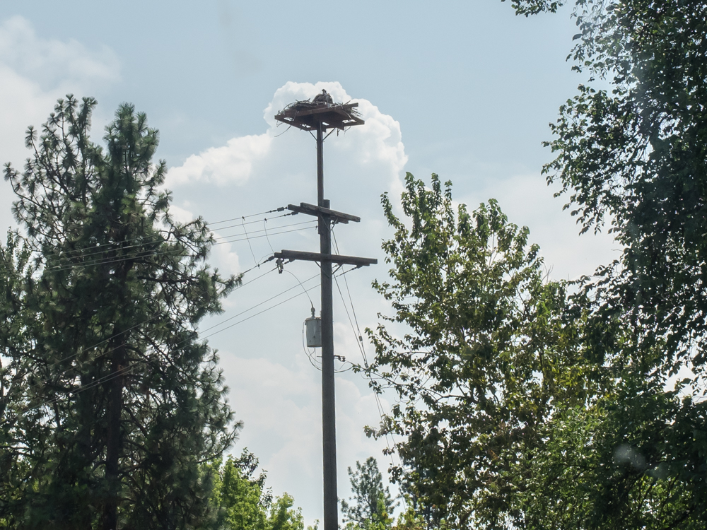
We
traveled south from Orofino and along the way we spotted this
osprey nest compliments of the local utility company. This
one is occupied.
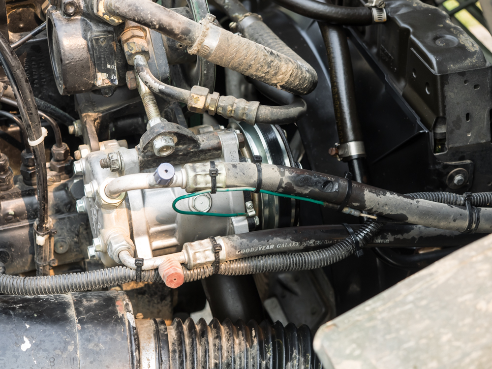
We
followed rivers and then crossed over a mountain range into
Grangeville, ID. In the parking lot of the local
supermarket, we discovered a hissing sound from inside the
cab. At first, we thought it was a cooling system leak,
but when we got back from shopping I examined the fluid dripping
from the truck and concluded it was from the air conditioning
system. We ate lunch and found a spot at a local RV park
to do laundry, etc. Next morning we tilted the cab and
discovered that it was in fact the air conditioning
system. Note the spot on the upper compressor hose that is
ablated. On deeper inspection, we discovered that the real
leak was on the underside of the hose where it had been pressed
against the compressor pulley.
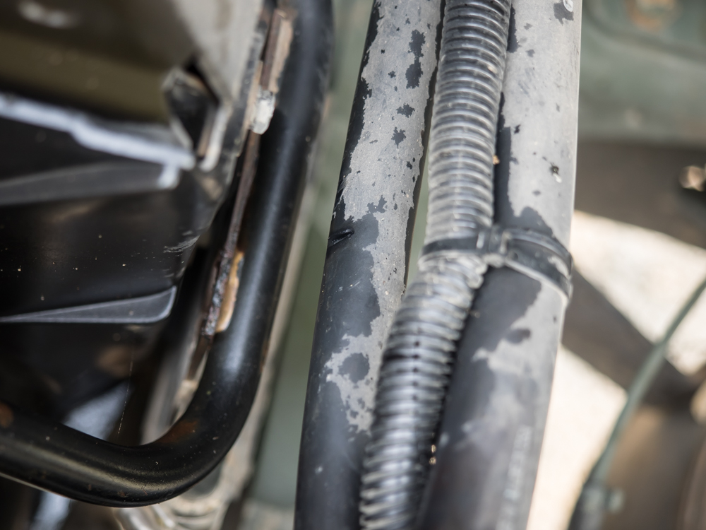
I stuck
the camera under the hose and shot a photo upwards. The
cut in the hose is visible in the center of the photo
above. This is lights-out for the a/c system for the
duration of this trip, which promises a very hot return home to
San Diego.
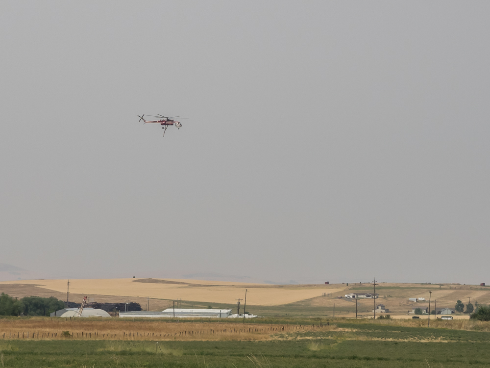
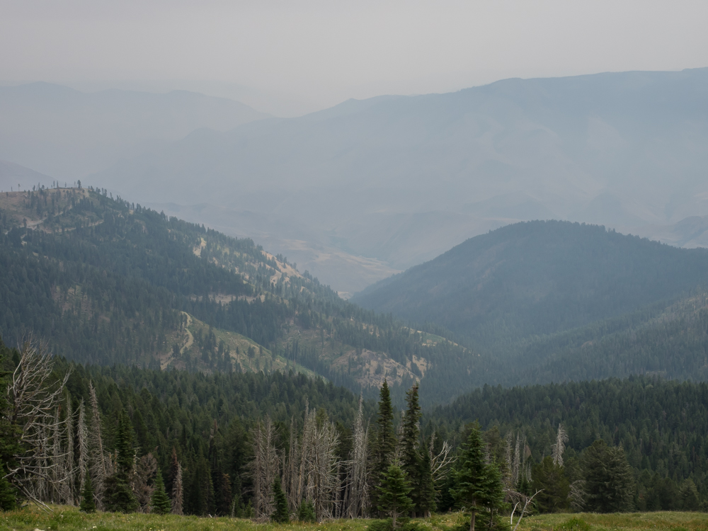
It was
really, really smoky in Grangeville due to the nearby forest fires.
We spotted a fire attack helicopter approaching it's base.
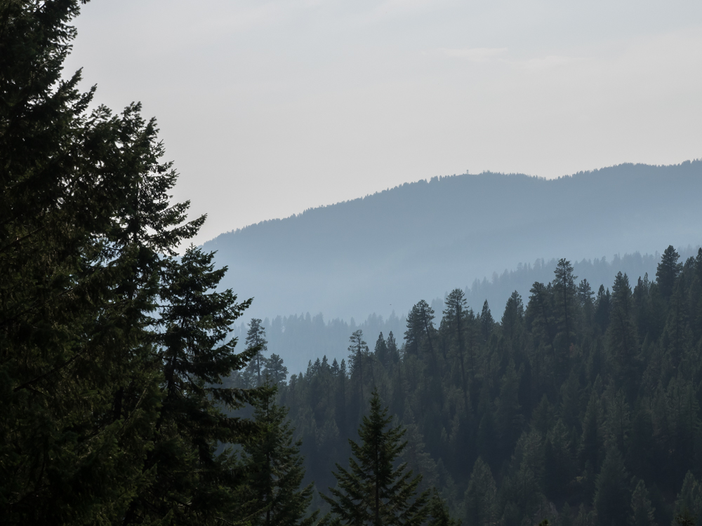
The
selected route took us south deeper into the Salmon River
Mountains. As we were descending the steep switchbacks to
the Salmon River, we could see a fire lookout tower on the ridge
through the thick smoke. Given the very limited visibility
due the smoke,
this lookout was essentially useless.
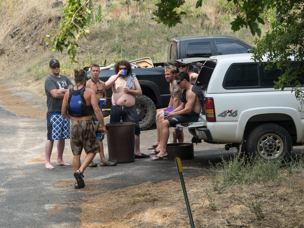
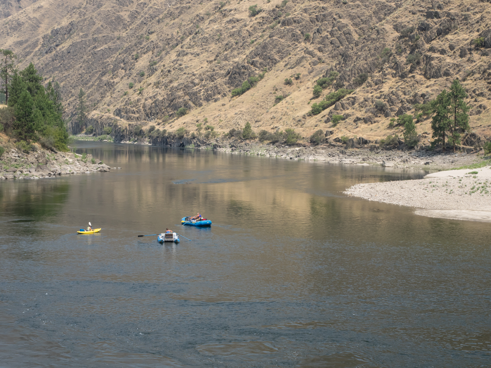
There
was a camping area right next to the Salmon River, so we took
it. The place is called Spring Bar and is a popular put-in
location with the river rafting crowd. Next morning, this
group of young bucks showed up with a keg in a trash can.
It looked to us as one of the fellows had more than his fair
share of beer.
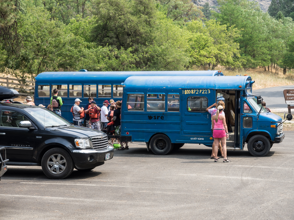
Buses of
rafters showed up too bringing tourists to the put-in point.
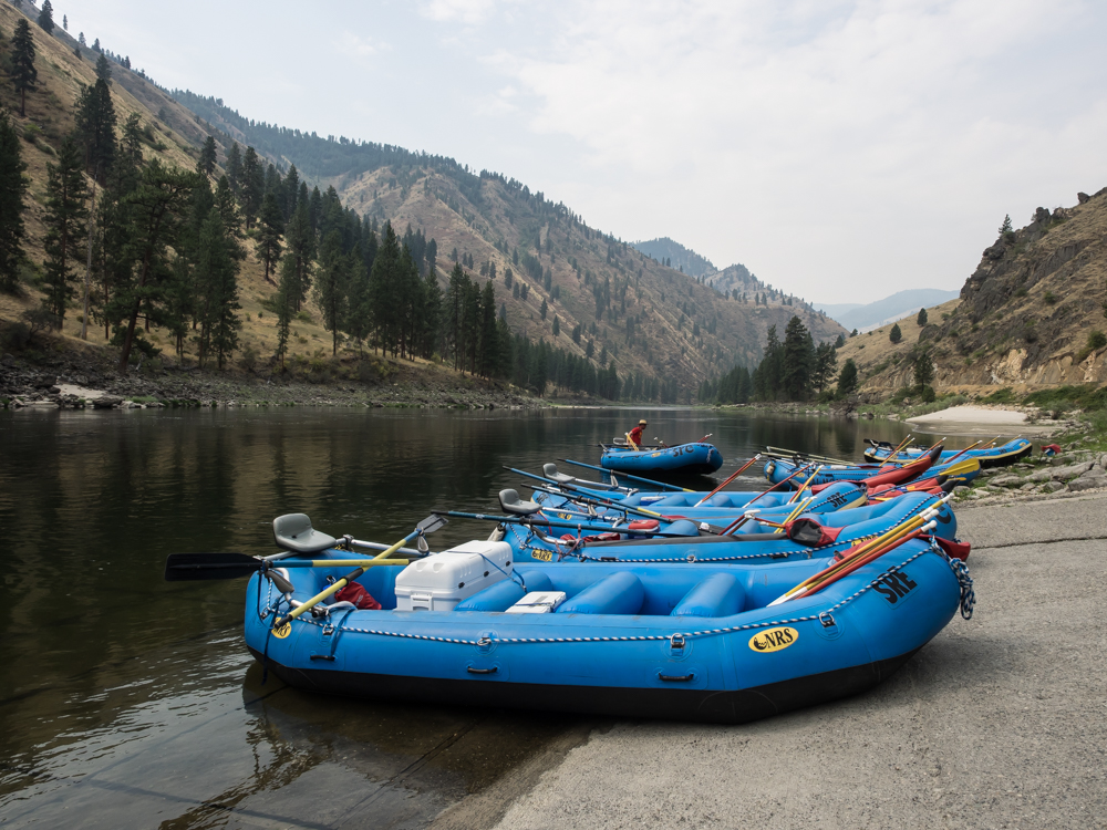
The
rafts had already been delivered by another team earlier in the
day.
We left
the rafters to their fun and headed west down the Salmon River
Canyon toward Riggins, ID.
Some of
the bottom land and side canyons were private land and had nice
dwellings.
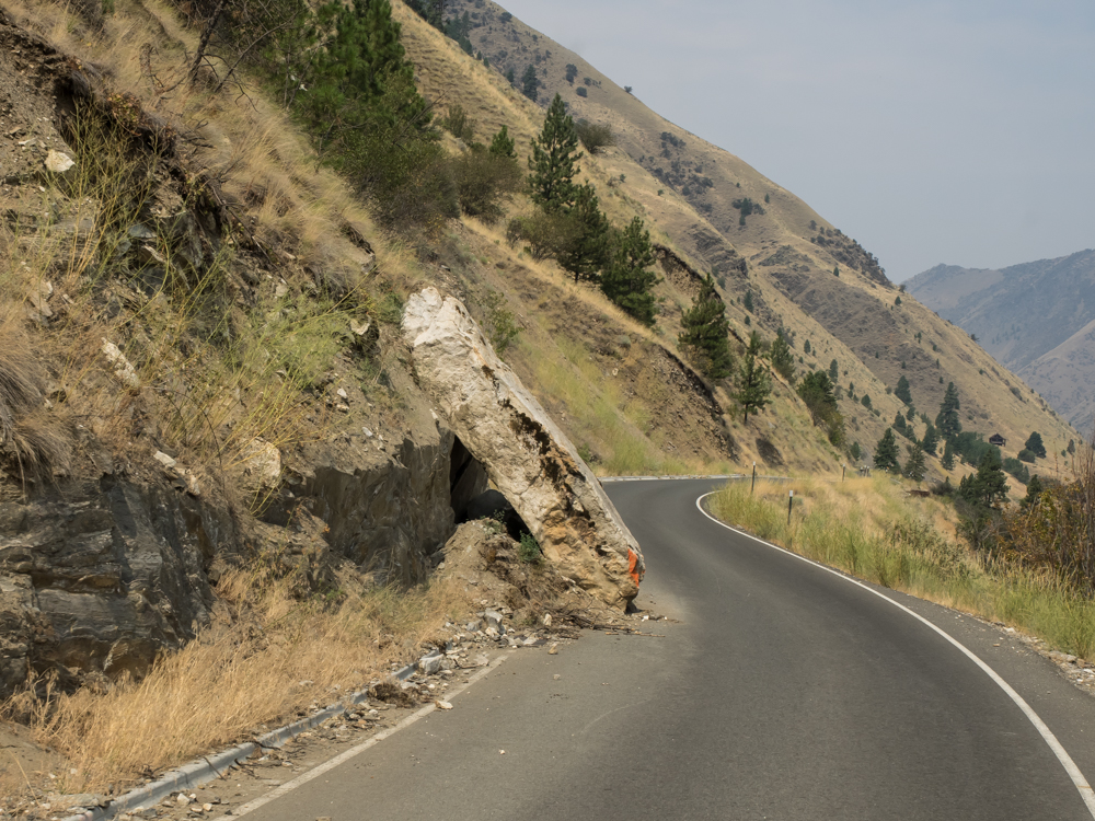
The sign
on the road said "Beware of falling rock". Yup, true
enough.
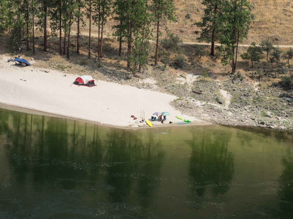
The
lower Salmon River area had many nice sand bars and folks were
camping there with their water toys.
We
passed another set of rafters closer to Riggins.
From
Riggins, we decided to check out the Seven Devils Mountains to
the west. The road was in pretty good shape, but narrow
and steep. The smoke greatly impacted visibility and made
our noses and lungs very unhappy.
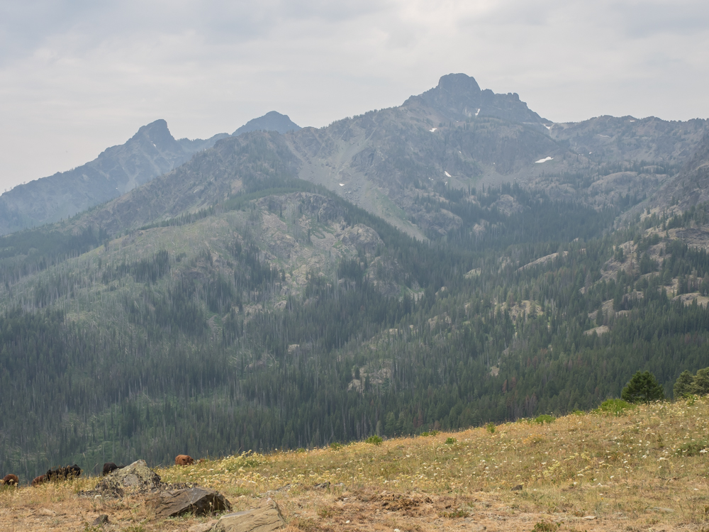
From a
saddle, we got our first view of the Seven Devils Peaks.
These were quite rugged and were high enough to still have some
snow.
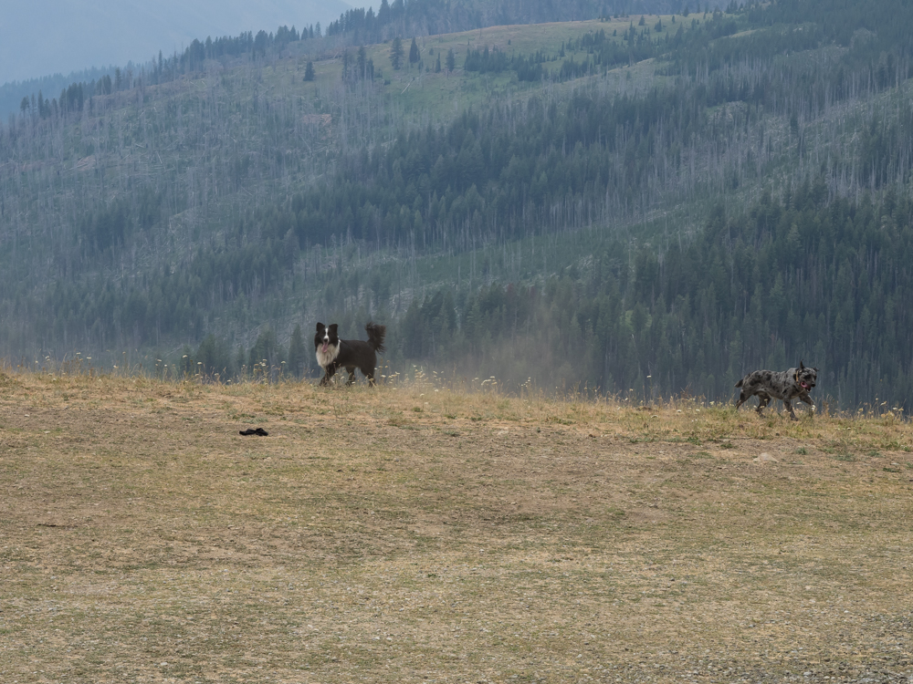
Close to
the saddle, we spotted a rancher with his working dogs herding
cattle. Above, the dogs are heading after a few cattle
that were away from the main herd.
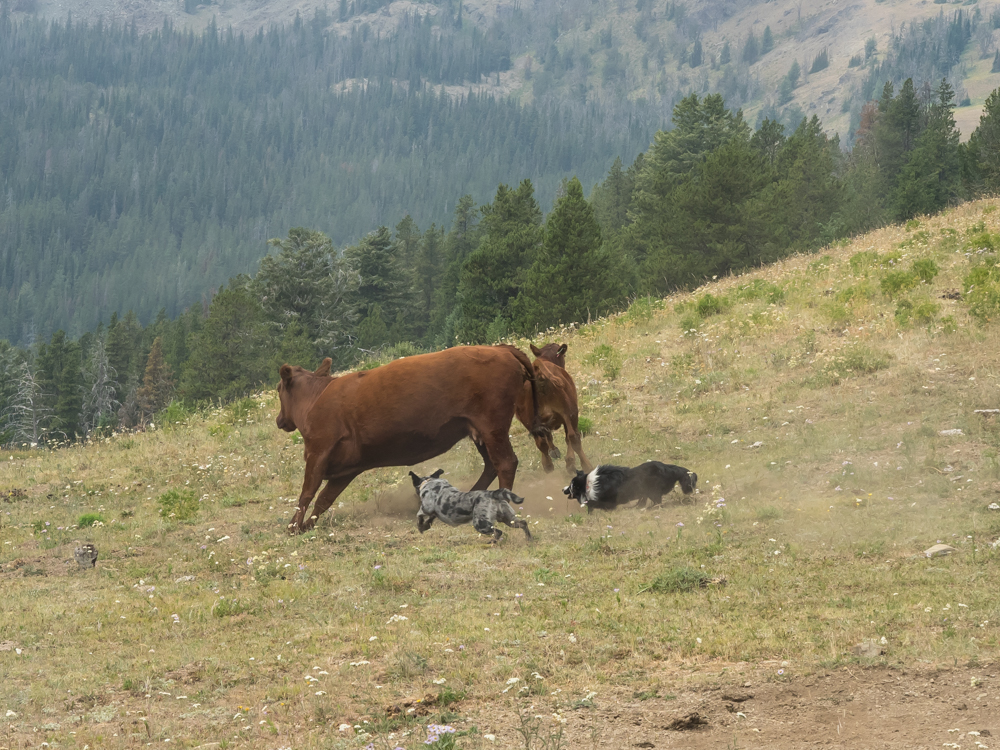
The dogs
worked the strays close together.
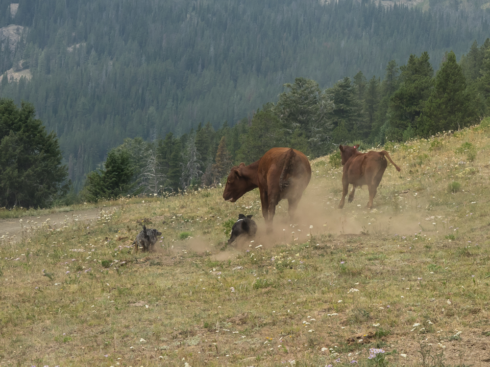
The
older cow on the left was bawling out of frustration and fear.
She attempted to kick the dogs multiple times, but the dogs were
too fast and too smart; they had seen that trick before.
Eventually, the dogs got in front of the strays and worked them
back to the herd.
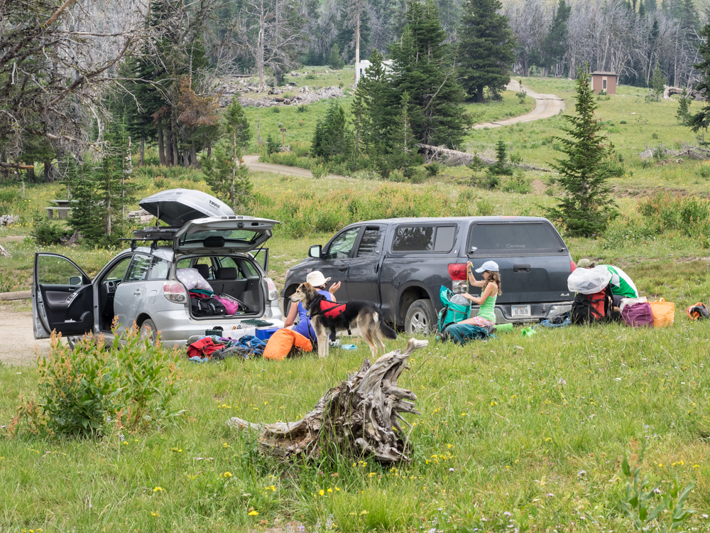
We got to
the crest and were surprised to see many cars with backpackers.
This family is heading out with 2 children and a dog. And
judging from the amount of stuff, they won't be going too
far. Camping with small children is the definition of
"logistical nightmare".
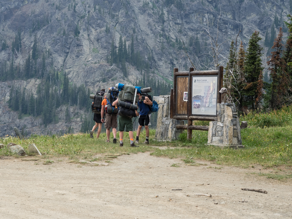
This
group of young guys shoulders their packs and head out.
We
looked around the crest area, but it was not that interesting
(due to the thick smoke) so we decided to head back toward
Riggins and then over the mountains to south through steep,
narrow French Creek grade. On the river grade, we passed a
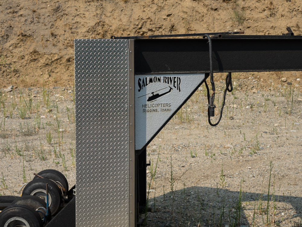
trailer used for transporting helicopters to fire camps.
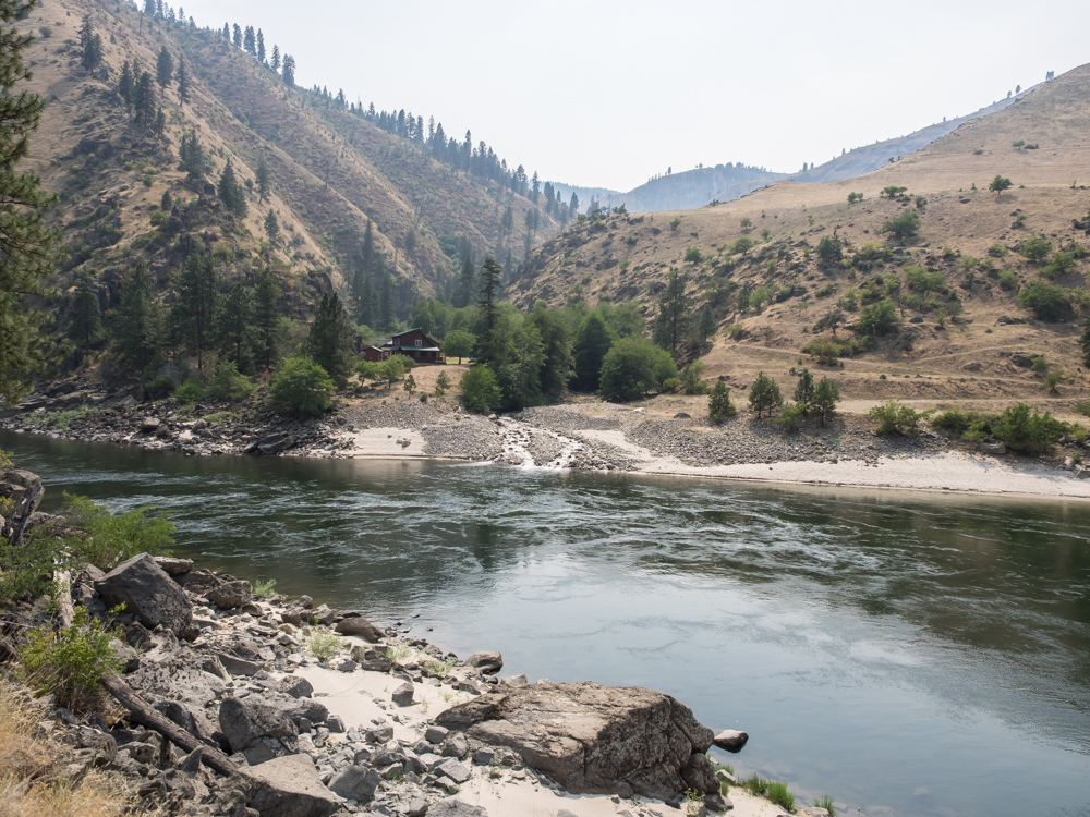
Further
upstream on the Salmon we spotted this nice ranch in a side
canyon.
The
canyon walls were steep and travel was only possible in a small
number of areas. This trail is steep and narrow and
fortunately it is not our route.
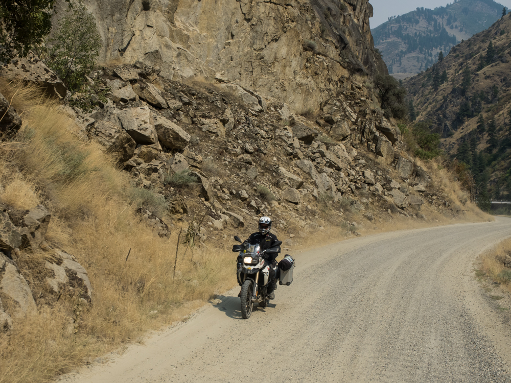
Closer
to French Creek, we passed a series of cross-country
motorcycles.
This
bridge across the Salmon River was built by the CCC in the 1930s
out of concrete, wood posts and steel beams.
The road
took a lot of dynamite to build and some areas were impassible
except for the path cut by the road.
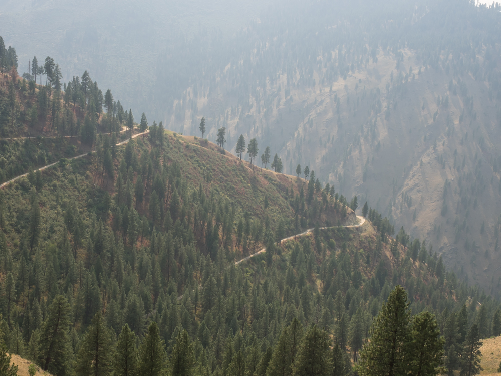
We took
the turn-off to French Creek and the road got steep in a
hurry. The switchbacks went right up the face of the
cliff. As a bonus, the narrow trail had plenty of washouts
and other obstacles. It was slow going and rather scary in
a wide vehicle like Thor.
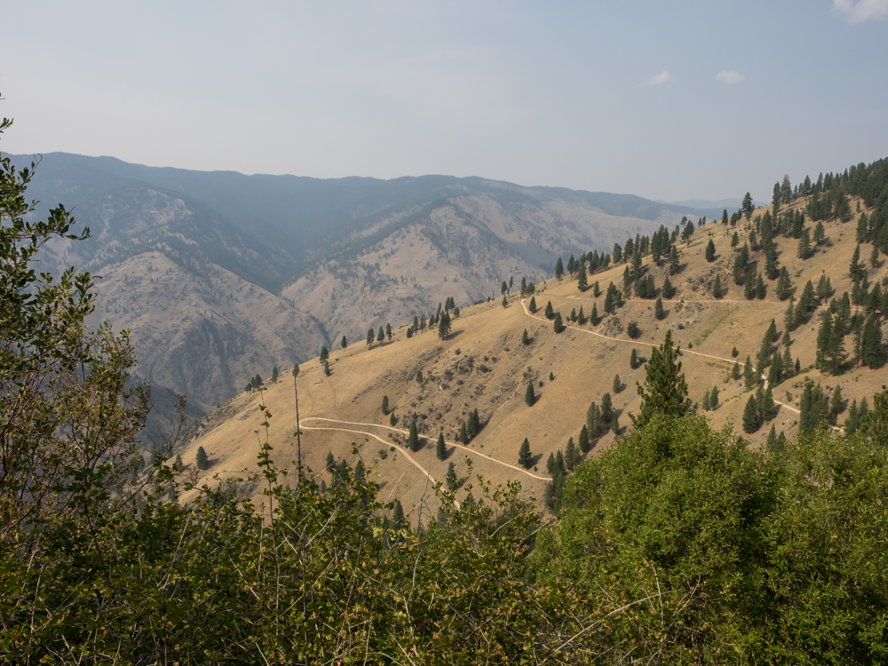
Further
up the grade, we reached a clear area that allowed a partial
view of the trail.
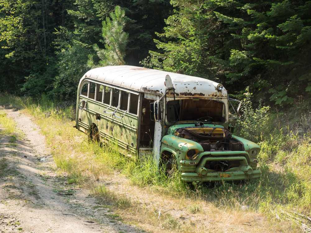
At the
top of the grade we came upon this abandoned bus that may have
been used by the loggers. It has long since been stripped
of anything valuable. Plus, derelict vehicles make great
targets for shooting.
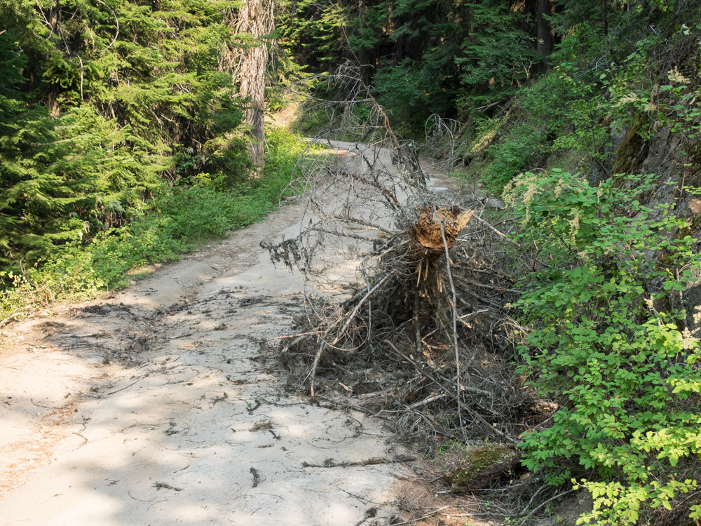
The
amount of dead-fall on the road was actually quite small.
Fortunately, the ones that we did encounter were at easy spots
on the trail.
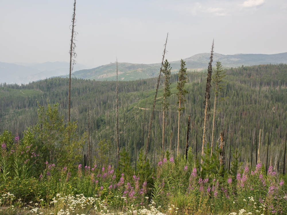
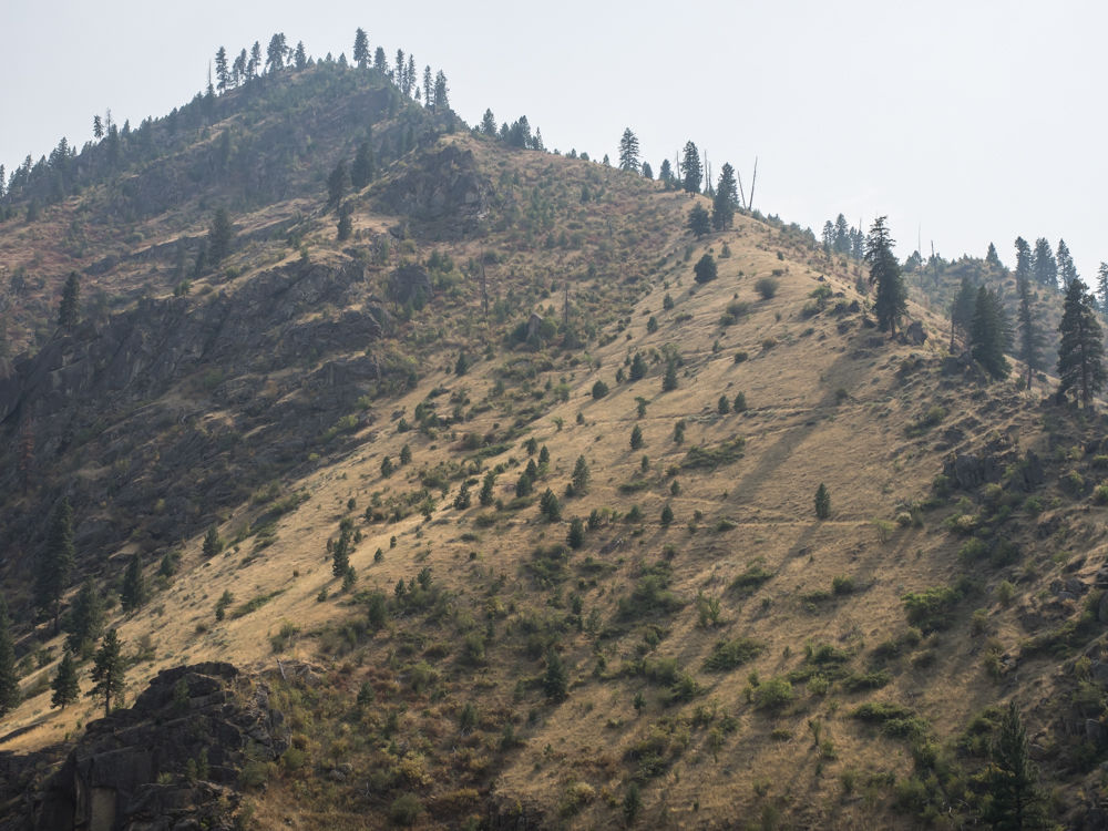
Higher
on the ridge we could see areas that we recovering from fires.
| Previous Adventure | ||
| Trip Home Page |
Photos and Text Copyright Bill Caid 2014, all rights
reserved.
For your enjoyment only, not for commercial use.