We left
Jackson Lake State Park and pulled over in a parking lot to
check a fluid splash that Kathleen spotted. The problem
seemed to be a clogged breather port on the transfer case.
I removed the breather and cleaned it out -- it was clogged with
black paint that had been used to paint the frame of the truck
back in 2010. The problem has not happened until now
because the engine improvements allowed running at higher speeds
and therefore higher temperatures resulting in increased
pressures in the transfer case.
Once we
checked things out and added a small amount of oil to the
transfer case, we headed west toward Longmont and Poudre Canyon.
The photos below are what we saw.
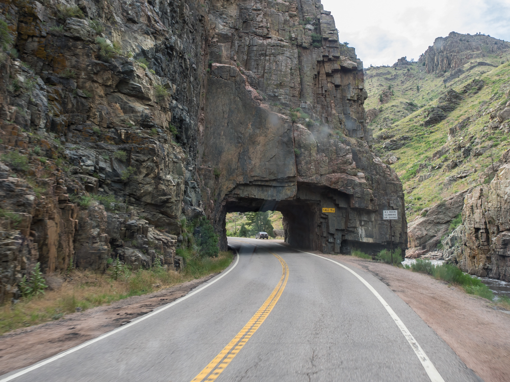
Poudre
Canyon outside of Ft. Collins was a narrow road next to the
creek.
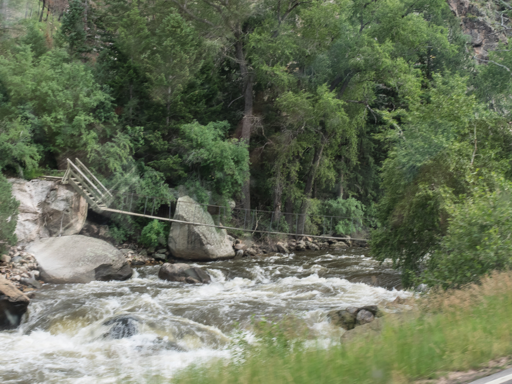
In a
stark reminder of last summer's flooding, there is a cable
bridge to allow access to the opposite side of the creek in the
event of an emergency. Because of luck of the draw, we
were attempting to find a campsite in the canyon on a Friday
afternoon. Given our proximity to "the city" and the
presence of an asphalt road, we had minimal luck until we
reached an RV park. We spent the night there and despite
rain, we had a nice night. Next morning brought brighter
skies.
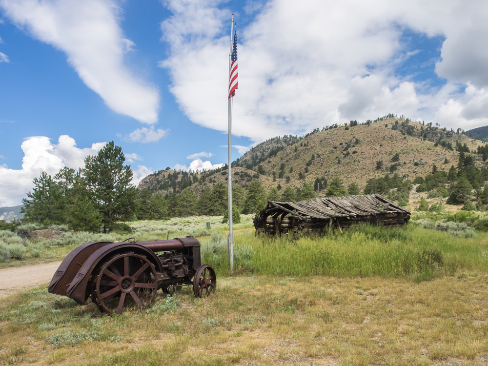
The RV
park had an interesting old tractor and a pioneer building on
their grounds.
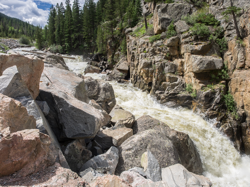
We
traveled up Poudre Canyon until we hit Poudre Falls. Though
not all that large a drop, the water flow provided a spectacular
scene and plenty of noise.
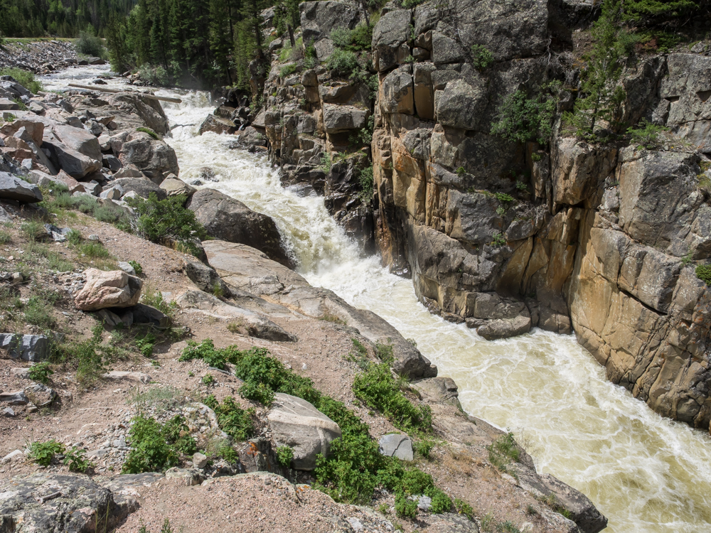
The
falls entered a narrow channel with very powerful currents.
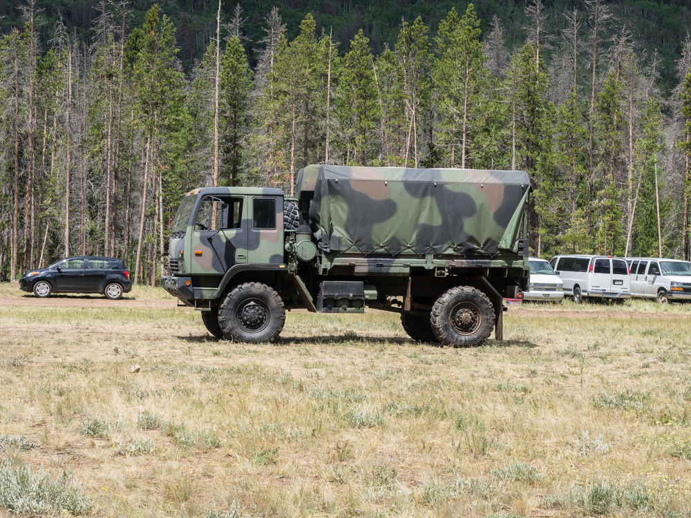
We turned
onto the dirt and headed north toward Wyoming along the Laramie
River. Many miles into the trail we spotted this Stewart
and Stephenson truck that was part of a Colorado National Guard
contingent that were supporting a "youth at risk" outreach
program.
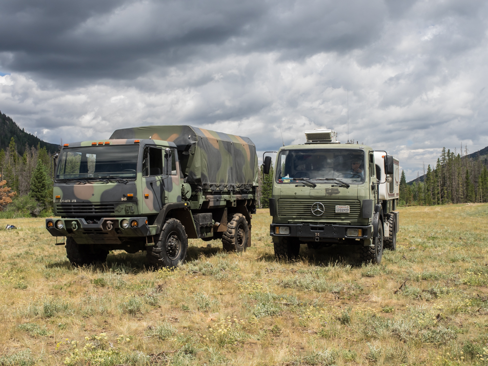
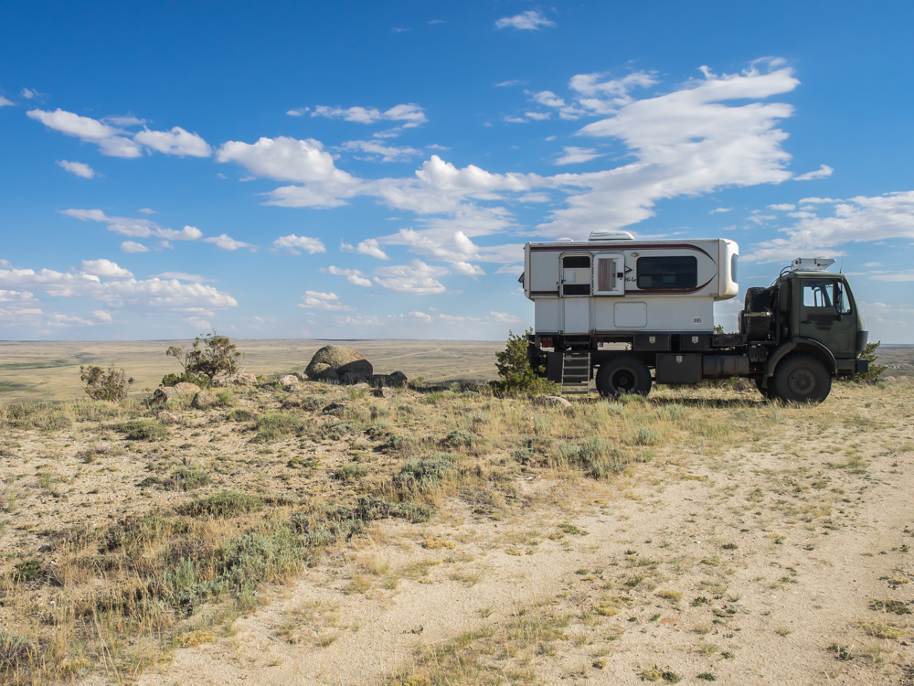
I had to
get a photo of the S&S next to Thor. The U.S. military
imported a set of 1017As as prototype vehicles which is a fancy
way of saying that they were stealing Mercedes intellectual
property on the design. It is not a coincidence that they
look so similar. One of the guardsmen told us that S&S
faced a lawsuit over the issue and one of the terms of the
settlement was that these trucks could not be sold on the
commercial market. When we were done with our photo shoot,
we continued north.
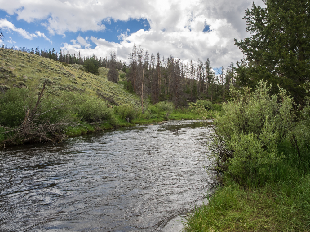
We
stopped along the side of the road for lunch. Our pull-out
was Laramie River that had trout.
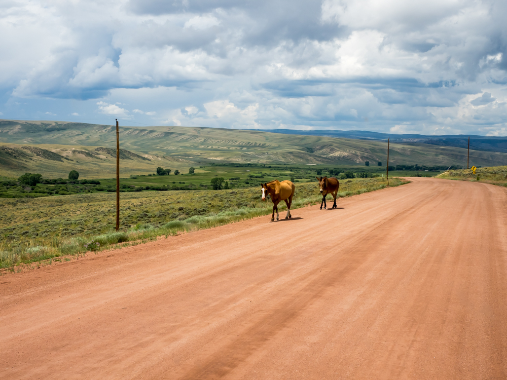
We
crossed over into Wyoming and the area became open range (stock
on the highway). The road was in excellent shape allowing
40 mph speeds. The valley was lush with the water from the
Laramie River.
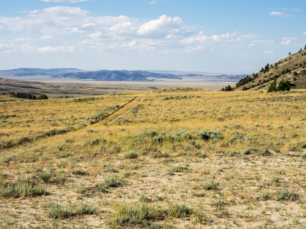
We
continued north along the Laramie River until we hit Wood's
Landing, then we headed north over Sheep Mountain and into the
Centennial Valley. From the north end of the Centennial
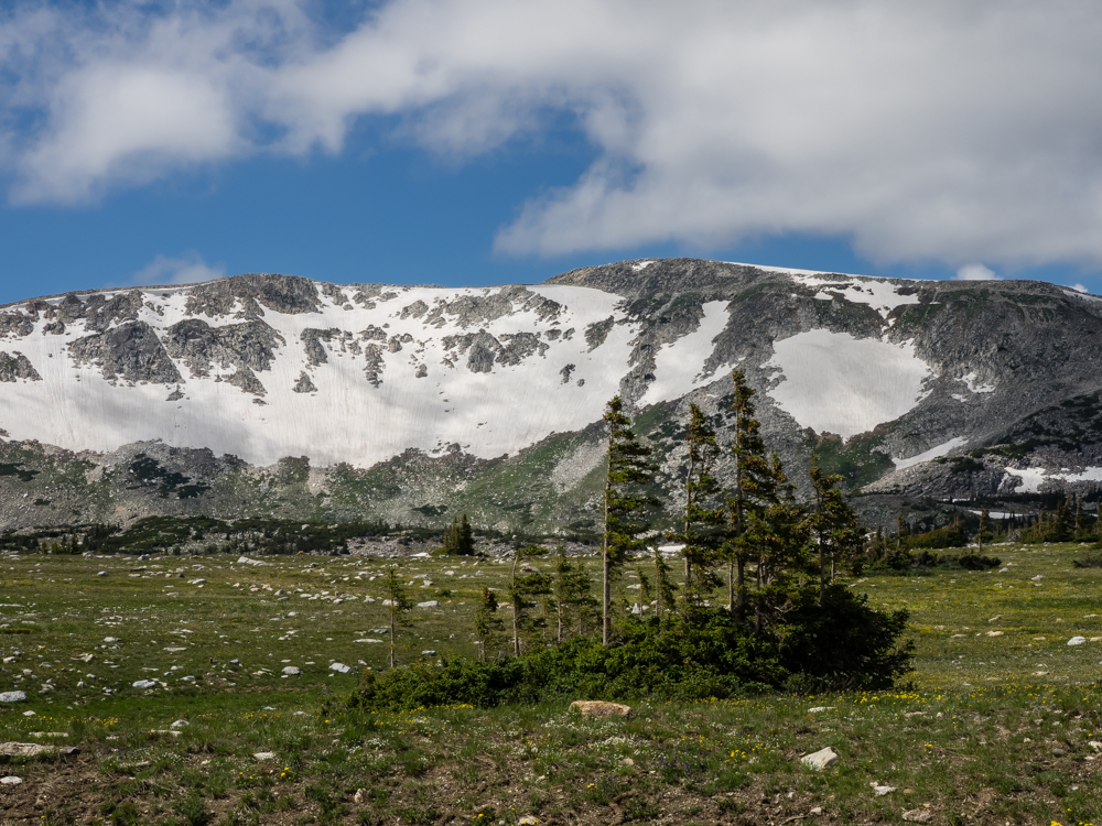
Valley we headed west into the Snowy Range portion of the
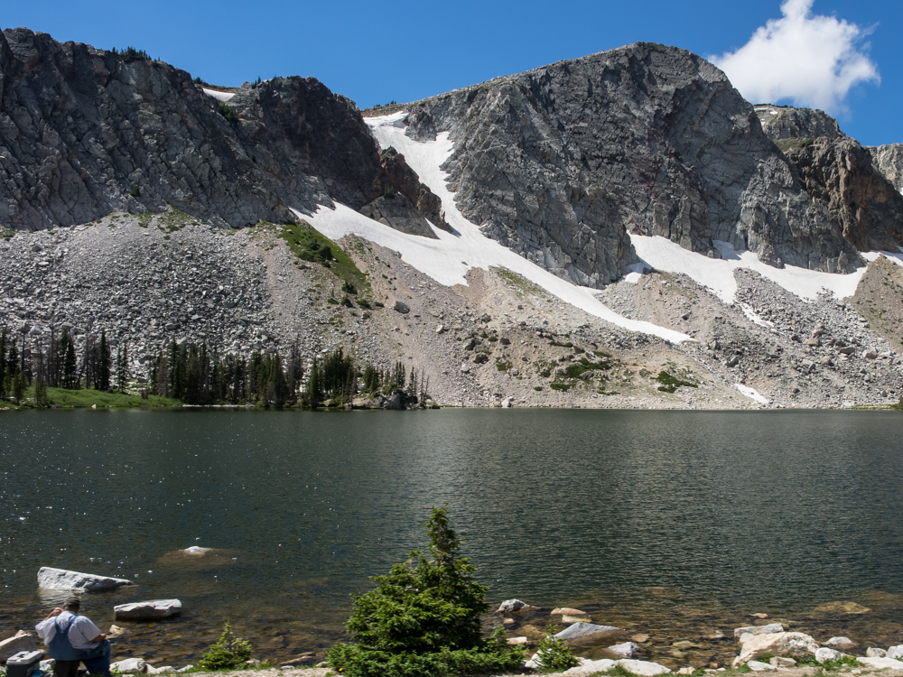
Medicine Bow Mountains. Just past Snowy Range pass we
stopped for a few photos. Snowy Range pass is at 10,800
feet and the surrounding peaks are nearly 12,000 feet.
There was plenty of snow remaining on the slopes.
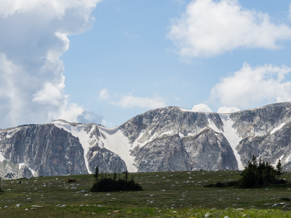
Note the
size of the cornice in the notch between the peaks. When
this fails, it will result in a spectacular avalanche.
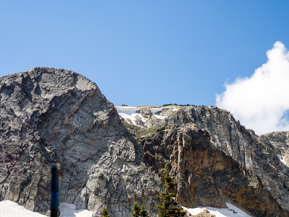
These
smaller cornices will fail as well in the near future.
Mirror
Lake was right next to the road and there were a number of
people there taking in the sights. We continued down the
west slope of the Medicine Bow mountains and found a camp at Ryan
Park and spent the night.
The
Forest Service camp at Ryan Park was more than acceptable, but a
bit buggy with mosquitoes. Next morning, we rolled into
Saratoga, WY for a supply stop. We had lunch at the local
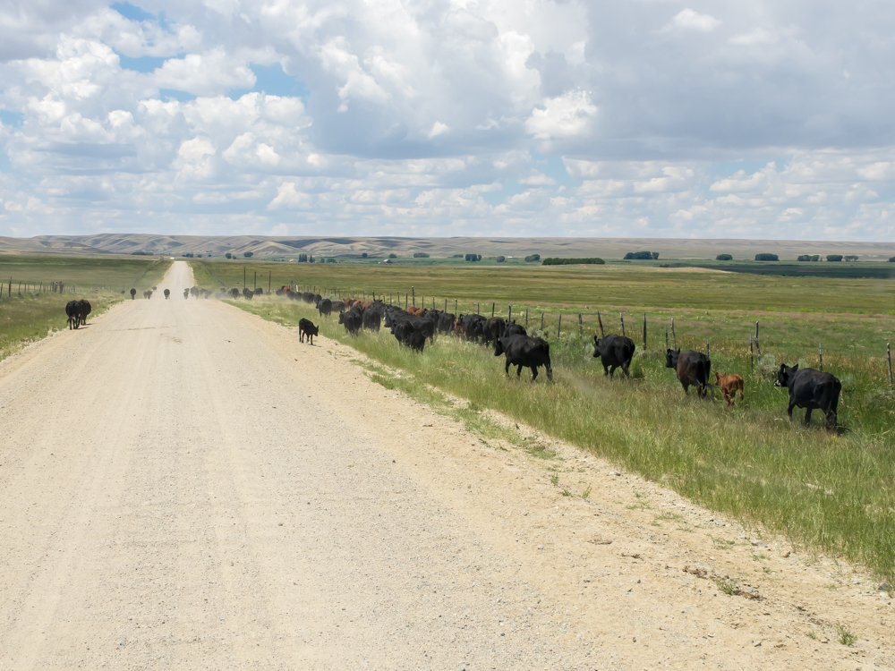
cafe and then headed west into the hills on the dirt.
There were many areas where there was loose stock on the road
requiring defensive driving. Cattle are not known for
their superior reasoning abilities and we had more than one
attempt to bold in front of us at the last second. Thor
would win that contest, of course, but it would result in grill
damage and likely cause me to pay the rancher for his losses.
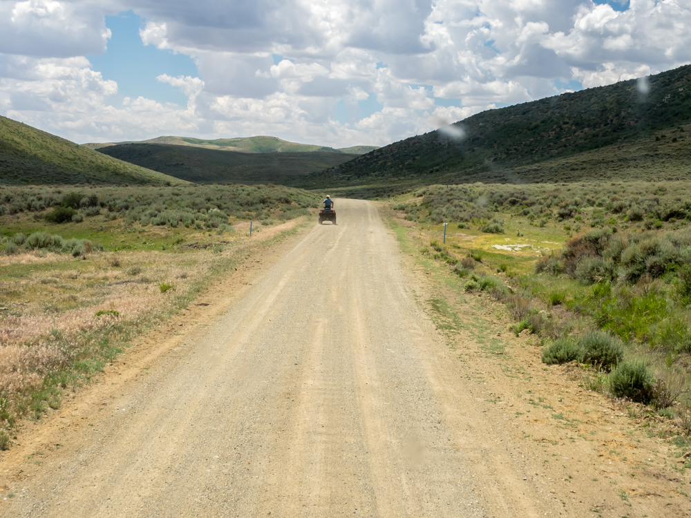
In the
old days, lost cattle were found from horse back. These
days, the horse is named "Honda" and runs on regular gasoline
rather than hay. This fellow was searching for a specific
cow, but I am not sure if he found it. We are 30 miles
from Saratoga in the hills in a remote are at this point and
have another 70 miles or so to hit civilization to the north.
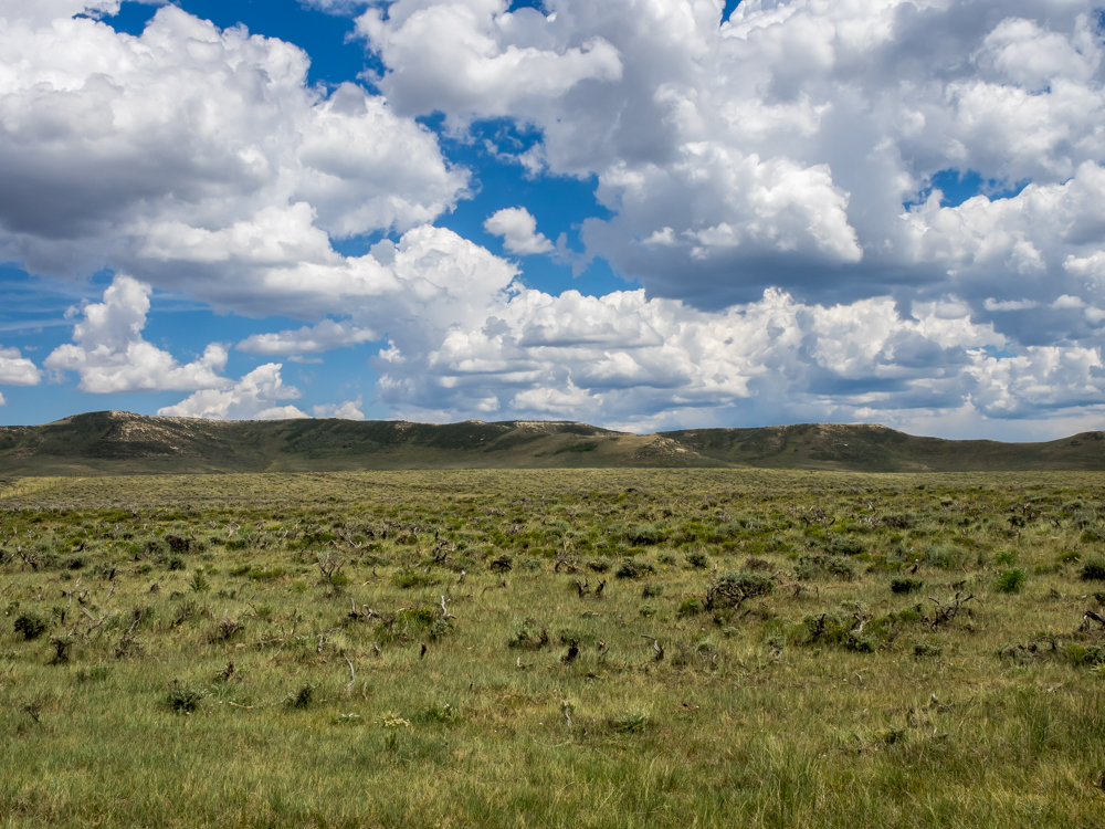
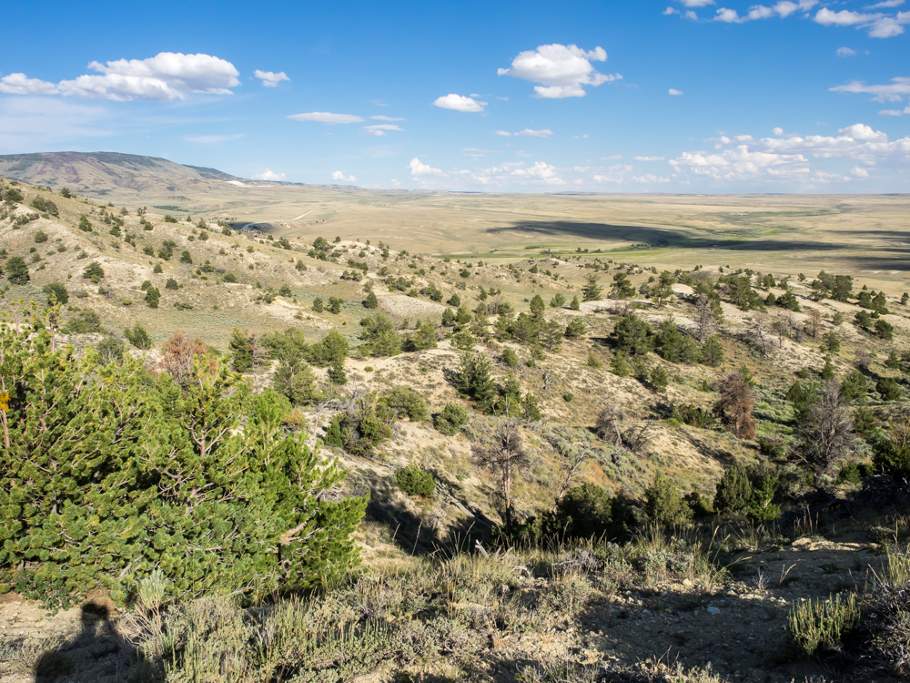
The area
looked like pretty good cattle country, at least in the spring
when things are green. There were very few trees except at
the higher elevations.
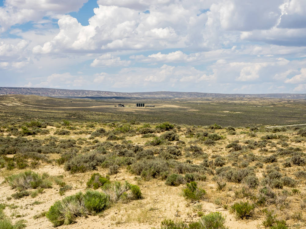
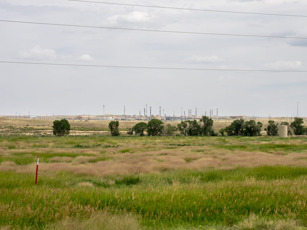
When I
finally thought we were in a remote area, we saw this oil
storage facility. The tanks store oil from the surrounding
wells until it can be trucked to a distribution point. We
continued north past Wamsutter, WY and then north through the
Great Divide Basin toward Crook's Gap. Along the way, we
passed several uranium mines and a refinement mill at Chain
Lakes Flat.
We found
an overlook point near Crook Gap and made camp for the night.
From our
campsite, we could see down into the Sweetwater River valley which
was the path of the Mormon Hand Cart expedition.
To the
east of the campsite we could see Sheep Mountain Mine on the
flanks of the Green Mountains.
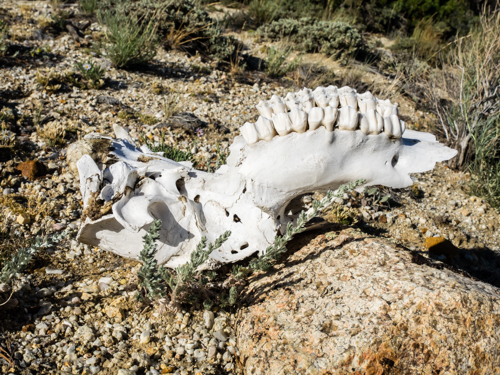
The
western terrain is harsh on animals. I spotted this
partial skull next to our camper.
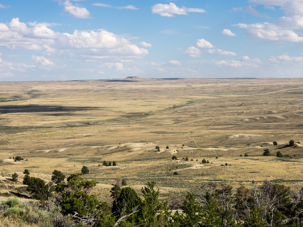
Looking
south east from our campsite, we could see Bare Ring Butte on
the horizon.
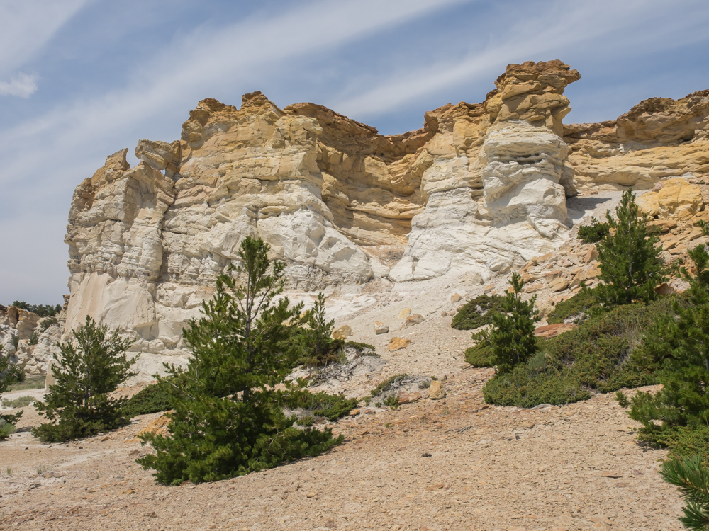
On the
map, we spotted a petroglyph site at a place called Castle
Gardens. We left the main road and headed east 5 miles
from the "main" road to the site. Unlike the rolling hills
of the surrounding area, the Castle Gardens area is a small
fault and uplift that resulted in a cliff.
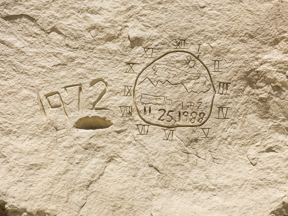
Like
many uncontrolled petroglyph areas in the west there was some
graffiti. But at least these more recent glyphs were well
done.
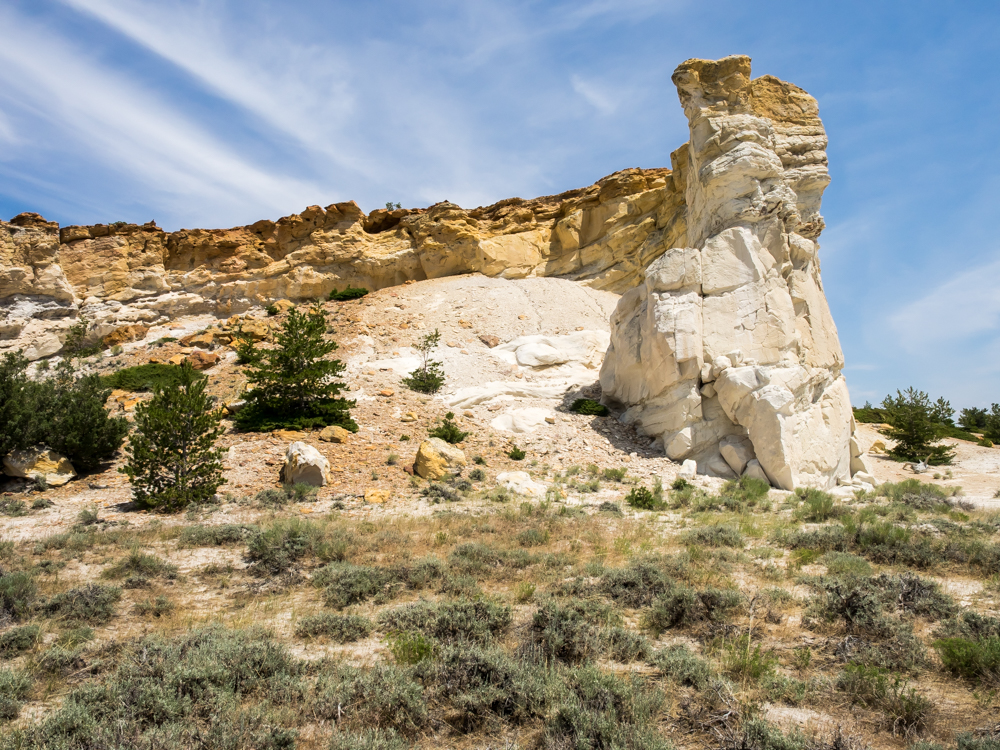
Some of
the exposed formations were quite dramatic.
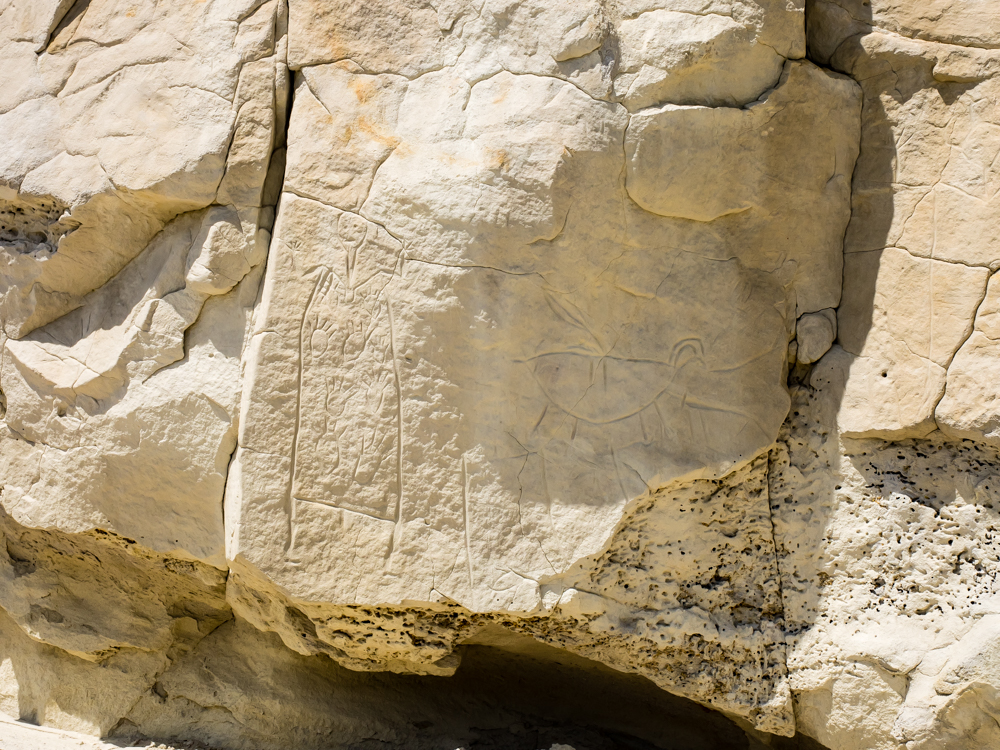
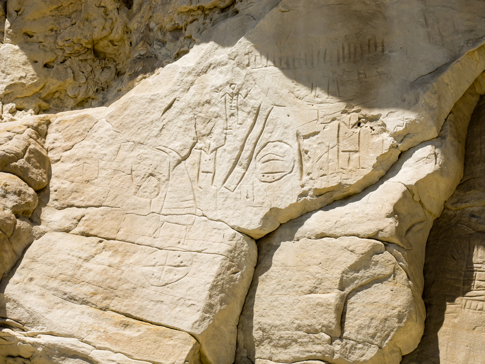
Some of
the petroglyphs were rather novel compared to others that we
have seen in the west.
The
symbology employed in these petroglyphs seem unique compared to
the Anasazi regions.
The stone
was quite soft and it was easy to make lines using sticks and
sharp rocks.
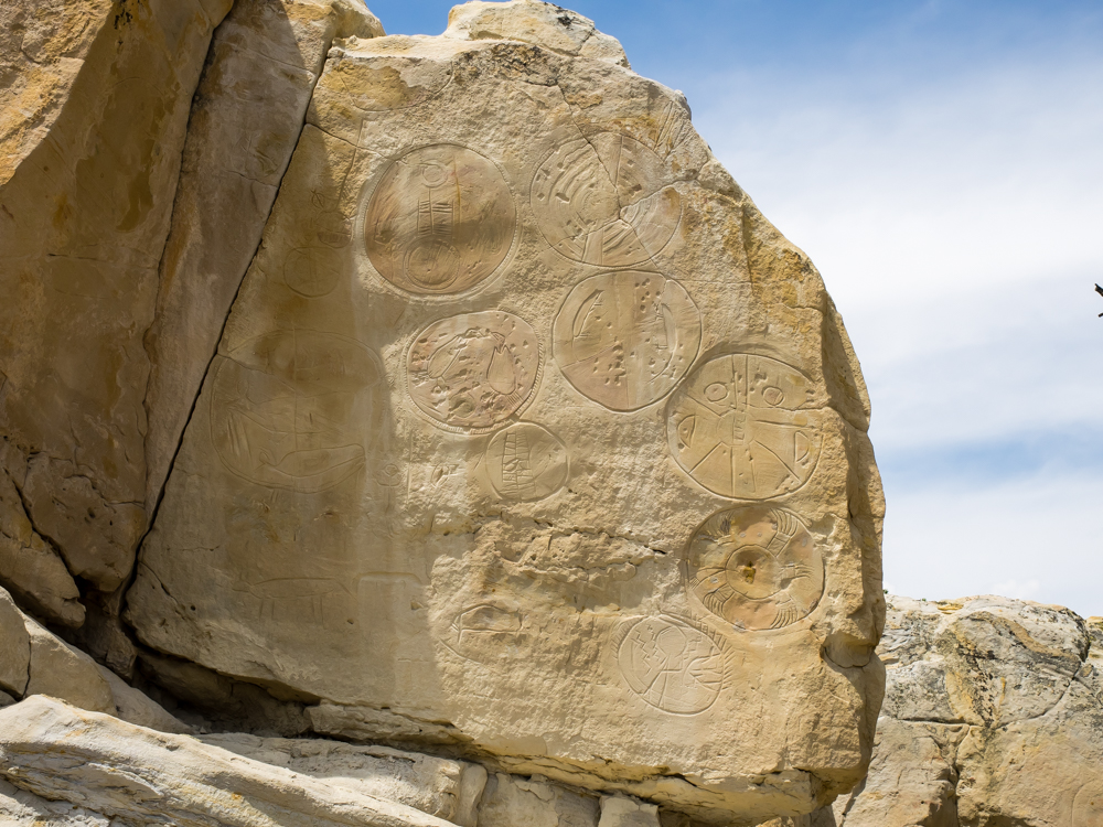
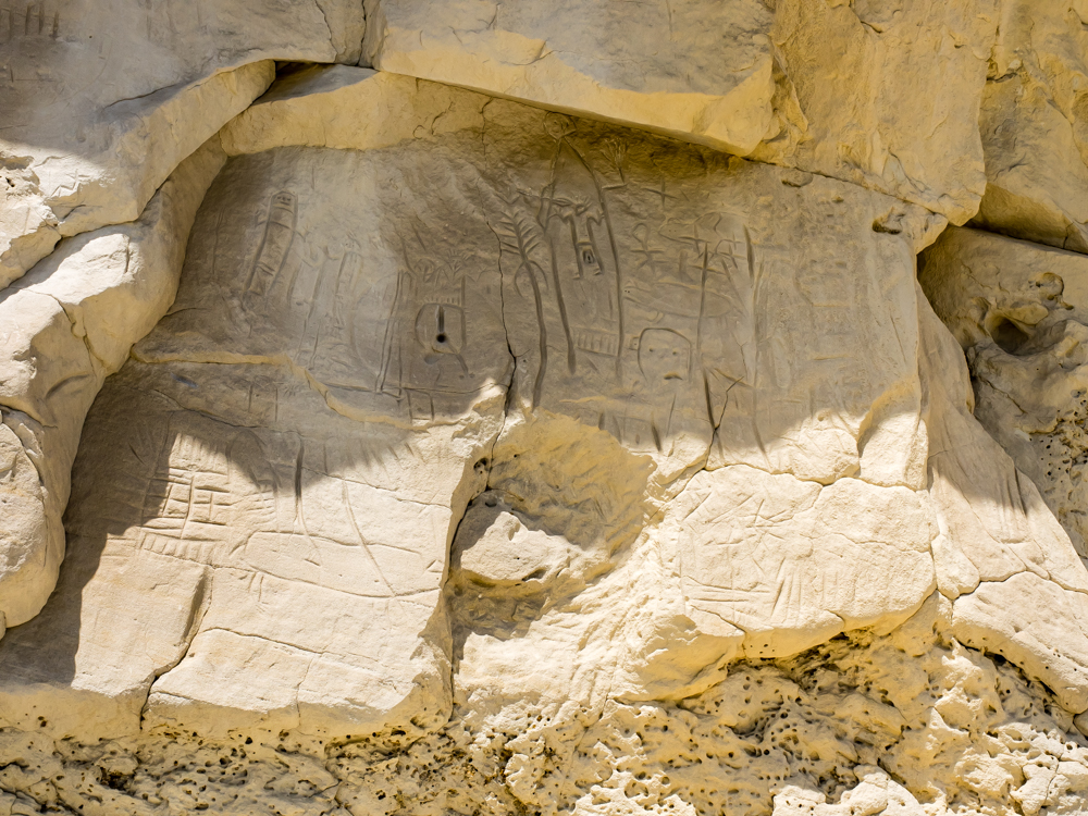
These
sets of glyphs were interesting in that there areas that were
ground flat to prepare for the actual carving of the patterns.
We ate
lunch at Castle Gardens and then continued north past the geographic
center of Wyoming, through Moneta to the poison gas areas near
Lysite. At Lost Cabin there was an oil refining facility.
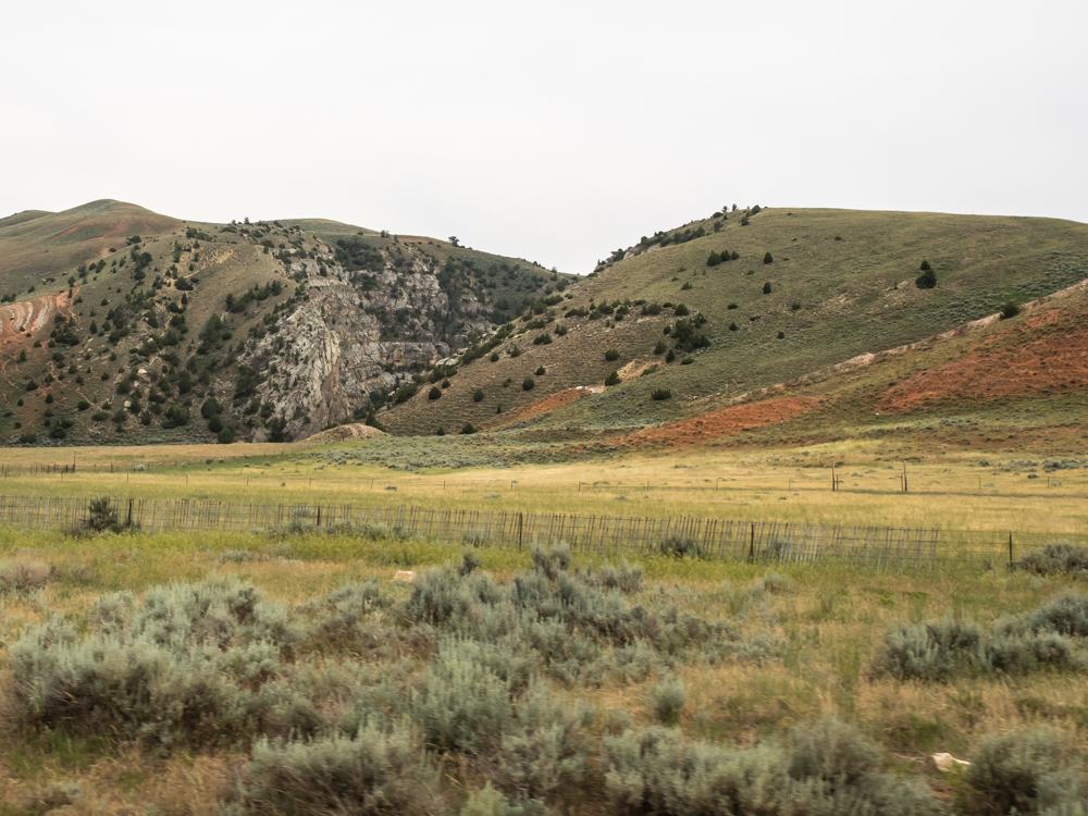
North of
Lost Cabin, we headed into the Bighorn Mountains and passed
through several hogbacks that have been breached by rivers.
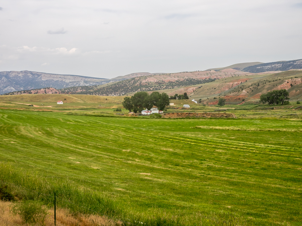
We followed
the Nowood River and found many nice ranches.
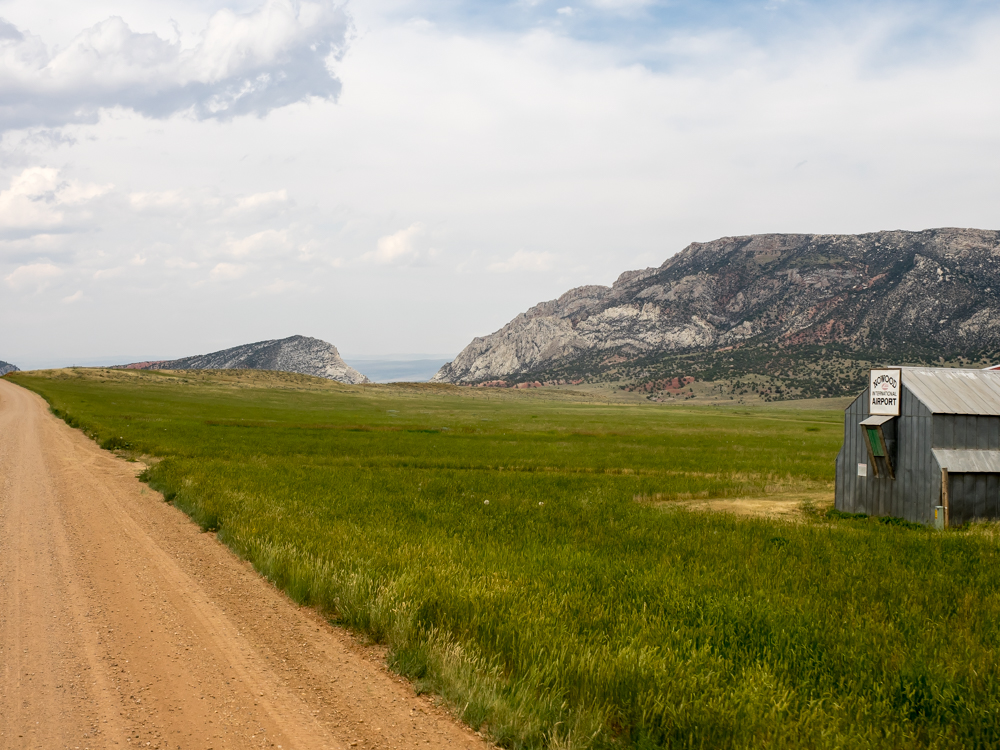
The
Nowood River carved a huge notch in the eastern flank of the
ridge.
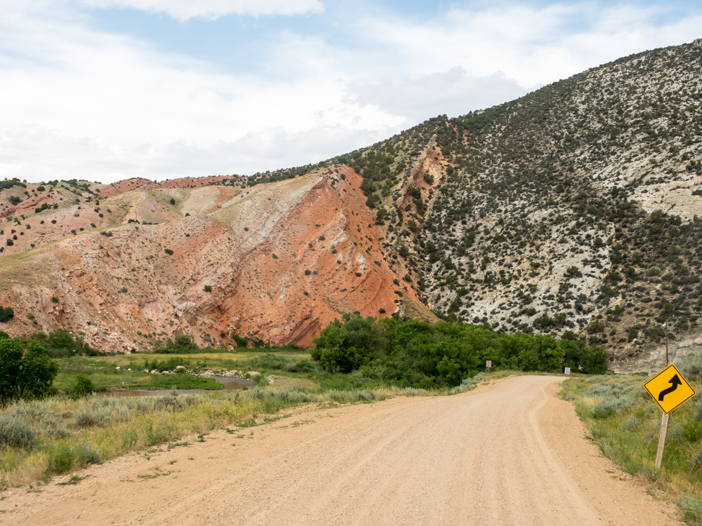
The
river banked a hard turn and cut right through the ridge.
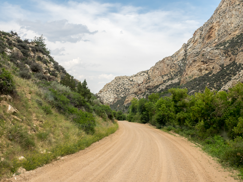
The road
through the notch followed the creek. The walls of the
notch were very steep.
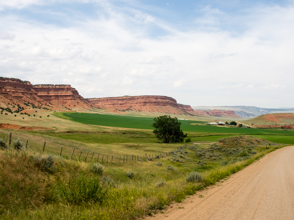
The
lower reaches of the Nowood River valley had nice fields with
both cattle and sheep and red cliffs similar to southern Utah.
| Previous Adventure | ||
| Trip Home Page |
Photos and Text Copyright Bill Caid 2014, all rights
reserved.
For your enjoyment only, not for commercial use.