While
at Candlestick, we had a nice dinner and then watched a movie
with popcorn. The wind calmed during the night and the
temperatures were mild. Next morning we were treated to
bright, clear skies and calm winds. Since it was calm and
we were in no hurry, we decided to launch our quadcopter to get
some shots of the canyon.
The
photos below are what we saw.
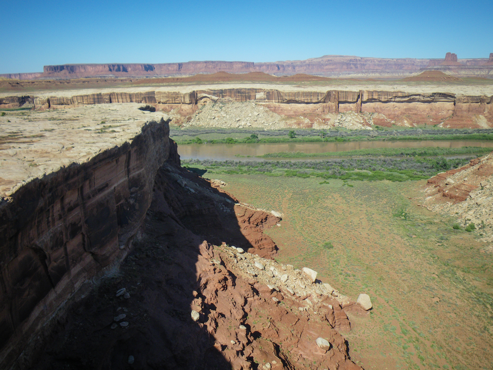
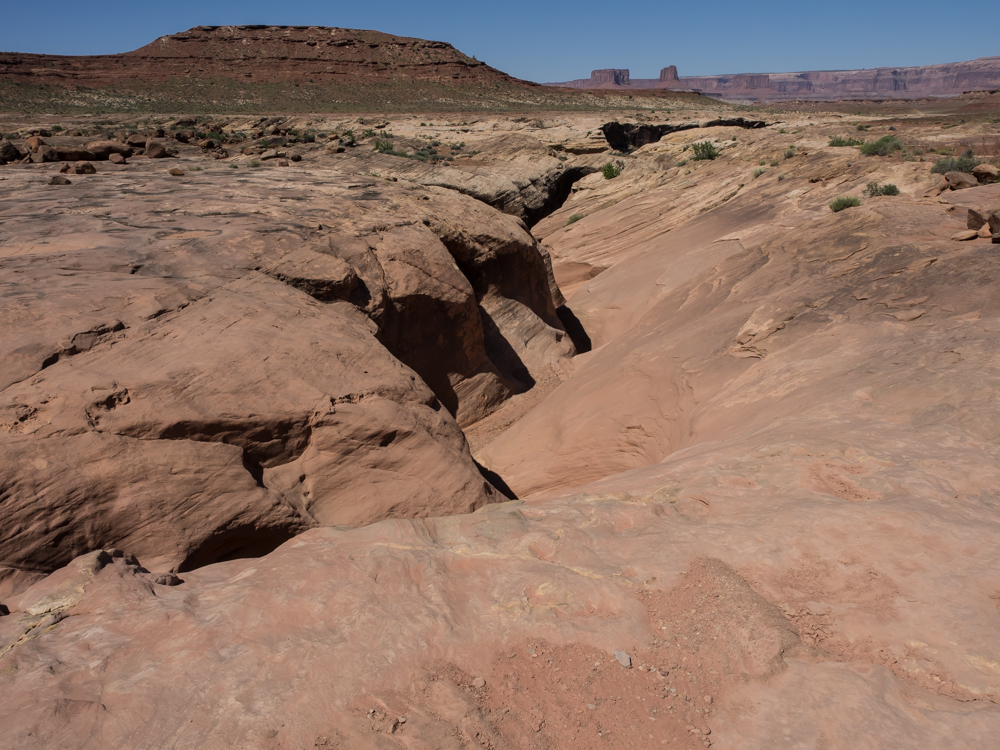
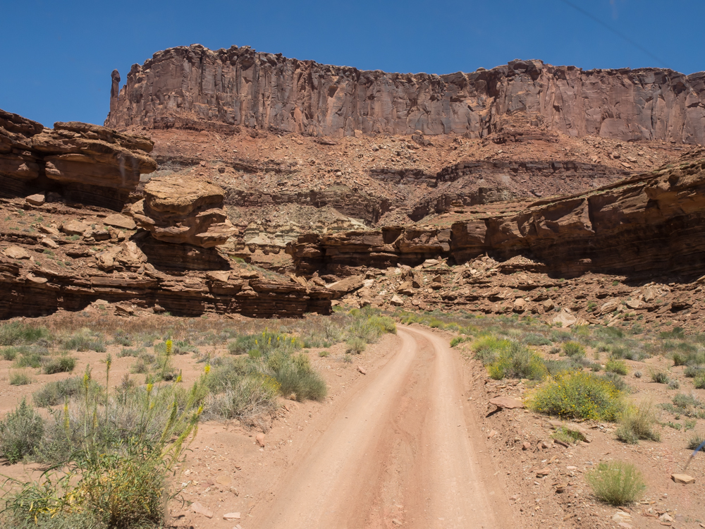
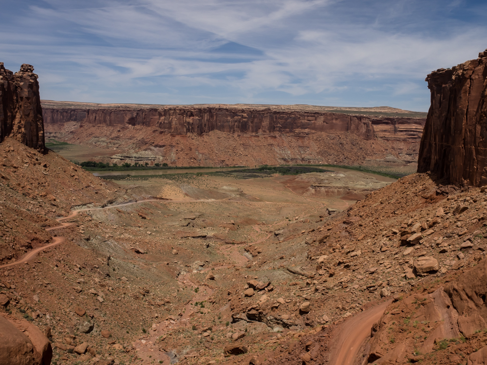
The side
canyon next to Candlestick camp was narrower than I expected and
I overflew the center. But, the photo produced was more
than acceptable.
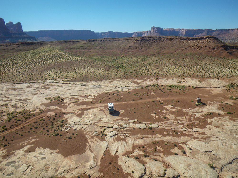
Looking
back at our camp, you can see how barren it was. The
structure at the right-center of the photo above is the NPS pit
toilet. The exposed surface of rock is petrified sand
dunes.
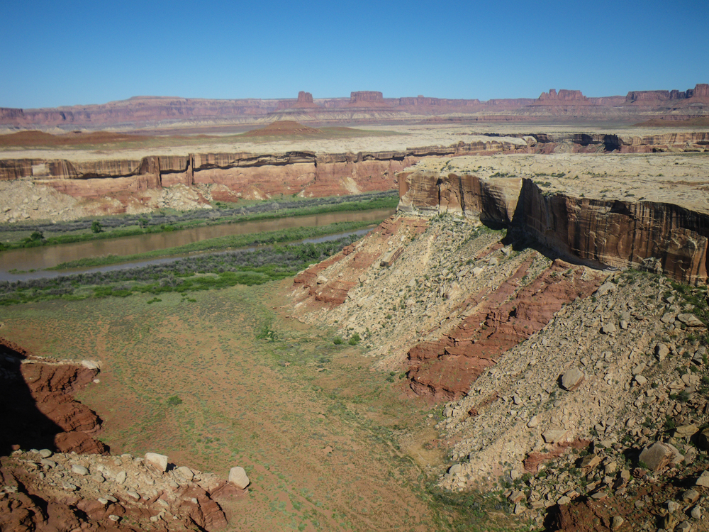
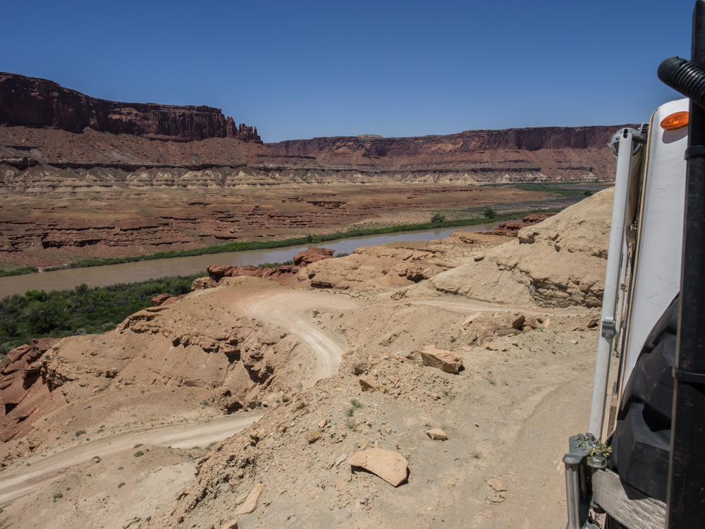
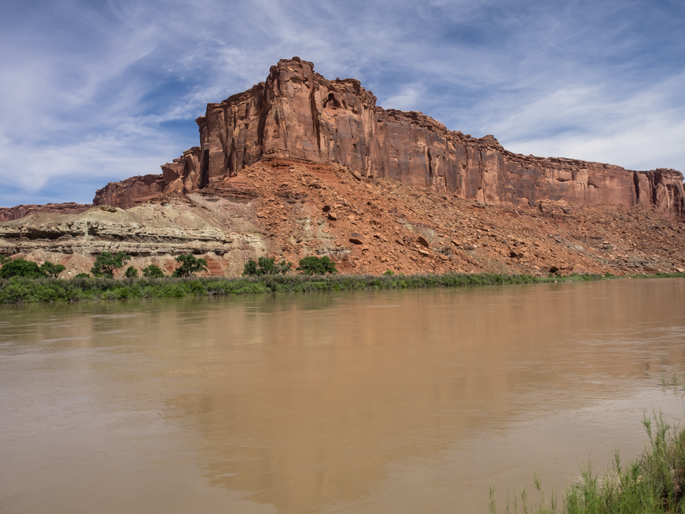
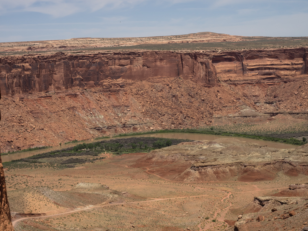
On the
far side of the Green River were more towering cliffs. The
only green in the scene is where water flows.
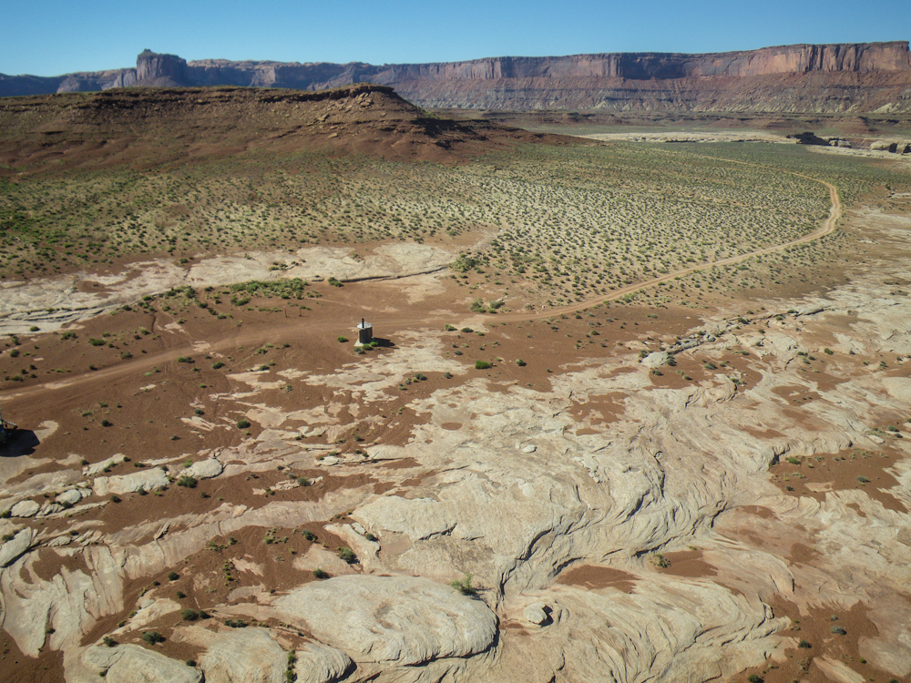
Identical
cliffs were present to the east of our camp.
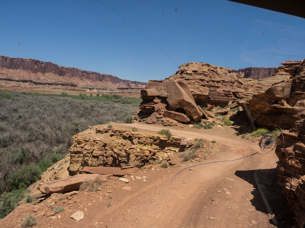
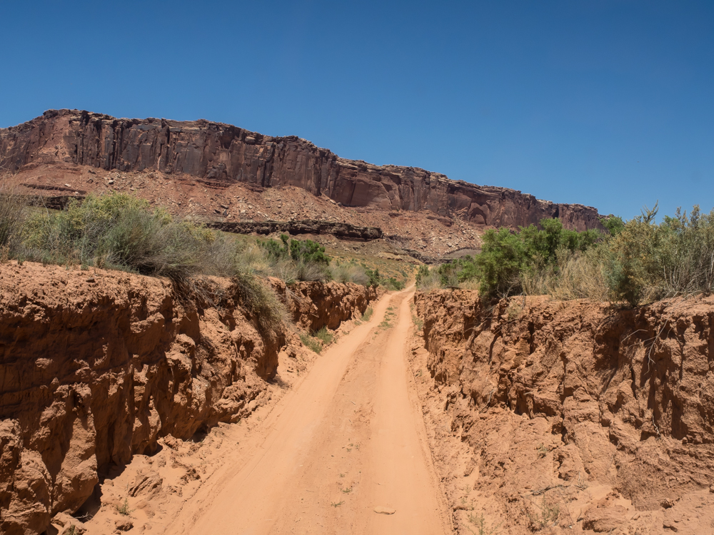
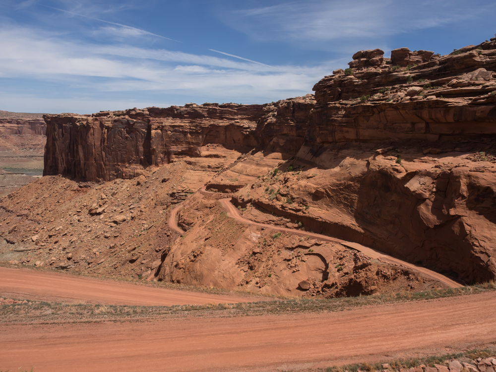
As we
rolled out of Candlestick we got to see the start of a new side
canyon. The path of the rainwater cuts trenches through
the sandstone. These trenches become huge canyons over the
course of thousands of years.
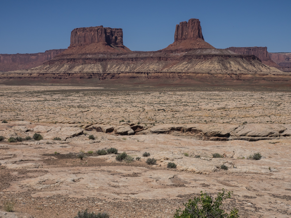
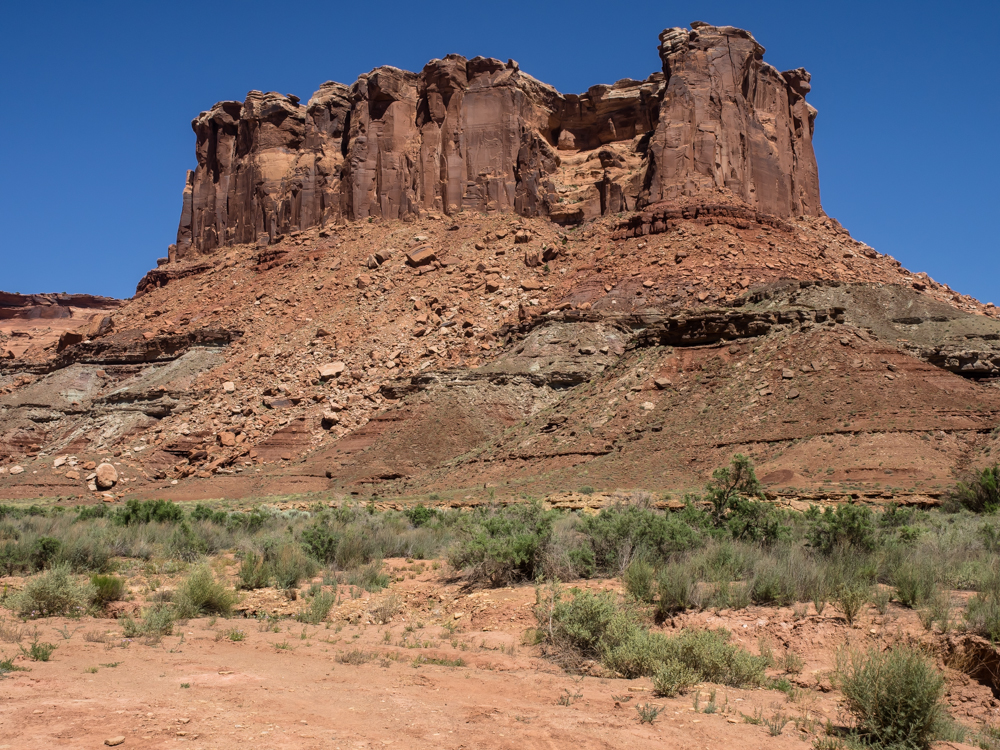
There
were huge monoliths everywhere. There is a deep canyon
between us and the monoliths, only partially visible in the
photo above.
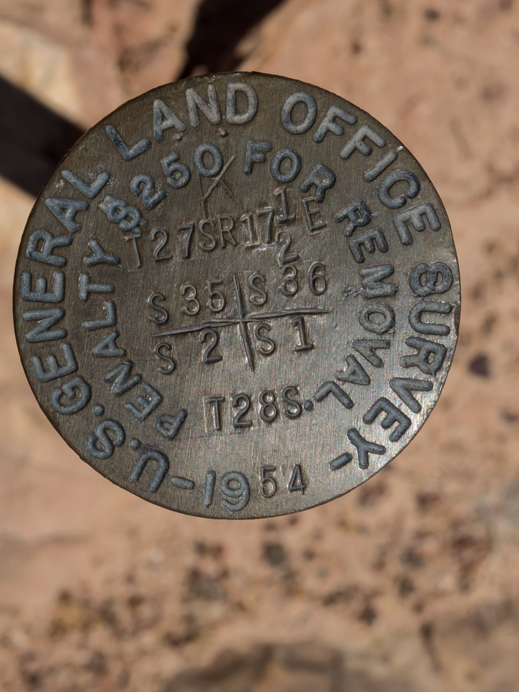
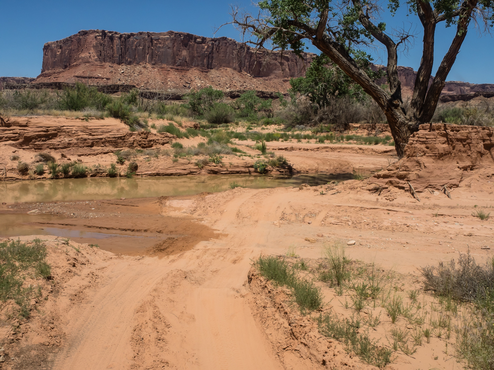
We
stopped for lunch near the Green River and while I was scouting
around I found this witness post/section marker. Note the
date.
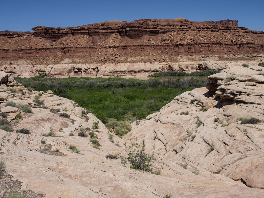
The
lunch stop was close to the Green River which was accessible via
the small side canyon. I did get to the bottom but could
not get to the river due to the thick brush.
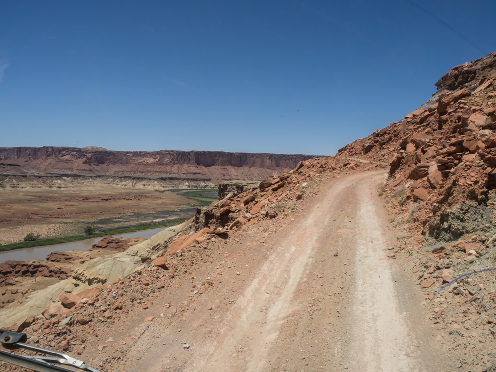
From the
trail's low point near river-grade, we were forced to ascend to
the next bench which brought steep grades, narrow trails and
tight switchbacks.
Kathleen
stuck the camera out the window looking backwards as we ascended
the switchbacks. The were tight and narrow. Our
angst was building.
As we
got higher on the cliff, the pucker factor increased. At
this point, the cost of a mistake was fatally high.
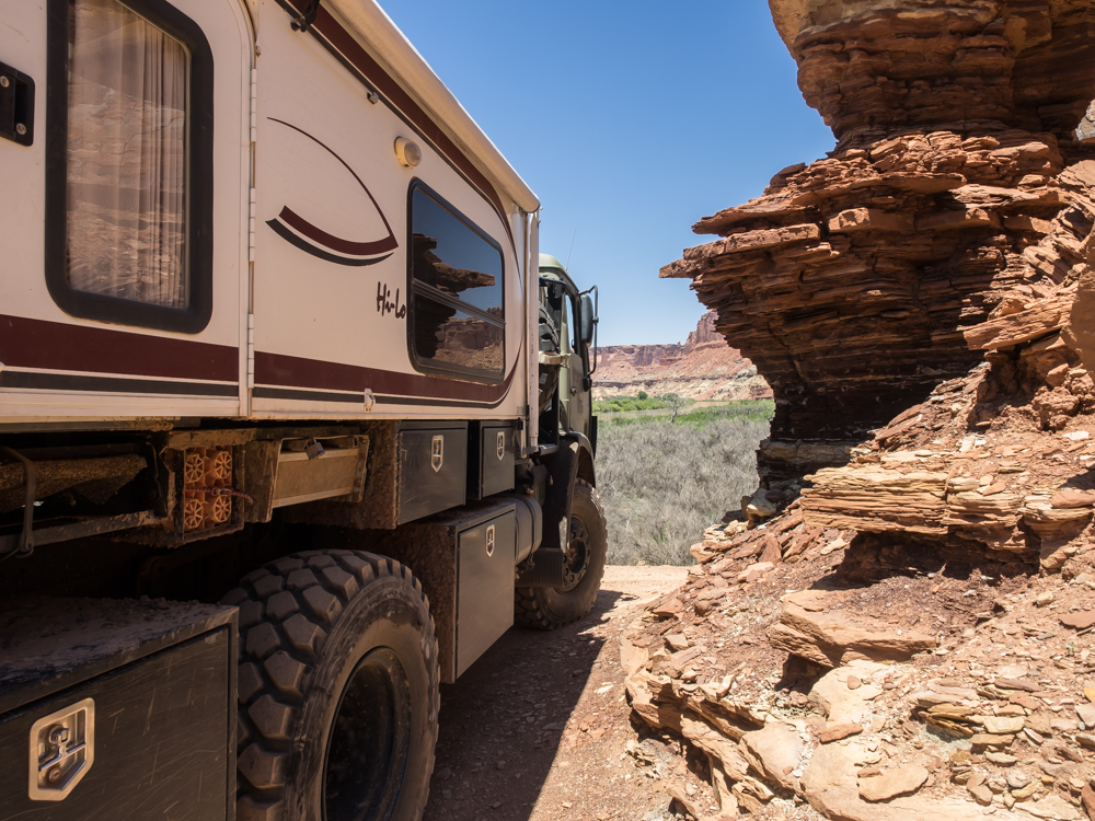
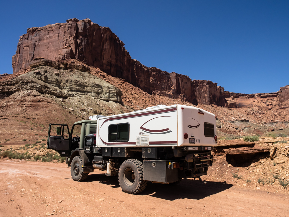
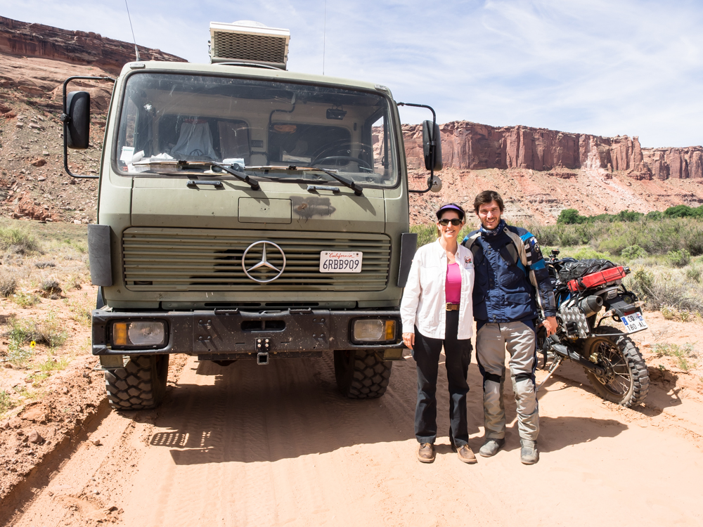
Thor's
wheel width and turning radius made this portion of the trail
exciting. Note the rock damage in the windshield; this
will be replaced in a few weeks at Rob Pickering's shop.
Potential
damage ahead! Due to the slope on the trail, we passed
underneath the ledge. I could have taken my sledge hammer
to the overhang, but we cleared without issue. Tight, but
no impact.
Our
planned camp was in Taylor Canyon. But, Kathleen had
reached her "tense-wheeling limit" and voted to proceed to exit
the park. In the interest of domestic tranquility, I
agreed. That and the fact that the map showed that the
trail to Taylor Canyon was chock-full of tight
switchbacks. So, we took the left fork on the trail and
worked our way along the Green River. Then, we encountered
a water crossing. Normally, this is not a cause for
concern. But, the river silt has a high clay content and
becomes slick as snot when wet. And, we had no idea of how
deep the crossing was or how soft the bottom was. But,
faced with 2.5 days of backtrack, a re-do of tense cliffs and
Murphy Hogback, the decision to forge ahead was easy.
The
water crossing turned out to be trivial but the exit was a
trench cut from river silt which likely would have been
impassible if wet. Thor's track totally filled the trench
edge to edge.
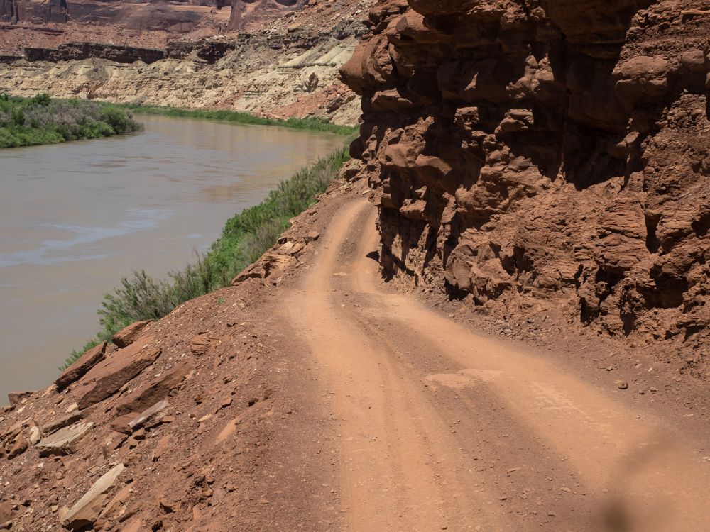
A cause
for great concern. The trail is very narrow here and the
cliff is about 50 feet into the ice-cold, flood-stage Green
River. The overhang looks like it will impact the cab or
camper or both.
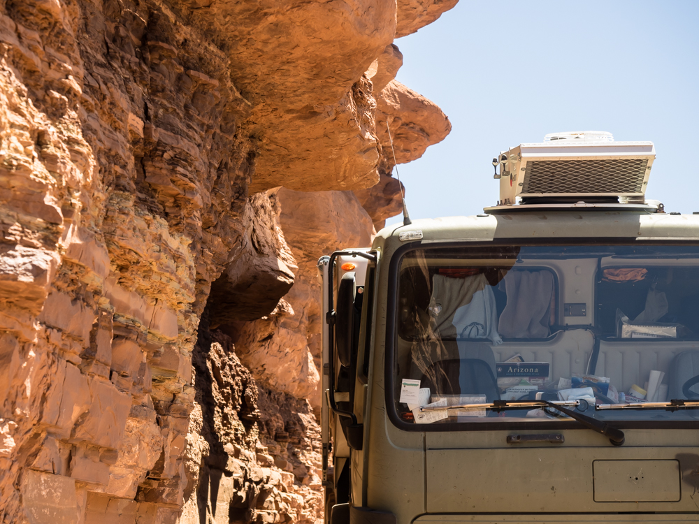
It
turned out that the overhang we were concerned with was high
enough to not be an issue. Again, a close-but-no-impact
obstacle. However, the next little ledge was not so
nice. And, due to the tightness of the trail and grade,
backing up was futile. The trail was so narrow that I had
to take special care on exit from the cab to prevent going down
the cliff into the river.
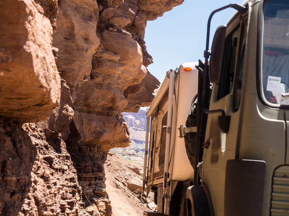
Kathleen
spotted and we proceed ahead at a snail's pace. The
choices were few: impact the cliff or go for a swim in the
flood-stage river. Above, the ledge cuts into our awning.
On the cliff side, there was about 1 inch between the edge of
the tire and the cliff. To say I was sweating was putting
it mildly.
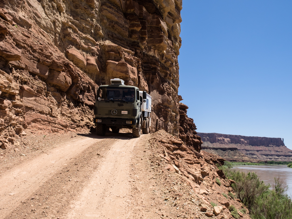
The
cliff is actually spoil from the creation of the road. The
photo above shows the steepness of the cliff. At this
point we are fully committed -- there is no going back. We
had no insight as to obstacles between us and the canyon exit.
We
reached the exit from the canyon onto a wider road. We
stopped to relish the situation and breathe a collective sign of
relief. Of course, we still had to get back to the top of
the mesa.
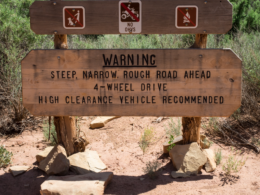
The NPS
sign says it all.
We
finished our "oh shit" moment and headed upriver to find a camp
on the BLM land.
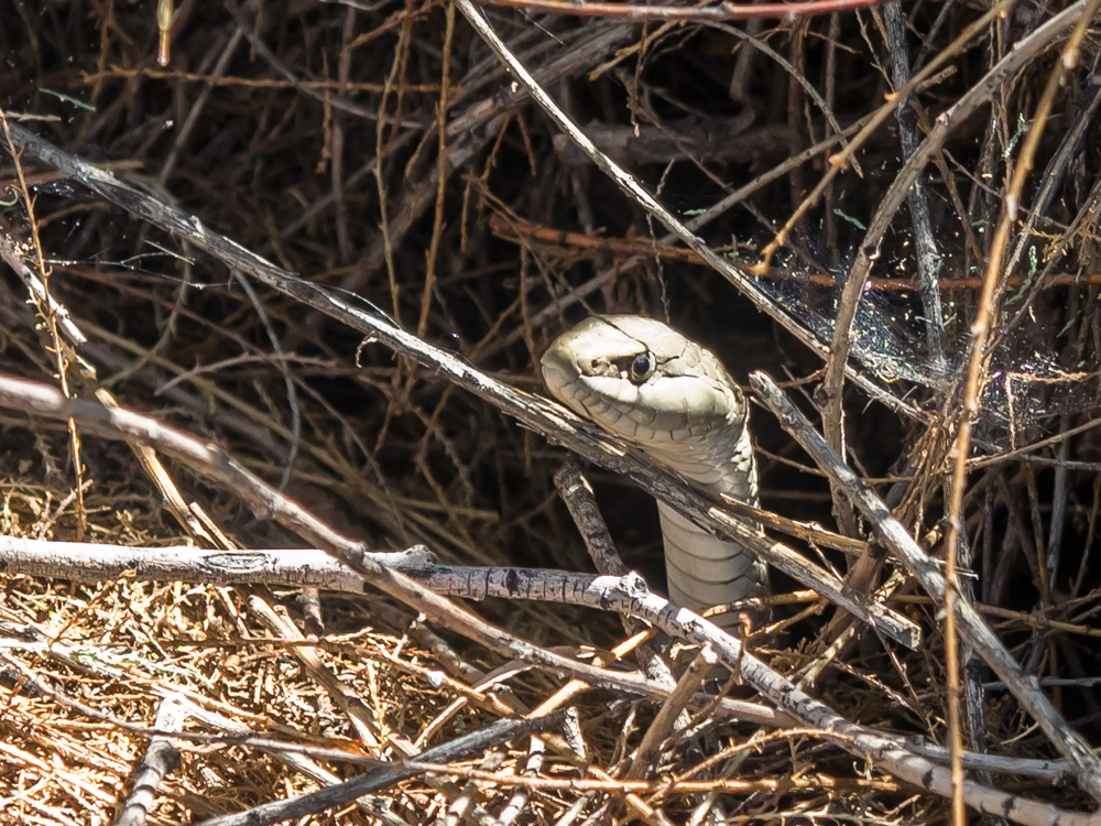
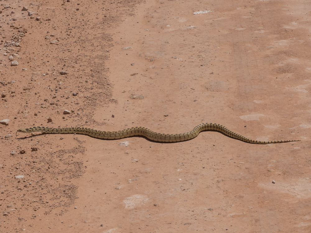
We found
a camp in the brush near the river on a narrow pull-out.
While sitting and recovering from the tight cliffs, I noticed
this snake watching me from the brush. He sat there
watching my comings and goings for about thirty minutes then
slithered away into his hole.
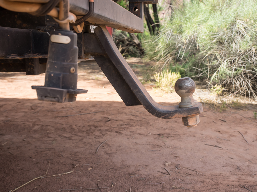
The exit
from the water crossing bent our trailer hitch. Note to
self: remove trailer hitch before any hard-core wheeling -- it
becomes a plow.
The bad
news about our camp was that after 3 days we were out of ice for
cocktails. Warm beer is not my thing. And, as
Kathleen and I have long said, "The definition of adversity is
cocktails without ice". Above is the morning view across
the Green River from our camp. The river had risen
substantially during the night.
Next
morning, we broke camp and headed down the road toward the
canyon exit and we came upon this fellow. He is French
with very poor English language skills. But, we were able
to determine that he only had 2 liters of water and was
alone. I gave him another liter, but that was all he could
carry. His plan was to do the 100 mile White Rim Trail in
one day. For an accomplished rider, this is reasonable,
but if he encountered issues and had to stay the night, 2 liters
of water in the high heat was problematic. We later saw
him at our campground in Moab, UT.
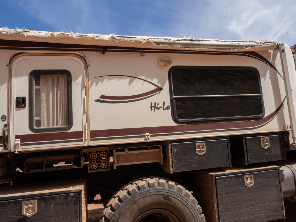
The
morning sun allowed us to assess the damage to the awning.
The verdict is easy: it is toast and will be removed.
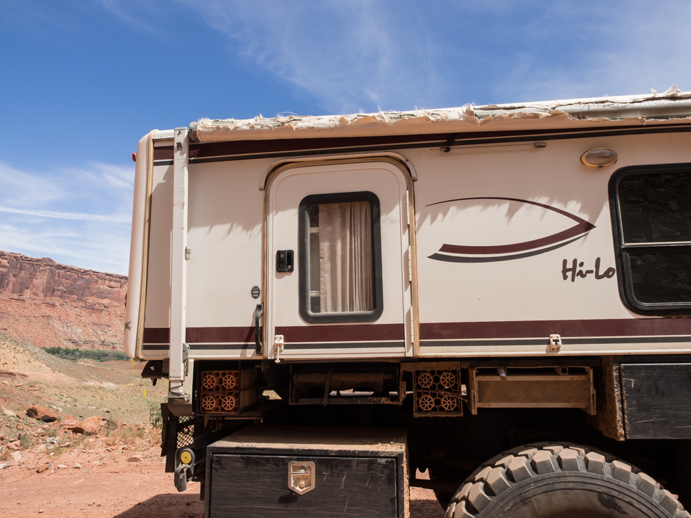
The
damage due to the overhangs was impossible to avoid given the
width of the truck. We never used the awning in our 4
years of ownership of the HiLo.
The exit
from the canyon was just as steep as the other grades we
encountered but the road was twice as wide.
Above, the green patch has a nice camp area that we will use next time we are in the region.
The
switchbacks were tight. On the exit we encountered the NPS
ranger and talked with him at length. My first question to
him was "have you ever seen a bigger vehicle than mine
successfully complete the White Rim Trail?". His response
was he saw a European Unimog (likely with a Unicat camper) do
it, but there was damage to the camper from the same overhang
that tagged us. We did not damage our camper, only the
awning (which is useless due to the height of the truck and has
never been deployed in 4 years). Score for Thor! The
ranger was running the trail because the Green River was
rising. He got all excited when we told him that we did a
water crossing and stated that they would likely close the
trail. We were just in time it would seem.
Further
down the path we encountered this fellow crossing the road.
| Previous Adventure | ||
| Trip Home Page |
Photos and Text Copyright Bill Caid 2014, all rights
reserved.
For your enjoyment only, not for commercial use.