We
decided to take a small side trip to check out a National Monument
called El Morro. Without knowing anything about it other than it
existed and the location, we set out to see what was there.
The photos below are what we saw.
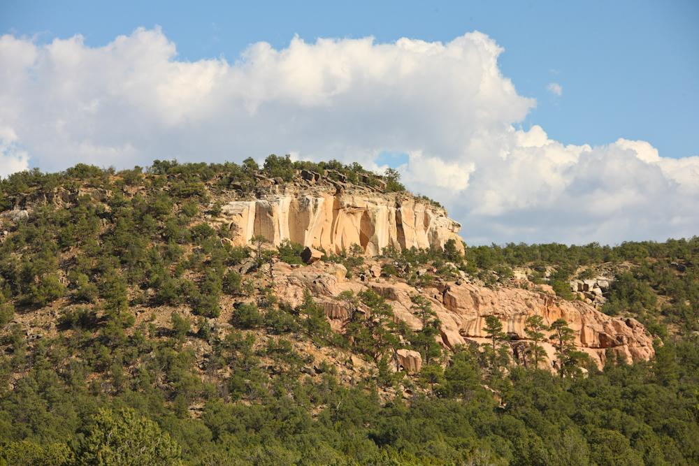
We
stayed at the camp site at the Monument and we had a nice view of the
sandstone cliffs near El Morro. The camp fee was a whopping $5
per night, so it was a reasonable deal.
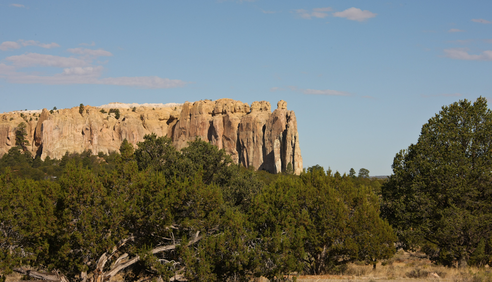
El
Morro is actually this structure. The attraction of the place was
still a mystery to me but we would visit the site the following day and
determine why folks came here over the years.
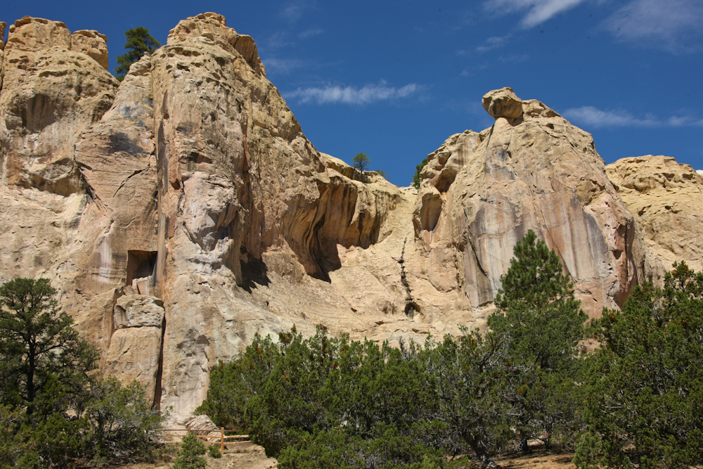
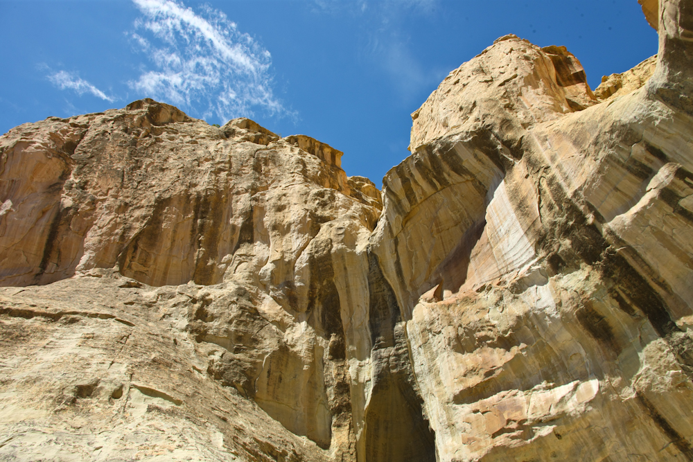
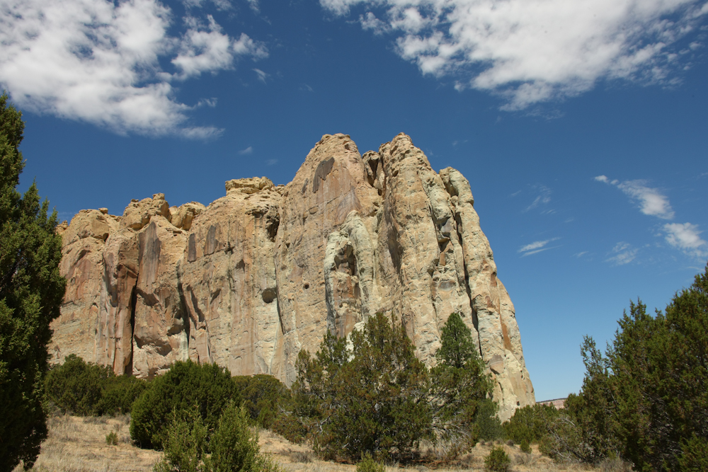
The
cliffs at El Morrow were massive and the light colored sandstone
provided nice contrast to the bright blue sky. Oddly, the square
hole at the left of the photo above is a natural structure.
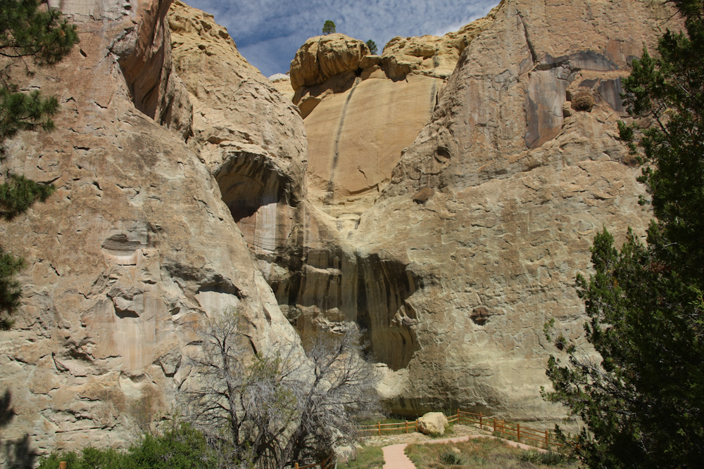
The
reason that people came here over the centuries is that there as a
natural catchment at the base of the cliffs. This catches runoff
from the stone mesa above forming a natural, year-around water
source. In fact, this is the only dependable water hole for more
than 30 miles in any direction. The Native Americans discovered
this waterhole and the word was passed down through the years.
Many of the groups that passed by left their mark on the stone walls of
the cliff in a place now known as "Inscription Rock". The water
is visible as the green pool behind the fence.
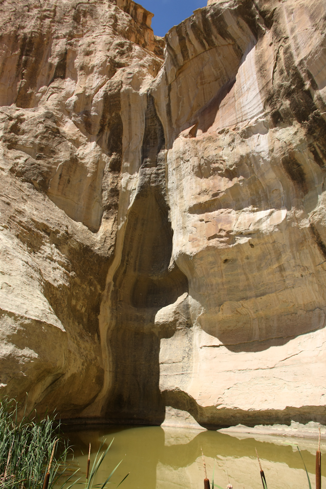
The
green water does not look very tasty, but I am sure that if you had
walked 30 miles to get here, it would look, and taste, wonderful.
Runoff comes down the chute into the pool below.
The
upper sections of the cliffs have stains from the rain.
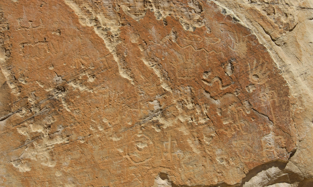
A
short distance from the pool, the inscriptions become visible.
The natives left their marks here in their now-famous petroglyph
patterns.
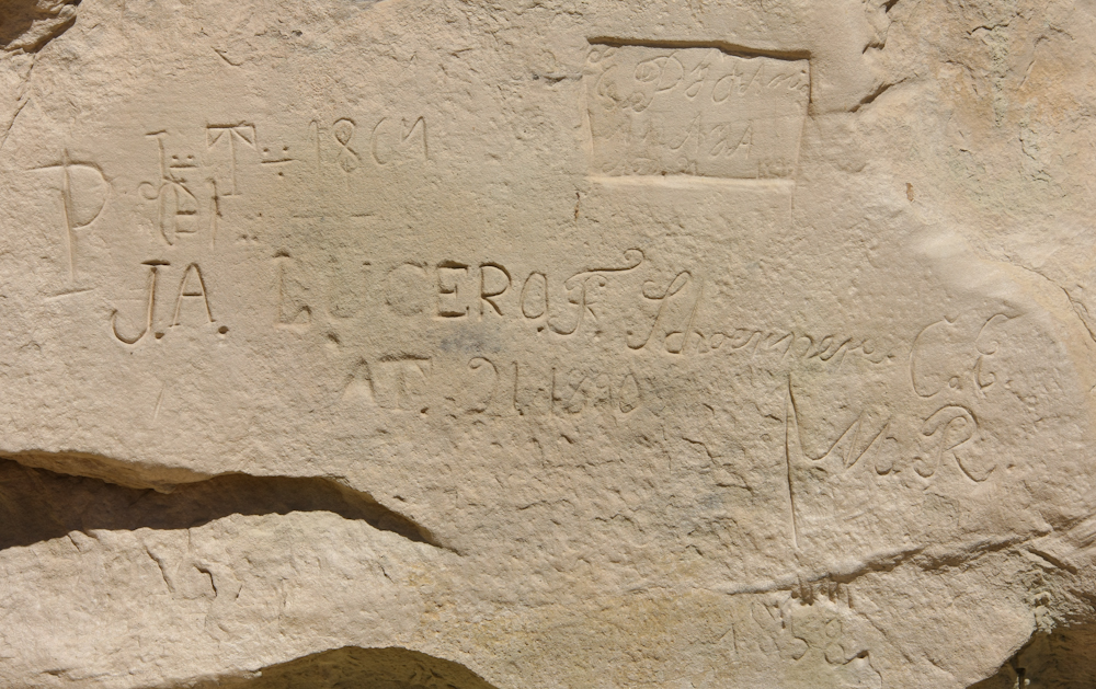
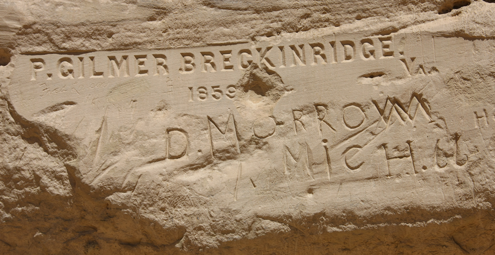
Some
of the newer inscriptions were not as well preserved as one might
expect given their age. Above, you can see 1864 and 1890.
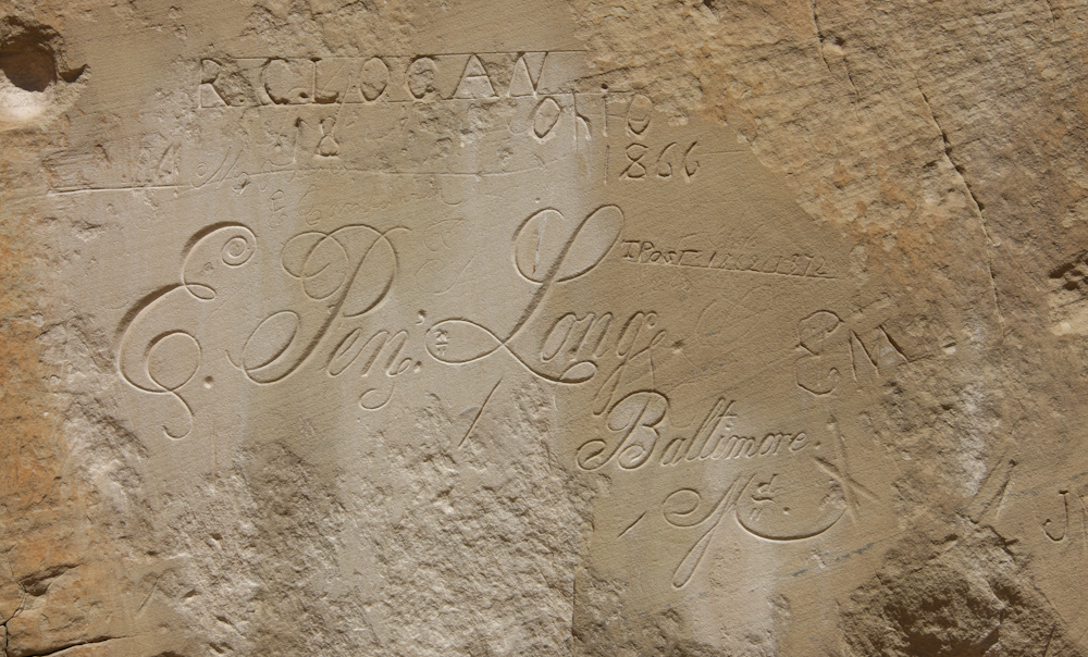
A
few of the folks that passed by the water hole at El Morro left elegant
markings.
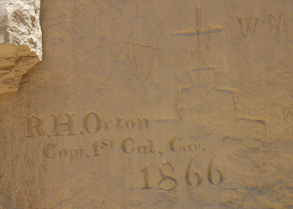
The
top inscription is professional enough that it makes me wonder if the
fellow did headstones for a living.
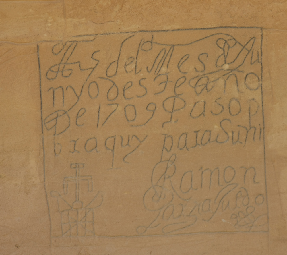
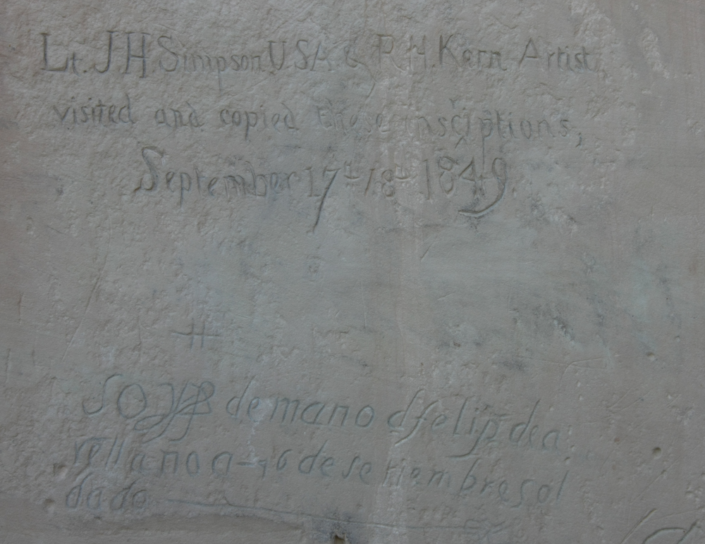
This
set of inscriptions dates to the Spaniards expedition in 1709.
The carvings were darkened with pencil by an early curator making them
more visible.
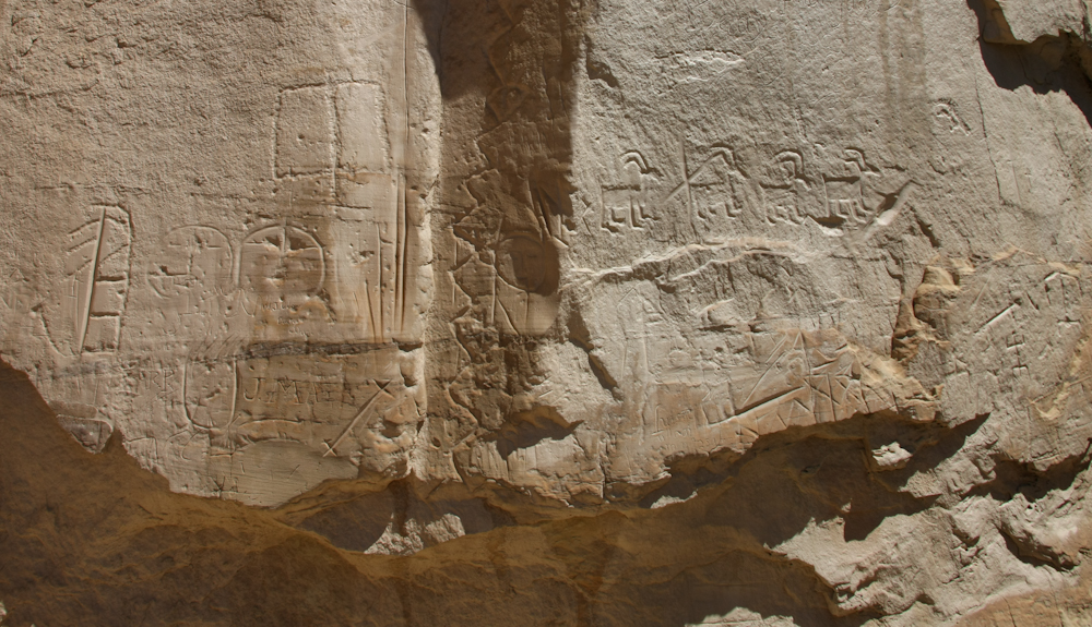
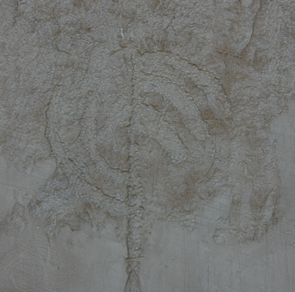
This
set of glyphs were all native in origin and no date is known.
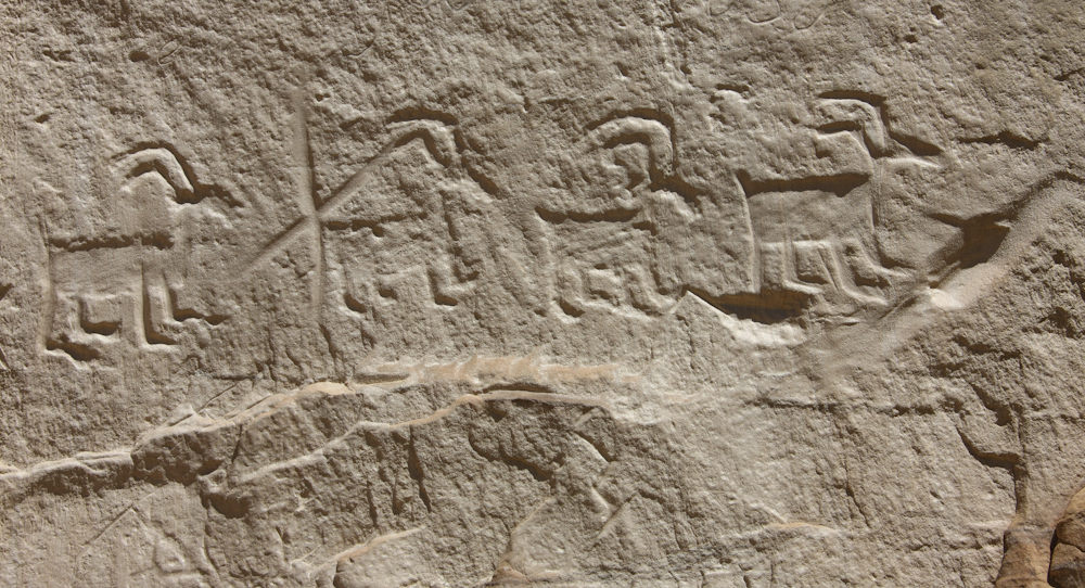
Some
of the native glyphs were carved quite deep into the stone and had well
defined edges.
I
think that the date is not that significant, but the key issue is the
diversity of visitors and the time span.
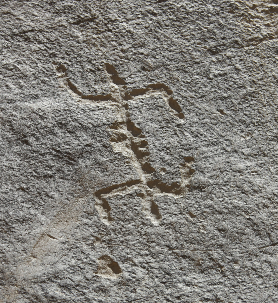
This
fellow was surely popular with the ladies.
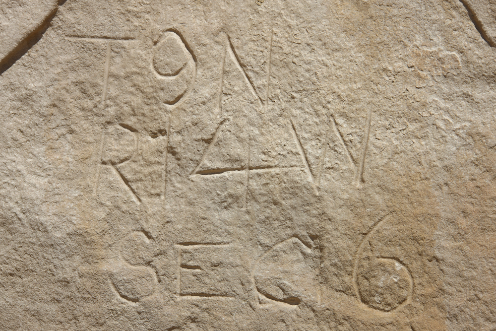
Not
all the marks were idle scratchings. This set of marks show that
this rock was on a map boundary for Township 9 North (T9N) Range 14
West (R14W) Section 6. These designations are still used today
for legal descriptions of property.
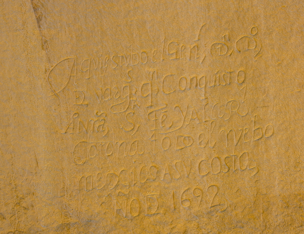
This
inscription, in Spanish, was one of the earliest non-native marks and
shows 1692. Assuming that the date is correct, and there is no
reason to question it, these marks greatly predate the formation of the
United States.
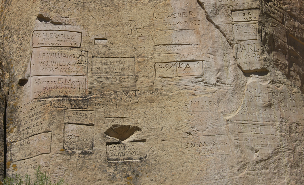
We
rounded the end of the point and the number of inscriptions greatly
increased. Also, to make the upper inscriptions, a ladder or
scaffold was used.
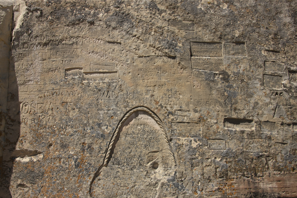
The
markings in the rope carving were not legible, so I assume that they
were quite old, likely Spanish.
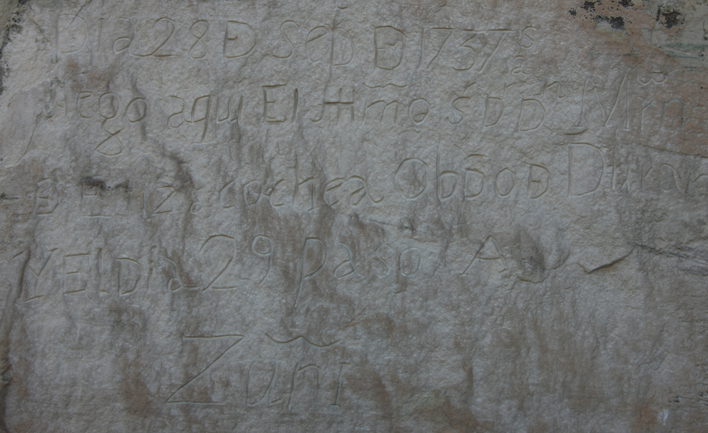
More
Spanish, this one from 1737.
A
pecked-style petroglyph.
An
inscription stating that the inscriptions were recorded. I don't
know what happened to that record.
A
parting shot of El Morro rock. All of the inscriptions are at the
base of the cliff to the point and around the far side.
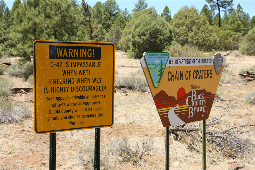
We
left El Morro and headed south on a dirt road to see what was
around. We encountered the sign above, a stern warning about
travel in adverse conditions. The road was not bad, but it was
dry.
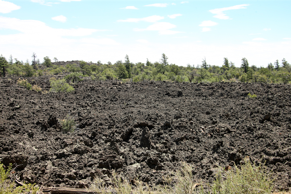
A
few miles in we came upon the so-called Malpais (bad lands) lava
flow. This terrain is nearly impassible even on foot. There
is no hope for crossing the lava with an animal such as a horse or mule
as the sharp rocks would shred their hooves. Early travelers had
to divert around the flow to travel west.
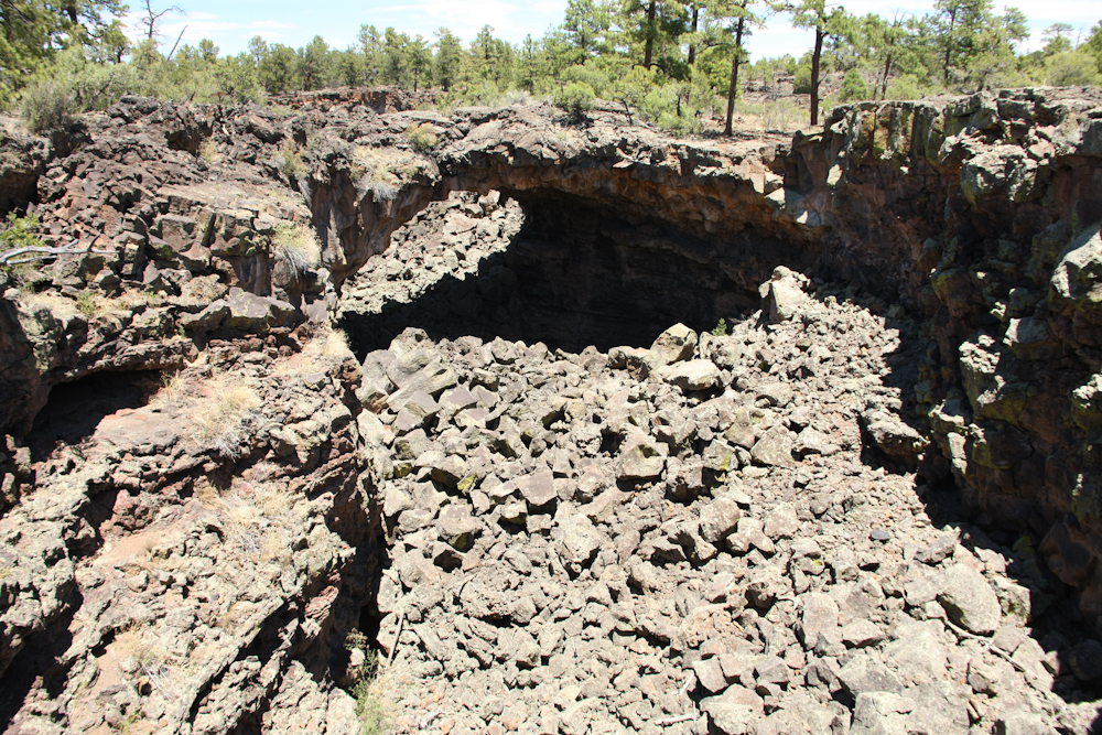
Our
objective was to see the large lava tubes that were in the area.
This one is called the "Caterpillar collapse". The tube goes way
back into the cliff and the foreground is one of the collapsed sections.
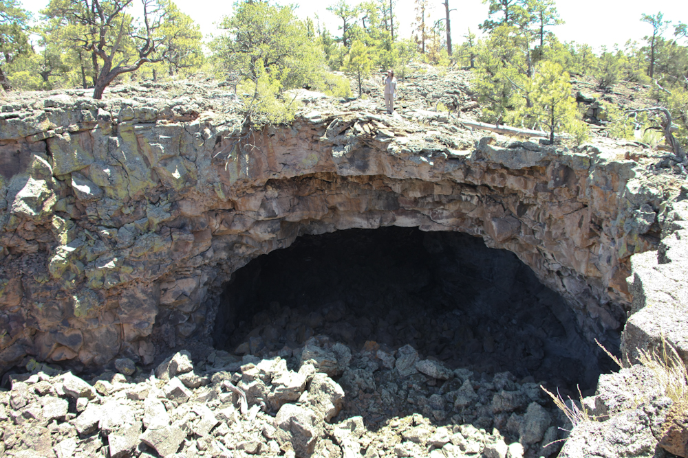
Kathleen
is standing at the top center of the cave to give a sense of scale.
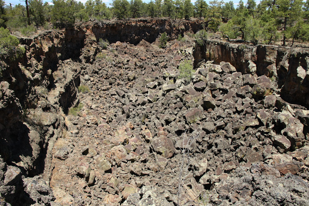
The
collapsed tube ran for quite a distance and was deep.
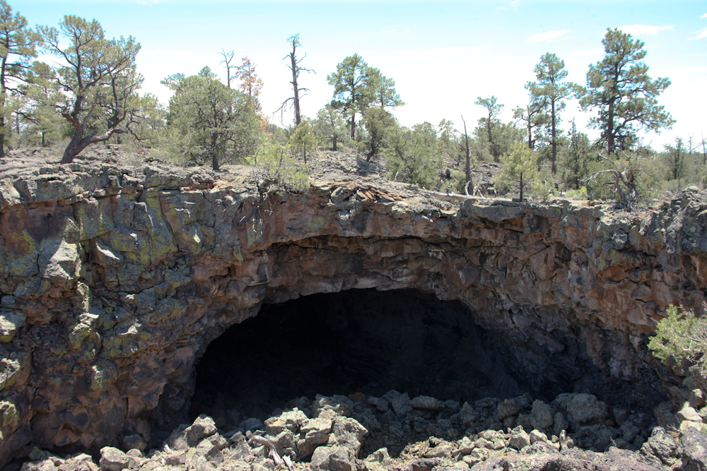
Each
section of the tube was interesting. But, to do it right, you
would have to get caving gear and rappel into the cave itself.
The Park Service was not issuing caving permits so the whole area was
off-limits.
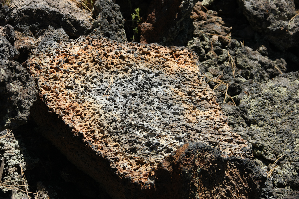
A
close-up of the lava surface. The rocks were very difficult to
walk on and did the soles of our boots no good. Having to cross
this flow would have been hell in hot weather as the black rock nicely
absorbs heat from the sun.
| Previous Adventure | ||
| Trip Home Page |
Photos
and Text Copyright Bill Caid 2011, all rights reserved.
For your enjoyment only, not for commercial use.