2011 Baja Expedition
Friends re-unite for exploration
of northern and central Baja California
20110226-0304
Back to Bill Caid's Home Page.
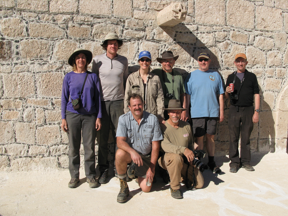
The Baja Expedition 2011 Team.
Back Row (L to R): Nancy, Matt, Kathleen, Bob, Dan, RonFront Row (L to R): Kai, Bill
All photos copyright, Bill Caid 2011. All rights reserved.
The Trip
Baja. Just
the name invites intrigue and mystery. I have lived in the Southwest
for most of my life and despite that fact, I have been enthralled with
the idea of Baja California. Baja is unique in that it is relatively
close to the continental US and has large tracts of undeveloped desert
and mountains. For years, the off roading community in California
had
made trips to Baja seeking adventure, solitude and in some cases, just
respite from the day-to-day grind of life in these United States.
Our group of Unimog friends have been to Baja many times and this year, rather than returning to the Altar Desert, we decided to join one of the members of the group at his surf camp at Punta Canoas. From there, we would continue south along the Pacific coast and then cross inland and return north along the Sea of Cortez side of the peninsula.
The group consisted of 5 vehicles and 10 people and our trip was a full week in duration. We logged many miles of both highway and dirt roads and had a fair number of mechanical problems along the way. The good news was that nobody got sick or hurt.
The Maps
The following figures were from Baja California Almanac
and show the index pages from the book. At $25, this book
is
reasonably priced, an outstanding value and is a great help when
navigating the peninsula. I strongly recommend that you get it
before
you heading south as it is the best one that I have found. It is
available, among other places, at the Map Center in San Diego as well
as direct through their web site.
They also sell a folding map that is not as detailed, but still
provides great information. As you can see in the figures, the book a
detailed section (2 pages) for each numbered region on the map.
These
are full topo maps and include a section for traveler's notes.
Sadly, during the trip, we heard that the Almanac was now out of print,
but that copies could still be found on eBay.
As
you can see, Baja is a big place. Nearly 1100 miles long, careful
attention to logistics are required before you go. As any person
who
has been there can attest, services are not always as they seem.
Just
because there is a Pemex station does not mean they have fuel.
Forewarned is forearmed, so go prepared with fuel and water. Be
sure
to arm yourself with the most recent information before you go.
Oh,
one other thing. Baja is a desert. Water is in short supply
-- most
of the time. Rains can take a casual situation and turn it into a
crisis, washing out roads, bridges and other infrastructure. In
the fall of 2003, a hurricane put ashore at La Paz causing
substantial damage and interruption to traffic on the main north-south
highway. You can be stranded for days should such an event occur,
so
insure that you have extra food and water to meet your needs.
Indeed, on our trip, we were hit by a major winter storm that left many
towns giant mud holes and made the trails slick and treacherous.
Due to the luck of the draw, I
left our Almanac at home sitting happily on the couch. Our only
map was the AAA map and it generally proved sufficient. We did
not purchase a Mexican base map for our GPS, so it was of no use to us
in navigation.
Areas of Travel
Our travels were constrained to Baja California Norte. While we have been to the state of Sur before, the time allotted to the trip was not sufficient to get that far south. Indeed, our actual itinerary was somewhat of a "forced march" in that it required that we camp in a different location each day and precluded us from deeply exploring the area traveled. In Figure 1 below, our camps were located in cell numbers as shown in the table below.
| Camp |
Location |
Map Id |
| 1 |
San Quintin |
13 |
| 2 |
Punta Canoas |
17 |
| 3 |
Punta Vibora |
20 |
| 4 |
Bahia Santa Maria |
20 |
| 5 |
Mission San Borja |
22 |
| 6 |
Punta Final |
18 |
| 7 |
Guadalupe Canyon |
6 |
Matt was kind enough to provide me with several links to our actual route. The first is a KML file that will launch Google Earth, the second will redirect you to everytrail.com
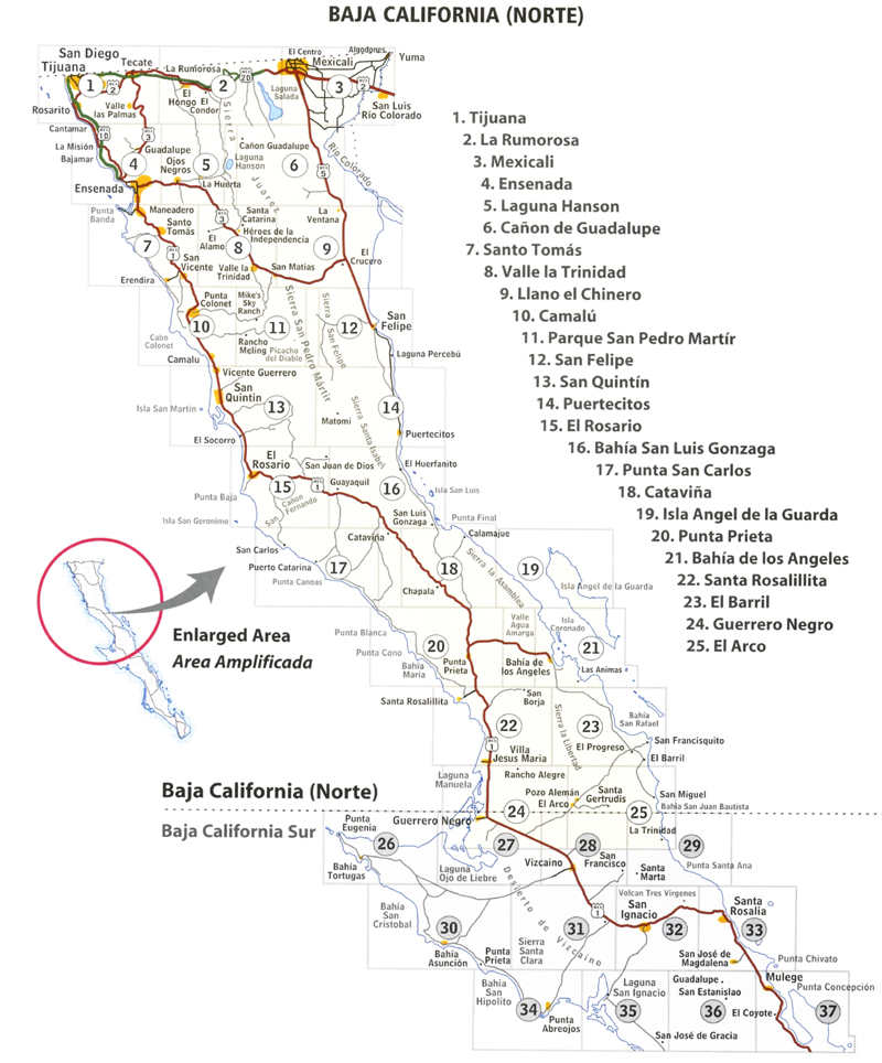
Figure 1. Baja California Norte overview.
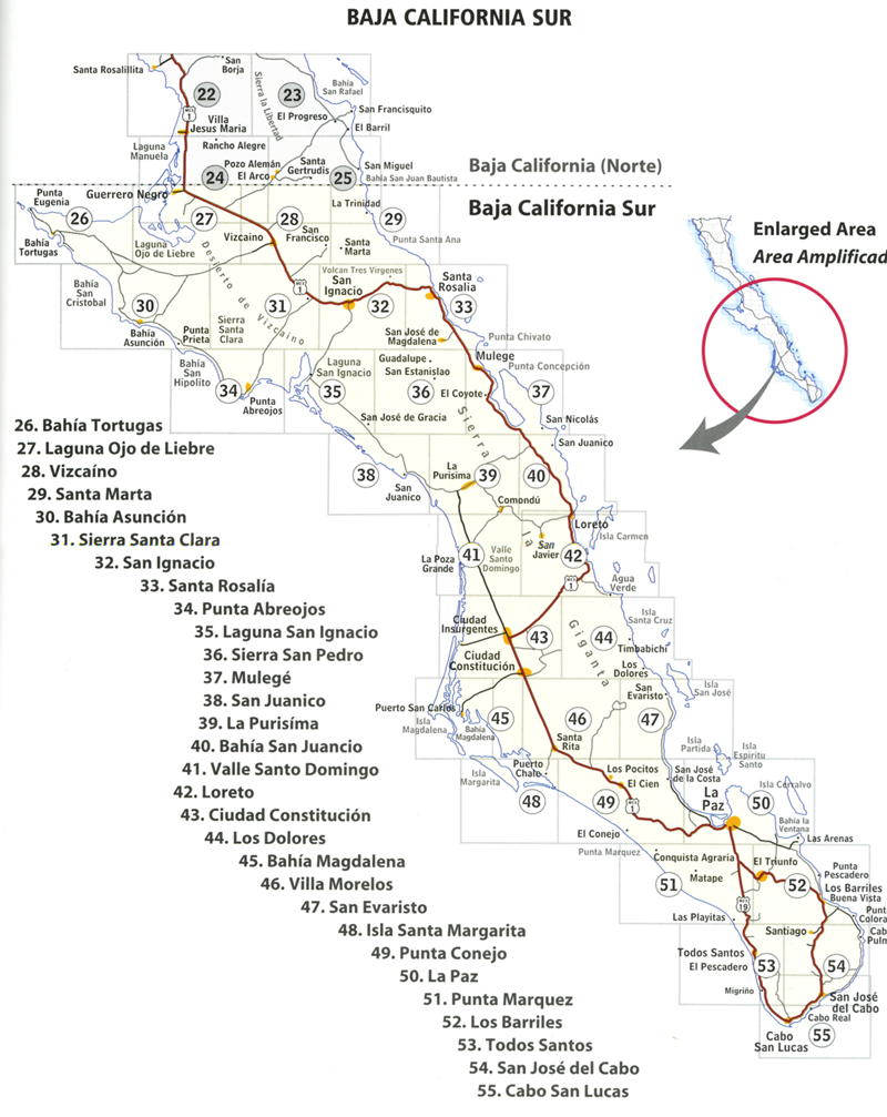
Figure 2. Baja California Sur overview.
Trip Details
The link table below contains links to the photos and dialog for each of the days of the expedition.
| Part | Dates | Adventure Locations |
|---|---|---|
|
1
|
20110226
|
San Diego to San Quintin, BCN |
| 2 |
20110227 |
San
Quintin to Puna Canoas |
| 3 |
20110228 |
Punta
Canoas to Punta Vibora |
| 4 |
20110301 |
Punta
Vibora to Bahia Maria |
| 5 |
20110302 |
Bahia
Maria to Mission San Francisco Borja |
| 6 |
20110303 |
Mission
San Francisco Borja to Punta Final |
| 7 |
20110304 |
Punta
Final to Guadalupe Canyon and San Diego |
Conclusion
I was very, very pleased with the performance of the 1017A and camper. It did everything that I requested of it, and more. Since this was the first off road trip with the rig, I was gentle and did not thrash it as hard as I would have with my 1300. But, thrashing is never a good thing when you are traveling in a foreign country. We did have one mechanical issue, but the component held together long enough to get us back to the states. The severity of the issue is TBD, but I think it is something that I can address by myself. All told, both Kathleen and I were very pleased. The HiLo camper made setting up at the end of the day a snap and provided a nice shelter from the strong Pacific winds.
Miscellaneous Information
The Mexican Military has greatly increased it's presence in
Baja. We
encountered them time and time again, even in remote locations.
One
checkpoint was very remote on a dirt road and we had to pass through at
9pm which made us look very much like drug runners . You must let them
inspect your vehicle, even if they are making
"unreasonable" demands. One fellow insisted that I open a sealed
MRE
package to demonstrate what was inside.
If you go to Baja, you will need liability insurance through a Mexican
company. These policies are reasonably priced (usually by the
day,
week or season) and are available through the AAA and online as well as
kiosks at the border. Mexican law dictates that you must have
insurance and if you were to be stopped by the police or be involved in
an accident and did NOT have insurance, you will not be pleased with
what happens next.
The fuel situation in Baja has improved greatly over the years.
That
said, just because the map states that there is a Pemex station does
not mean that they will have fuel. Or YOUR fuel. If the
supply truck
does not come, for whatever reason, you will be unpleasantly surprised,
so take extra fuel.
U.S. dollars are widely accepted in Baja. Usually, you will pay
less
for items if you pay in Pesos since the exchange rate of the day
usually does not filter into the back country. Generally
speaking, the
exchange rate is 10:1 ten pesos per dollar as it is easy to
compute.
At the time of this writing, the current exchange rate is about
11.5:1. ATM machines will accept U.S. credit cards and dispense
pesos.
If you have a GPS and intend to use it for navigation in Baja,
insure that you have a recent base map that shows trails and roads in
your intended area of travel. Without an updated base map, the
GPS will only tell you "I am here" but that will not be very useful.
Back to Bill Caid's Home Page.
Copyright Bill Caid 2011