After a
great night in Cottonwood, we headed east toward Durango, CO and
a meeting with our good friends Brad and Laura. From
Cottonwood, we headed toward Sedona and attempted to get a place
to camp close-by, but were skunked. We ended up staying at
a nice place in Page Springs. From there we headed through
Flagstaff, AZ and on to Page, AZ.
The photos below are what we saw.
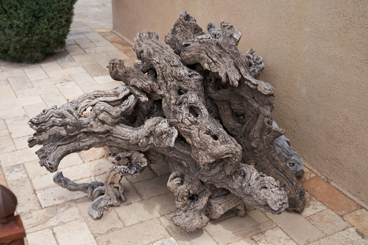
While we
were in the Cottonwood area, we were told that the Museum of
Copper Art was a good place to see so we headed out. Near
the entrance, I spotted this gnarly root ball that had been
excavated and cleaned.
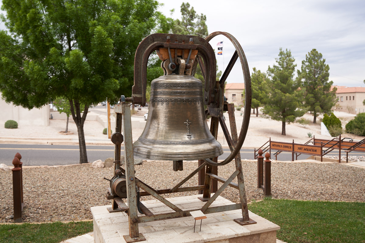
This
nice bronze (copper and tin) bell was at the entrance to the
museum
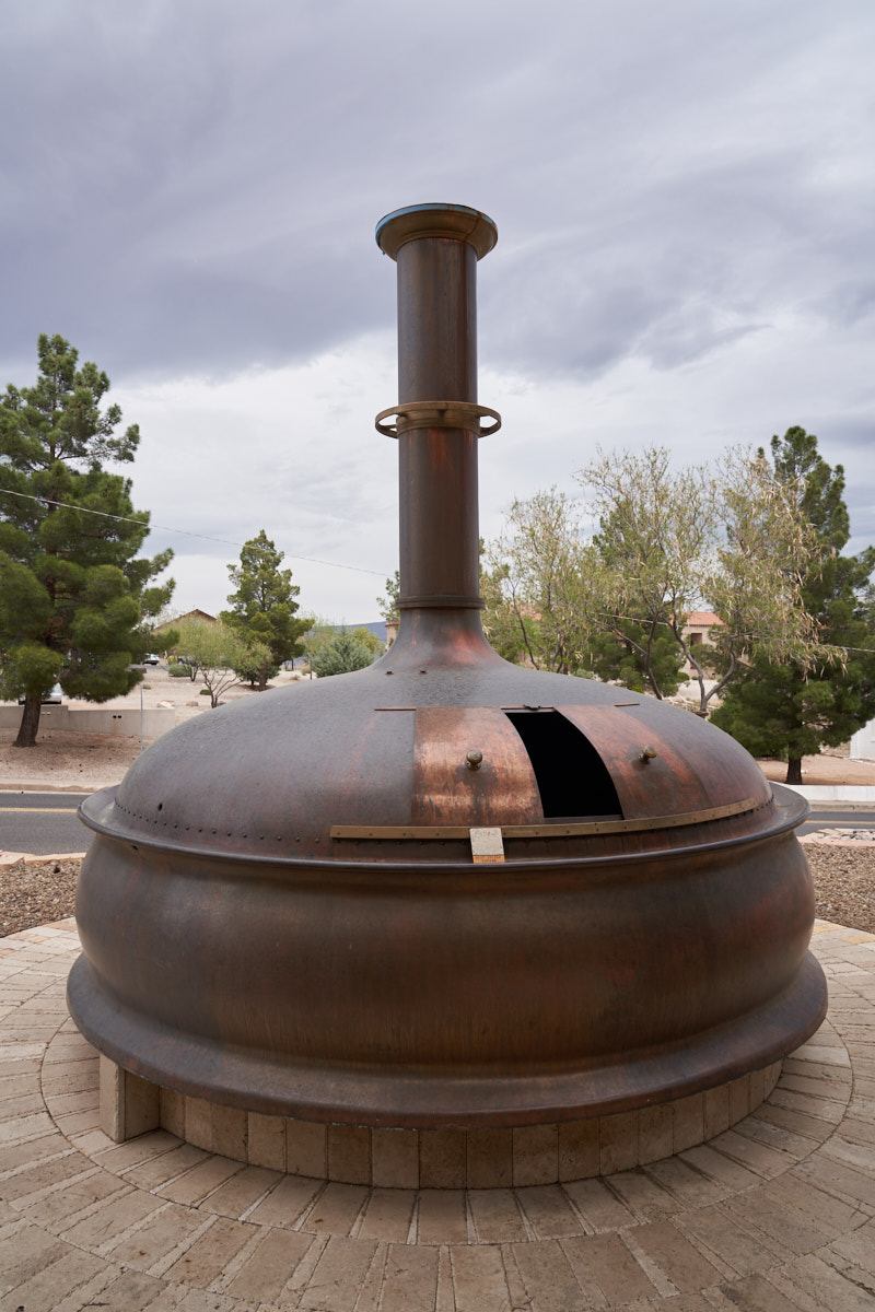
A copper
kettle used for brewing beer.
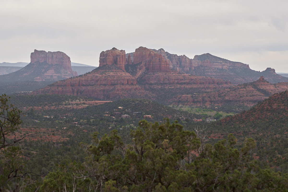
Our
first view of the red rock cliffs at Sedona, AZ. The
weather was poor with overcast skies and strong winds.
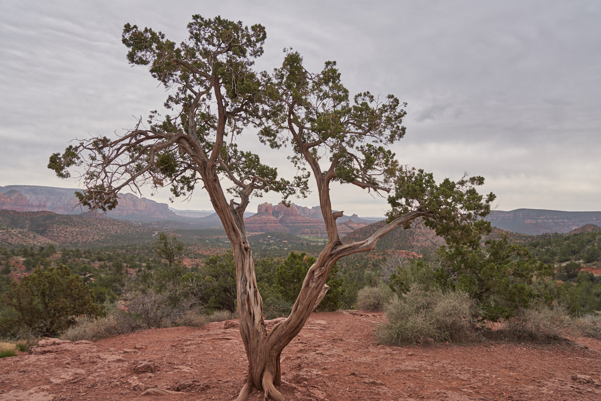
A local
juniper tree frames the sandstone monoliths in the distance.
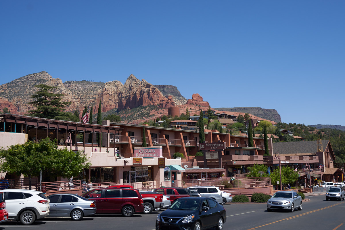
Sedona
apparently has strict zoning laws that force business owners to
choose colors from the approved pallet. Even the
McDonald's sign was in terracotta brown. These
observations aside, it did produce a pleasing result. The
city is nestled between the sandstone cliffs so bright colors
would be annoying.
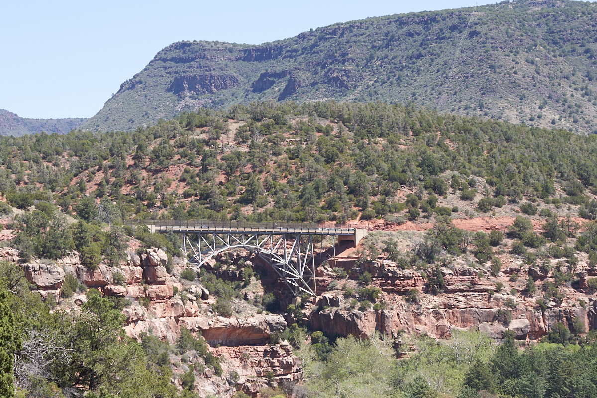
Our path
took us northeast on highway 89 along Oak Creek Canyon.
Above, a large bridge spans a gap in the canyon walls.
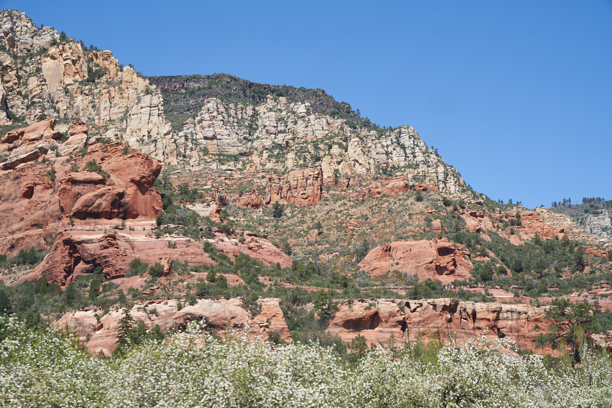
The
large sandstone cliffs in the canyon were very impressive.
From Oak Creek Canyon we headed north toward Flagstaff and the
Lowell Observatory.
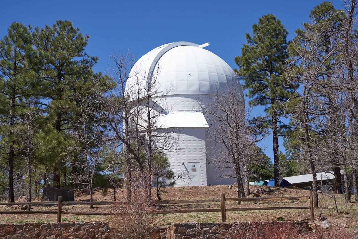
Excusing
the pun, the Lowell Observatory was a shining star in the world
of astronomy around the turn of the (previous) century.
The observatory is popularly known for its identification of
Pluto as a planet. But, the REAL important discovery was
Hubble's work on the discovery of the expansion of the universe.
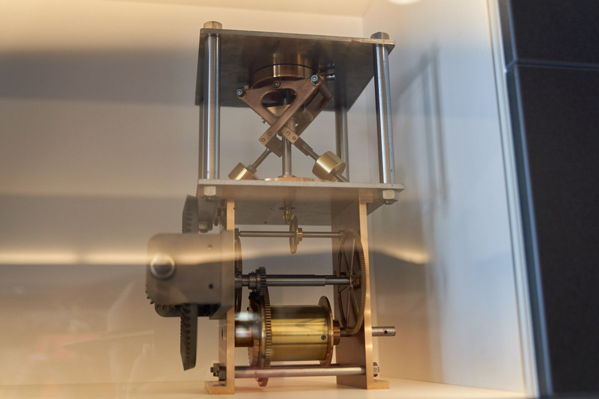
This is
likely the worst photo ever, but given the reflections from the
glass case in the observatory museum, it was the best I could
do. This is one of the first tracking mechanisms for
guiding telescopes. The large drum at the bottom was
wrapped with steel cable which was attached to a heavy
weight. The torque from the weight turned the drum which
drove the balance of the gears. The fly-wheel weights at
the top were to smooth the rotations. The large gear on
the left is part of the winding mechanism to raise the
weight. This mechanism drove the tracking for the
telescope that found Pluto and supported Hubble's discoveries.
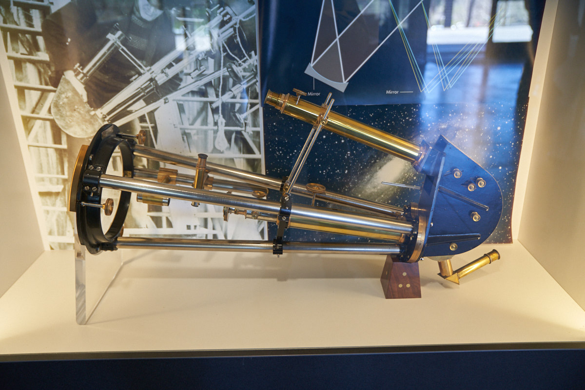
Glare on
the glass case notwithstanding, the device above is as early
spectrograph that can identify the composition of stars and
galaxies. This device consisted of a slit, a diffraction
grating and a couple of mirrors. The large left end was
attached to the telescope and the spectra was produced through
the single tube on the top.
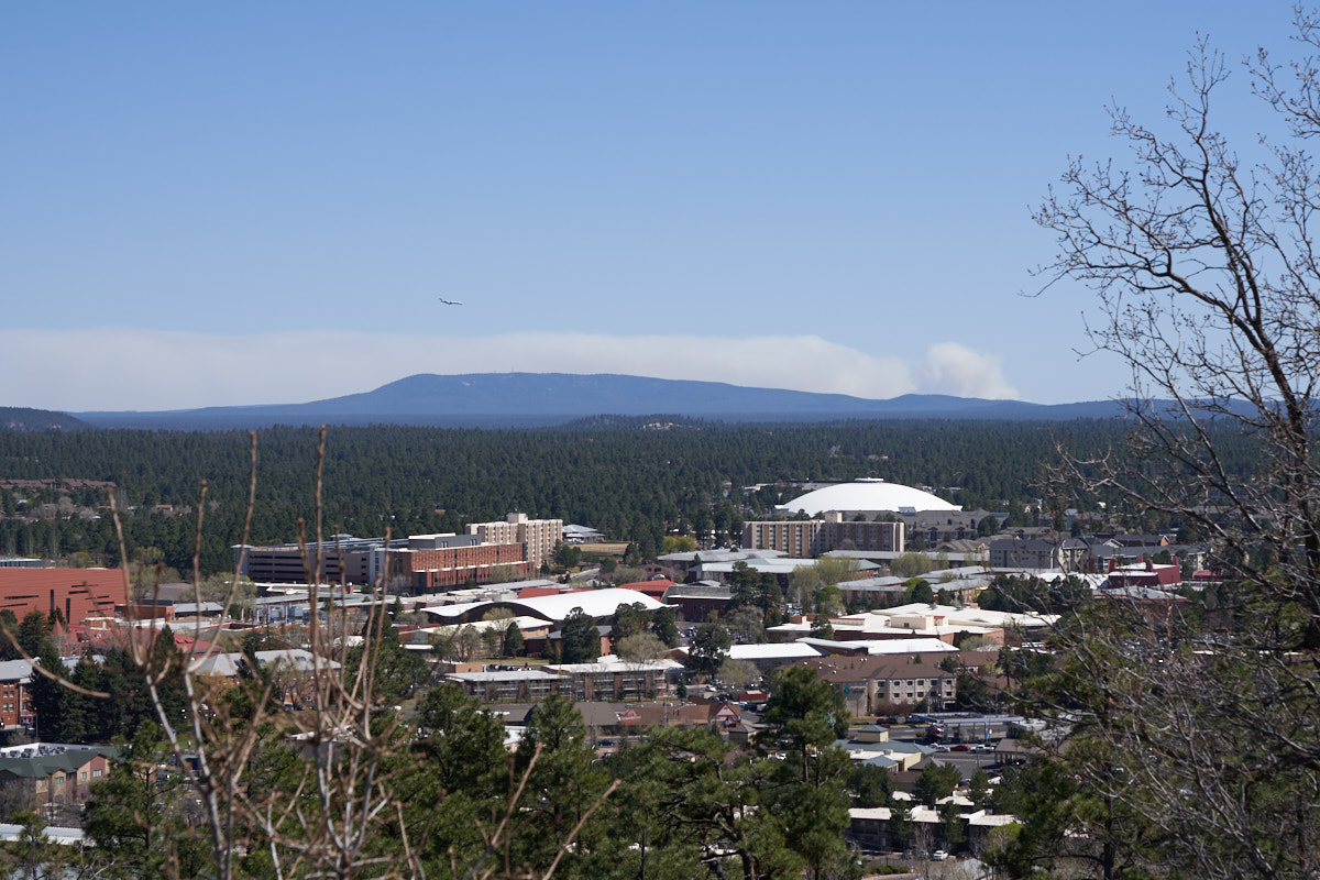
From a
viewpoint at the observatory, we could see the Northern Arizona
University campus and a large forest fire in the distance.
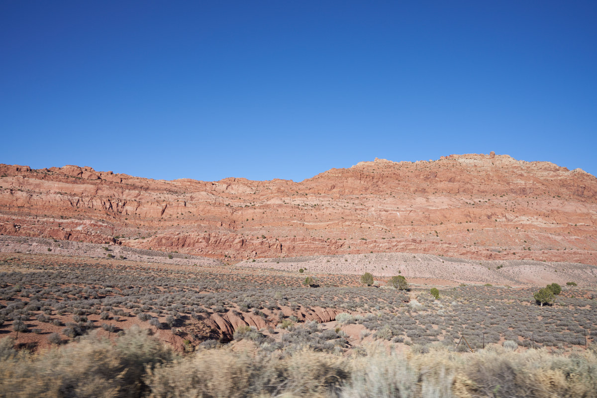
En-route
to Page, AZ we passed a huge cliff structure that ran for tens
of miles parallel to the highway. We spent a windy and
cold night in Page at an RV park in preparation for viewing Glen
Canyon Dam and Horseshoe Bend the following day.
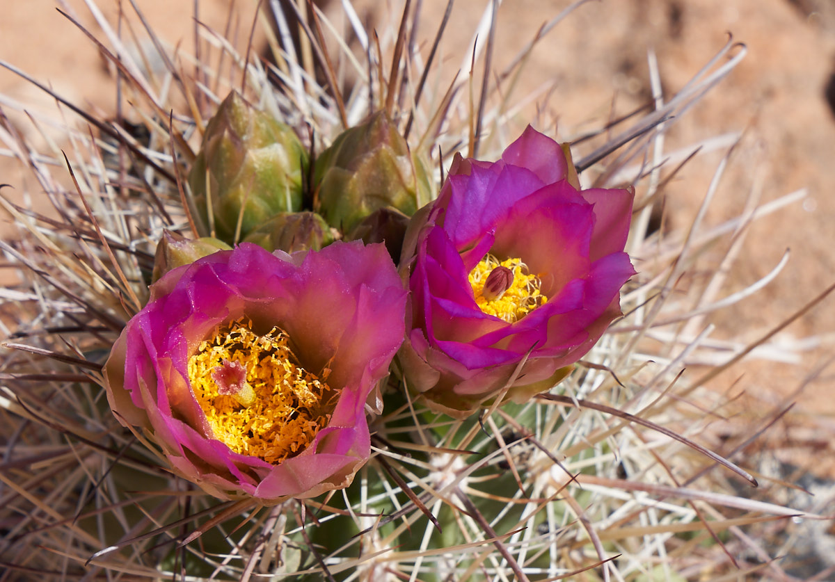
Hiking
to a viewpoint I passed this cactus in bloom. Note the
complex internal structure of the flowers.
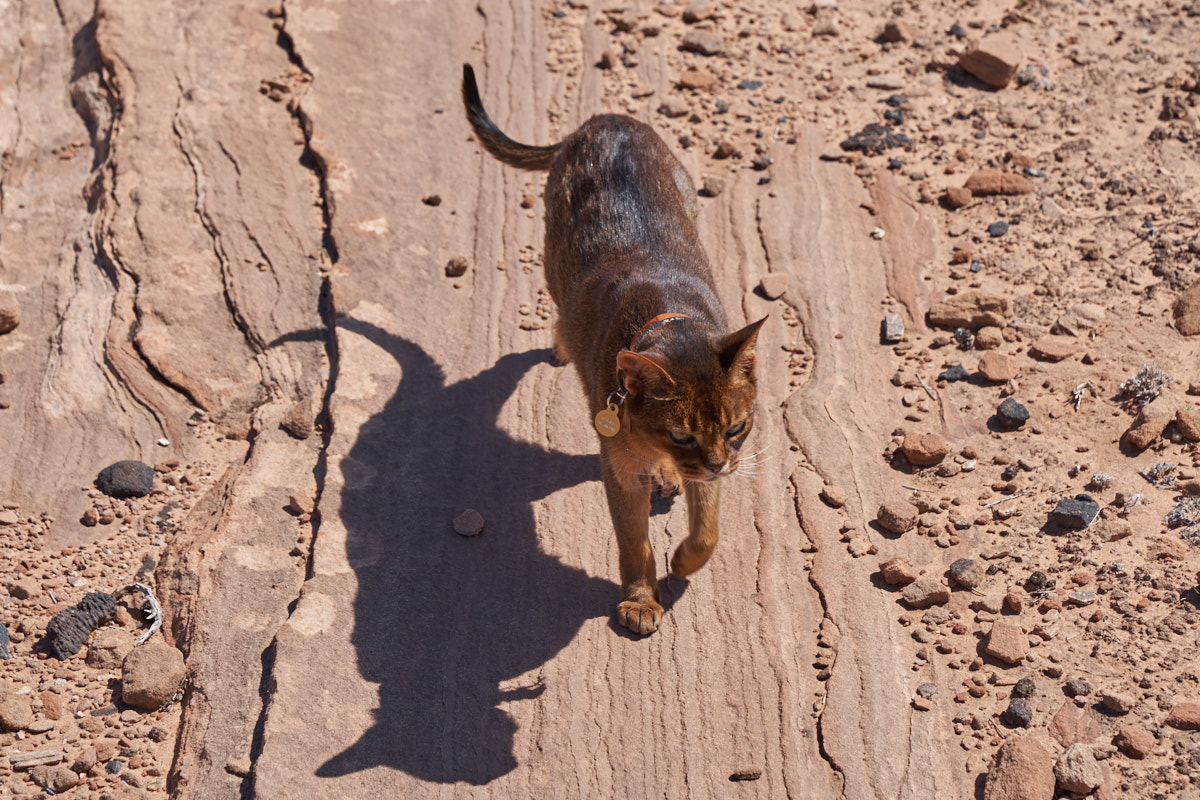
I was
surprised to see this woman walking her cat on a leash.
When she got sufficiently far from the parking area, she took
off the leash and the cat followed her.
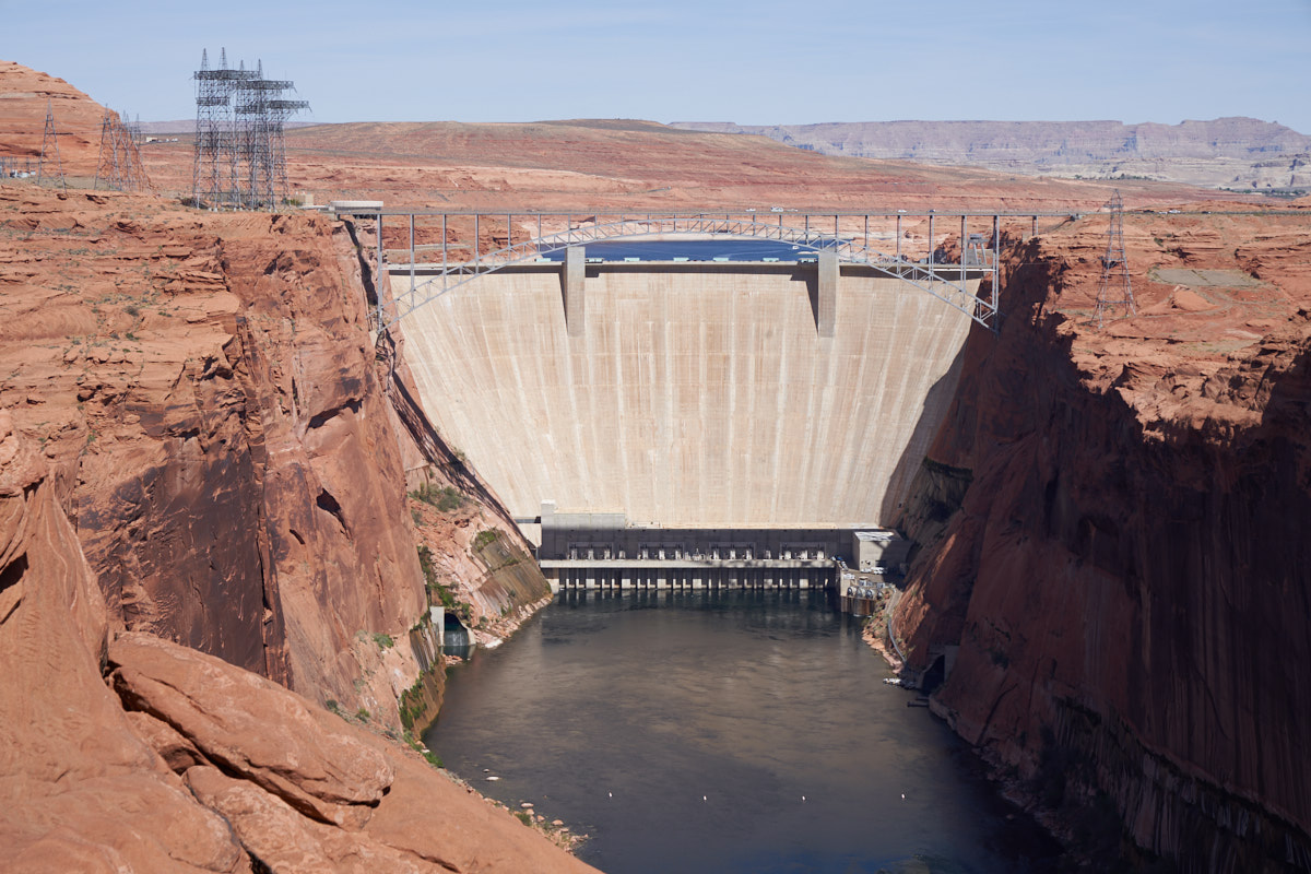
A nice
view of Glen Canyon dam, a major power source in the west.
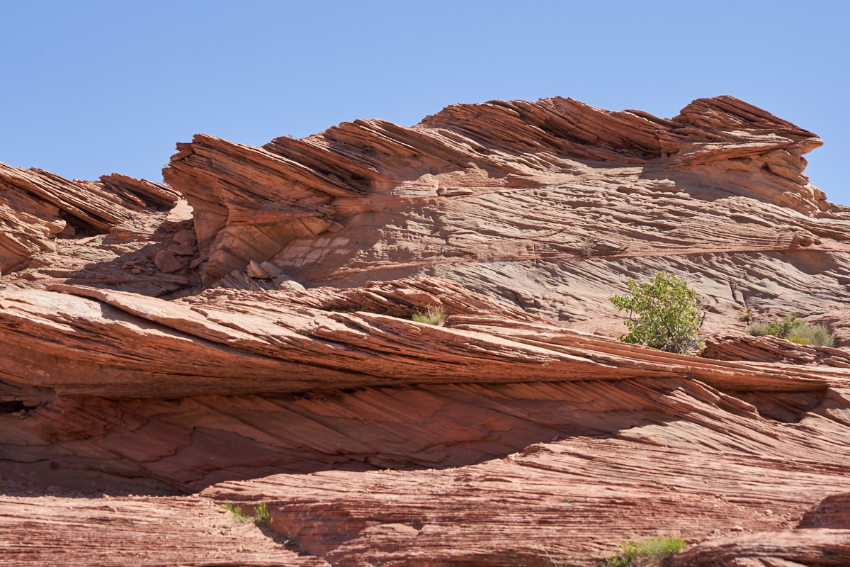
The
Colorado River has eroded a huge canyon over millions of
years. The walls of the canyon are sandstone and nearly
vertical.
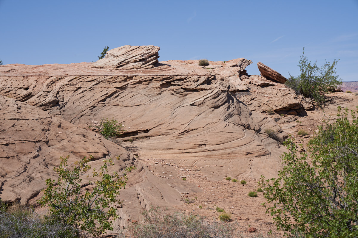
The
sandstone mesas near the dam show a tortured history of uplift,
tilting, erosion and deposition.
Notice
how many uplift angles are included in this small sandstone
bluff. A complex and tortured past indeed.
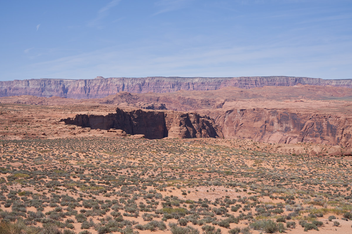
In the
distance we could see the Vermilion Cliffs with the Colorado
River Canyon in foreground. The terrain is essentially
flat and then drops into the abyss at the edge of the canyon.
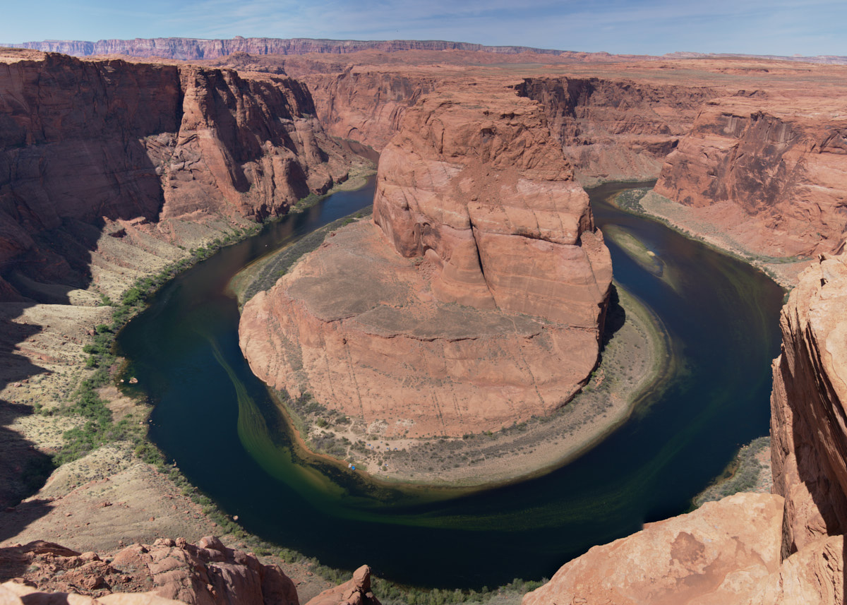
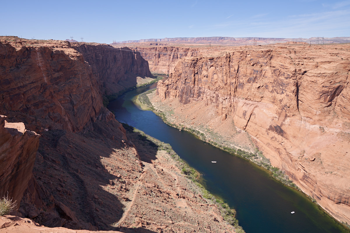
We had
to walk about 30 minutes to get to the Horseshoe Bend
overlook. This is a big structure and would normally
require a 12mm (full frame) lens to get it in one photo.
Not having anything that wide, the image above is a stitch of 7
images shot at 30mm in portrait mode. A respectable final
image, IMHO.
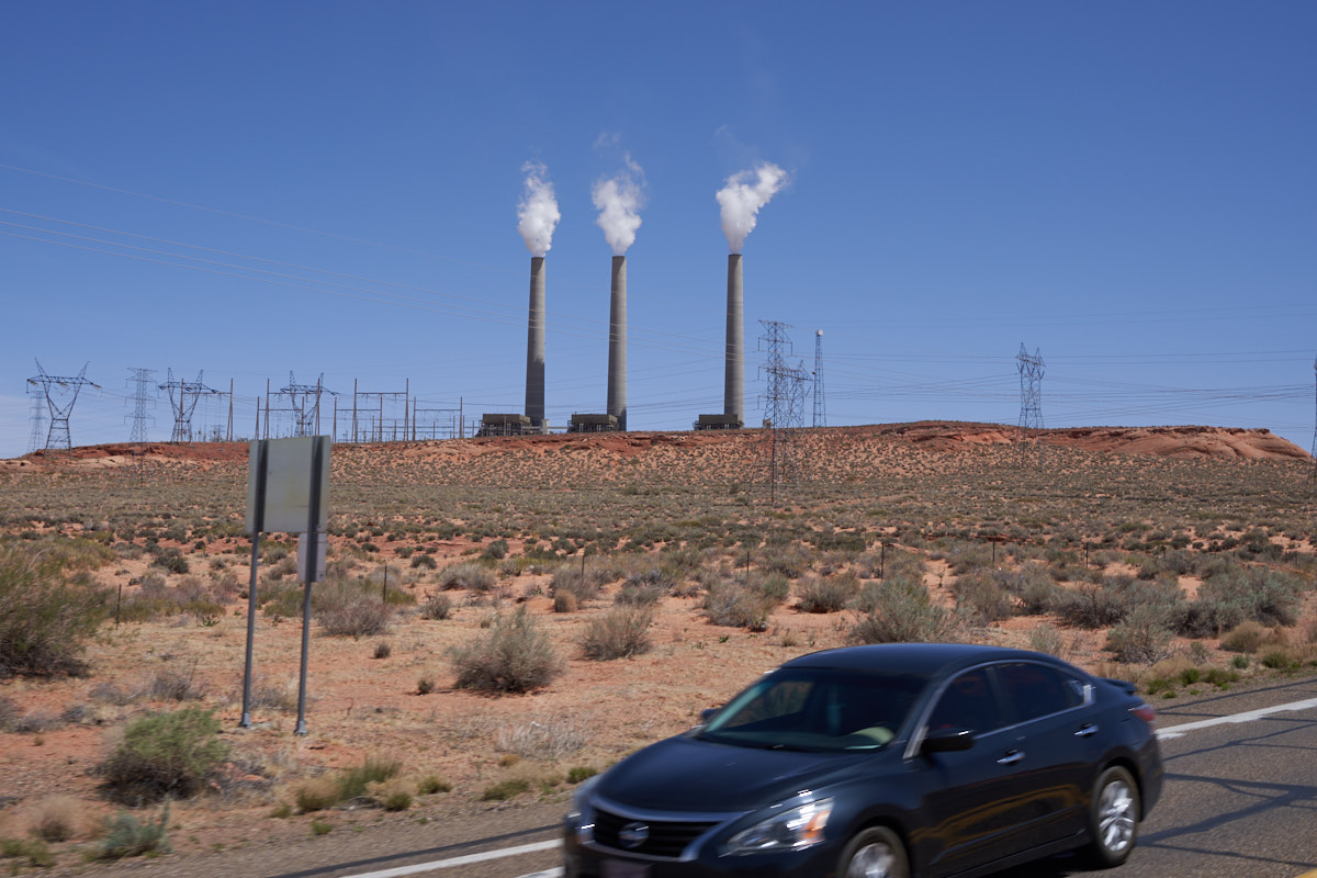
From
Page we headed east across the Navajo Nation. Just outside
Page is the Navajo Power Plant. This plant is coal-fired
and burns coal mined at the Black Mesa Mine near Kayenta, AZ (on
the reservation) about 100 miles away. The coal is
delivered by a robot train that is fully automated. The
plant location was chosen to leverage the existing power
distribution network and switch yard at Glen Canyon Dam.
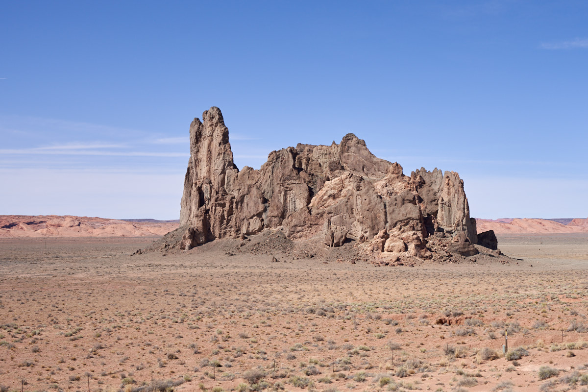
We
passed Church Rock visible from the highway. This
structure is a volcanic plug among surrounding sandstone strata.
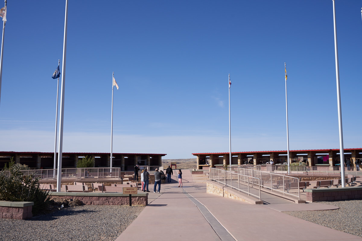
From
Kayenta we headed toward the Four Corners Monument. The
monument is on tribal land with a $5 fee per person to view
"it". The brick structures around the perimeter house
vendors selling "stuff".
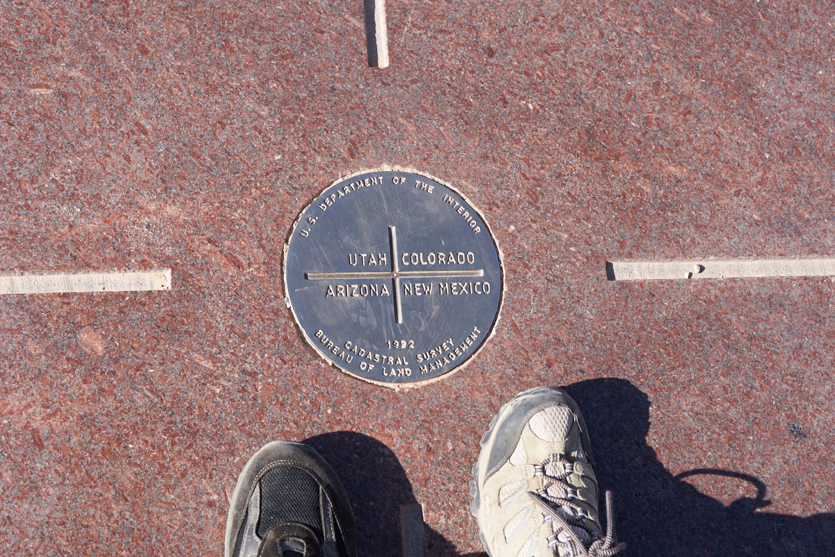
Kathleen
and I were holding hands while being in two states at once.
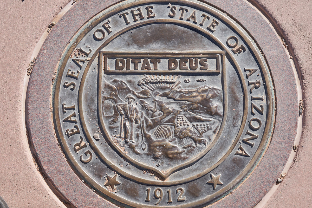
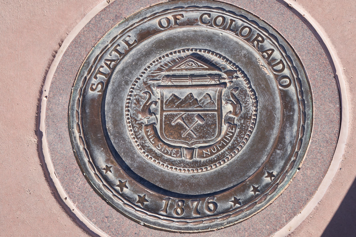
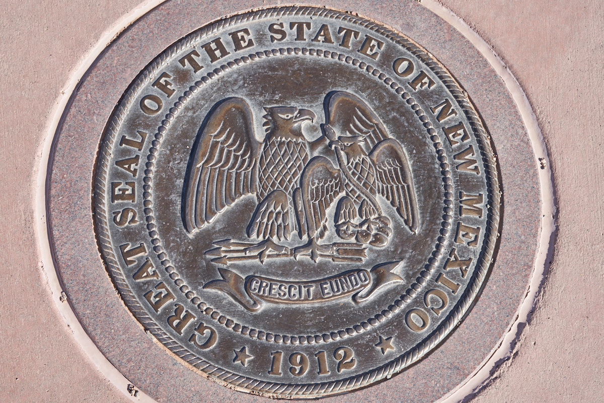
Replicas
of the state seals were embedded in the concrete. This is
Arizona's seal.
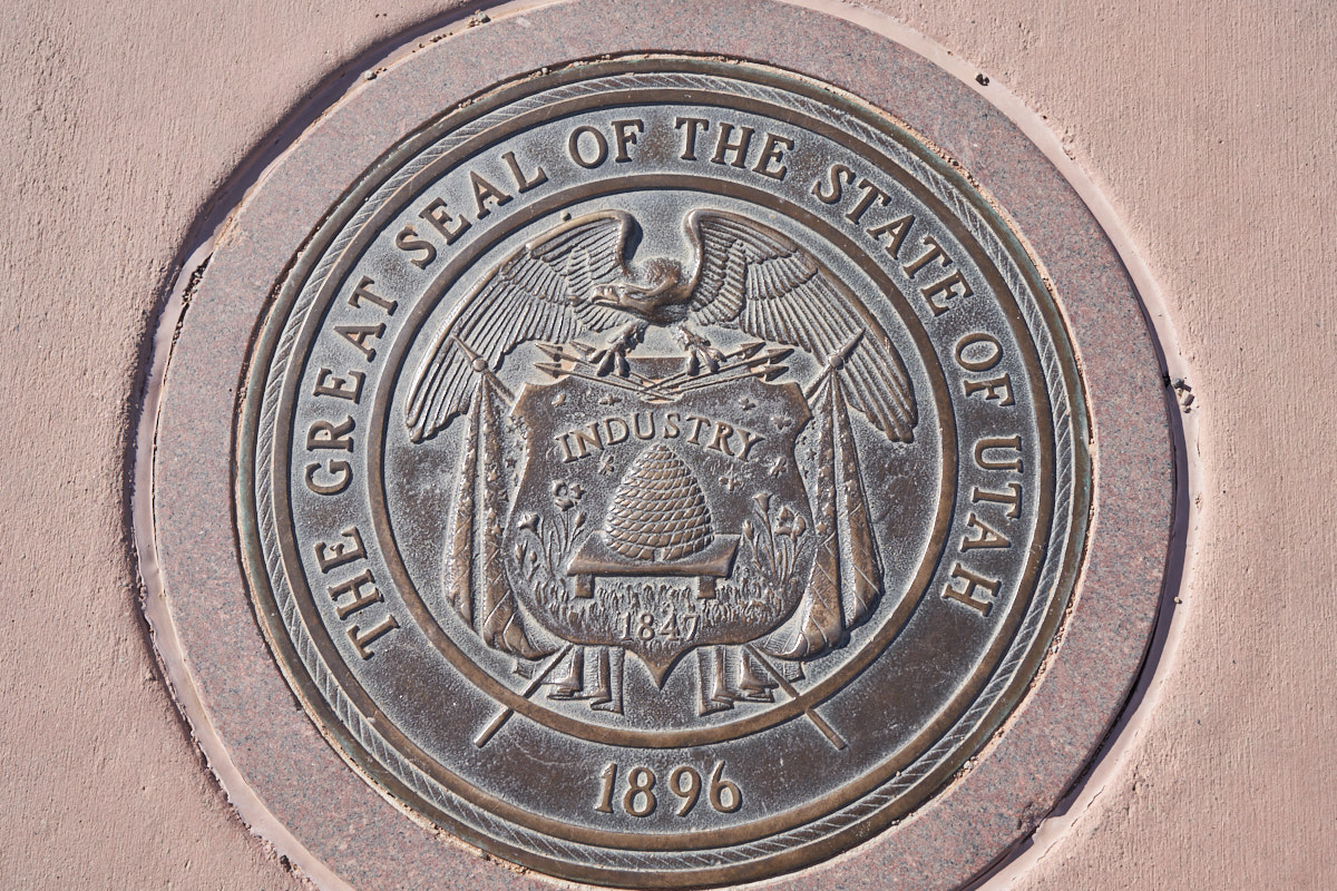
The Utah
state seal.
| Previous Adventure | ||
| Trip Home Page |
Photos and Text Copyright Bill Caid 2018, all rights
reserved.
For your enjoyment only, not for commercial use.