The photos below are what we saw.
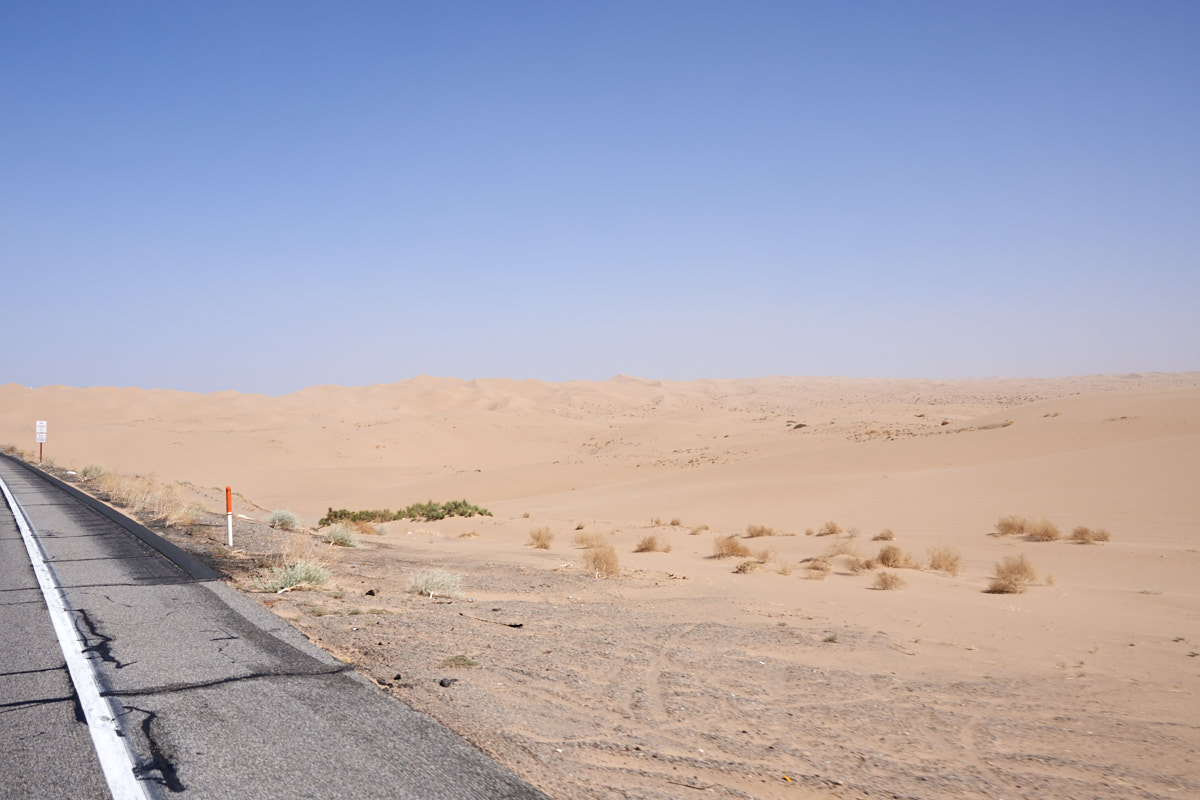
The wind
was launching huge clouds of dust into the air as we passed
through the Imperial Sand Dunes (AKA "Glamis"). In some
points, the horizon line was totally obscured by the blowing
dust.
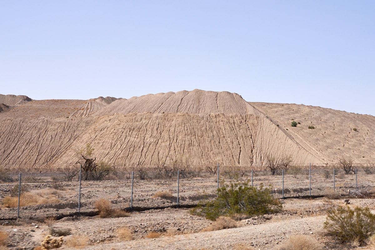
A short
distance to the east of Glamis we came upon the tailings of an
active gold mining operation. Rather ugly.
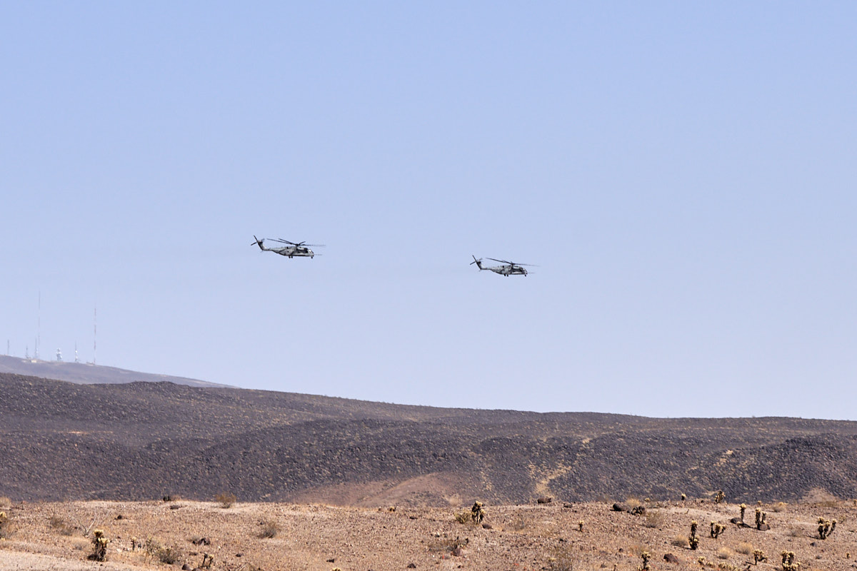
On the
far side of the Chocolate Mountains we spotted these USMC helos
heading back to their base at MCAS Yuma. Note the black
volcanic ejecta on the hillsides.
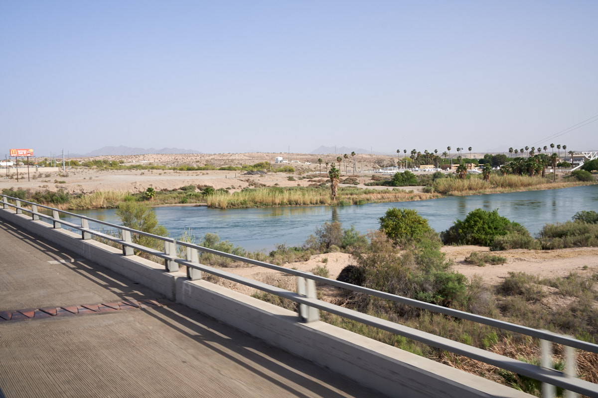
We
passed over the Colorado River at Blythe. The river does
not look like much by eastern standards, but it is a lifeline in
the arid west.
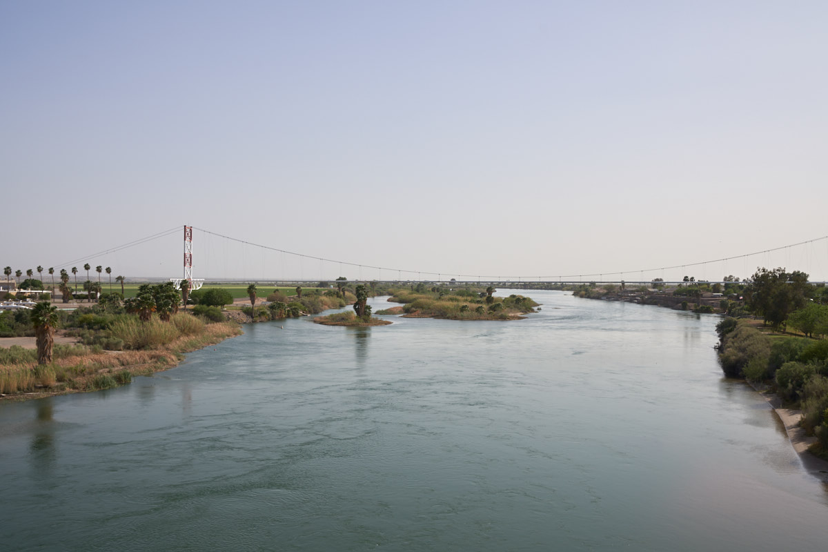
A
natural gas pipeline bridge spans the Colorado River at Blythe.
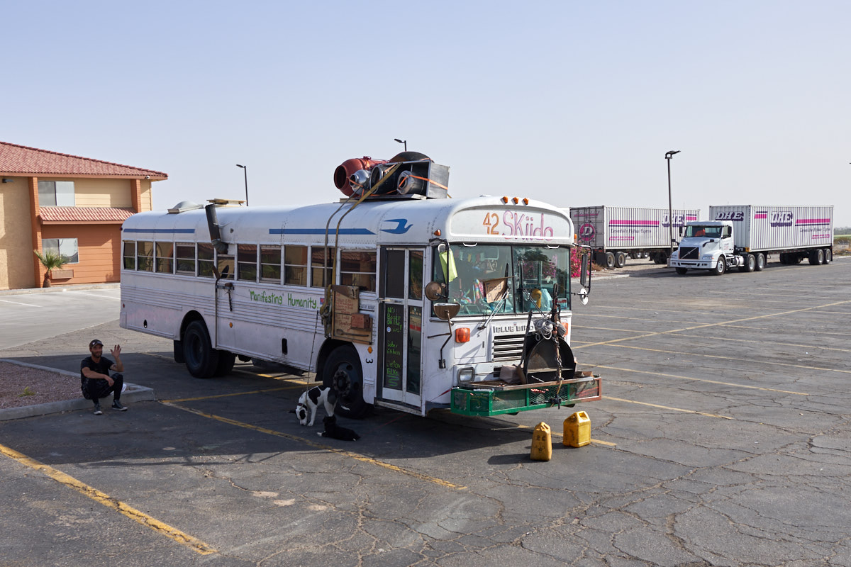
We did a
fuel stop in Erhenburg and spotted this fellow with his
bus-turned-camper. We were not sure of the circumstances
of his situation and did not ask.
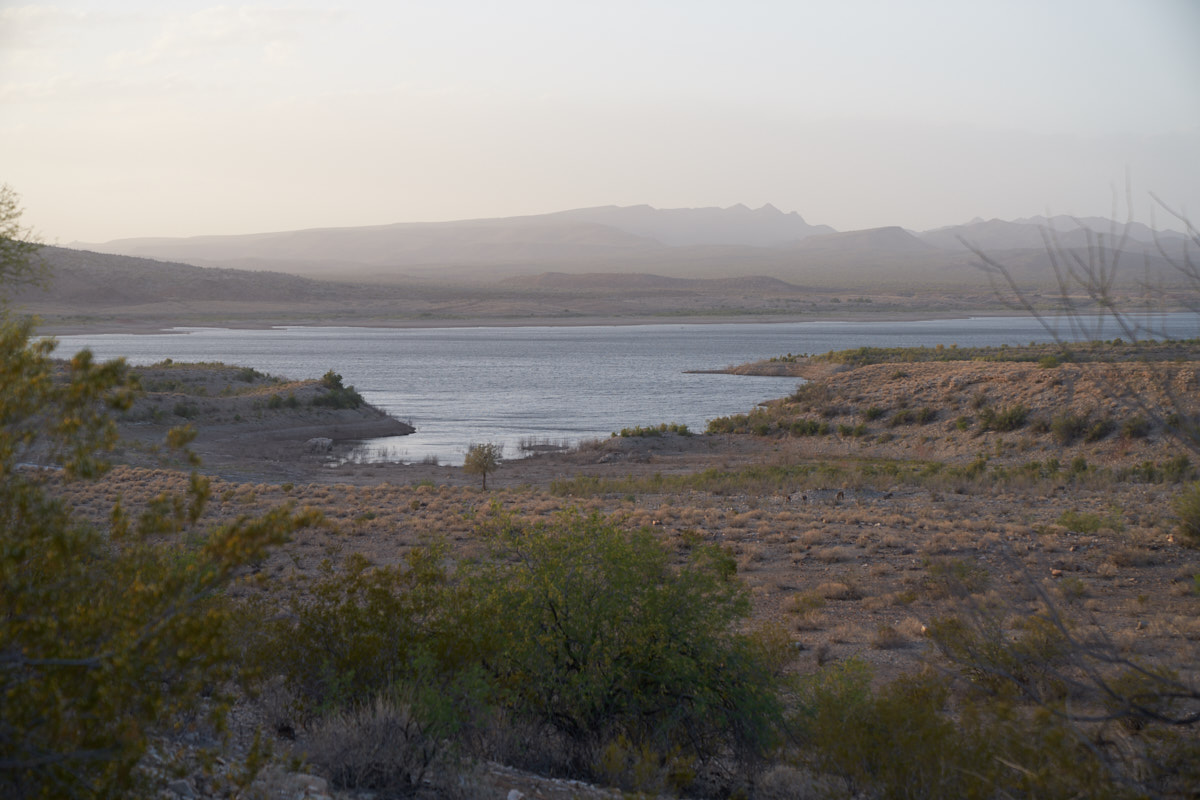
Near
dusk we arrived at Alamo Lake State Park in La Paz County,
AZ. The wind was still blowing hard resulting in poor
visibility.
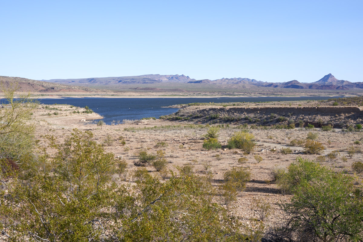
Next
morning, the wind had abated somewhat resulting in better
visibility. Alamo Lake is man-made and sits on the Bill
Williams River. The surrounding countryside is quite
barren.
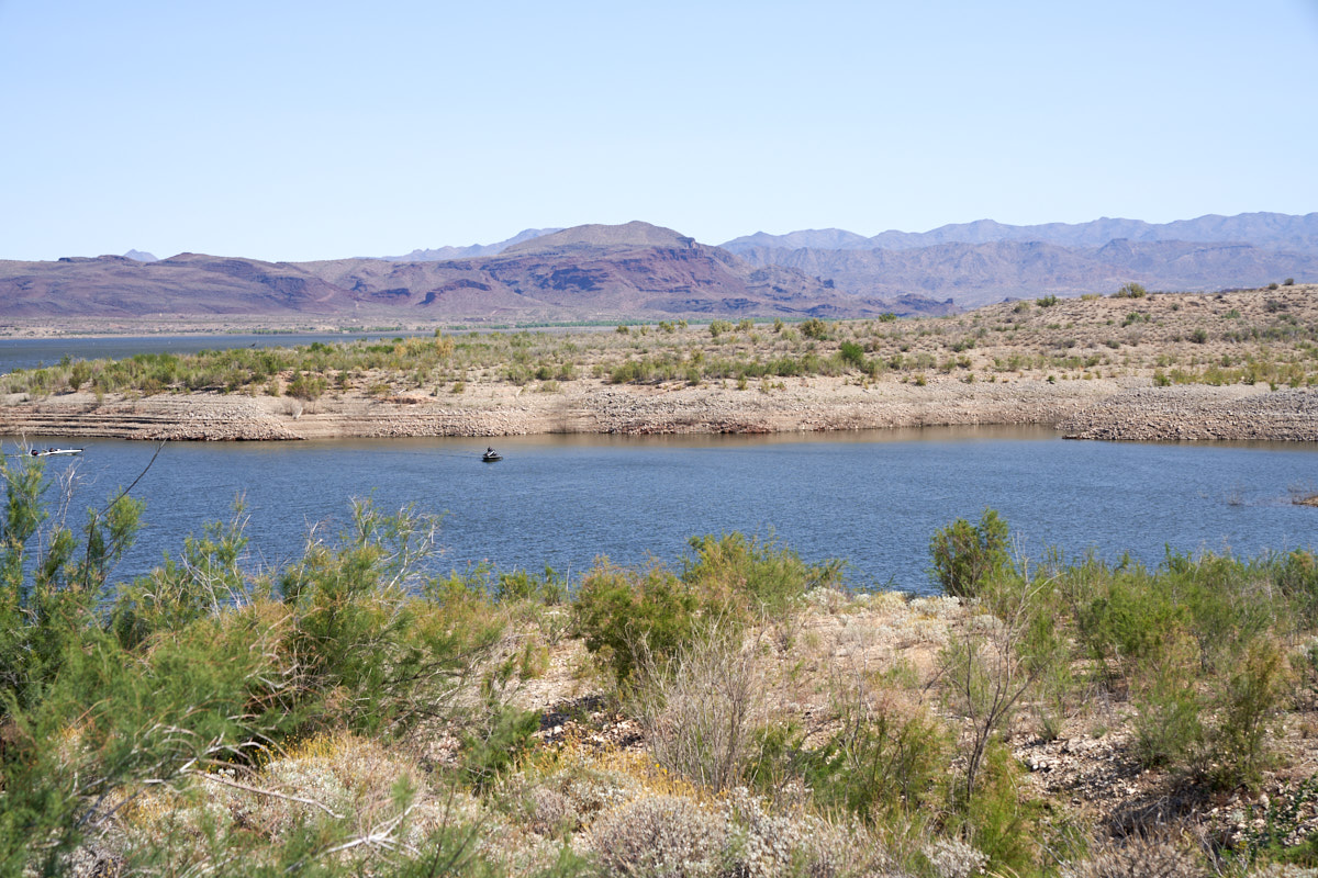
Note
there is no vegetation on the banks of the lake. Indeed,
the lake was down 30 feet or so from full pool. The
"bathtub ring" is visible in the photo above.
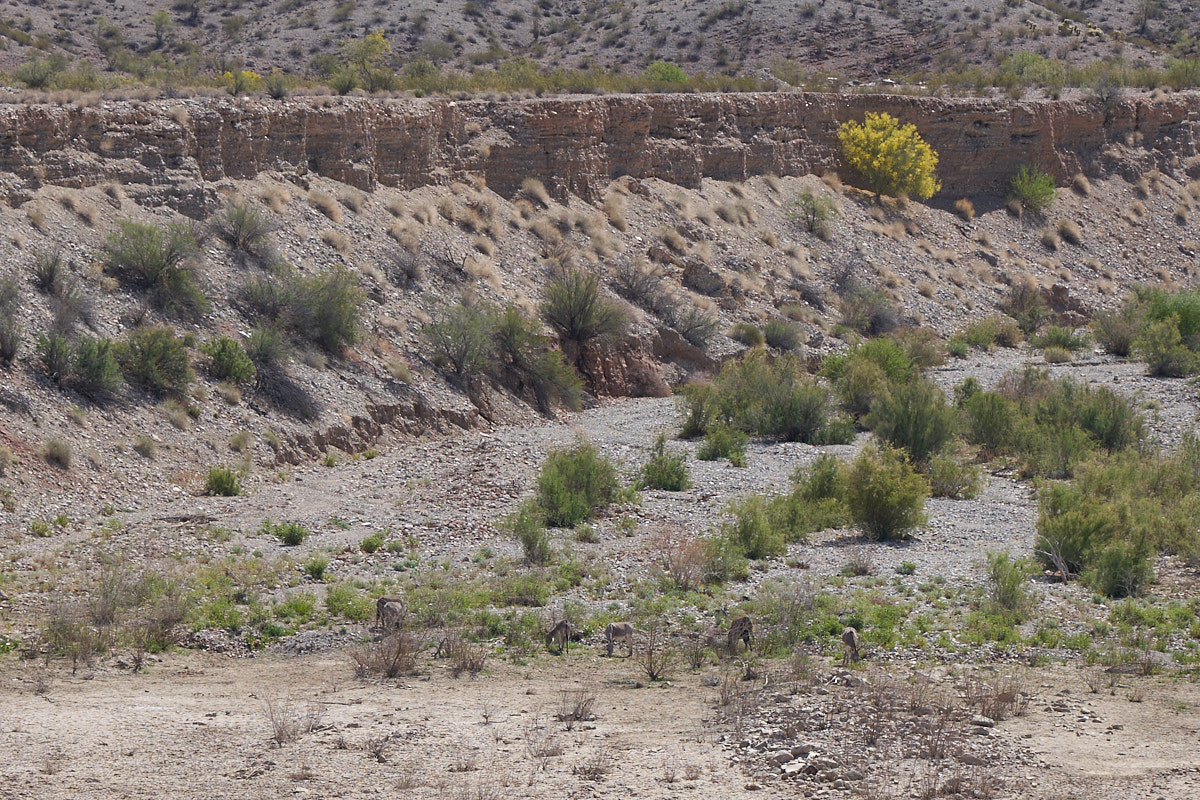
Some
critters came through our camp at night, snuffling around and
making odd noises. I assumed they were javelina (desert
pigs or peccary) but in fact they were feral burros. I
spotted the herd in the dry wash below our campsite when one of
the herd started braying.
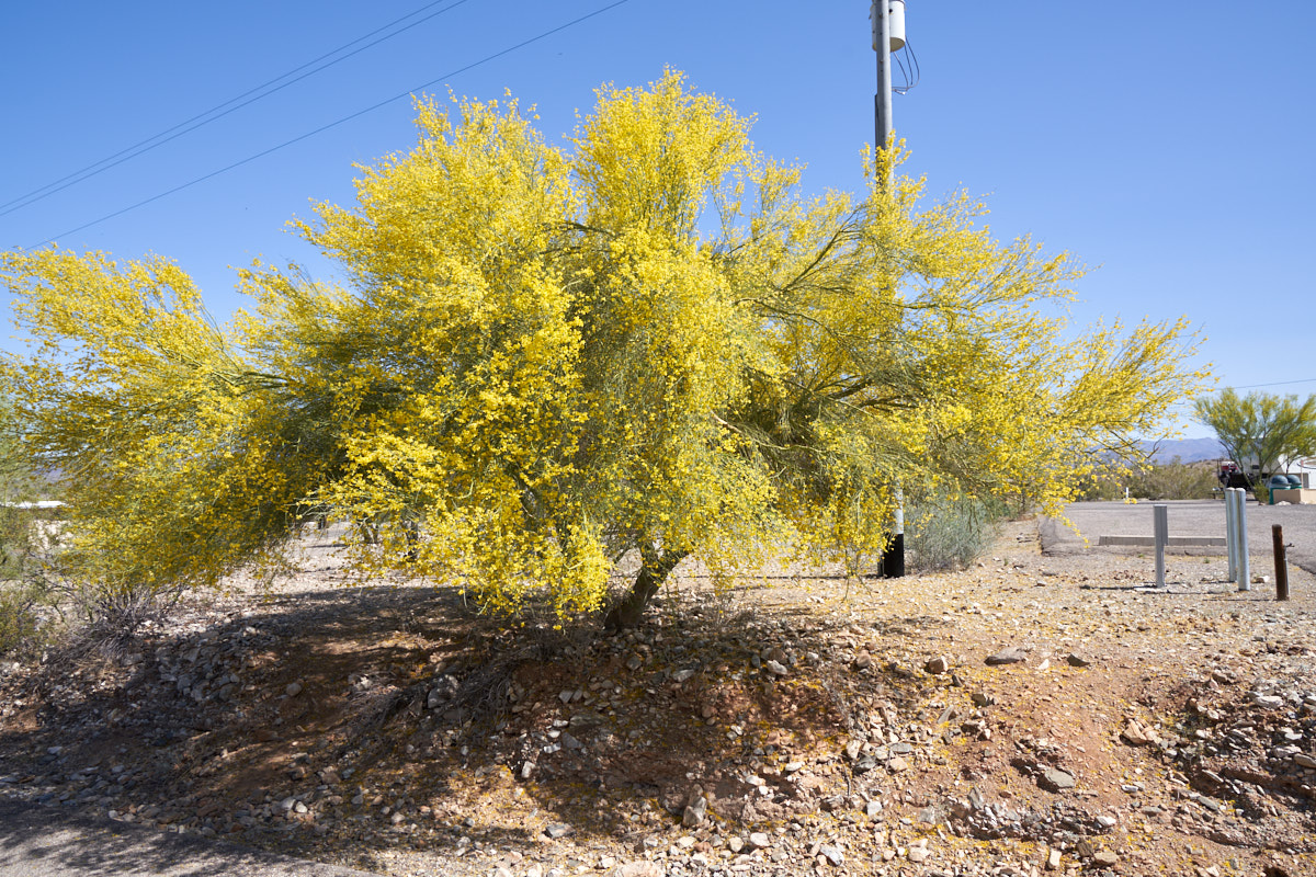
Being
springtime, the Palo Verde trees were in bloom offering up
bright yellow flowers and clouds of nose-tickling pollen.
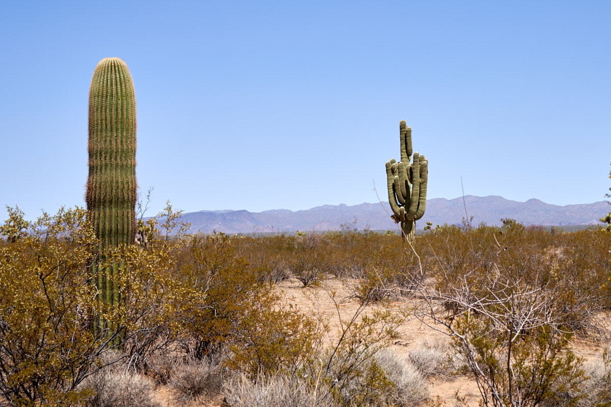
Our plan
was to take the most direct route from Alamo Lake to our next
destination near Cottonwood, AZ. The dirt road we traveled
started good, but ended bad. We were told by the counter
woman at Alamo that there is "no way" she would take that road
again. Since we were driving Thor, we HAD to take the road
to see if her interpretation of "bad" was the same as
ours. Thor had no issues and we never traveled slower than
25 mph, but Thor has major ground clearance and lots of
suspension travel. I am guessing that a low clearance RV
would have been pretty unhappy about the road. Along the
way, we pass a number of sahauros, Arizona's state cactus.
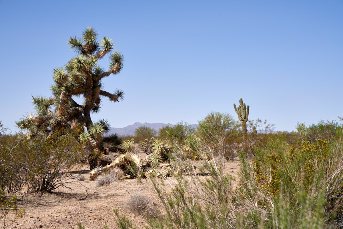
In
addition to the normal cactus species, we saw Joshua Trees.
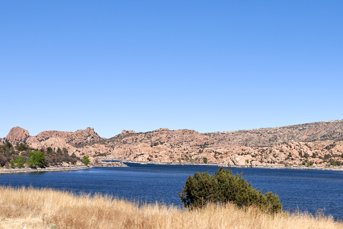
We had
lunch in a small diner near Prescott, AZ and then rolled past
Granite Dells. Note the bathtub ring here as well.
Rain has been scarce the last few years in the west.
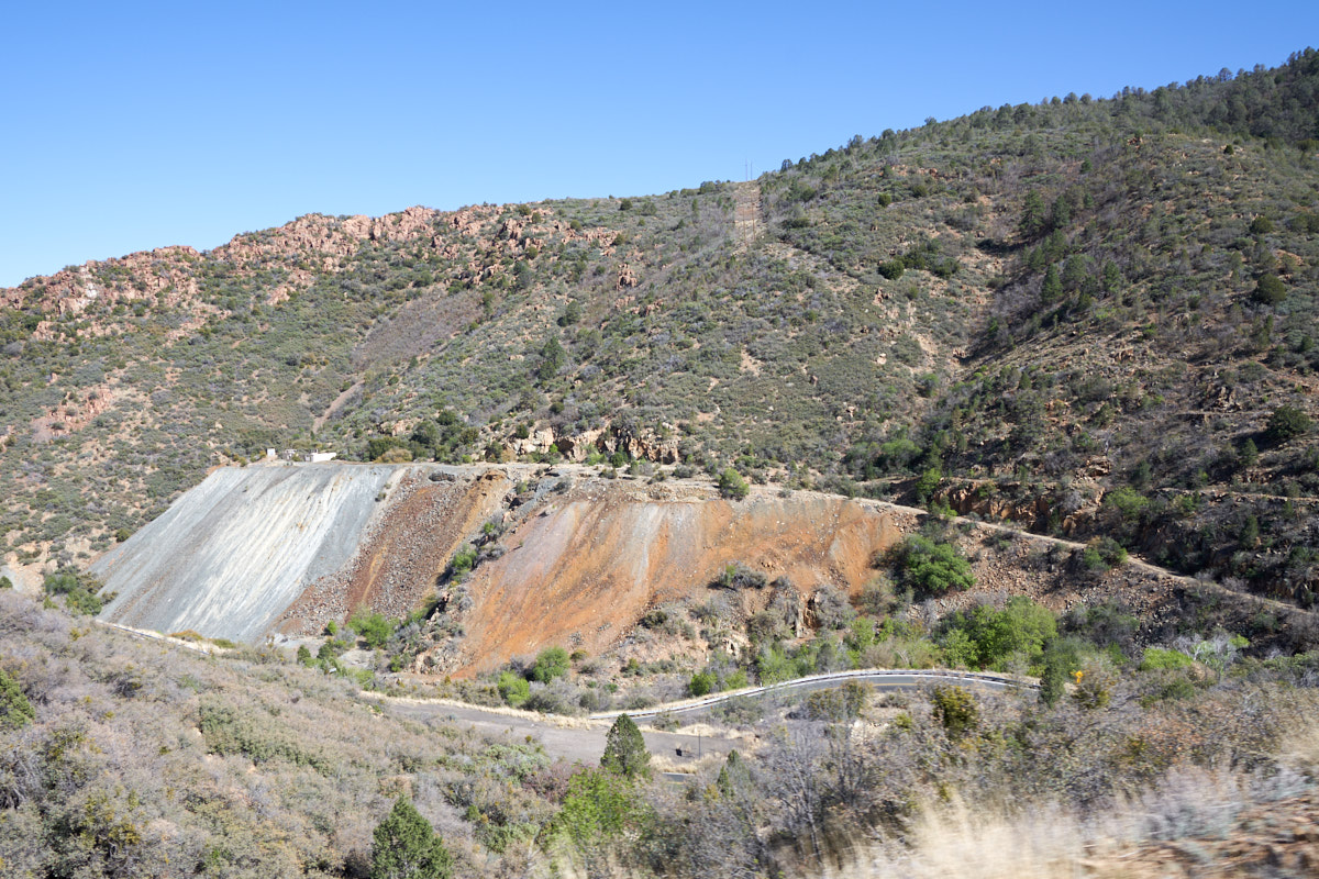
From
Prescott, we traveled east over Mingus Mountain and came into
the Jerome mining district. Lots of mines dotted the
hills, left over from the mineral rush days of the late 1800s
and early 1900s. Above, the tailings dump from the mine is
clearly visible and the volume suggests that an extensive
network of tunnels were excavated in search of mineral wealth.
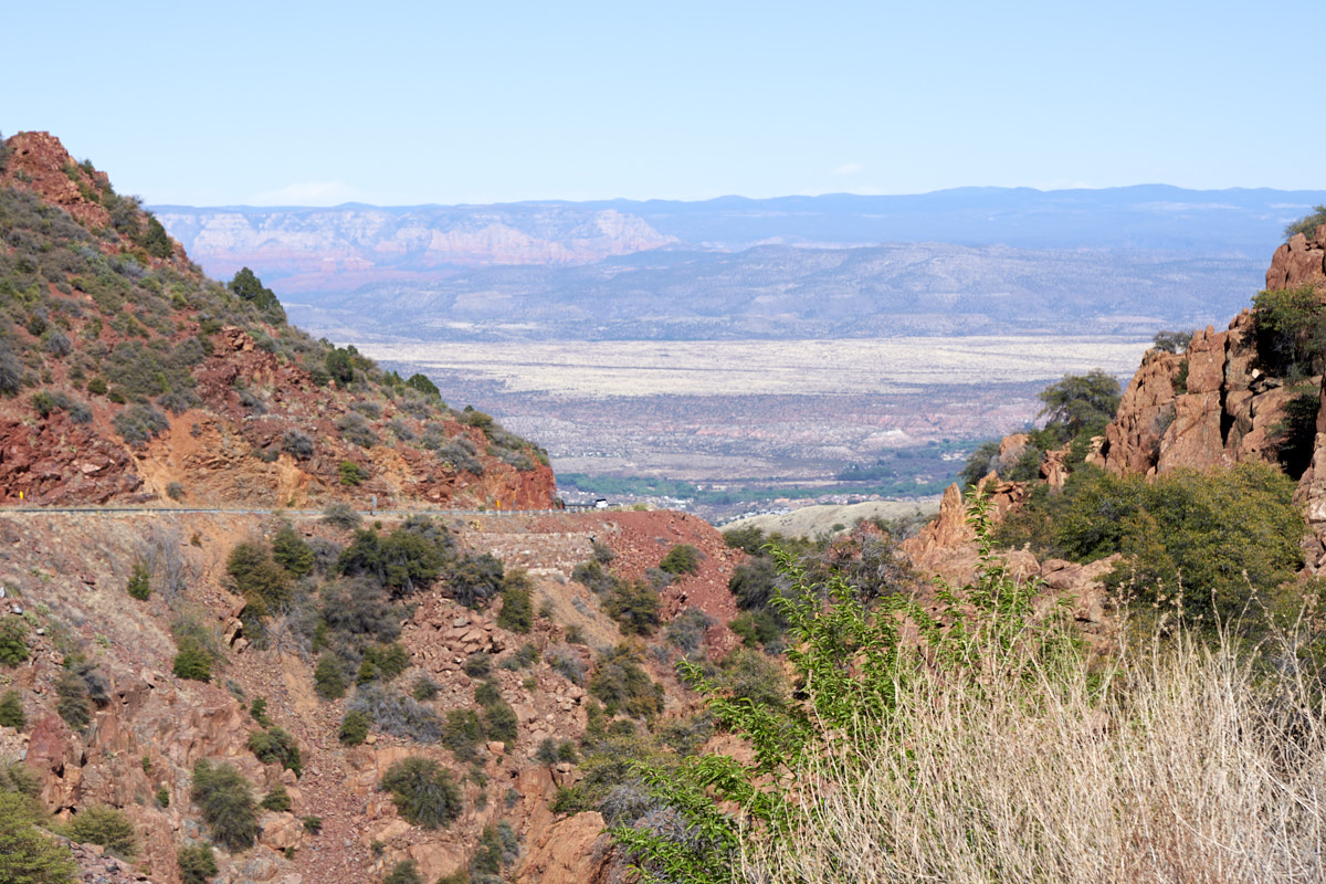
From a
turn-out on the highway we got our first view of the Verde
Valley and the red sandstone cliffs above Sedona, AZ.
Our destination for the night was Dead Horse State
Park, but arriving on a Friday afternoon, we ended up in the
overflow lot with no water or electrical. That said, they
did have bathrooms, showers and generally nice facilities.
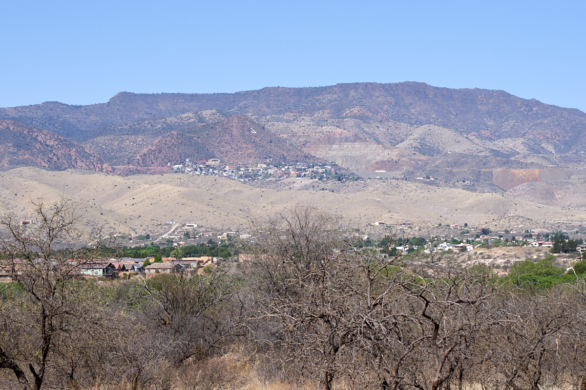
From our campsite we could see Jerome, AZ on the distant
mountainside. Terraces of tailings were also visible.
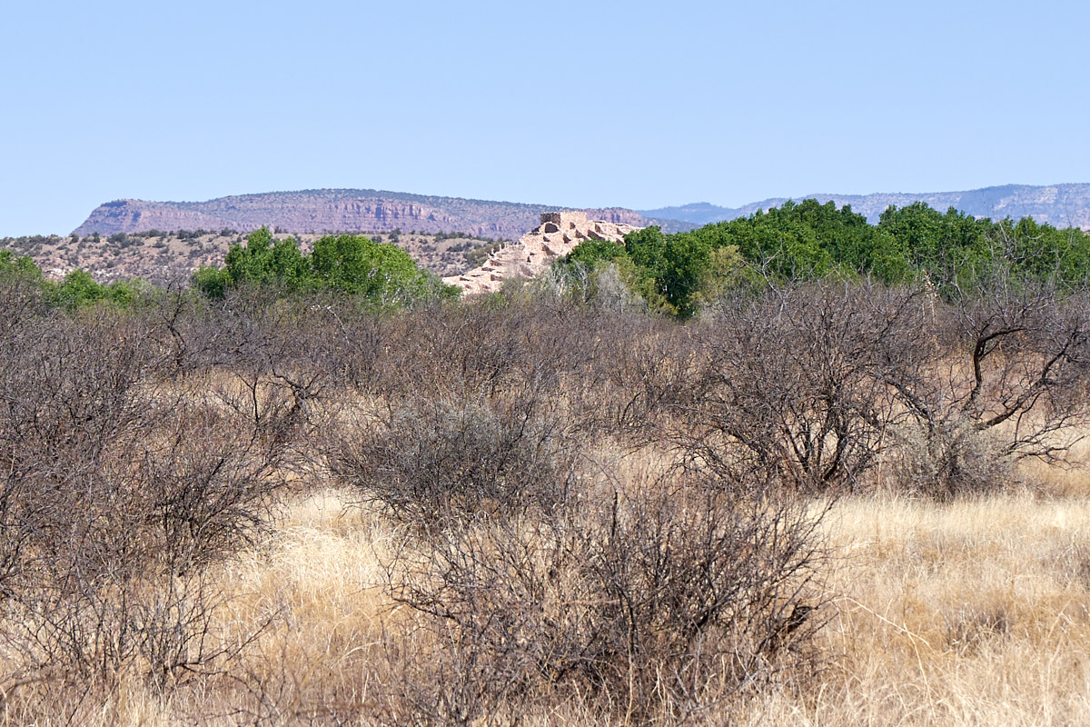
Our map
showed that Tuzigoot National Monument was close as well and
indeed we could see the ruins on a nearby hill. Like most
pueblos of the so-called "Sinagua" peoples, they went fallow
around 1400 AD for reasons unknown. Like causes were a
series of crop failures caused by an extended drought.
But, whatever the cause, the result was that most of these
pueblos were abandoned and the inhabitants moved on.
We went
to Tuzigoot to see what was there and it was, frankly, somewhat
unimpressive. Now, that said, this was a large pueblo
"back in the day", but quite small compared to some of the
larger pueblos like Chaco Canyon or Mesa Verde in southwestern
Colorado. I spoke with a docent at length and he said that
when the reconstruction was started, the ruins were just that --
ruins. Only the foundation stones were in place as the
balance of the walls had collapsed into a big heap. The
reconstruction consisted of placing stones back on the
foundation lines until there were no more stones. Oh yeah,
they diverted stones to build the visitor's center, thus
resulting in a deficit of material and therefore lower walls in
the ruins. In most places, the capstones were installed
with conventional concrete to prevent weather-based
erosion. Tuzigoot was located right next to the Verde
River, one of the only persistent streams in the area. The
fertile river valley soil provided the basis for the pueblo's
agriculturally-based food source.
A lot of
effort was put into the reconstruction of the ruins. At
Tuzigoot's height, it supported a hundred folks or so.
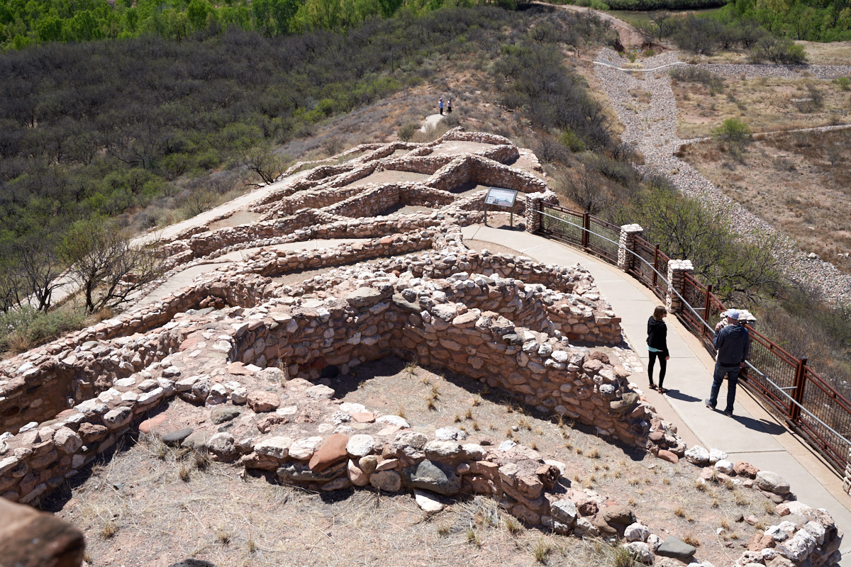
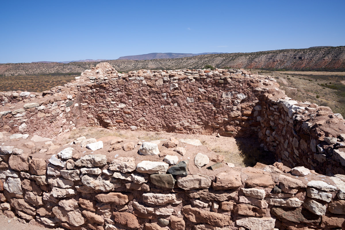
From the
top looking toward the south the scope of the site becomes
apparent. It is sad that the reconstruction process did
not include doorways. The Verde River is visible at the
top right of the photo above and indeed it is green in color as
the name suggests.
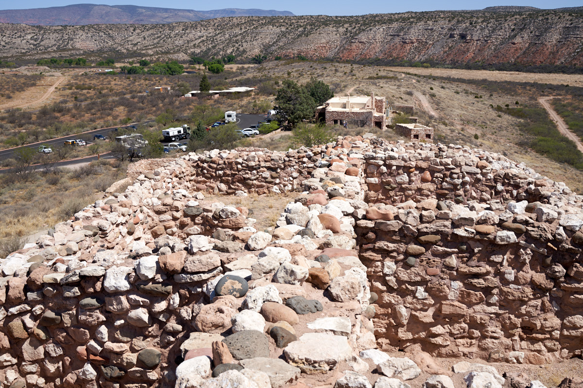
Looking
toward the north the visitor's center can be seen. As
stated above, material from the rubble pile was diverted to the
visitor's center resulting in an incomplete recreation of the
original pueblo. Also visible in the photo above is Thor,
our camper, in the parking area.
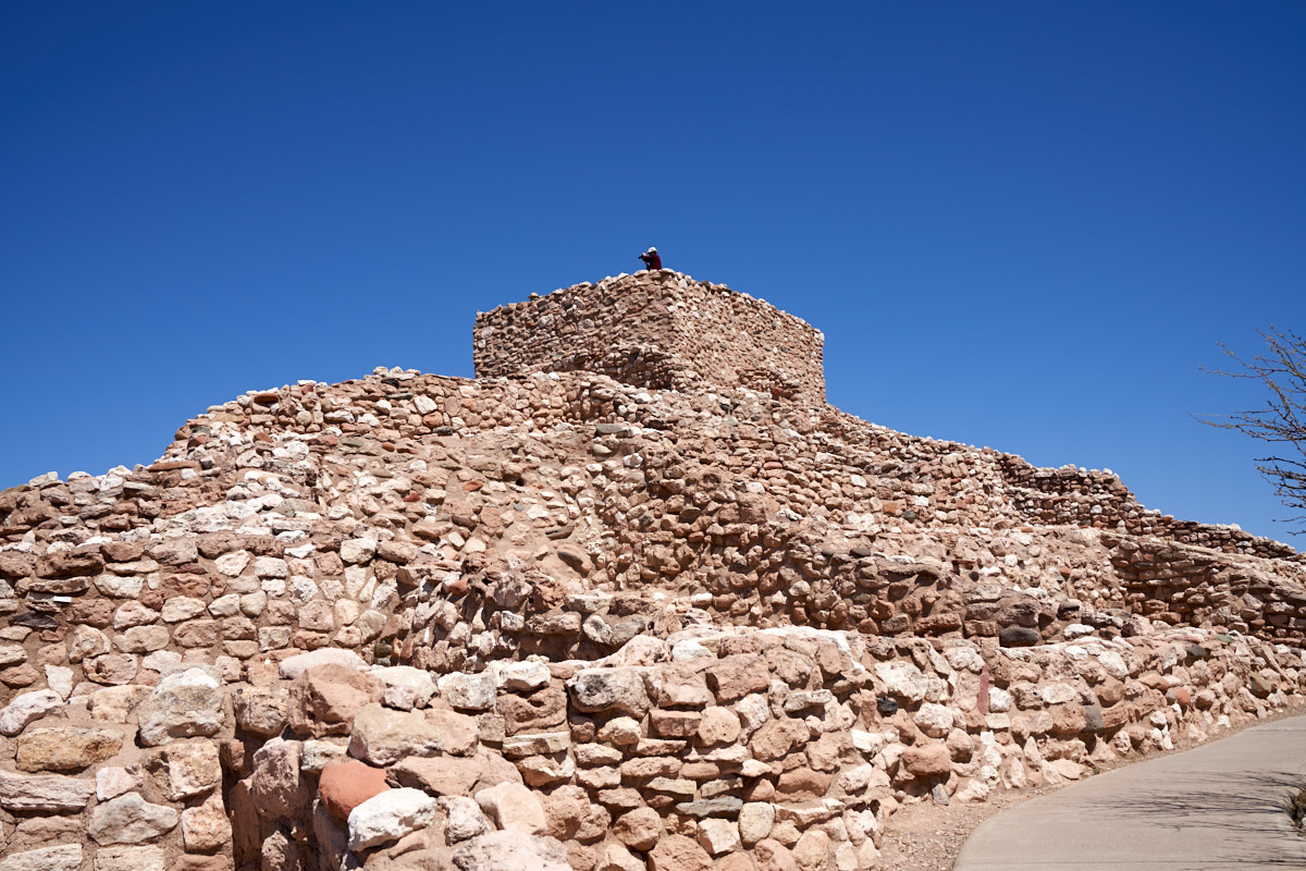
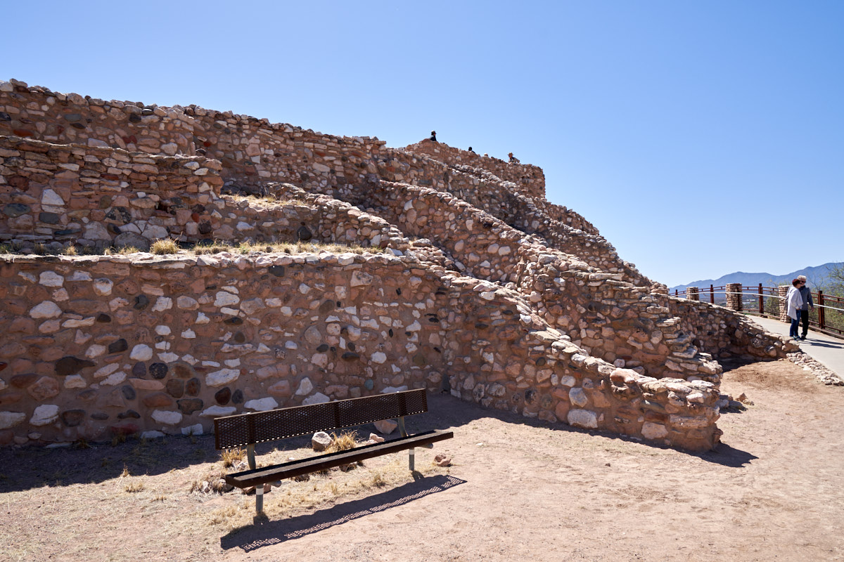
The
upper tower of the pueblo was fully reconstructed including
stairs and a sealed roof area that is now a viewpoint.
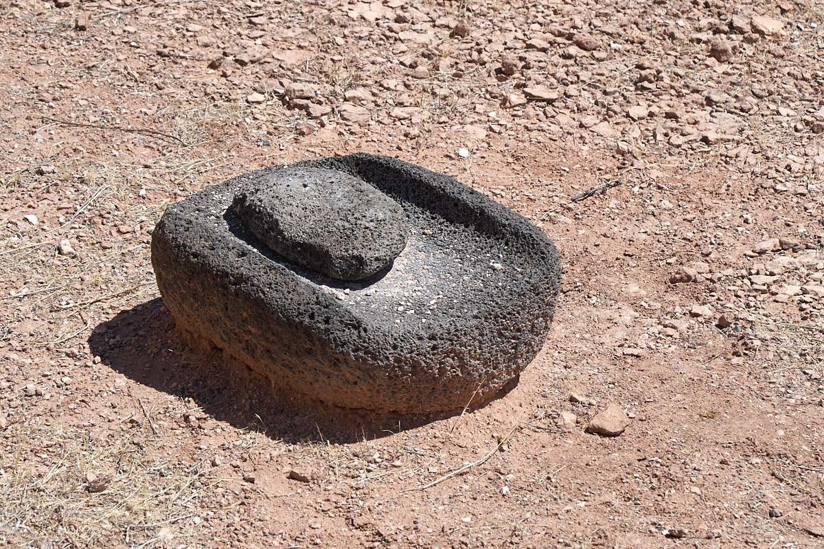
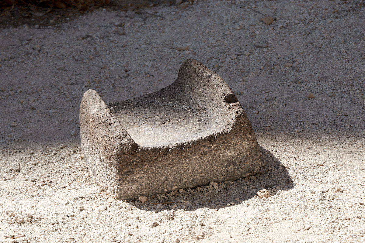
A number
of "metates" AKA "morteros" were found at the Tuzigoot
site. The example above consists of the mortero base and a
"mano" which is the smaller stone. This setup was used to
grind local seeds and mesquite beans into a flour used to make
bread and gruel. The volcanic stone was preferred over local
stone as it was harder and left less stone grit in the food.
This is
another mortero ground into the local limestone.
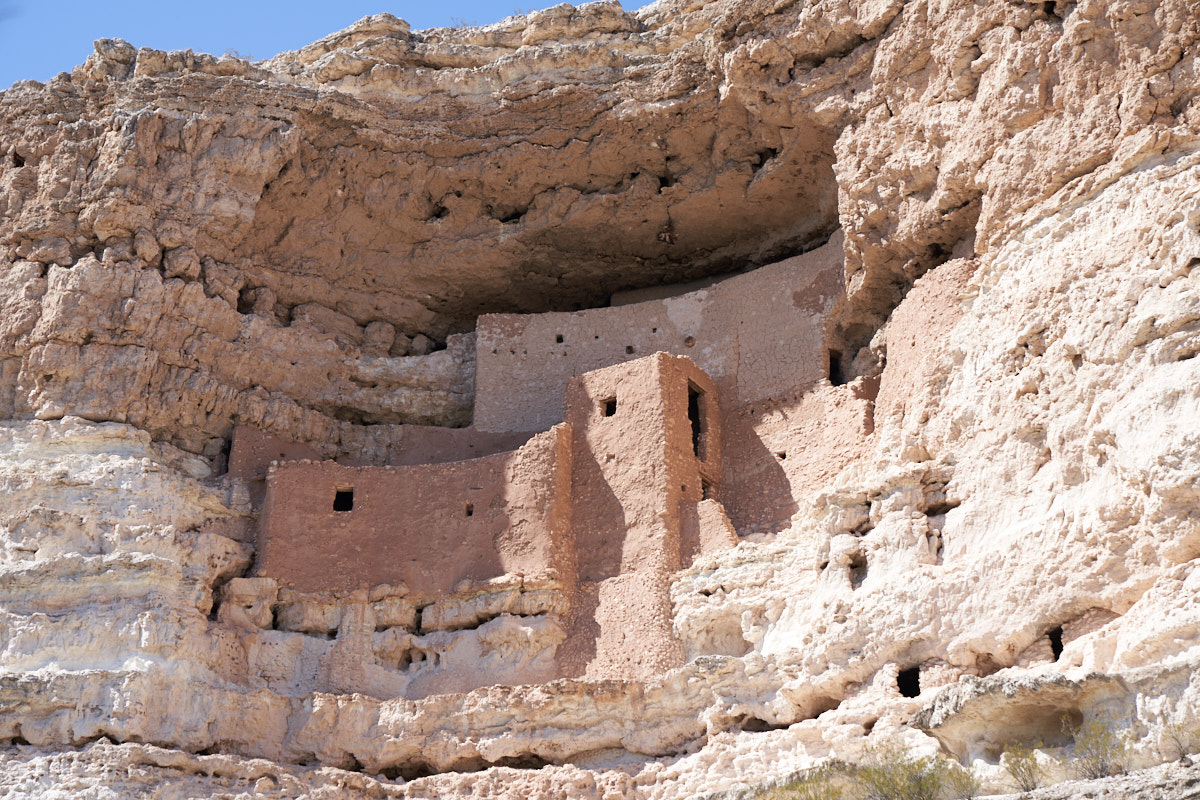
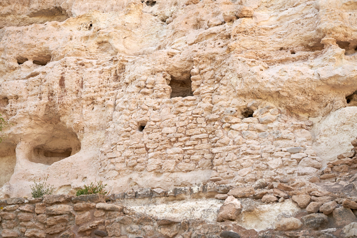
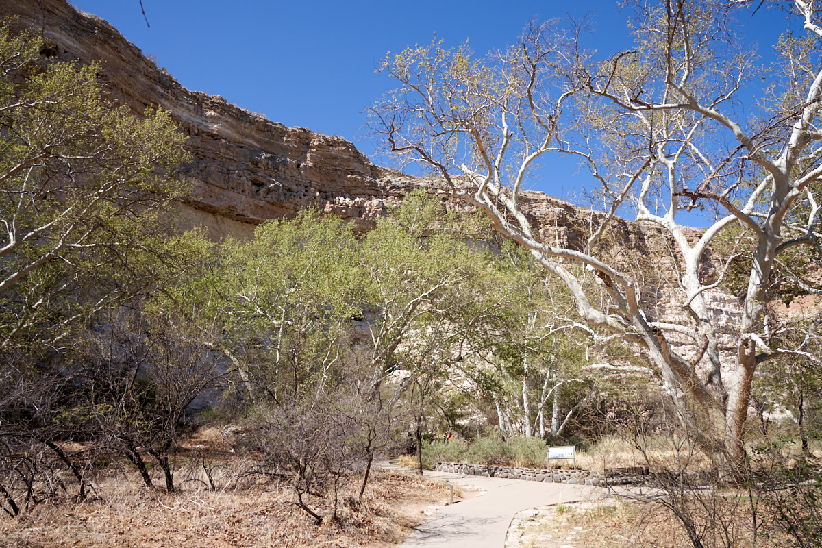
After
lunch, we headed about 30 miles away to Montezuma's Castle on
Beaver Creek, a tributary of the Verde River. Like
Tuzigoot, the ruins here were reconstructed. Back in the
day, tourists were allowed to climb ladders to view the ruins up
close, but the volume of people began taking its toll on the
site so access was cut off. Now, you can only view the
ruins from the valley floor. This pueblo was built into
the side of the cliff in an overhanging alcove to provide
protection from the sun, wind and rain. The overhang
shades the pueblo during the summer, but allows sun to shine on
the walls during the winter. All building materials were
hauled up by hand from the creek bed below. It has been
estimated that the entire pueblo consisted of less than 50
individuals. Given the height of the canyon walls and the
amount of material that was needed for the construction of the
dwelling, this was a massive undertaking that likely spanned
decades.
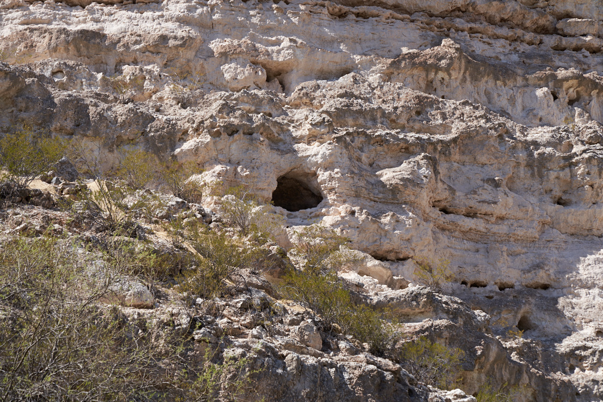
The
dwellers at this pueblo also occupied smaller caves in the
canyon walls.
Living
in one of these smaller caves would have been a tough life.
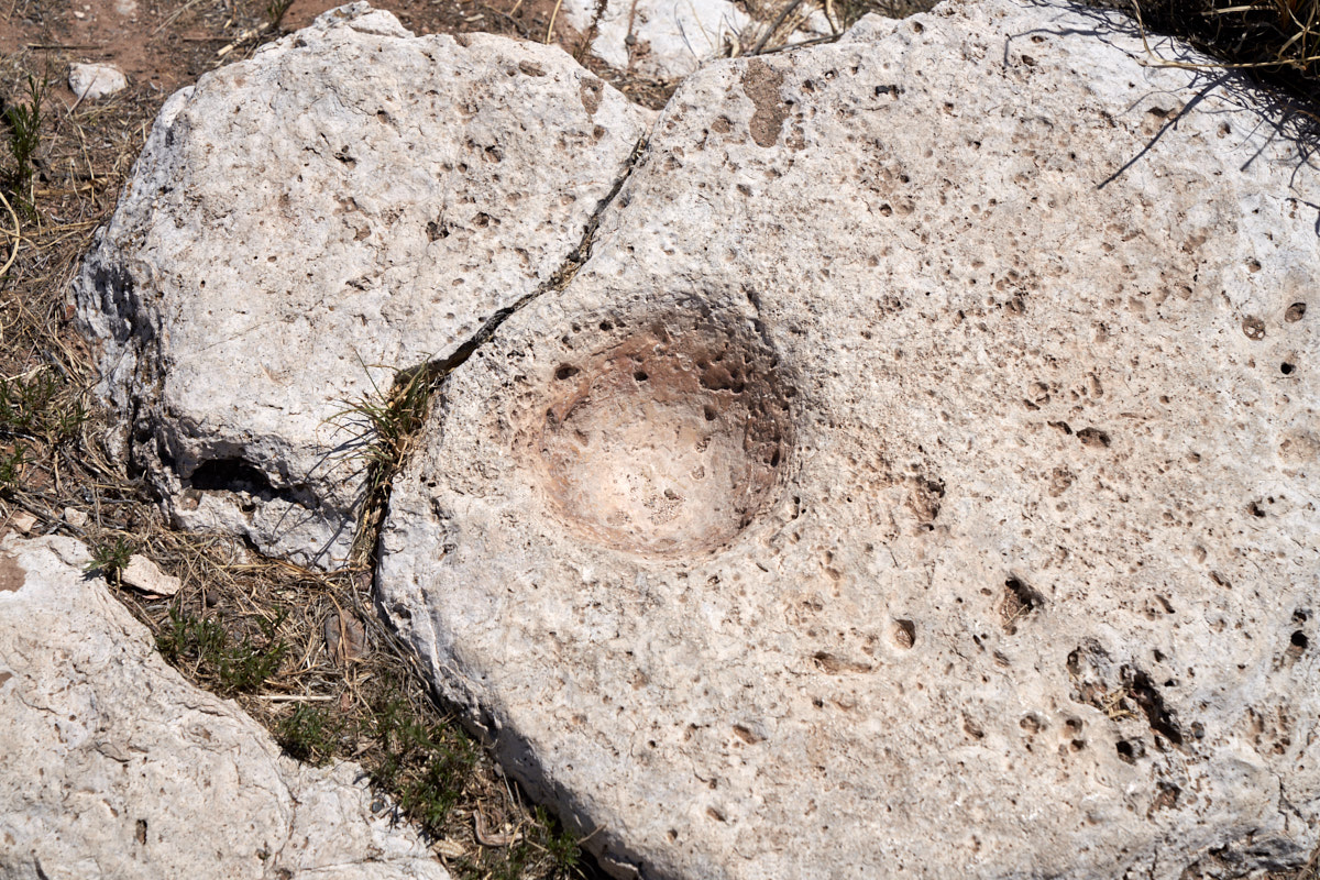
Montezuma's
Castle had been extensively looted in the early 1900s, but not
all artifacts were taken. This is a fine example of a
mortero used to grind seeds.
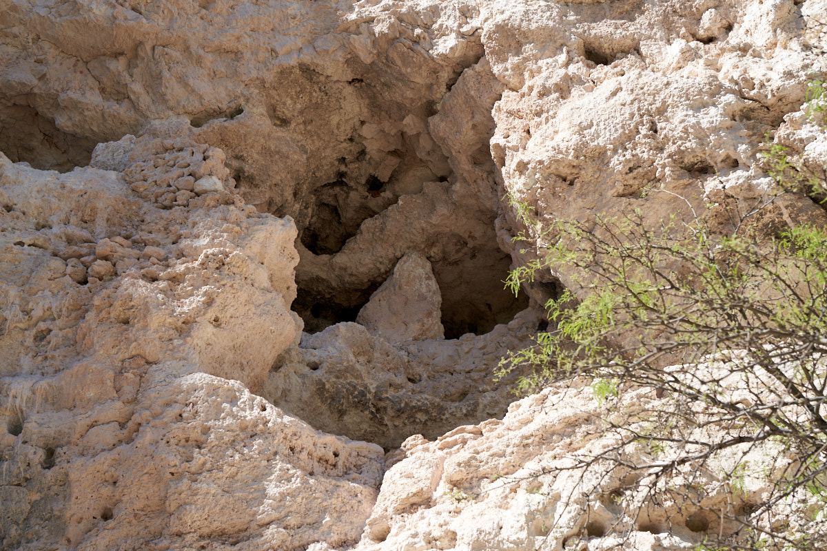
Some of
the smaller caves would have made cramped living quarters.
The
canyon floor was quite lush with vegetation. Not all the
trees had a full canopy yet as it was still early in the spring.
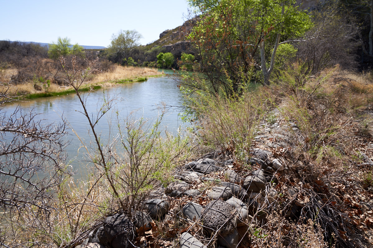
Beaver
Creek is not very large, but in this area any persistent water
source is a big deal.
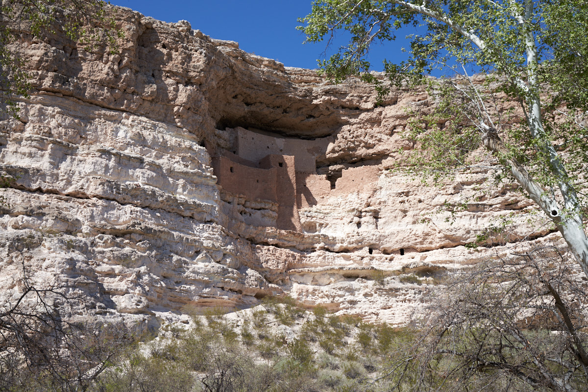
A
parting shot of Montezuma's Castle. These cliff walls are
high and steep and access to the pueblo must have been quite a
challenge. Nobody knows whether the location of the
dwelling was chosen for weather reasons (i.e. climate control)
or for defense against warring factions. Since Tuzigoot
was built on an exposed steep hill, I have to assume that
defensibility was the driving factor.
| Previous Adventure | ||
| Trip Home Page |
Photos and Text Copyright Bill Caid 2018, all rights
reserved.
For your enjoyment only, not for commercial use without attribution.