
We
had made arrangements to visit our Unimog friends Brad and Laura
at their beautiful home in Hermosa, Co just north of
Durango. We broke camp at Mesa Verde and headed east on
US160 to Durango. We stayed several days which allowed us to
catch up and have a relaxed visit. They recently got a new
puppy, Ruger, ( the dog is "a real pistol" so what better name
than Ruger?). Ruger kept us fully occupied. Brad's
house is line of sight of the Durango, Silverton and Rio Grande
steam train so we got an opportunity to see it come by 6 times
each day (3 up the Animas canyon and 3 returns).
The photos below are what we saw.
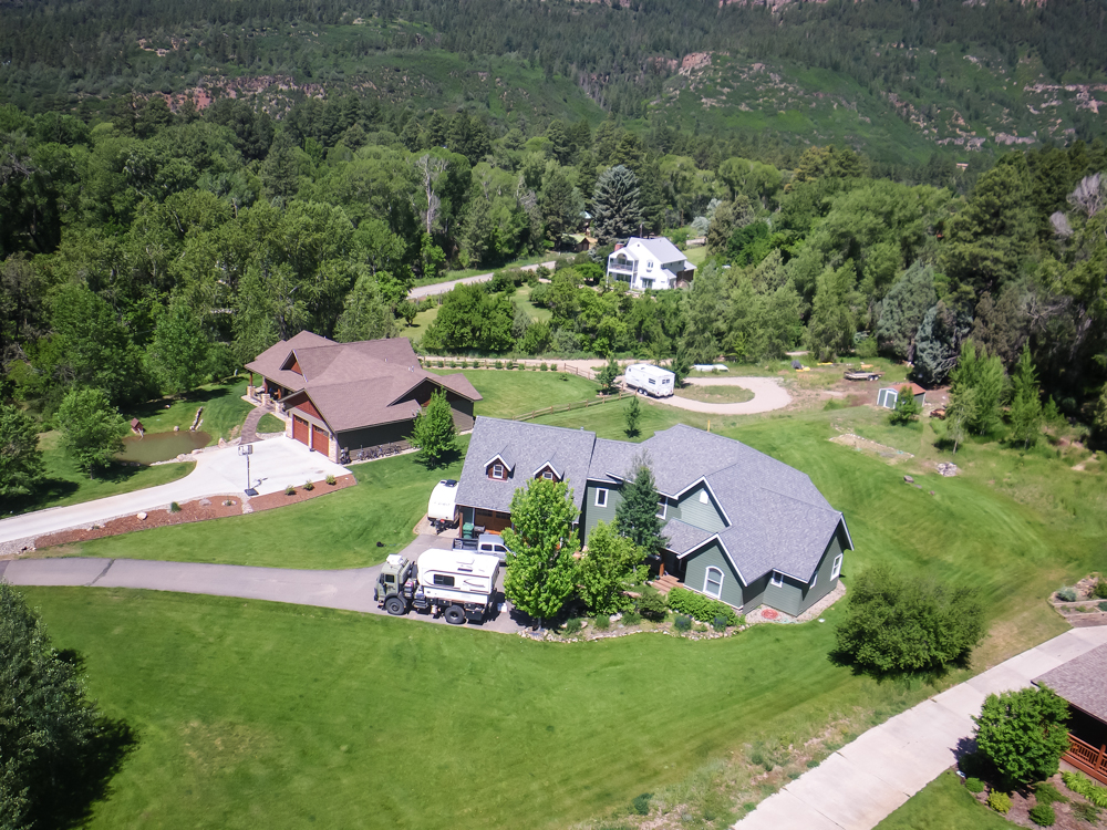
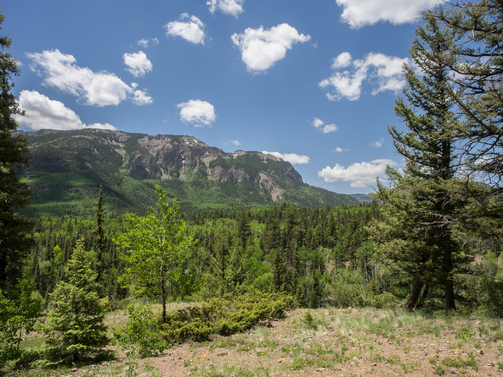
Brad
wanted to see the quadcopter fly and get some photos of his
house. Thor is visible in the driveway and we are visible
watching.
Another
view of the house taken the next morning.
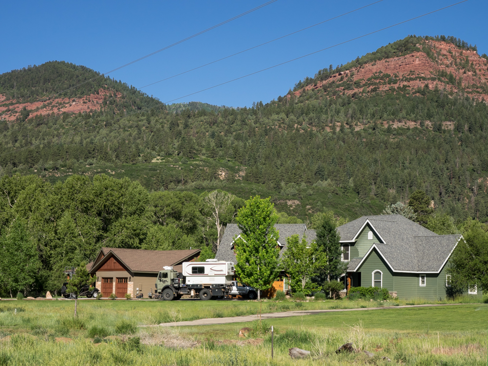
The
view of the red cliffs behind their house is spectacular.
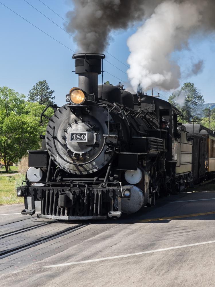
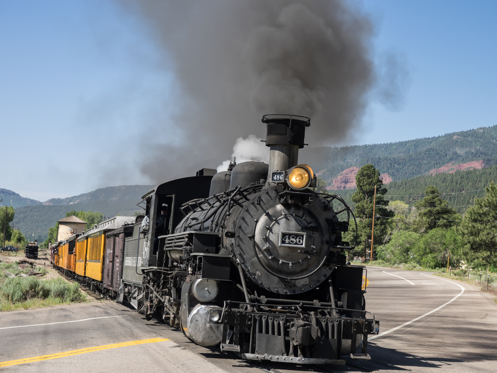
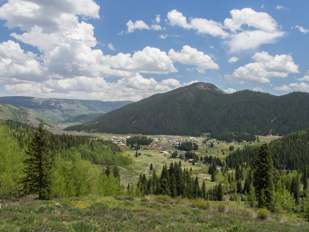
Because
their house is very close to the DSNGR narrow gauge line, it was
easy to get photos of the passing steam engine. We could
hear the steam whistle with just enough time to walk to the
crossing with US550. Engine number 480 has a particularly
loud whistle.
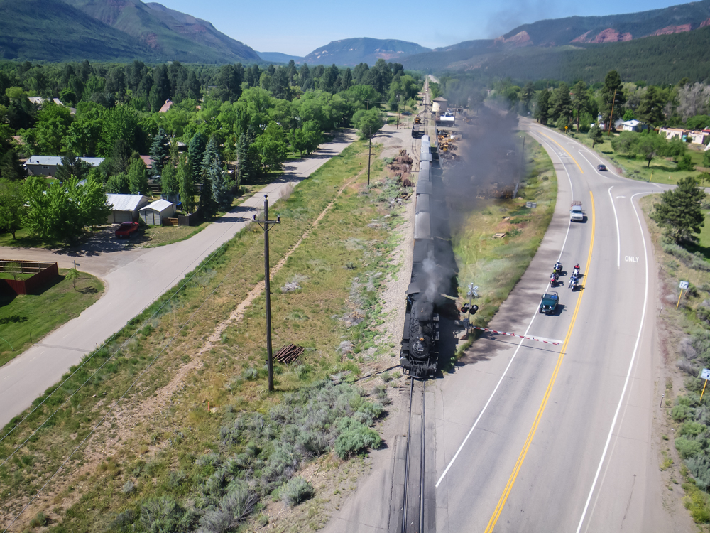
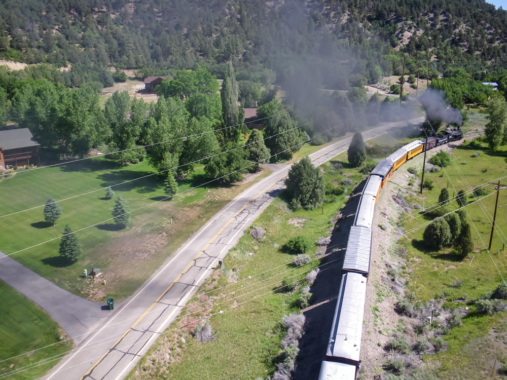
I
got the bright idea to float a camera over the train. The
first time we did it, the quadcopter was perfectly positioned, but
because of operator error (that, friends, would be me), the camera
failed to capture any images. But on the second try we were
able to get a reasonable photo.
Kathleen
got the engine as it was coming by. The ground literally
shakes due to the locomotive's mass.
We
got the train coming and going with the quadcopter.
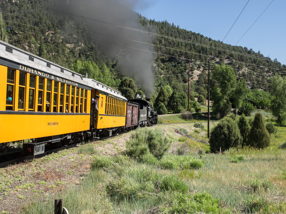
This
was the third passenger train of the day and it was quite full.
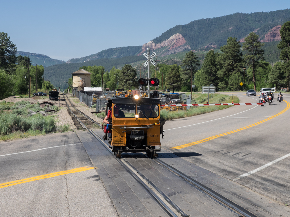
Every steam train is, by law, followed by a fire control "speeder" to put out any fires caused by burning cinders before they get out of control. This view is looking south along the DSNRG line toward Hermosa station. The water tower of the Hermosa station is visible in the background.
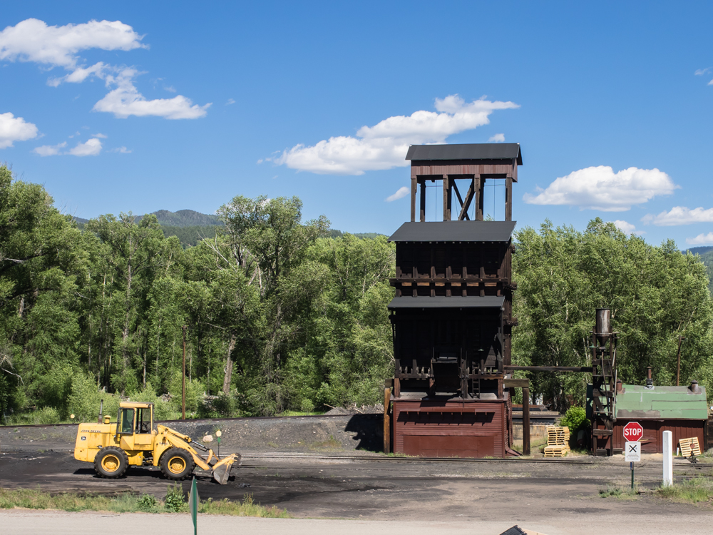
We
left Durango and headed east to Pagosa Springs, then south to
Chama, NM. We passed through Chama (which also hosts steam
engines) but all the steam locomotives were out on the track.
Above, the coal fueling station was visible.
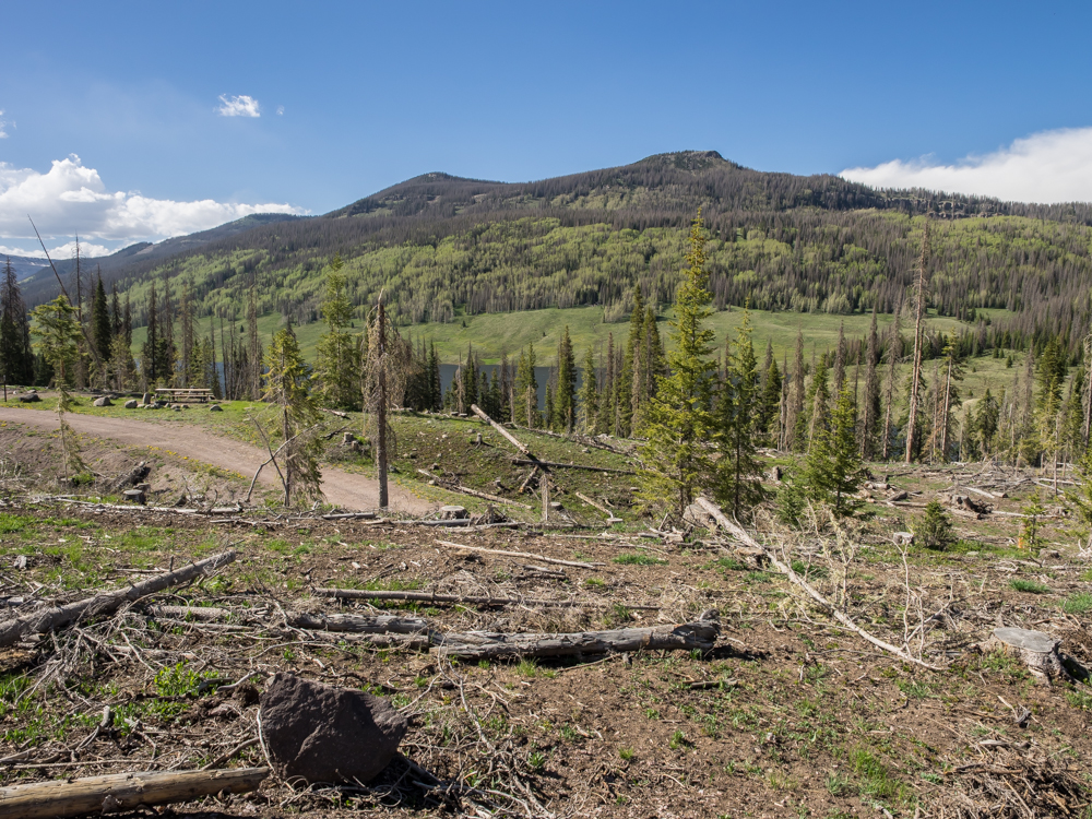
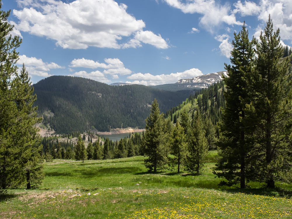
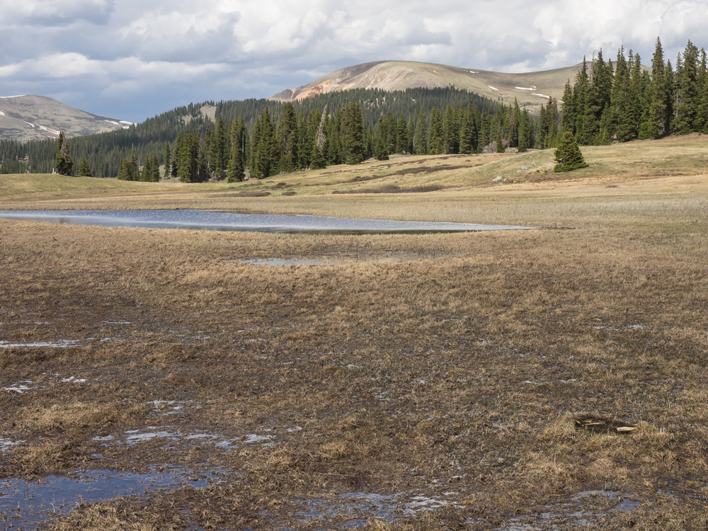
From
Chama, NM we headed north to Cumbres Pass. Cumbres is a
10,000 foot pass and the approaches to the pass are quite
steep. When we crested the pass we decided that we would
camp at Trujillo Meadows just to the north. The camp site
was above 10,000 feet so breathing was a bit labored. The
Trujillo area had been infected with bark beetles and the USFS
sent a crew in to cut down infected trees resulting in a
quasi-clear cut look. The reservoir is visible in the center
of the photo above.
The
beetles will eat every tree they can and the damage was
substantial.
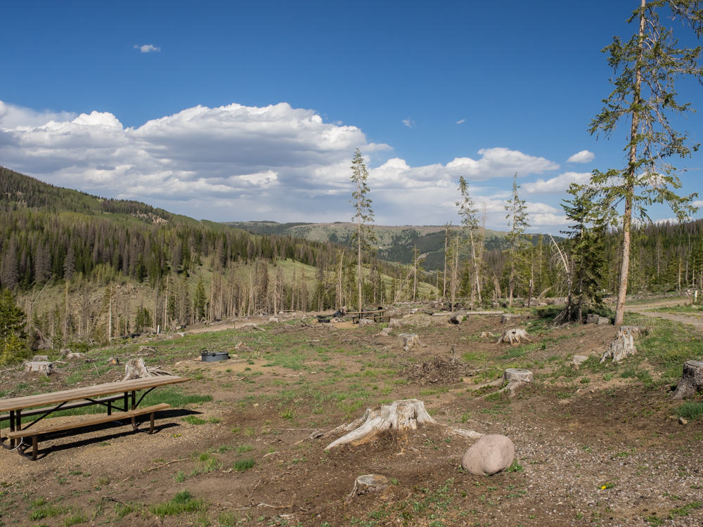
Being
early in the season and a weekday, we had the place to
ourselves. The winds were strong so we retired early.
Next
morning we came down from Trujillo Meadows and continued north
thru La Manga Pass to the Conejo River Valley. We headed
north along the Conejo River, but the road was one of the roughest
we had encountered so far. There was a sign at the start of
the road that said "USFS no longer contracts road maintenance with
Conejo County and is therefore soley responsible for its
condition". The road was heavily washboarded and had plenty
of huge tire-swallowing pot holes. We aired down to 30 psi
to ease the bite of the rough road. Shitty road
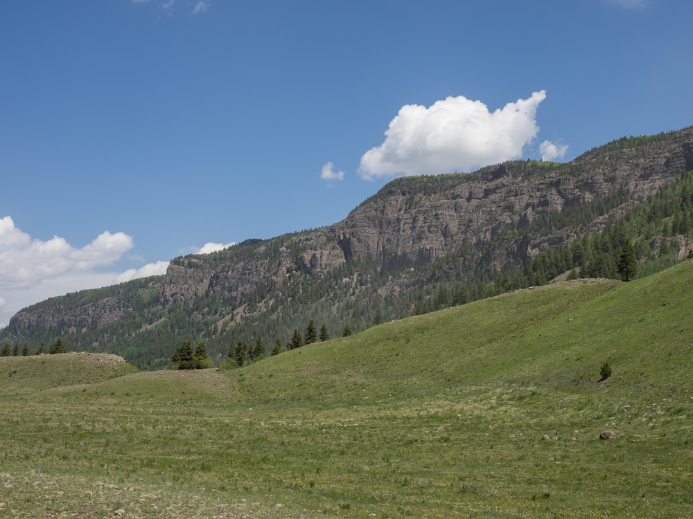
notwithstanding, the Conejo River valley is spectacular.
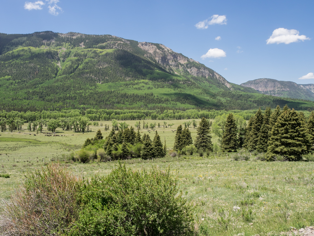
Further
upstream we passed large meadows that hosted substantial herds of
cattle.
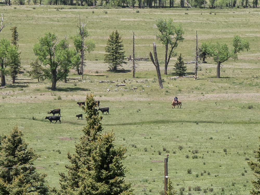
This
cowboy is working for a living bringing the herd together.
We
stopped at a primitive camp for lunch. The cliffs of the
eastern wall of the canyon were steep and impassible.
The
western wall of the canyon was equally daunting.
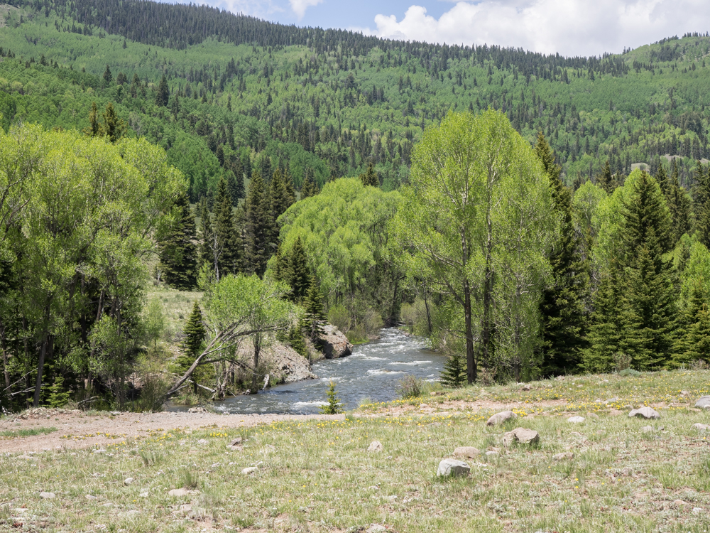
Near
South Fork we got a nice view of the Conejos River. The
river has trout, but given that it was a weekday, there were
minimal fishermen around.
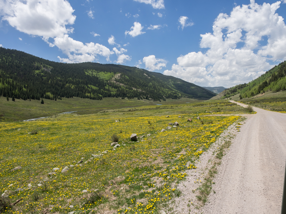
Getting
close to the village of Platoro, CO the valley broadened.
The valley floor was covered with wildflowers.
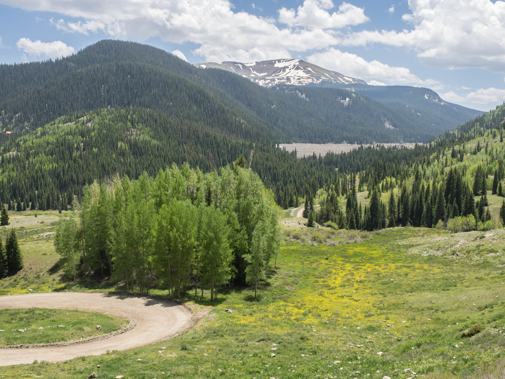
We
passed Platoro and continued on toward Stunner Pass (10,541
feet). The switchbacks were tight but we did get a view of
the dam at Platoro Reservoir.
The
village of Platoro, CO was visible in the valley below.
Only
a small portion of Platoro Reservoir was visible from the road to
Stunner Pass.
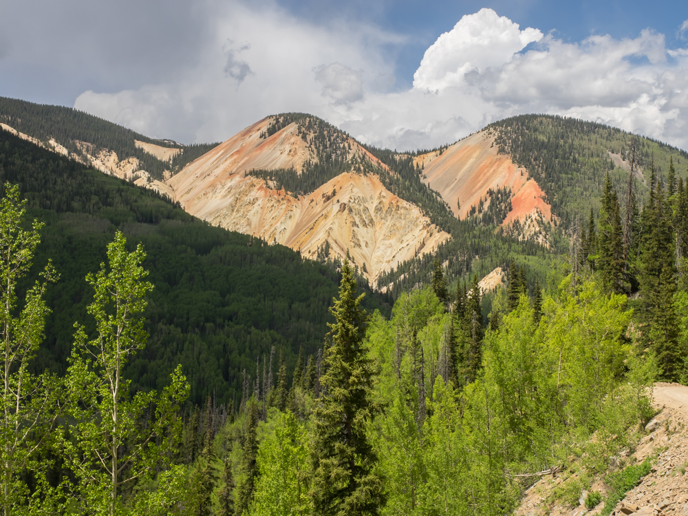
Stunner
Pass was indeed stunning. The heavily mineralized cliffs
provided rich colors against the building clouds.
The
junction below is our "fork in the road". Left takes us to
11,631 foot Elwood Pass and then Del Norte, CO; right goes to La
Jara, CO. We chose left which was the wrong choice.
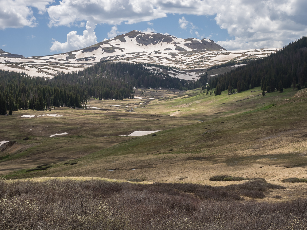
Spring
comes late at 11,000 feet. Near Elwood Pass there were
tundra-like meadows.
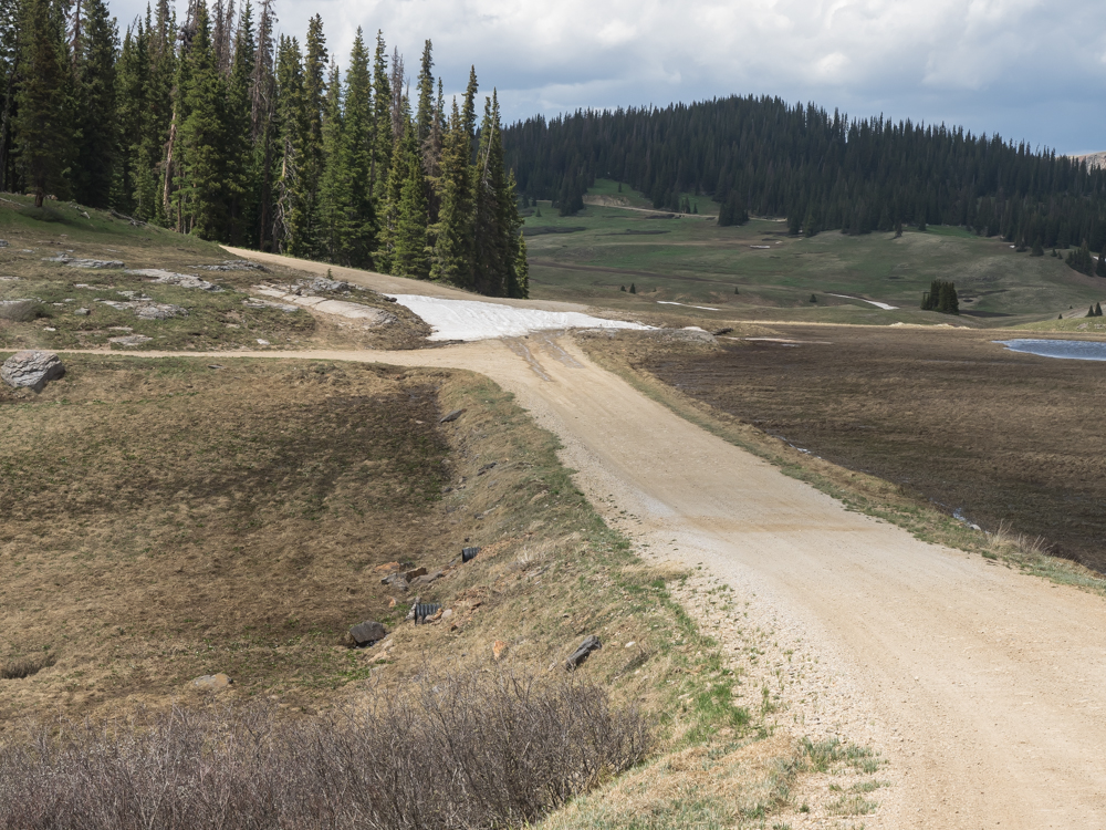
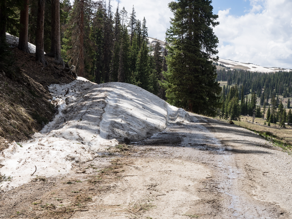
After
we chose the left fork, I asked Kathleen if the road would be open
given that was early in the season. We soon got our
answer. This small snow bank thwarted normal attempts to
cross it. But, being resourceful, I chose another path.
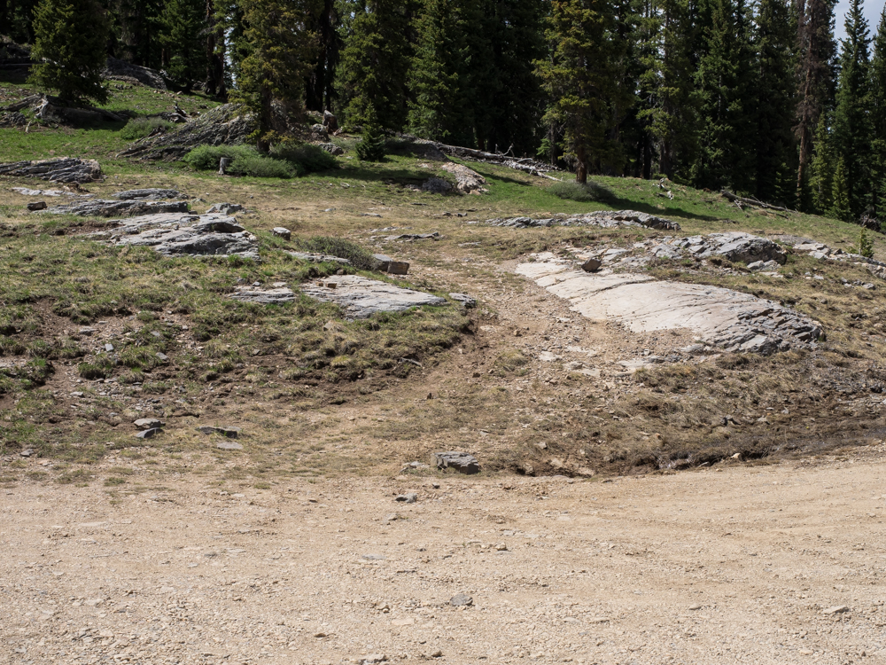
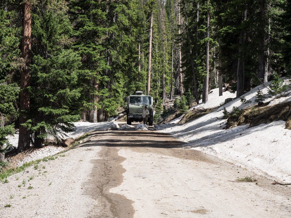
Our
bypass would be around the ditch and over the rocks to the left
around the large slab.
Thor
easily handled the obstacle.
Past
the slab, the ground was softer.
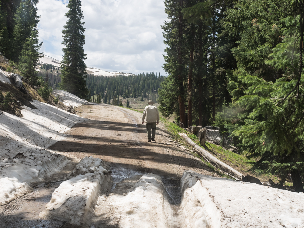
We
rounded several more corners and came to our end of the
trail. The first snow bank was crossable, but.....
The
next one was not passable. End of the line.
We
found an acceptable place to turn around and headed back down
Elwood and Stunner Passes to lower elevations.
Many
of the high meadows were very mushy with spring runoff.
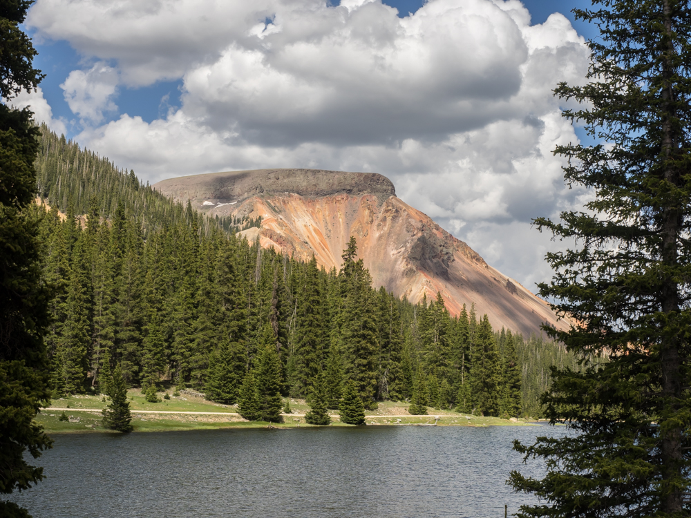
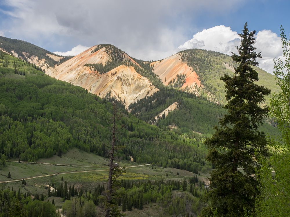
Approaching
Stunner Pass from the west gave us a new view of the mineralized
cliffs.
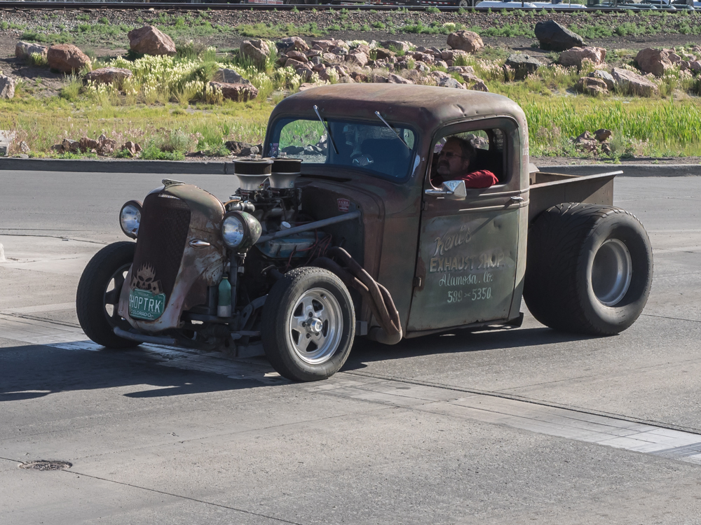
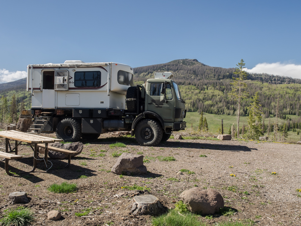
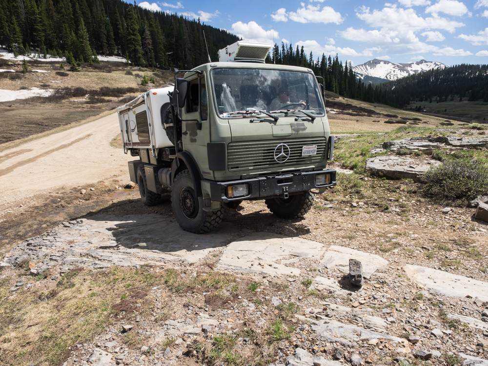
We
traveled many miles of dirt back down to the San Luis Valley where
we aired up the tires. We turned north to Alamosa, CO where
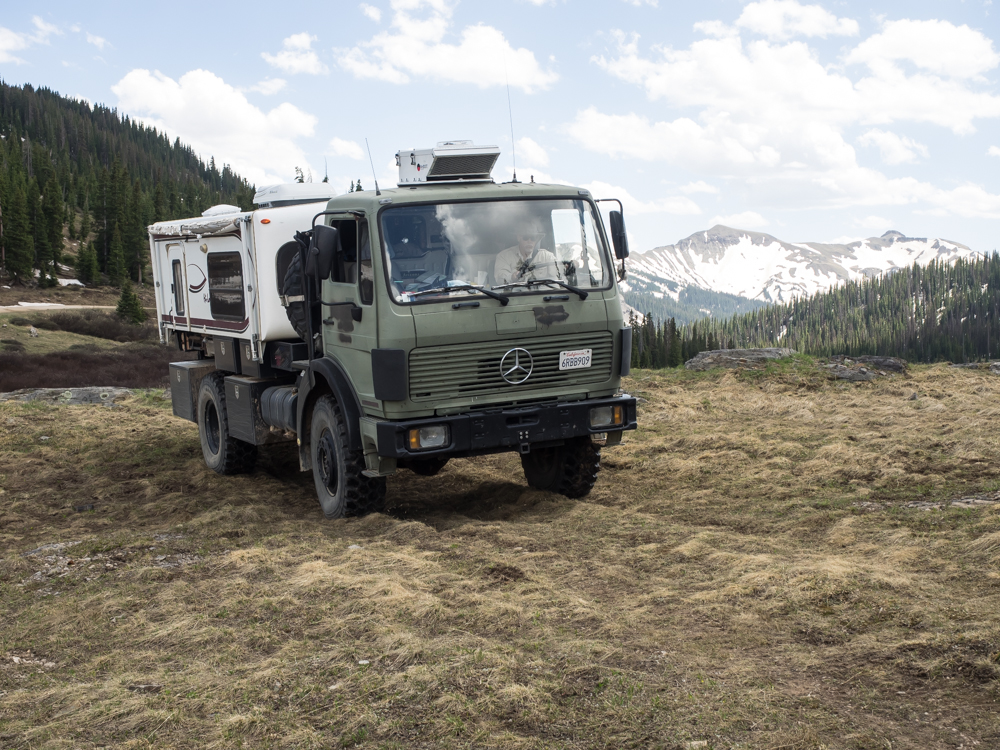
we saw this interesting vehicle.
| Previous Adventure | ||
| Trip Home Page |
Photos and Text Copyright Bill Caid 2014, all rights
reserved.
For your enjoyment only, not for commercial use.