We spent a pleasant night at Lake
Juliette in the camp site run by Georgia Power. It seems that
they have an extensive network of lakes that they maintain as part of
the utility's power production processes. Once we broke camp, we
continued north toward Oakwood, GA and from there on to Chapel Hill, NC.
The photos below are what we saw.
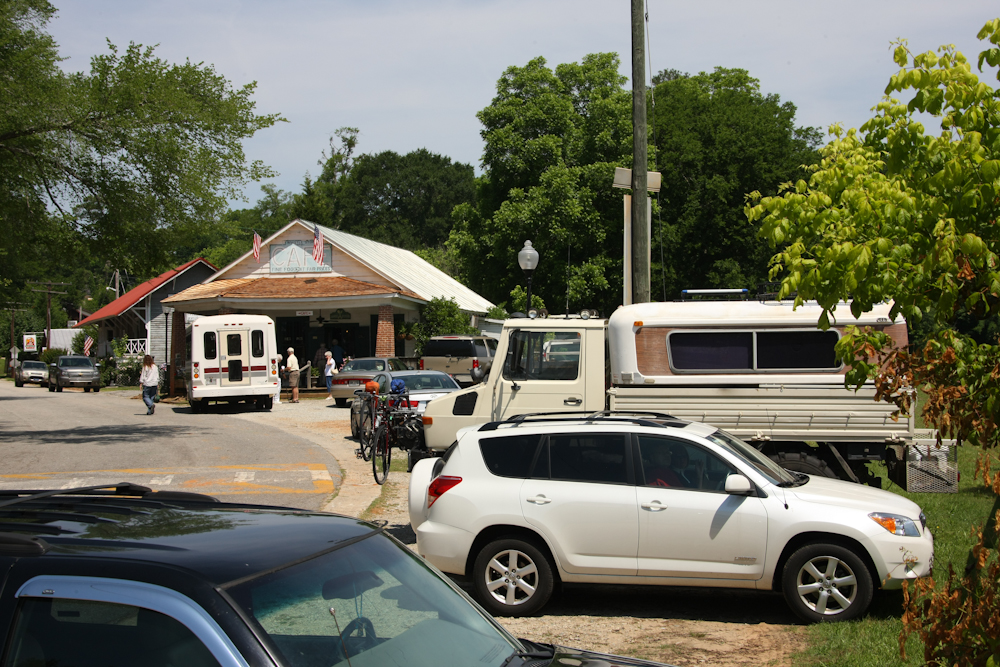
The locals suggested that we head to the Whistle Stop Cafe, made famous by the filming of the Southern classic "Fried Green Tomatoes". We had lunch there and the place was hopping.
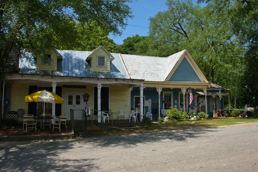
Across the street from the cafe were a number of small, rustic shops that pander to the tourists.

From the Macon area, we headed
north along the back roads toward Oakwood to see some other Unimog
buddies, Sean and Steve. Both Sean and Steve had come to San
Diego and have joined us in the Altar Desert. Along the way, we
passed this frankencar. Somebody put a lot of effort into this
conversion, but it would have been more impressive if they had made the
wheel base of the frame match the wheelbase of the body.
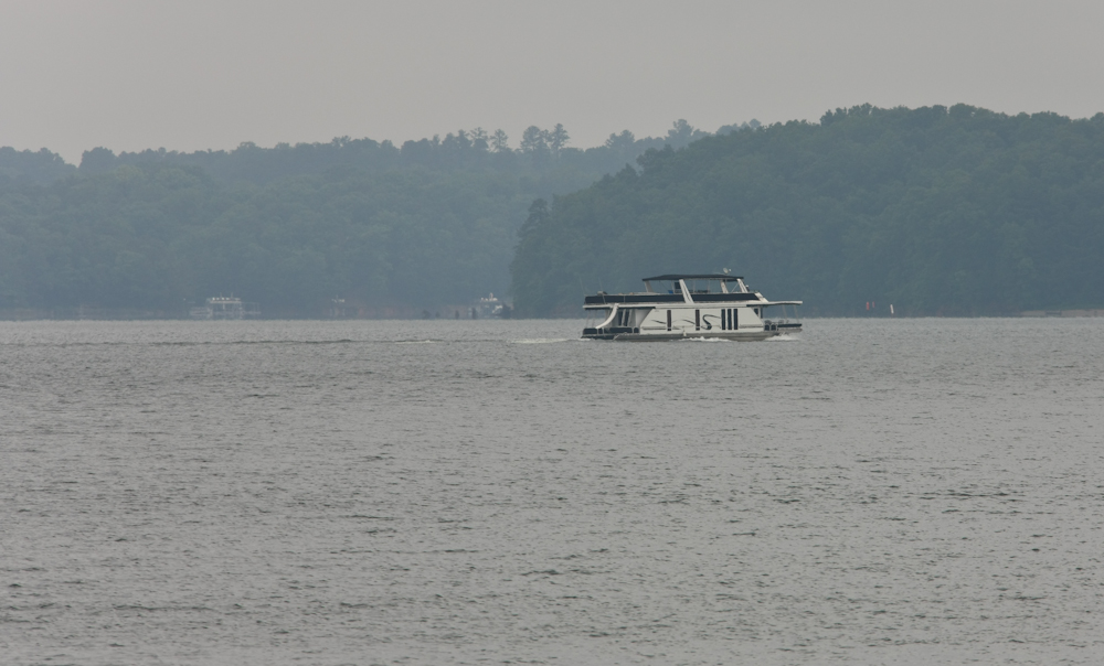
Sean hooked us up with a camp site
at Lake Lanier, very close to his shop. We arrived after dark,
got set up and then it rained. It was still raining the next
morning. From our position on the shore of the lake, we could see
some of the pleasure boats were coming out despite the overcast.
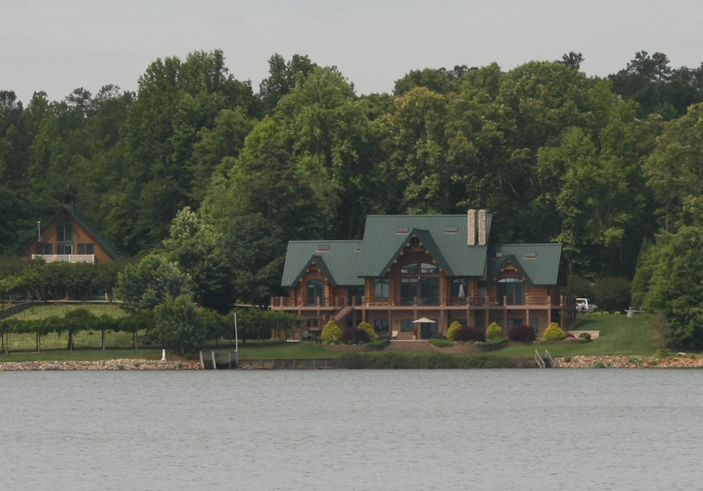
Above is a large party barge that passed our position. There were
some fantastically large homes on the far side of the lake.
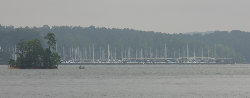
The lake is large enough to have
several marinas with many sail boats.
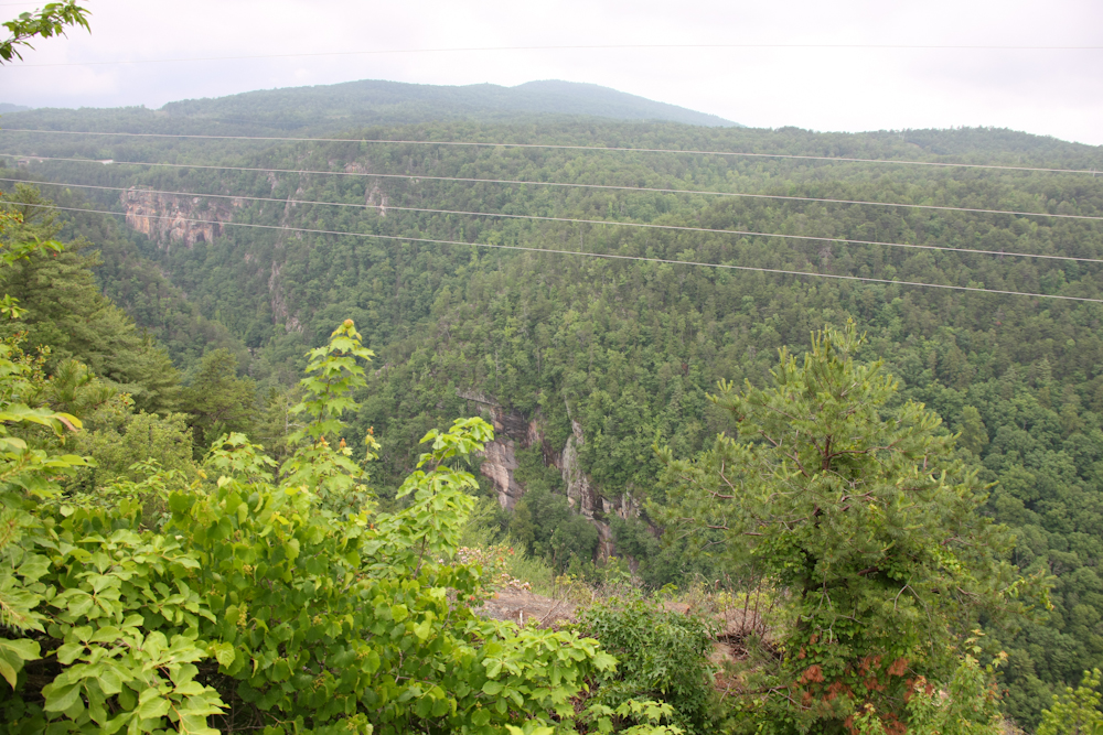
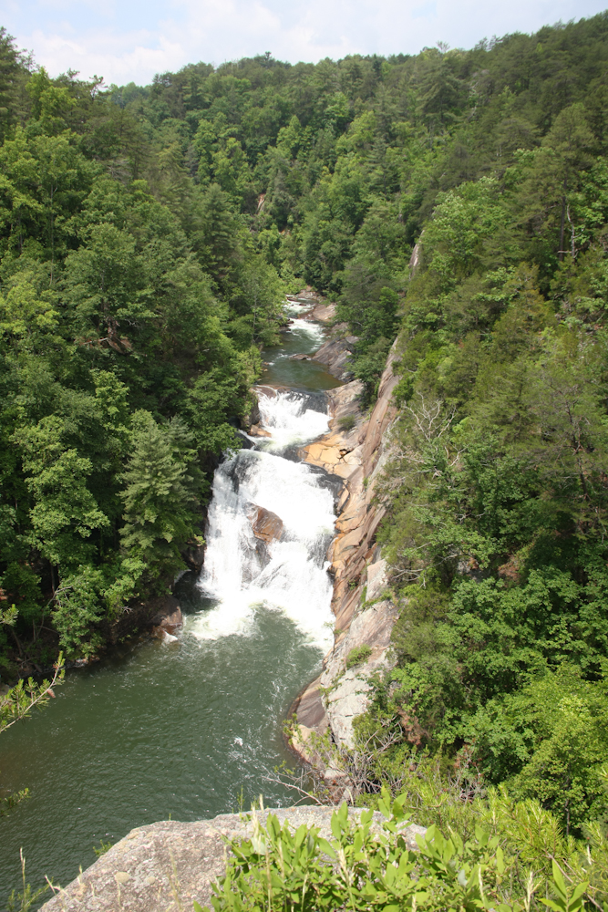
From Oakwood, we headed north to
Tallulah Gorge. There was an overlook that gave us a pretty nice
view of the canyon. The canyon is damed and used to produce
power, thus the power lines in the photo.
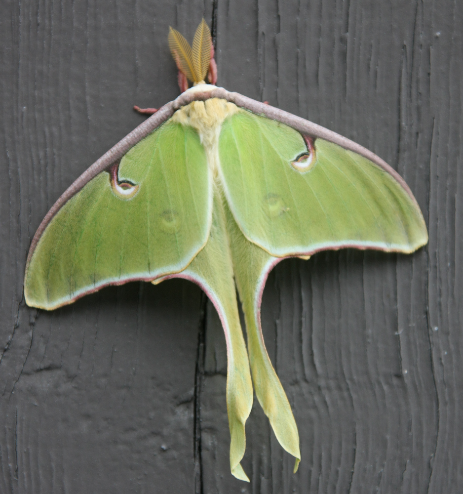
We stayed at the state park at
Tallulah Gorge and while we were checking in for a camp site, we
spotted this huge Luna Moth. This moth is about 5" across and
there were two of them outside the office. These were the only 2
we saw. Later, we learned that they are rarely seen and only fly
at night.
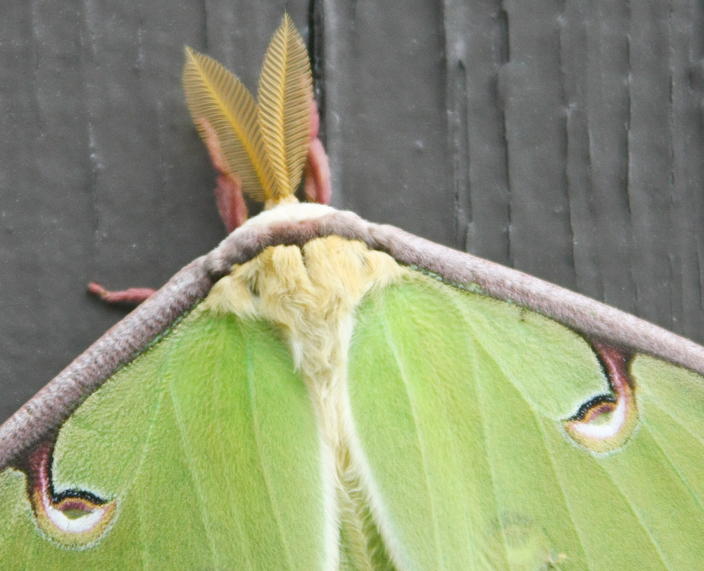
Note the eyes on the dorsal side
of the body and the "fur" around the head.
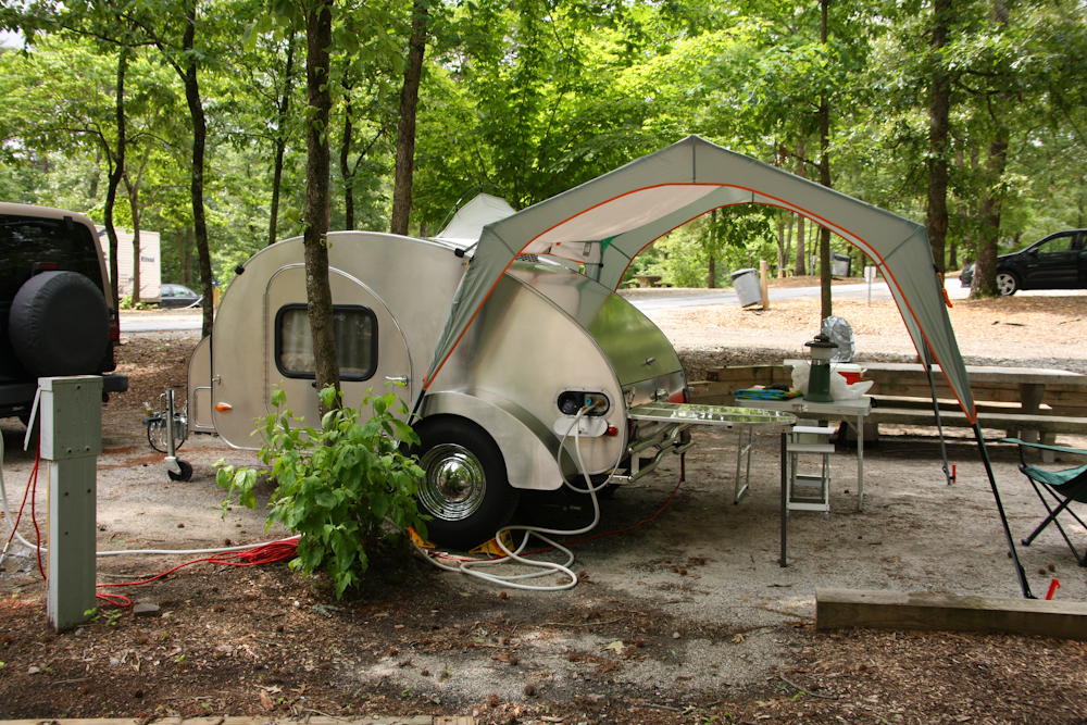
This is a very efficient
retro-design trailer. There is a cooking compartment at the rear
of the trailer with sleeping quarters behind the door.
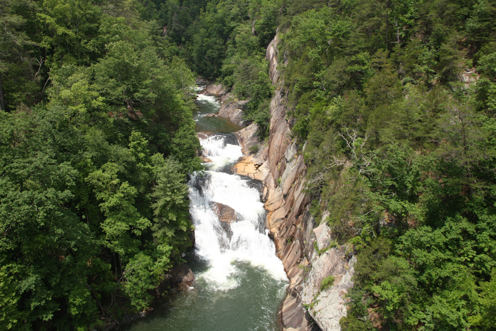
There was a substantial hike
required to get to the view points and then the bottom of the
gorge. Above is a shot of one of the falls at Tallulah Gorge.
This set of falls is below the dam
and Georgia Power was releasing large amounts of water
downstream. The flow was about twice the normal flow and they do
this several times per year to maintain health of the stream below the
dam.
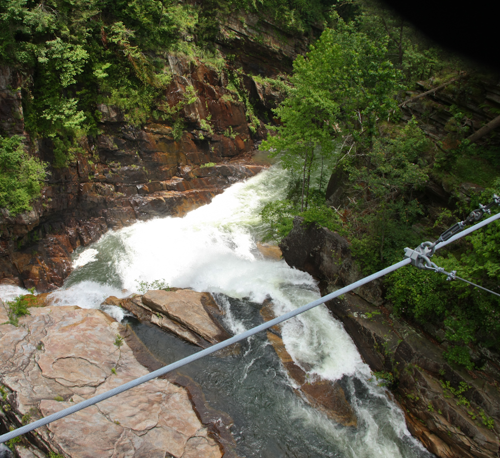
We hiked to the bottom of the
gorge to the suspension bridge over the river. From the bridge,
we could see another smaller falls just down stream.
From the gorge, we headed through
several small towns that were hosting the Warrior Dash. There
were tons of folks participating and lots of muddy feet were walking
the street. The Dash is a cross between a 5K and an obstacle
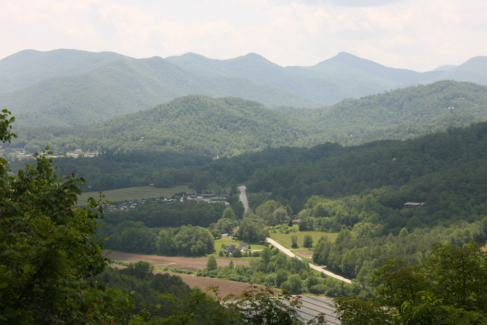
course. From the Dash, we headed to Sky Valley to stay at a
buddy's mountain cabin. The view from the deck of the cabin is
shown above.
We stayed at the cabin for 2
nights; the place as awesome. Thanks Trey!! When we left
the cabin, we were told that we should go to Highland, NC so we headed
that way. En route, we passed some really nice places on private
lakes.
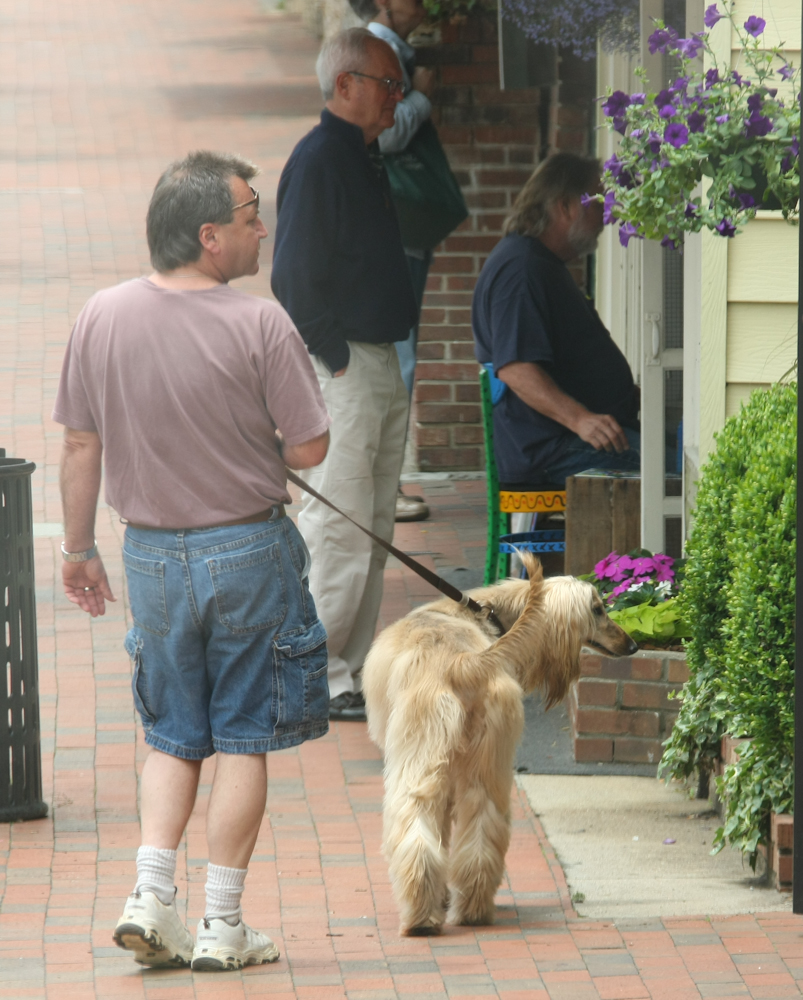
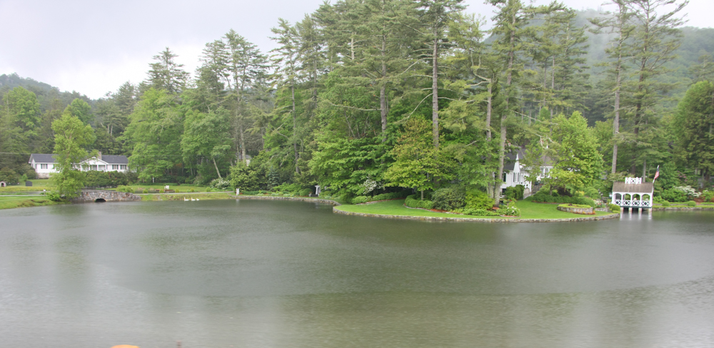
Highland is a high-class place,
not unlike La Jolla, CA but in the mountains. We saw plenty of
interesting folks there and had lunch at a local supermarket-wine
store-cafe. On our departure, we spotted this fellow walking his
Afghan hound on the sidewalk.
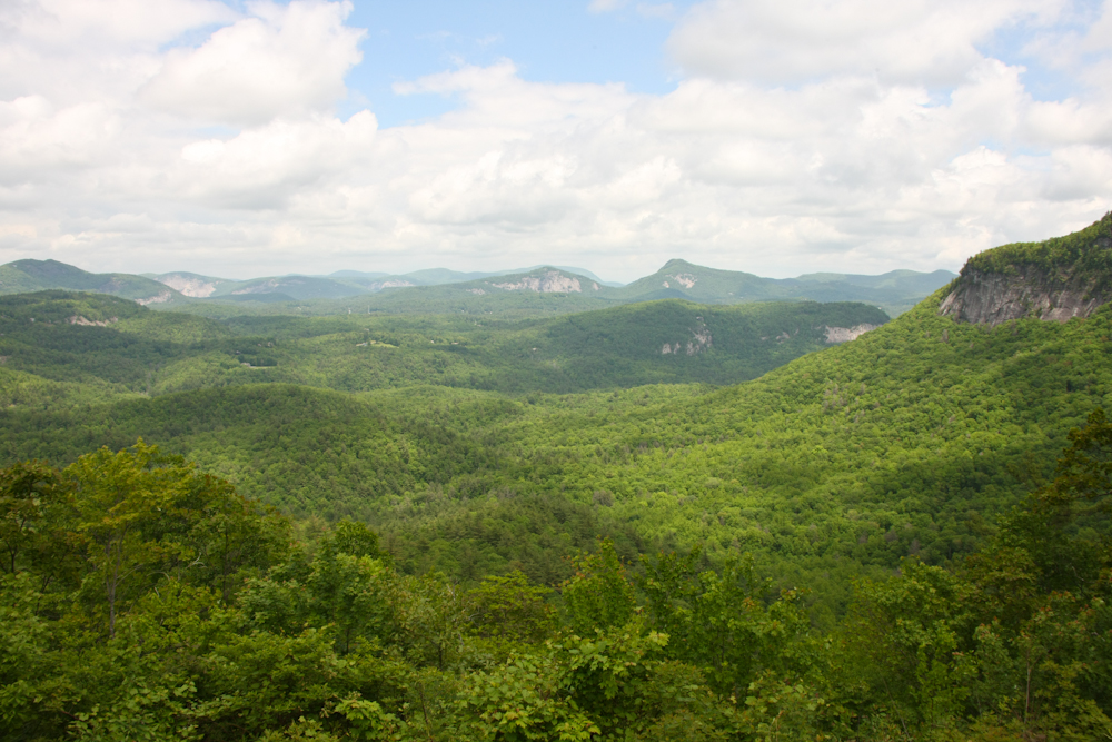
East from Highland, we went over a
mountain pass that was nearly 5,000 feet. At the top of the pass
there was a pull-out that provided a breath taking view of the valley
below.
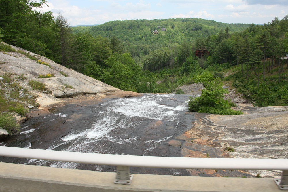
Along our route, we passed several
creeks that flowed over smooth rock faces producing nice waterfalls.
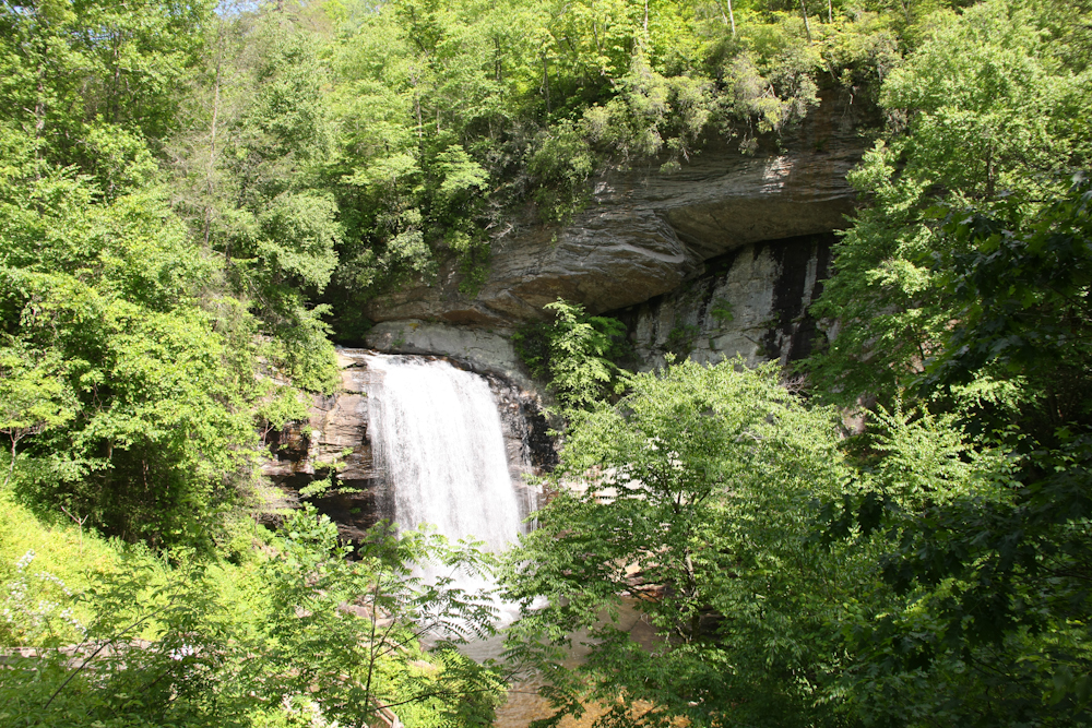
We followed the highway east until
we intersected a road that provided access to the Blue Ridge
Parkway. On the access route, we passed a very nice waterfall
right on the side of the road.
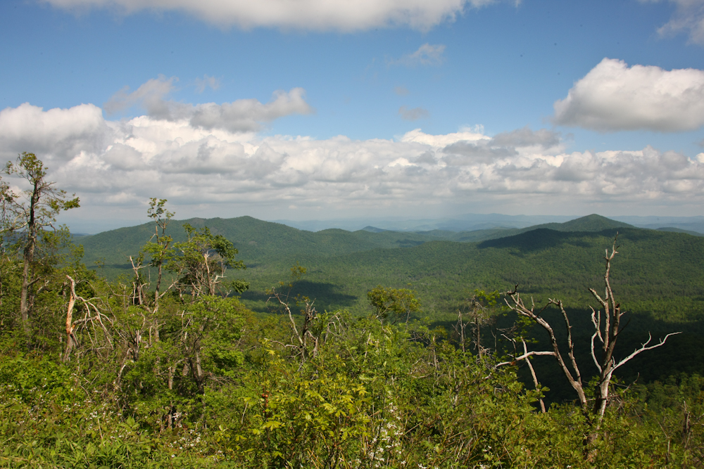
Several view points on the Blue
Ridge Parkway provide great views of the piedmont areas to our
east. The section of the parkway that we traveled was over 4500
feet in altitude, so it was much cooler than the lowlands. We
also found out that a landslide had closed the parkway to the north of
our position, but luckily, there was a side route that we could take
without requiring a back-track.
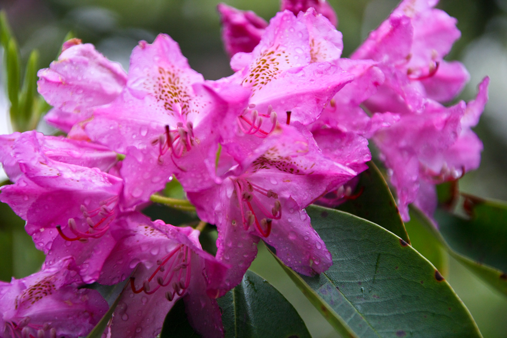
We stayed at a National Park
Service campground right off the parkway at Mt. Pisgah. It rained
on and off all night and was quite chilly due to the altitude.
Next morning, after the rain cleared, I found this rhododendron bush in
bloom close to our camp.
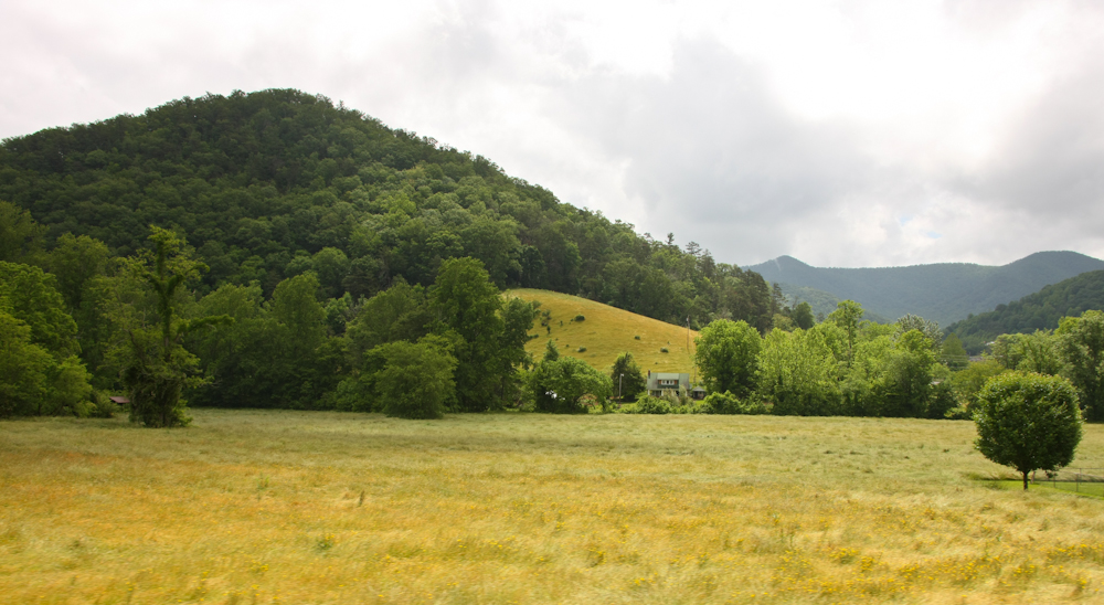
We were forced to take the detour
route to avoid the landslide area. Once we were back in the
valley, we passed nice pastures along the road.
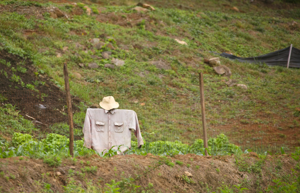
I have not seen a scarecrow for
many years. We spotted this one in a garden near the road.
We traveled on to another NC state
park that was right on Lake Norman. This lake is quite large and
a lot of the shoreline is privately owned. There were plenty of
slum houses on the water's edge.
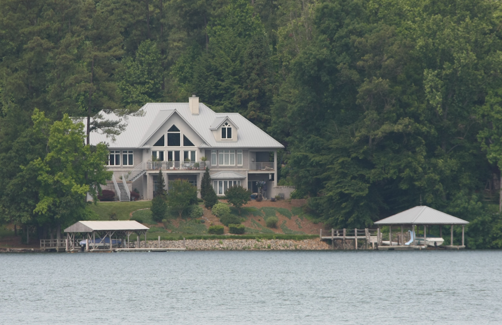
In addition to being a very nice
place, this shack has twin boat docks and piers. Not too shabby!
The park at Lake Norman was clean
and well maintained. We had a great night and then headed into
Chapel Hill the next day to visit our friends Scott and Heather.
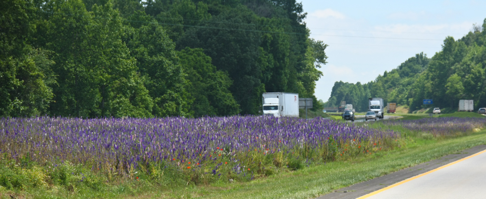
From I-40 we saw plenty of flowers in bloom.
| Previous Adventure | ||
| Trip Home Page |
Photos and Text
Copyright Bill Caid 2010, all rights reserved.
For your enjoyment only, not for commercial use.