Trip Report 20100103
For years, I had heard about a very large train trestle in far eastern San Diego county. Both Kathleen and I are train buffs, so I researched the situation on the web and was intrigued by what I saw. A trip to view the trestle would entail nearly 20 miles of travel on our mountain bikes, 150 miles of asphalt and the better portion of an entire day, end to end. The Goat Canyon trestle is a sight to behold and was well worth the effort.
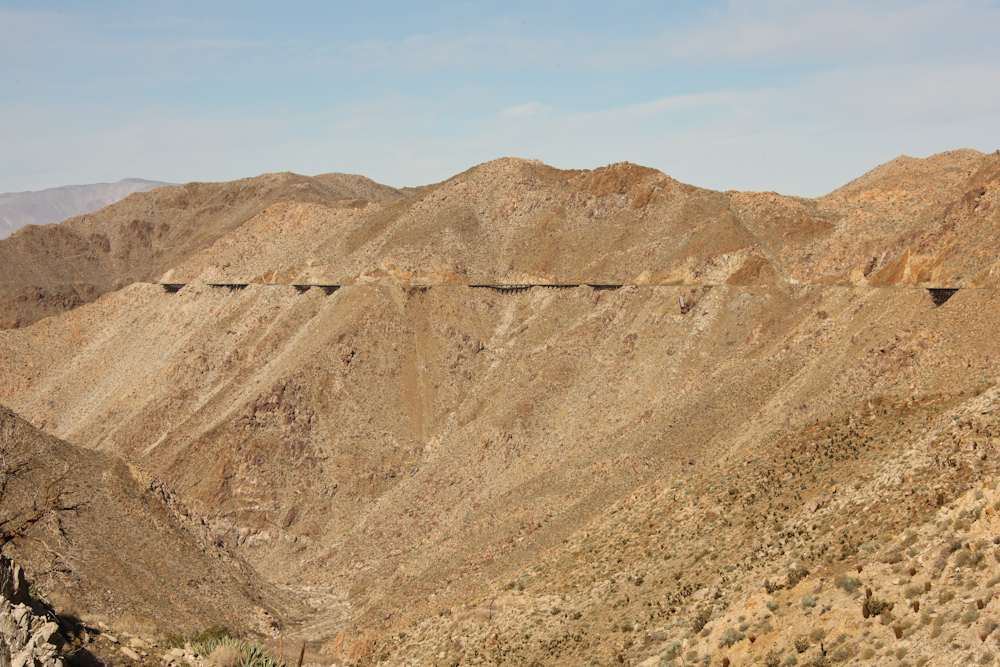
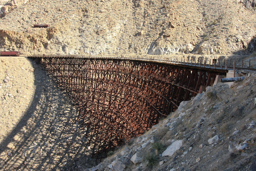
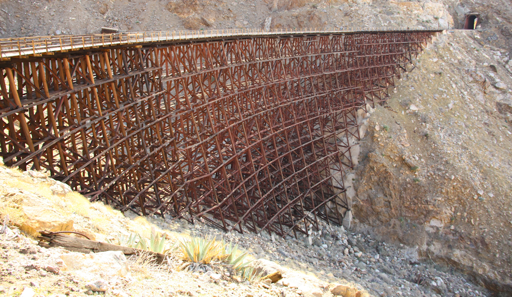
The history of the San Diego and Arizona railway is deep and plentiful and the details associated with it will not be repeated here. Many accounts can be found on the San Diego Railway Museum's web site's page dedicated to this subject. The Goat Canyon Trestle was started in 1932 when an earthquake collapsed one of the tunnels on the SD&AE's route between Jacumba, CA and Ocotillo, CA. The whole route had been problematic from the outset and was originally dubbed the "impossible railroad" due to the many engineering challenges that were encountered during the planning and construction of the railway. The railroad was completed in 1919 and goes from an elevation of about 2800 feet at Jacumba to 400 feet at Ocotillo. The path goes through the rugged Carrizo Gorge and the path includes 17 tunnels, including one 1/2 mile in length, and many trestles to cross the lateral canyons. The Goat Canyon trestle was constructed as a result of a landslide that collapsed one of the longer tunnels and required the development of an alternate route for the tracks. The resulting trestle is a curved bridge that is over 600 feet long and 180 feet high in the center of the span.
The photos below are what we saw.
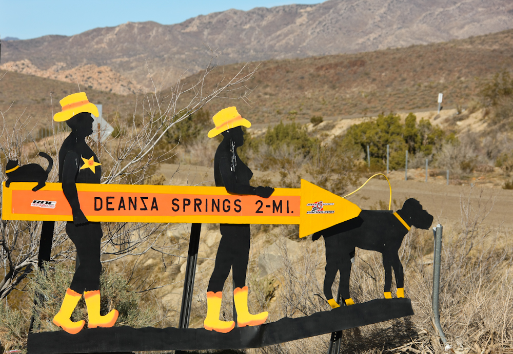
Our trip to the trestle started in Jacumba. From the fuel stop, we spotted the sign for the De Anza Springs resort, a "clothing optional" camp on our path to the trestle. Bird droppings notwithstanding, a close inspection will reveal the anatomical correctness of the sign.
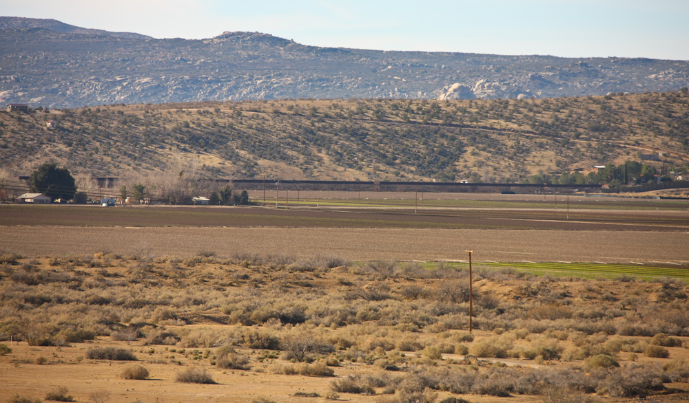
Looking south from the fuel stop in Jacumba, you can see the new border fence. In the photo above, the fence is the dark line in the center of the photo. Like it or not, the fence is there to stay and I think that is a good thing. Camping just to the east of Jacumba in the Valley of the Moon, we have had many border-hoppers come through our camp attempting to make the illegal crossing undetected. My position on this is simple: border sovereignty is unrelated to immigration policy. End of argument.
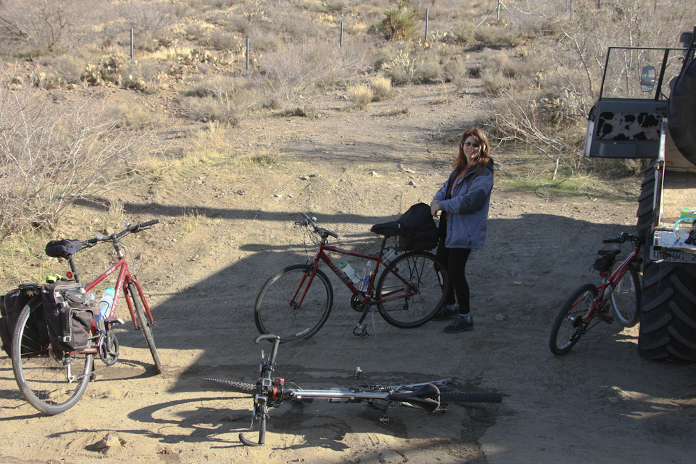
It was quite chilly in the early morning. We completed our trip from San Diego and were on site and ready to go while the shadows were still long.
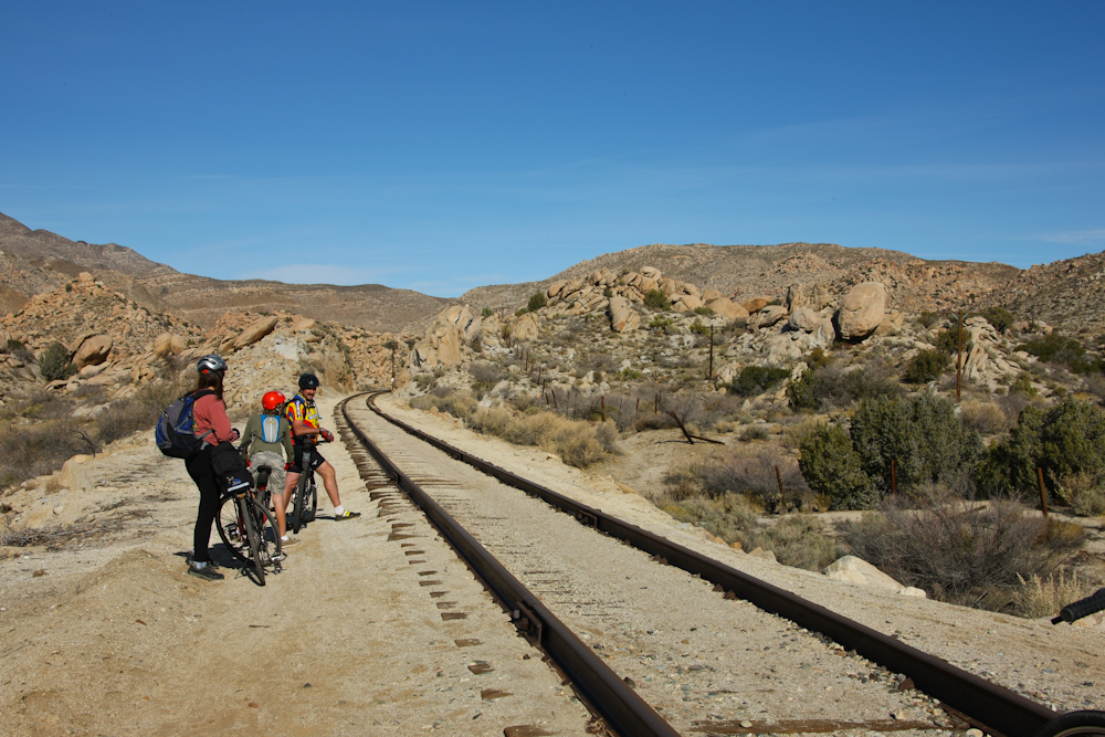
At the northern end of the trip, you can see one of the first cuts that takes the road bed through the hills.
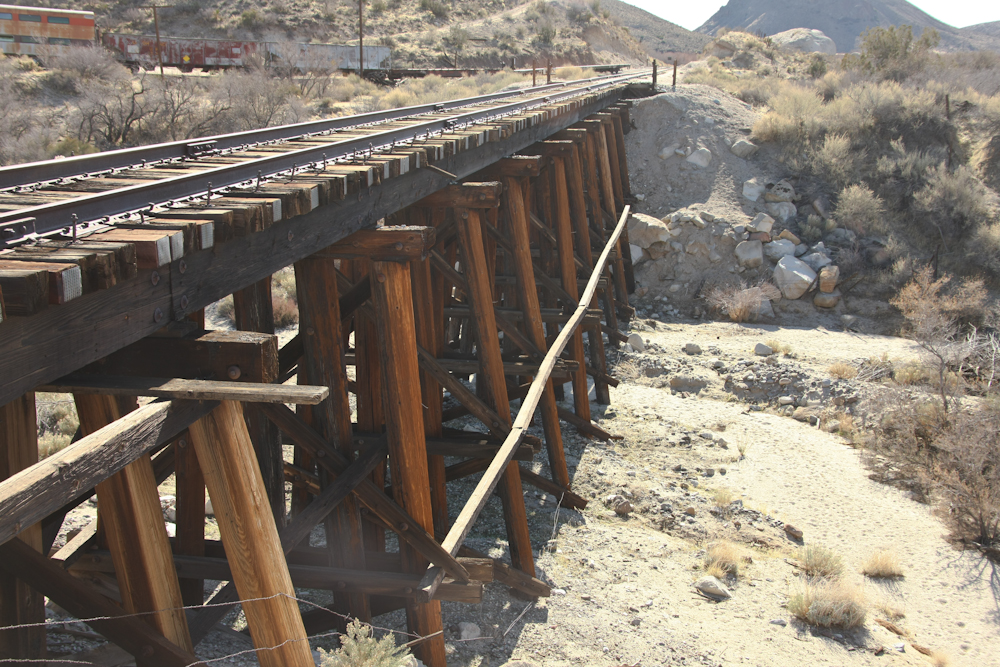
We would cross over a number of bridges. Some had catwalks on the side, others required you to step (or ride) carefully between the rails. The bridge above spanned a shallow wash and had about 50% of the surface ties replaced.
The first tunnel passes through a low ridge.
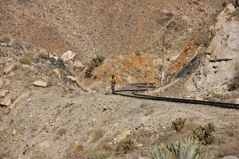
As we got deeper into the rugged canyon, the scope of the engineering challenge that was faced by the construction crews became visible. Note that in the photo above, the bridge spanned a lateral canyon of the main gorge.
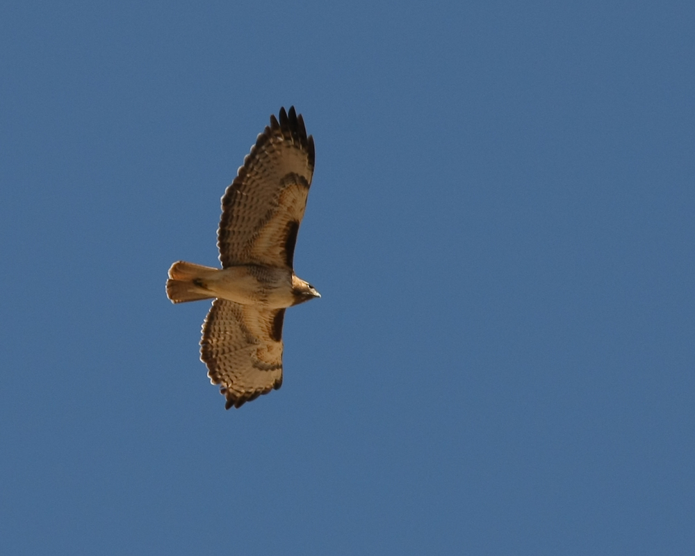
We did not see much wildlife, but we did see several Red Tail Hawks. The sun shining on the trailing edge of the wing feathers provided an interesting effect.
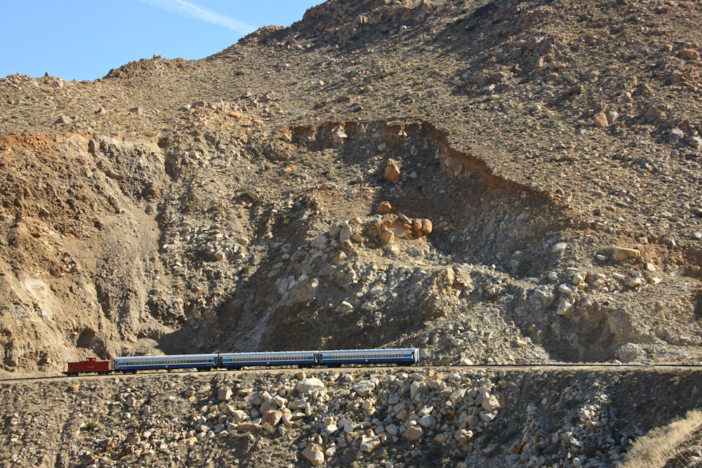
Some miles into the trip, we came upon this set of passenger cars and caboose. But the real story in the photo above is the landslide that is brewing above the tracks. These mountains are historically very unstable and the area is only a few miles from the seismically active San Andreas fault. Frequent earthquakes only add to the instability problem.

A number of the tunnels have recently been rebuilt with modern materials and concrete.
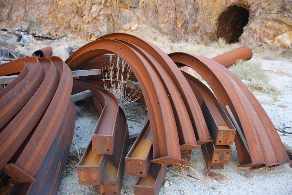
These shoring beams were used to support the roof of the tunnels. I am guessing that these were excess since the construction appeared to be complete. Note the old tunnel in the photo above.
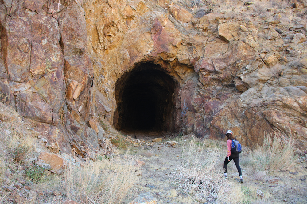
This was one of the old tunnels that had collapsed due to seismic activity. The entire path was blocked a short distance from the mouth of the tunnel.
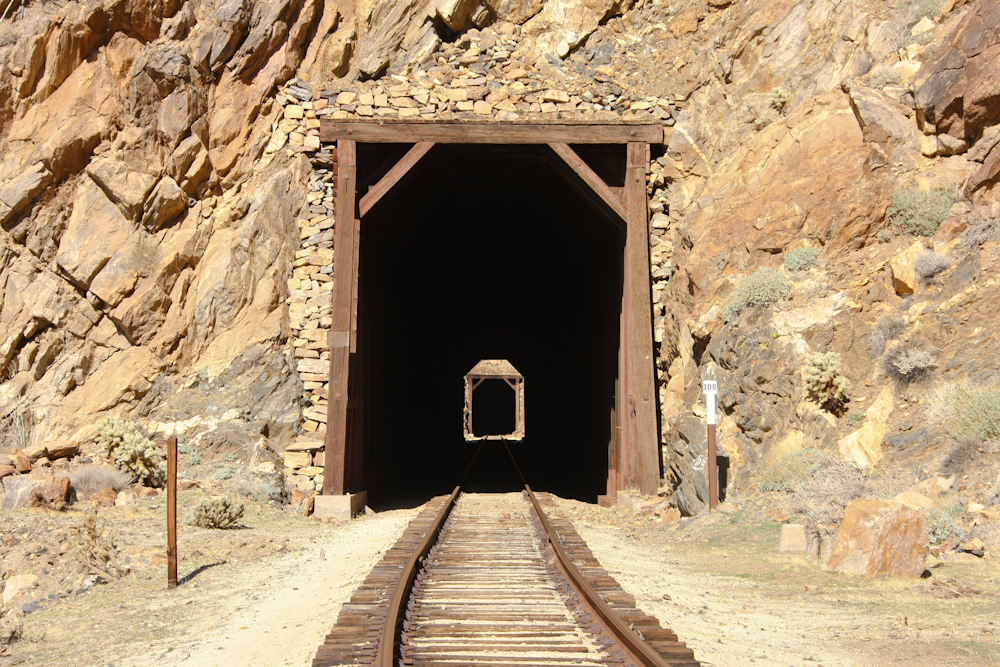
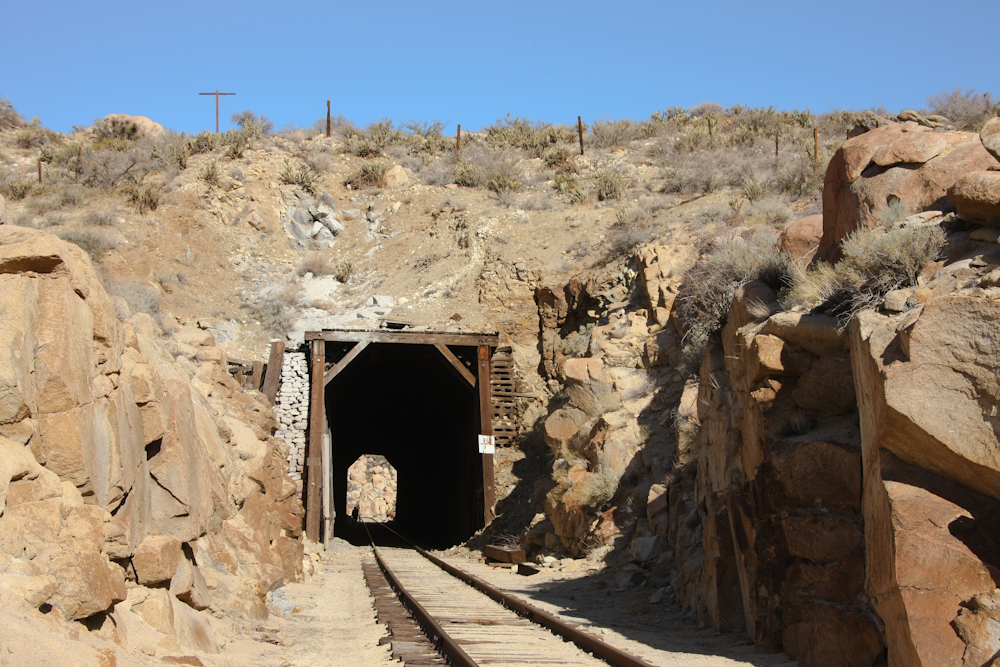
Some tunnels were short, others long. Above, you can see the entrances to 2 tunnels at once as well as the mile marker.
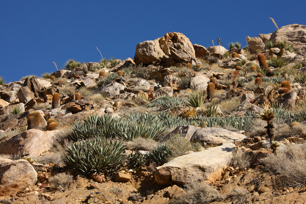
The path along the trucks provided nice views of the desert vegetation including yuccas, cholla, agaves, and barrel cactus.
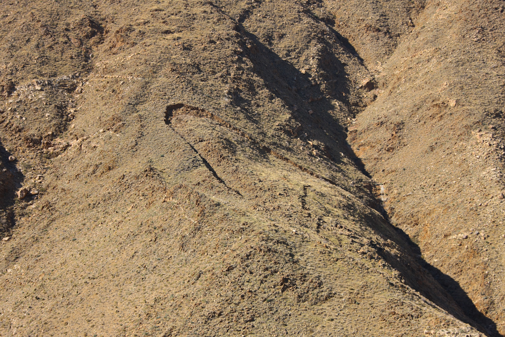
Across Carrizo Gorge from the tracks, a large slumpage could be seen. One good rain or medium size quake and this area is headin' south!
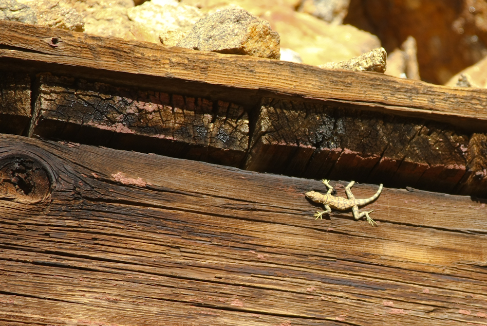
I spotted a small lizard on the top of one of the tunnel mouths.
This fellow is on his way up from the desert floor several thousand feet in elevation below.
Look carefully at the photo above. Note that there are many brides on the lateral canyons, but note further that there are several railroad cars that have fallen from the tracks and are stuck on the cliff face. Cars were visible at a number of points on our route. Truth be told, I did not notice these cars until I uploaded the photos from the camera.

This is the uphill end of the tunnel that collapsed resulting in the construction of the Goat Canyon trestle. Note that the track does not go through the tunnel.
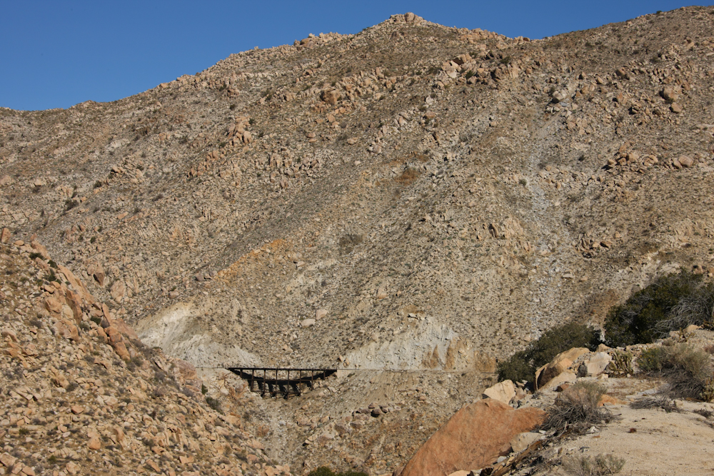
Our first view of the trestle was coming out of a short tunnel. To be able to get a reasonable shot of the bridge, I had to risk life and limb by following a path along the side of the cliff. Look carefully and you will see that there are 2 folks near the center of the span. The railroad tank car on the hill above was placed to provide water in case of fire. See the San Diego Railroad Museum's drawing of the fire control system.
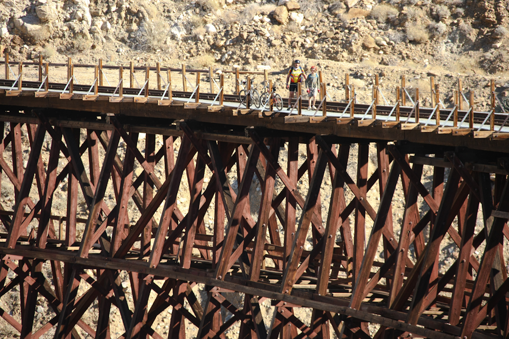
Kai and Parker on the bridge.
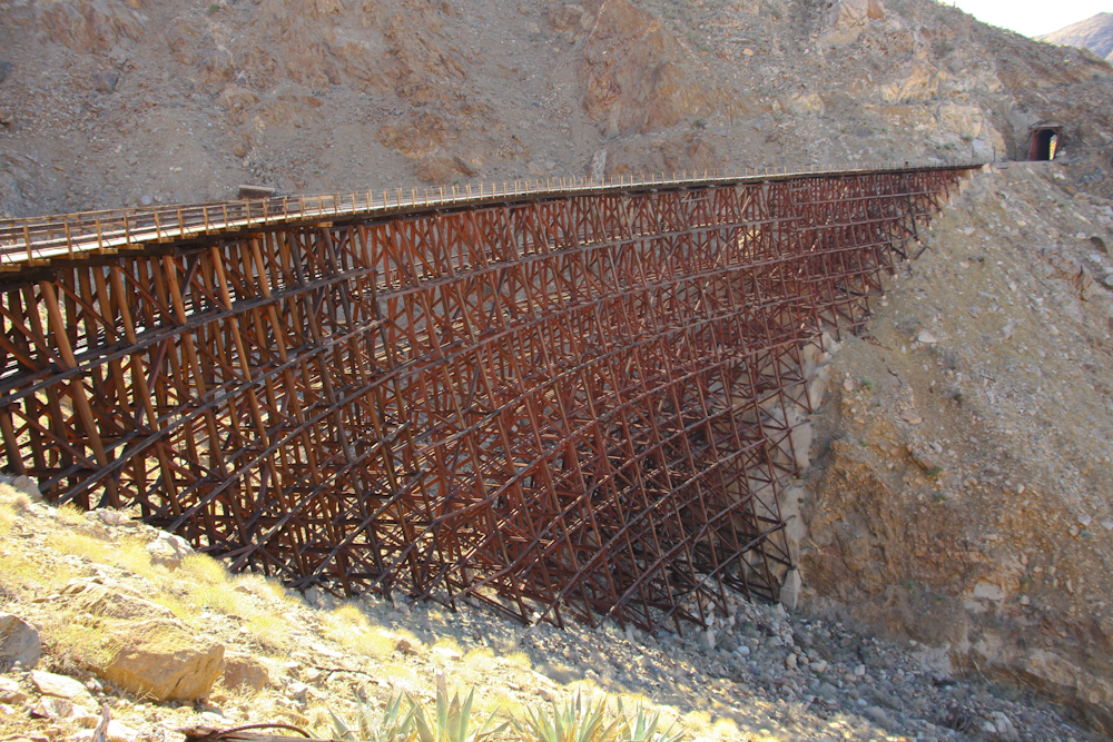
A view of the bridge from the east end. Look carefully and you can see the tunnel portal that was destroyed just above the bridge railings near the center of the span.
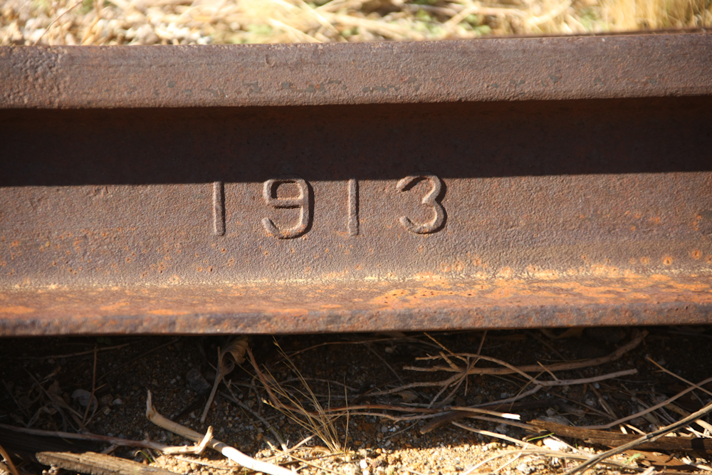
The manufacturing date was stamped into most of the rail used in the construction of the line.
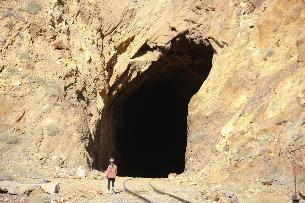
We came out of a tunnel to get to the trestle and the line went right back underground. Above, Kathleen walks over to inspect the mouth of the tunnel. Note that portions of the roof of the tunnel have collapsed leaving an odd shape. This rock is quite unstable and I am surprised that construction team did not use any rock bolts to prevent the roof from collapsing.
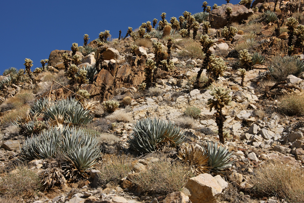
The slopes above the bridge had nice stands of agave and cholla. Although, I am not sure that "nice" and "cholla" can be said in the same context.
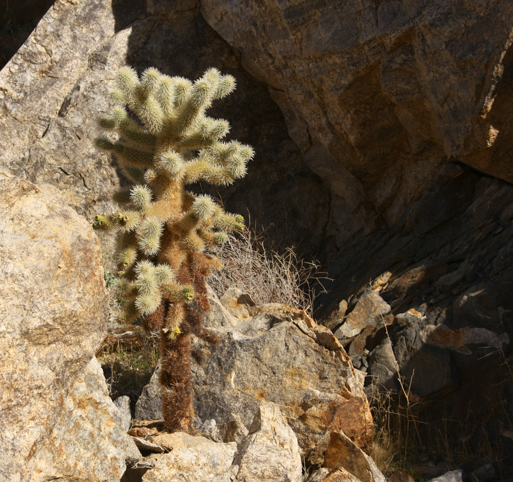
This particular cholla bush looked reasonable healthy. Cholla -- bane of the desert.
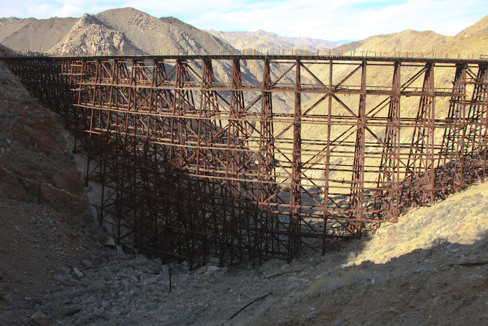
I hiked to the south side of the bridge to check out the damaged tunnel mouth and was presented an alternate view of the trestle. This is an impressive structure!!
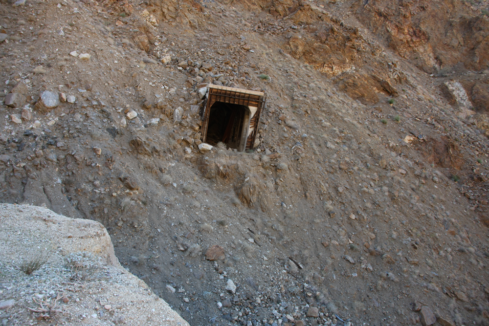
An earthquake in 1932 caused a massive landslide that shifted the entire side of the mountain. The tunnel was destroyed in the process.
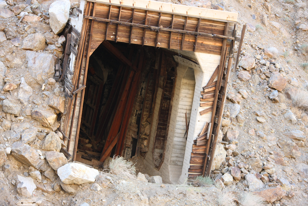
The concrete and steel mouth of the tunnel survived intact, but the ground underneath it shifted, breaking the tunnel like a matchstick.
A parting view of the Goat Canyon trestle.
From the bridge, we returned to the staging area along Interstate 8. The trip was almost exactly 16 miles along the tracks and took about 5 hours total including many stops for photos and general sightseeing. If you go on your mountain bike, be sure to bring extra tubes, a pump and a headlamp for the tunnels. Due to the proximity of the desert floor, the winds in this area can be very strong. Check the weather before your departure as you may want to reschedule if a Santa Ana is in the forecast.