Trip Report: November 11-14, 2004
Quick link to start of daily log and photos Day 1: 11-11-2004 Crossing Border to Camp Gumbo
Here is the recipe for adventure in the Altar Desert:
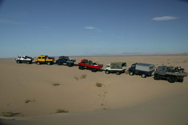
- 70,000 pounds German steel (in the form of 7 Mercedes Unimog trucks)
- 2,000 pounds of Japanese steel (in the form of high power quads and motorcycles)
- 17 adventure starved adults
- 3 gallons Cajun gumbo
- 20 New York steaks
- 8 kilos large gulf shrimp
- 20 dozen clams
To prepare, take ingredients, douse liberally with diesel, gasoline and alcohol. Mix with 300 square miles of trackless desert. Add large quantities of wind-blown sand. Shake (not stir) with a vigorous pounding in northern Sonoran "tundra". Bake in the desert sun daily for 4 days, letting mixture cool at night. Garnish with 8 large de-beaded 20" tires and top with serious knee injuries.
Mixture serves 17.
The general plan was to pick a point off the map and then use the GPS to help us navigate to the waypoint. This point was "the cross" and is shown in the GPS Waypoint table below. From there, we were to head to El Gulfo in Sonora for supplies and then return via dunes to Cesar's and then to the boarder.
Once in El Gulfo, we would refuel, re-ice and buy camarones (shrimp), almejas (clams) and then head back to the dunes to find a camping spot. See the satellite photos and maps lower on this page.
Like any trip to a foreign country, substantial pre-planning was required. To do such a trip required detailed knowledge of what conditions were expected as well as research on issues beyond just road conditions. To prepare for this trip, we utilized experience gained from previous trips, tide charts, satellite photos, Mexican maps as well as other intelligence gathered from the local four wheel clubs.
To insure the success of a major expedition in a foreign country, it is absolutely essential that the proper team of vehicles and operators was assembled. Of key importance was vehicle reliability. The size of the Altar dunes basically precludes the ability to tow a truck as dead weight. While theoretically possible, the time required to complete the winching make recovery a practical impossibility. Therefore, special attention was given to mechanical preparations prior to the trip. And, in general, this paid off in a relatively trouble-free trip, some tire issues and several injuries notwithstanding.
Back row left to right are: Dan Johnson (Indiana), David Lopez (New Mexico), Dick Lane (Arizona), Jose Aizcorbe (Celaya, Mexico), Mark Mitchell (San Diego), Matt Oliphant (La Cresenta), Erin (Chicago), Rob Pickering (Colorado), Kathleen Jones (San Diego), Jason Clark (San Diego), Nancy Pistole (La Cresenta).
In the front row, left to right: Mike Nayoski (San Diego), Roberto Espinoza (Celaya, Mexico), Kai Serrano (San Diego), Russell Mitchell (San Diego), Dave Clark (San Diego).
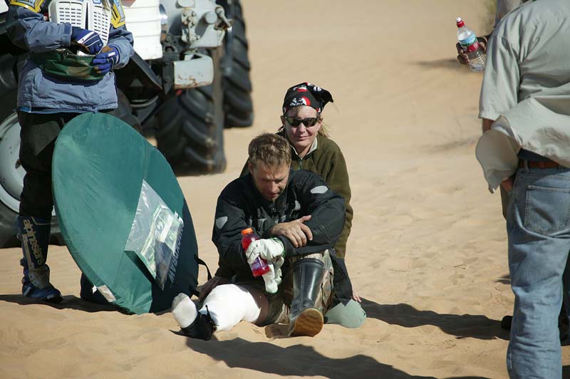
Missing from the photo is Bill Caid (San Diego) who was the photographer and Jay Couch who was drugged and passed out in Pickering's DOKA due to his knee injury.
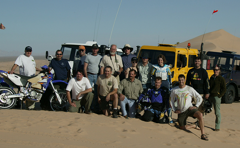
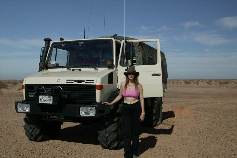
Below, is Kathleen Jones (San Diego), the resident self-appointed "trail dominatrix" with Caid's 1300L.
All drivers had substantial experience in hard-core off-roading. Most had completed the Rubicon and the hardest trails in Moab. Additionally, Caid, Serrano, Johnson and Mitchell had previously successfully done the high dunes of the Altar Desert in 2003 and lived to tell about it. However, the balance of the group were "Altar Virgins".
In Figure 1, San Diego bay is just below the top edge on the left. The large lake is the Salton Sea. Farmed areas are shown in red. The road in Mexico that parallels the border can be seen. Refer to the map below for reference.
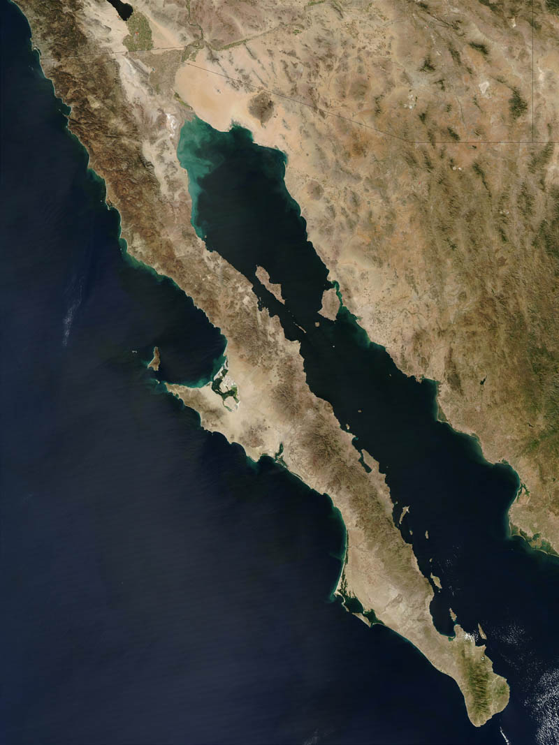
Figure 1. Satellite Photo of Baja and Northwest Sonora, Mexico.
In Figure 2, the large dunes are evident and can be seen as forming a set that roughly parallel the coast to the south. The destination was El Gulfo de Santa Clara, and this is due east of the end of the largest "gray colored" island at the mouth of the Colorado River.
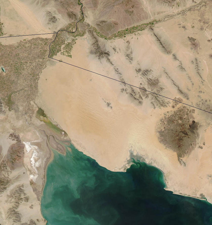
Figure 2. Zoom Photograph of Area of Interest.

Figure 3. Map of the Northern Portion of the Trip.
Figure 4. below shows the southern portion of the trip. Click on the map to get a full resolution view. This is a 300kb file, so if you have a phone modem, this will take a while to load. The parallel lines are 10km marks, so distances can be estimated from them.

Figure 4. Map of the Southern Portion of the Trip.
On this trip, unlike the last time, I got a good estimate of mileage. The total dune travel was 160 miles. Total fuel usage for my 1300 was about 1 1/2 tank or about 55 gallons border to border. Remarkably, and unlike previous trips, there was diesel in El Gulfo. On the two previous trips, El Gulfo was out of diesel so I counted myself as lucky. Figure 5 below shows an overlay of our waypoints on the satellite photo. This figure has waypoints from several trips, but this will give you an idea of the area that was traversed by the team. In the top right of the photo is the global view of Baja for a better perspective.
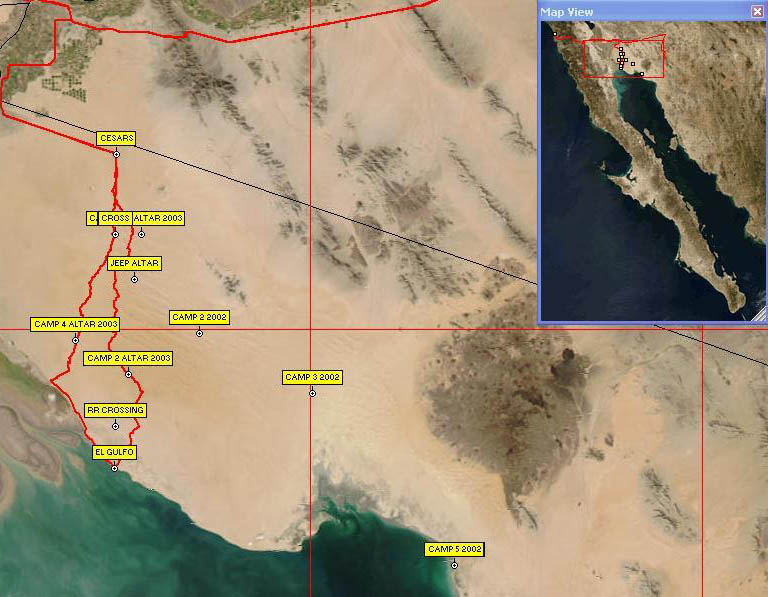
Figure 5. Ozi Explorer overlay of waypoints on satellite photo
El Gulfo is a very small town; this is primarily a fishing village, but does cater to tourists, particularly Gringos around Thanksgiving, Christmas and New Years. There is a Pemex station, and it probably has gas. I say probably, because in Mexico, if the fuel truck does not show up for what ever reason, then there will be no gas or diesel. There is a store and ice is available along with plenty of fresh fish, shrimp, clams and sometimes other shellfish. Water is in short supply, but can be purchased at the town OXXO store. There are several RV parks in town and several "hotels". The quotes are used here since one of the selling features of the hotel is that it has indoor plumbing.
The locals make their living fishing, and good seafood is available at all times. The best restaurant in town is the El Delfin and has excellent food although modest accommodations (they did, however, have hot water in the washroom).
Firearms are prohibited in Mexico. Handguns, in particular, are frowned upon. If you are caught with one in your possession, you will go directly to jail. There is a very high likelihood that you will be unable to "buy" your way out of the situation no matter how much money you have with you, so this situation is better avoided. While lack of a firearm in the wilderness will place you at somewhat of a disadvantage should trouble arise, the penalty for possession is so harsh that it is not worth the risk. The proposed area of operations is known to be used by drug smugglers. However, the open desert crossing is not the preferred route, so the chance of encountering anyone is nil. But, the Mexican Army does patrol both the north end and the sea-side of the desert and if they stop you, they will most likely do a thorough search of the vehicle. They pose no threat to honest Gringos that do not break the laws of their country.