199709
One of the great trips in the American west is going down the Colorado River through the Grand Canyon. Typically, this trip is run by corporate river runners who operate under permit from the National Park Service (NPS). And, typically, these trips are booked years in advance due to the popularity of the event. We were lucky in that we did not have to wait years, but rather weeks. Kathleen and I arranged the trip through Western River Expeditions (a group that we had previously used for an expedition down the upper Colorado out of Moab, UT).
Trips down the main Colorado are a big deal for a number of reasons. First, it is a long trip. Using a motorized assist on big "J rig" rafts, it still takes a week to get from the put in point at Lee's Ferry in far northern Arizona to any reasonable pull-out point. If you go with an outfitter that uses paddle boats, the trip can take 2 weeks and sometimes longer depending on the current and specific pull-out point chosen (there are only a few). Second, there are no intermediate exits of consequence. You could potentially walk out about half way, but that would require you to hike out of the Grand Canyon. While possible, that would be a nearly 6,000 vertical foot ascent that would tax an Army Ranger. Particularly since you would have to take your stuff with you. Third is the simple logistical fact that everything has to be brought with you -- food, water, etc. And everything has to be brought out -- trash, human waste, etc.It is possible to do this trip on your own (without a corporate outfitter), but the NPS carefully regulates these private trips. Finally, there is the safety issue. There are deaths reasonably frequently. If you fall out of the raft in a big rapid, you will be in mortal danger. Depending on the water flow being released from the Glen Canyon dam, the rapids will run from big to nearly unrunnable. And the water is very, very cold -- 45 degrees, plus or minus a bit. You will not survive in that temperature water for long. The temperature of the water is a result of being downstream of the dam. The water is that temperature all year long sustaining trout and other non-native species of fish in the river. For this trip, we elected to go just after Labor Day. The logic was that the weather would be as hot as it was going to get and it would be past the monsoon season. This reasoning generally worked, but we still did get cloudy days and rain on several occasions. It was hot -- about 120 degrees on the canyon floor. However, when on the raft, the air temperature was about 65 degrees due to the cooling action of the icy water. A very interesting contrast.
The photos below are scans of chemical photos that I took while on the river. These were taken with a Nikon N90 camera. Enjoy.
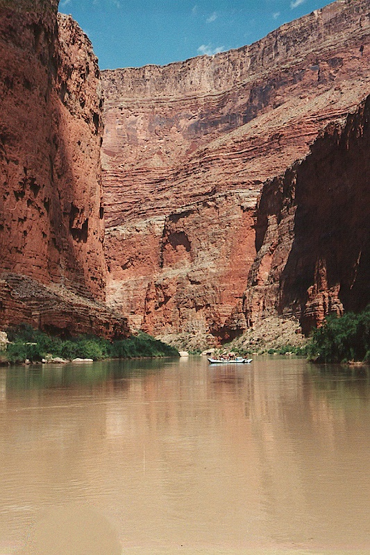
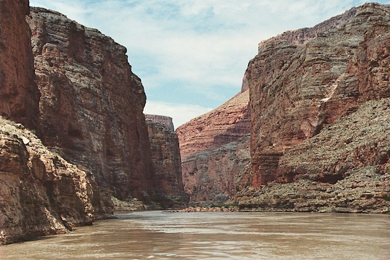
This shot was taken in Marble Canyon shortly downstream from the put-in point of Lee's Ferry. Visible is one of the Western River Expedition's "J rig" rafts. Note the high, vertical walls of Marble Canyon. Once you are in, you are in for the duration. There is no escape from the canyon.
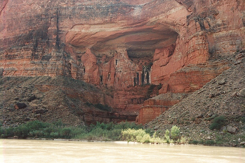
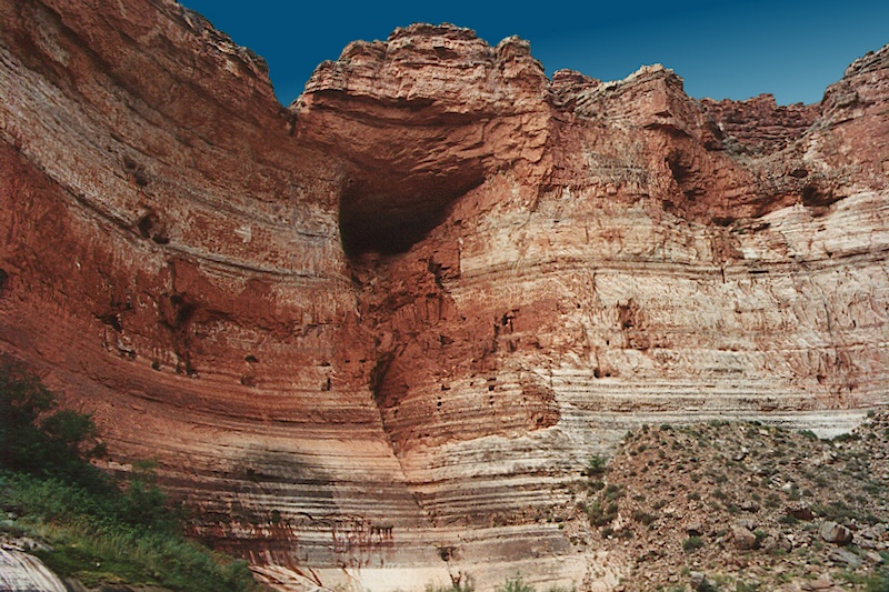
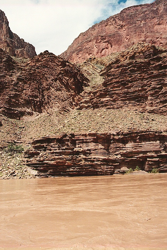
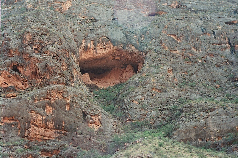
One of the many, many alcoves that line the river cliffs. This is a moderate way downstream from Lee's ferry. Notice the scree and talus slopes that are formed from the rocks that spall off of the cliffs.
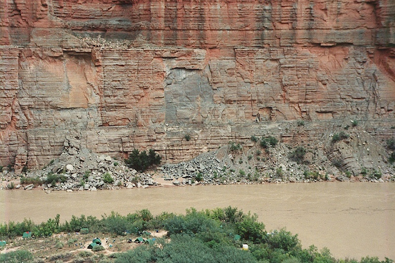
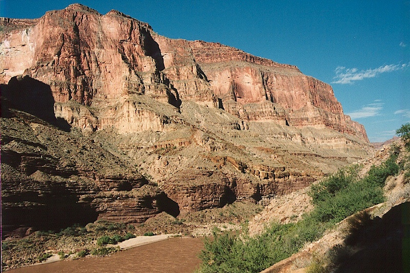
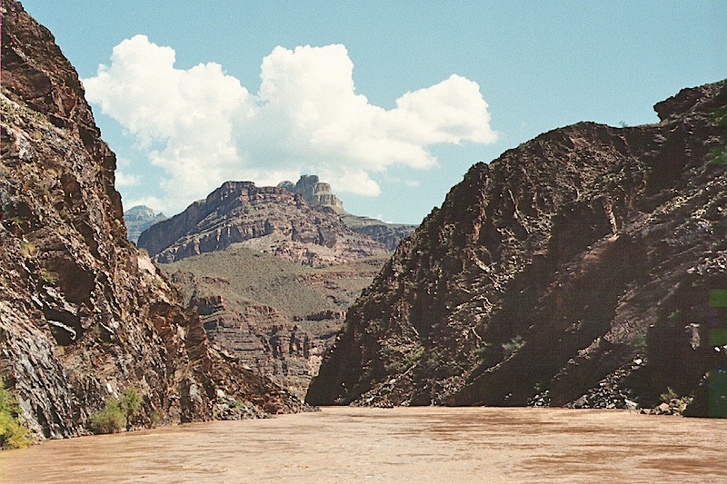
Vertical walls of the Marble Canyon river gorge. Note the talus and debris at the base of the cliff.
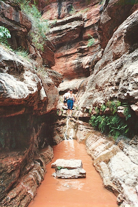
Kathleen exploring a side canyon during a rafting break. The water in the side canyons is MUCH warmer than the main river. The color of the water is due to suspended silt. The original settlers to this area used to say "the Colorado is too thick to drink, too thin to plow".
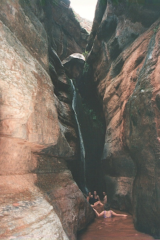
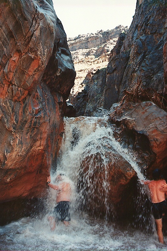
The group takes a swim in another side canyon with warmer water.
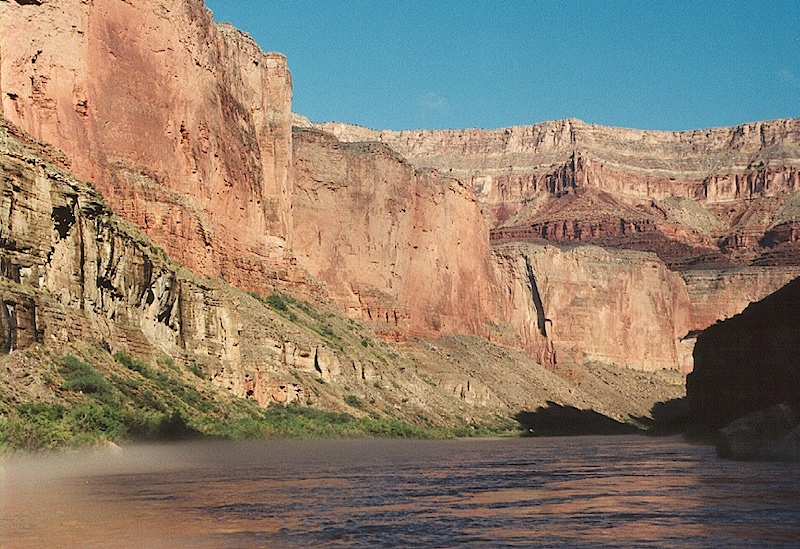
Early in the morning, the cold water temperature causes fog on the surface of the river. The water is so cold that it creates a microclimate.
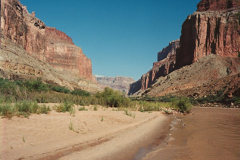
A nice sand beach in the sun. This shot is looking upstream.
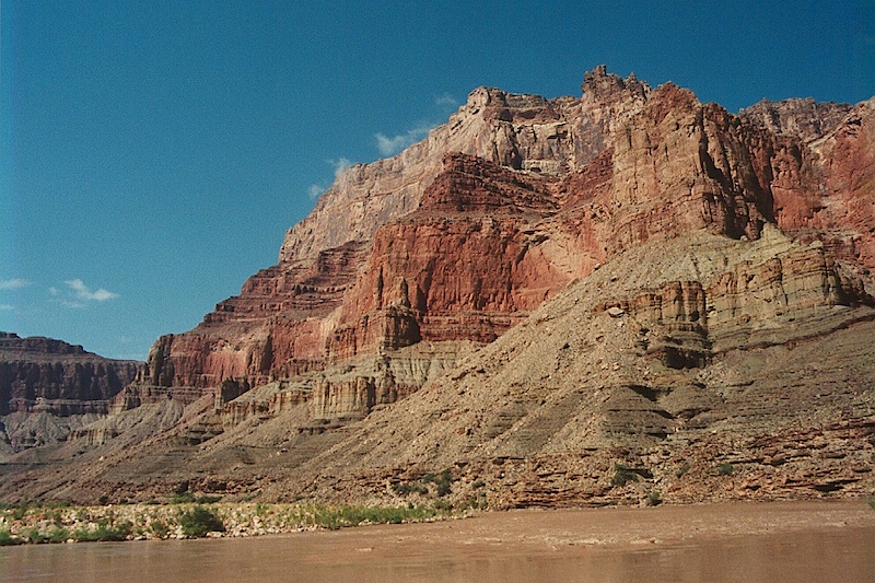
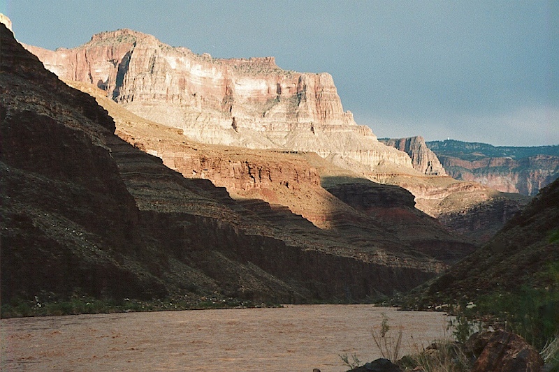
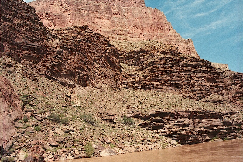
The high canyon walls make great vistas. Here the south facing cliffs are illuminated by the mid-day sun.
The entrance to a salt mine used by the indians who lived in the river bottom.
A view of a small rapids before any of the rafts went through.
One of the J boats in the thick of it. The holes in the rapid bent the boat in half several times. Notice the person on the rock. The water is so cold that when you get splashed in the face, it takes your breath away. The rapids were not as small as they looked once you were actually in them.
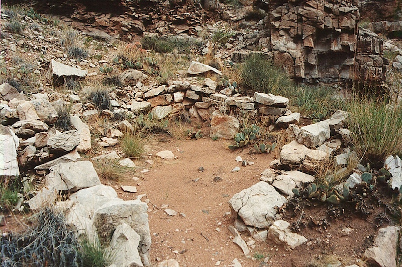
Remains of an Anasazi kiva on a ledge close to the river. I am sure that this was a hard life.
 .
.
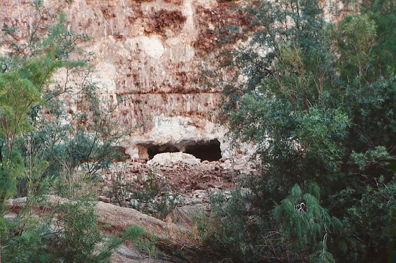
There were plenty of interesting alcoves hidden in the canyon walls.
One of the many springs that burst out of the canyon walls. This one has a name, but I cannot recall it.
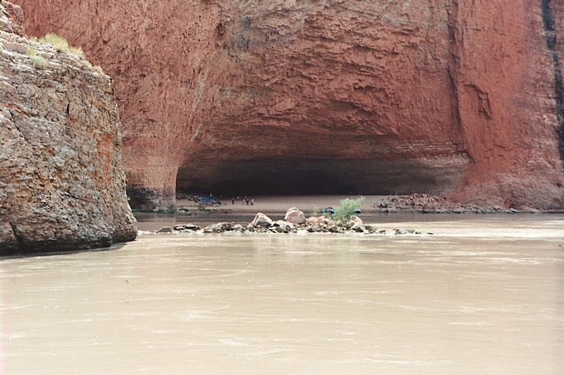
This is Redwall Cavern. This "cave" is really an eroded area in the canyon wall in the Redwall limestone. Notice the rock fall in the river. Also note the size of the cavern relative to the people on the left.
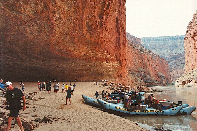
Another view of Redwall Cavern and the J rig rafts. This is a big cave. But a bad place to be in high water. However, since this whole area is downstream of Glen Canyon Dam, the river flow is highly controlled.
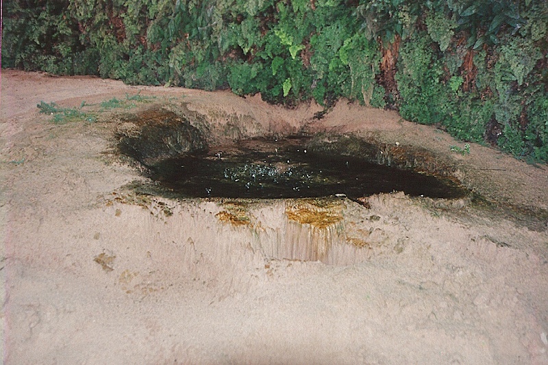
This was an interesting structure that we discovered in a seep. The water is coming from above, but there is some kind of life form in the sand that results in the interesting structure. The bubbles in the water are due to bacterial action.
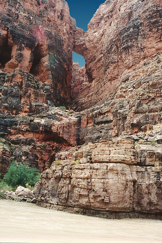
Several rock bridges were visible from the canyon floor. This one was framed by the clear blue sky. I think this is called the "Bridge of Sighs".
The white structure on the ridge line is called "Desert Tower" and is accessible by car from the south rim of the Grand Canyon. The view from there is awesome.
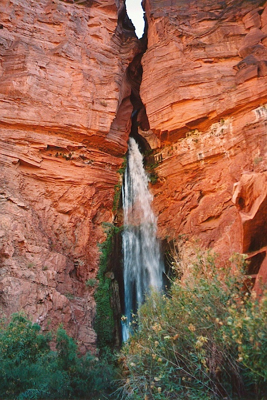
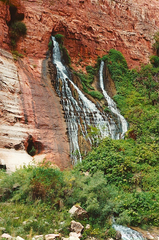
Water gushes out of a side canyon. This is Deer Springs.
.jpg)
The inner canyon is a true desert. Here is a baby sahauro cactus. The terrain is dry and rocky once you get away from the river's edge.
Once you get away from river level, the scope of the canyon becomes more apparent. Here, the blue sky and white clouds make a great backdrop for the red canyon walls.
.jpg)
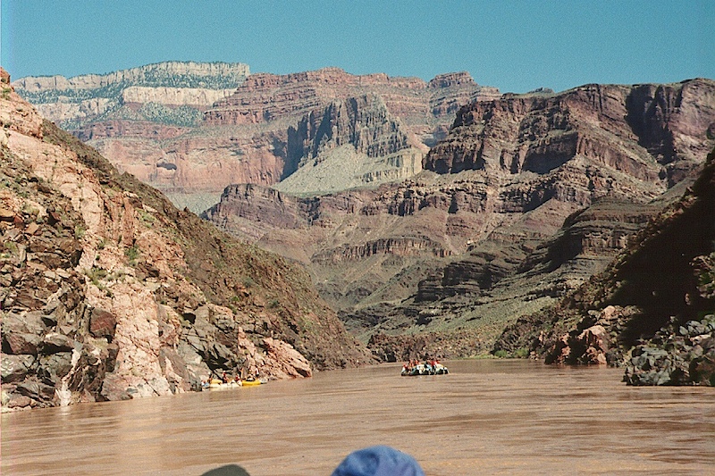
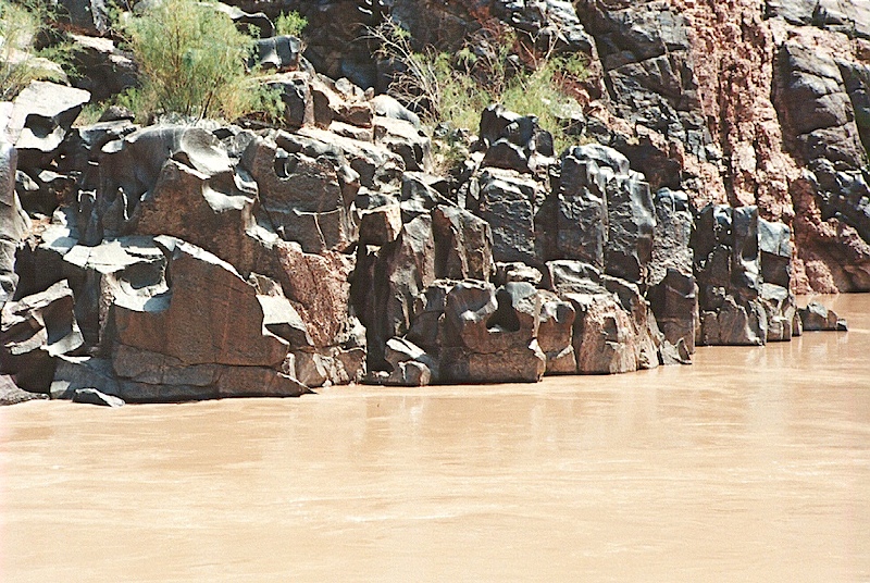
The other J rig in our party is visible underneath one of the canyon's great "temples". Here, we are in the "inner gorge" where the rock is metamorphic.
The Kaibab limestone formation is visible high on the canyon walls. It is the white band. Note the large white dike on the left. This is an intrusion of newer rock from below. Also note the yellow paddle boat on the left next to the dike.
.jpg)
We hiked above the river grade to get this shot looking west into the sun. Note the dark canyon walls of volcanic and metamorphic rock. Also note the narrow channel in the center of the frame. Not a good place to be in high water flows.
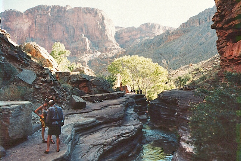
Our destination was the "headwaters" of a small waterfall. There were nice cottonwood trees here, visible in the center of the photo
 .
.
The lower end of the creek before it dumps into the main river.
Deeper into the inner canyon.
Notice the folds in the rock. These are at a fault. The canyon is crafted by faults and the action of water on those faults.
Look carefully at the rock just above the waterline. There are many "flutes" that are carved by the action of suspended solids in the water.
Another interesting fault system.
.jpg)
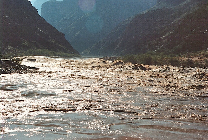
We were in calm water for quite awhile, but danger lurks ahead.
Big water is coming.
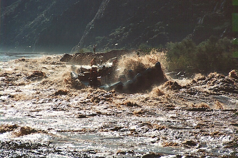
Just past Crystal Rapids. The gal in gray fell out of the raft in the thick of the rapids requiring the boatman to cut the motor, eliminating steering. We were afraid that she would get "propped" by the motor. We picked her up in the eddy downstream from the rapids and stopped long enough for her to get some warm, dry clothes on. That 42 degree water is pretty cold. The whole thing was really quit terrifying.
Flow stone on the rock.
After Crystal rapids, we beached at Havasupai canyon and took a hike upstream. Why I did not get photos of that is a mystery to me as it is one of the most photogenic places in the canyon. But, that was over 10 years ago (sad it took me that long to post the photos). The boatman told me a story that happened several weeks earlier to one of his trips where they suffered heavy rains and flash floods in the canyon. He said that the flood happened while the customers were in Havasupai canyon. They had to climb the walls of the canyon to escape the wall of water. They were stranded for several hours while the waters receded. Meanwhile, the rafts had broken their moorings and were drifting down river stranding the customers. Meanwhile, the second team of boatmen were in the middle of the river when the rains came. They said that boulders were crashing off the cliffs into the river like bombs. Everybody was terrified as there was no place to hide. The river was choked with large logs and debris that were being washed into the main channel from side streams. When the second crew arrived, the had to drop off their customers, race after the first set of rafts and bring them back upstream to pick up the customers. All in a day's work I guess when you are a boatman on the Colorado.
Once we left Havasupai, we traveled downriver and pulled out at Wentworth Canyon. The outfitters arranged for helicopters to take us to the north rim where we would be flown back to Page, AZ in a small plane. Again, I did not get photos, but I am not sure why.
This was a good trip. There were some scary moments, but otherwise it was very enjoyable. The food was good and the folks on the trip were nice as well. I am not sure that I would do it again as it does take more than a week all told. Plus, the water is cold; very cold. Despite air temperatures of 100+ degrees every day, the air in the center of the river is cold. When we went into the shade or clouds passed over, it became uncomfortable quickly. Once you were more than 20 feet away from the river, it became quite hot. But, that is the nature of the beast. All told, it was the trip of a lifetime, minor complaints notwithstanding.